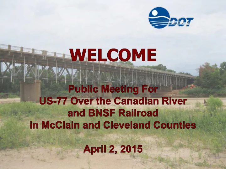
TEAM INTRODUCTIONS ODOT Paul Rachel - Division 3 Engineer Siv - - PowerPoint PPT Presentation
TEAM INTRODUCTIONS ODOT Paul Rachel - Division 3 Engineer Siv Sundaram - Environmental Programs Scott Sundermeyer - Cultural Resources Nick Granko & Diana Barlow - Right-of-Way & Utilities Frank Roesler III - Public
- ODOT
- Paul Rachel - Division 3 Engineer
- Siv Sundaram - Environmental Programs
- Scott Sundermeyer - Cultural Resources
- Nick Granko & Diana Barlow - Right-of-Way & Utilities
- Frank Roesler III - Public Involvement Officer
- GARVER
- Matthew Youngblood - Project Manager / Bridge Lead
- Jenny Sallee - Roadway Lead
- Kirsten McCullough - Environmental Lead
TEAM INTRODUCTIONS
Purpose of This Meeting
… is to Inform the Public About Proposed Improvements to U.S. Highway 77 Over the Canadian River and BNSF Railroad in Purcell/Lexington, McClain and Cleveland Counties, and to Solicit Public Input Regarding the Proposed Improvements.
Project Location
Purpose of the Project
… is to Provide a Safe Crossing of the Canadian River and BNSF Railroad Between Purcell and Lexington
N
5th St. Canadian River
Purcell Lexington
4th St.
McClain County Cleveland County
N
Canadian River
City of Purcell City of Lexington
5th St. 4th St.
- ODOT Will Also Study Improvements to US-77 Through Lexington
Design Scheduled to Begin in Spring of 2015
Project Development Process
Initial Alternate Screening Develop Preliminary Alternates Initial Data Collection State the Problem Public Meeting TODAY Identify Preferred Alternate
Project Area Information
State Problem Initial Data Collection Preliminary Alternates Alternate Screening
- General Data
- Speeds – 45 mph on Bridge, 35 mph in Town
- 2-Lane Bridge With Curb and Gutter and two
3-Foot Sidewalks
- Tie-In Points
- Canadian Ave. in Purcell – 5-lane section
- West of 5th St. in Lexington – Divided 2-lane
Section
N
Canadian River 5th St.
Project Area Information
State Problem Initial Data Collection Preliminary Alternates Alternate Screening
- General Data
- Speeds – 45 mph on Bridge, 35 mph in Town
- 2-Lane Bridge With Curb and Gutter and two
3-Foot Sidewalks
- Tie-In Points
- Canadian Ave. in Purcell – 5-lane section
- West of 5th St. in Lexington – Divided 2-lane
Section
- Existing Traffic (2014): 11,830 Vehicles/Day
- Projected Traffic (2040): 17,340 Vehicles/Day
(8% Trucks)
Collision Data
- Collision Data
- Total: 37 Documented Accidents (2009-2014)
- 26 Personal Property Damage
- 11 Injury (17 People)
- Slightly Higher Than the State Average for
Collisions State Problem Initial Data Collection Preliminary Alternates Alternate Screening
McClain County Cleveland County
N
Canadian River
City of Purcell City of Lexington
Angle Turning Fixed Object Head-on Rear End Other Collision History: 01/01/09 - 03/31/14
5th St. 4th St. Ash St.
2 2 3 2
2 2 2 2 8
Existing Roadway
- Roadway Deficiencies
- Capacity (Number of Lanes)
- Substandard Sidewalk
- Substandard Guardrail
- Intersection Geometrics
- Left Turn Bay at Canadian Ave. Purcell
- Inadequate Drainage
- Poor Pavement Condition
State Problem Initial Data Collection Preliminary Alternates Alternate Screening
- Existing Bridge Information
- Age of Structure (Built in 1938)
- Planned Service Design Life of 50 Years
- Listed National Register of Historic Places
Existing Bridge
State Problem Initial Data Collection Preliminary Alternates Alternate Screening
- Existing Bridge Information
- Age of Structure (Built in 1938)
- Planned Service Design Life of 50 Years
- Listed National Register of Historic Places
- 36-Span Configuration (3,642 Feet)
- 2 – 50’ I-Beam End Spans
- 33 – 100’ Deck Truss & 1 – 200’ Rail
- Railway, Canadian River and Basin
Existing Bridge
State Problem Initial Data Collection Preliminary Alternates Alternate Screening N
Canadian River
City of Purcell City of Lexington
Overall Bridge Length ≈ 3,642’
- Existing Bridge Information
- Age of Structure (Built in 1938)
- Planned Service Design Life of 50 Years
- Listed National Register of Historic Places
- 36-Span Configuration (3,642 Feet)
- 2 – 50’ I-Beam End Spans
- 33 – 100’ Deck Truss & 1 – 200’ Rail
- Railway, Canadian River and Basin
- Substandard Clear Width (32 Feet)
32 FOOT CLEAR ROADWAY
Existing Bridge
State Problem Initial Data Collection Preliminary Alternates Alternate Screening N
Canadian River
City of Purcell City of Lexington
Overall Bridge Length ≈ 3,642’
- Existing Bridge Information
- Age of Structure (Built in 1938)
- Planned Service Design Life of 50 Years
- Listed National Register of Historic Places
- 36-Span Configuration (3,642 Feet)
- 2 – 50’ I-Beam End Spans
- 33 – 100’ Deck Truss & 1 – 200’ Rail
- Railway, Canadian River and Basin
- Substandard Clear Width (32 Feet)
- Condition Evaluation
- Structurally Deficient
- Deck, Superstructure and Substructure Poor
Rating
Existing Bridge
State Problem Initial Data Collection Preliminary Alternates Alternate Screening
Existing Bridge cont’d….
- Existing Bridge Information
- Requires Continual Evaluation
- Maintenance and Inspection
- Fracture Critical Bridge Inspection
- Daily Inspections
- Rehabilitation Projects
- Truss Strengthening
- Cleaning and Repainting of Steel Components
- Replacing Deck Joints, Drainage System
- Emergency Terminal Repairs
- Closures and Detours
- Detour Time and Cost Impacts to Community
- Load Posting on Existing Bridge
State Problem Initial Data Collection Preliminary Alternates Alternate Screening
Study Area
- Study Area
- Large Enough to Encompass all Alternatives
- Detailed Data Collection has Been Performed
- Field Survey and Mapping
- Comprehensive Environmental Investigations
State Problem Initial Data Collection Preliminary Alternates N
5th St. Canadian River
City of Purcell City of Lexington
4th St.
McClain County Cleveland County
Alternate Screening
Study Area Constraints
- Homes and Businesses
- Intersections in Purcell and
Lexington
- Railroad
- Canadian River
- Utilities
- Environmental Considerations
State Problem Initial Data Collection Preliminary Alternates Alternate Screening
Study Area Constraints cont’d….
- Homes and Businesses
- Intersections in Purcell and
Lexington
- Railroad
- Canadian River
- Utilities
- Environmental Considerations
State Problem Initial Data Collection Preliminary Alternates Alternate Screening
- Homes and Businesses
- Intersections in Purcell and
Lexington
- Railroad
- Canadian River
- Utilities
- Environmental Considerations
State Problem Initial Data Collection Preliminary Alternates Alternate Screening
Study Area Constraints cont’d….
- Homes and Businesses
- Intersections in Purcell and
Lexington
- Railroad
- Canadian River
- Utilities
- Environmental Considerations
State Problem Initial Data Collection Preliminary Alternates Alternate Screening
Study Area Constraints cont’d….
- Homes and Businesses
- Intersections in Purcell and
Lexington
- Railroad
- Canadian River
- Utilities
- Environmental Considerations
State Problem Initial Data Collection Preliminary Alternates Alternate Screening Water Line
Study Area Constraints cont’d….
Environmental Constraints
- Noise Impacts to Homes and
Businesses
- Wetlands
- Veterans Park
- Potential Contaminated Sites
- Bridge
- Threatened and Endangered
Species Habitat
- Least Tern
- Arkansas River Shiner (Critical
Habitat)
- Historic Bridge
State Problem Initial Data Collection Preliminary Alternates N
5th St. Canadian River
City of Purcell City of Lexington
4th St.
McClain County Cleveland County
Alternate Screening
Arkansas River Shiner
- The US Fish and Wildlife Service has Designated
the Canadian River as Critical Habitat for the Arkansas River Shiner (Threatened)
- Any Work in the River or Within 300 Feet Requires
Formal Consultation With USFWS
- Consultation Process Determines the Extent of
Impacts and the Required Measures to Avoid or Minimize Impacts, Including Seasonal Restrictions on Construction
- All of the Proposed Alternatives Would Require Work Within the
Critical Habitat N
5th St. Canadian River
City of Purcell City of Lexington
4th St.
McClain County Cleveland County
Historic Bridge
- US-77 Bridge is Listed in the National
Register of Historic Places
- Deck Truss Completed in 1938
- Significant for its Place in the History of
Oklahoma Transportation
- Significant for its Engineering: Longest
and Highest Bridge of its Type in the State
- Significant for its Association with Works
Programs of 1930s
- Historic Integrity: Retains Original
Design, Materials, Overall Feeling and Association
- US-77 Bridge Character Defining
Features
- Features That Contribute to the Bridge’s
Historic Significance
- Trusses, Height, Length, Overall Visual
Appearance
Section 4(f) Alternative Analysis
- Because the Bridge is Historically Significant, Section 4(f)
Regulations Require Analysis of Alternatives That Preserve the Historic Integrity of the Bridge
- Five Options for Consideration
- Option 1 – Do Nothing
- Option 2 – Rehabilitation of Existing Bridge at Current Width
- Option 3 – Rehabilitation and Widening of Existing Bridge
- Option 4 – Use the Existing Bridge as one Half of a “One-Way” Couplet
- Option 5 – Move Vehicular Traffic to New Bridge. Use Existing Bridge as
Monument, Pedestrian or Bicycle Facility
- Option 6 – Complete Bridge Replacement – Only Considered if
Options 1-5 are Not Feasible or Prudent.
State Problem Initial Data Collection Preliminary Alternates Alternate Screening
Meets Purpose and Need? Operational and Safety Impact Social, Economic, Environmental Impact Community Disruption Cost of Construction Option 1 – Do Nothing No High High High Medium Option 2 – Rehab Existing No High High High High Option 3 – Rehab Widen Yes Medium Medium High High Option 4 – One-Way Pair Yes Medium Medium Medium High Option 5 – Monument/Ped Yes Medium Medium Medium High Option 6 – Bridge Replacement Yes Low Medium Low Low
State Problem Initial Data Collection Preliminary Alternates Alternate Screening
- Due to Safety and Community Impacts, Options 1-5 Were Eliminated
- ODOT and FHWA Determined Replacement as the Only Prudent and Feasible
Option
Section 4f Alternative Analysis cont’d….
Development of Replacement Alternatives
State Problem Initial Data Collection Preliminary Alternates Alternate Screening
- Proposed Design Criteria
- Design Speed
- 45 mph on Bridge
- 35 mph in Both Towns
- Roadway Typical Sections
- Four 12-Foot Wide Lanes
- Two 8-Foot Wide Shoulders
- Curb & Gutter On the South Side
- Curb & Gutter and Open Shoulder on
the North Side
- 6-Foot Wide Sidewalk on South Side
- Left Turn Lanes at Canadian Ave.
- Compatible With Future
Improvements Thru Lexington
Development of Replacement Alternatives cont’d….
Identify Problem Initial Data Collection Preliminary Alternates Alternate Screening N
5th St. Canadian River
City of Purcell City of Lexington
4th St.
- Replacement Alternatives
- Connections to Existing Highway
- Maintain Traffic During Construction
- North and South Alignments
- Full Offset (62’-1”)
- Easier Construction
- Longer Extents
- Partial Offset (16’)
- More Phases of Construction
- Smaller Footprint
McClain County Cleveland County
Development of Replacement Alternatives cont’d….
Identify Problem Initial Data Collection Preliminary Alternates Alternate Screening N
5th St. Canadian River
City of Purcell City of Lexington
4th St.
- Replacement Alternatives
- – Full North Offset (62’-1”)
- Tie-in Near 2nd Avenue in Purcell
- Shift Canadian Avenue Intersection
- Eliminated Due to Intersection Impacts
- – Partial North Offset (16’)
- Shift Canadian Avenue Intersection
- – Full South Offset (62’-1”)
- Still Affects End Span of Existing Bridge
- Intersection Geometrics Not Ideal
- – Partial South Offset (16’)
McClain County Cleveland County
Evaluation of Alternatives
- Evaluation Criteria
- Impacts to Private Property
- Impacts to Other Environmental Resources
- Construction Duration
- Cost – Construction, Right-of-Way, Utilities
Comparison Matrix - Bridge Replacement Alternatives
ALTERNATIVE COST TIME RELOCATIONS ENVIRONMENTAL
Alternate # DESCRIPTION TOTAL COST (MILLIONS) CONSTRUCTION DURATION RESIDENTIAL RELOCATIONS COMMERCIAL RELOCATIONS ADVERSE EFFECT TO BRIDGE ARS CRITICAL HABITAT (ACRE) WETLANDS (ACRE) HAZARDOUS MATERIALS 6A Full North Offset (62')
Eliminated Due to Impacts at US-77 & N. Canadian Ave. Intersection
6B Partial North Offset (16')
44.0 Longer 1 2 Yes 10.5 0.12 1
6C Full South Offset (62')
44.4 Shorter 2 2 Yes 11.2 0.31 2
6D Partial South Offset (16')
43.6 Longer Yes 11.2 0.19 1
Proposed Alternative - 6D Partial South Offset
- Minor Changes to Canadian Ave.
Intersection (Left Turn Bay > 300ft)
- Transition to Two-Lane Before SH-39
Intersection
- Total Project Cost of $43.6 Million
- Some Acquisition of Private Property -
No Relocations of Homes or Businesses N
5th St. Canadian River
Purcell Lexington
4th St.
Cleveland County McClain County
- Minor Wetland Loss
- Affects One Potential Hazardous
Waste Area
- One Noise Impact
- Due to Location of Driveways and
Proximity to 5th Street, Noise Wall Not Feasible
- Adverse Effect to Historic Bridge
- Potential Impacts to Arkansas
River Shiner
Rendering of West Intersection
Proposed Canadian Ave. Intersection in Purcell (Looking East)
N
Rendering of East Tie-In
Proposed Tie-in at 5th Street in Lexington (Looking Northwest)
N
Proposed Bridge US-77 Over Canadian River and Railroad
- Proposed Bridge Structure
- Span BNSF Railway, Canadian River and Drainage Basin
- 100-Foot Typical Span, 200-Foot at Rail and River, 135-Foot Near River
- Structural Plate Girders and Conventional Prestressed Concrete
- Designed Service Life = 75 Year Minimum
- Estimate Time of Construction = 18 Months
- Maintain 2 Lanes of Traffic During Construction
Overall Bridge Length ≈ 3,725’ Railroad Drainage Basin River N
Canadian River
Purcell Lexington
Rendering of Proposed Bridge
Proposed US-77 Bridge over Canadian River and Railroad (Looking Northwest)
N
Rendering of Proposed Bridge cont’d….
Proposed US-77 Bridge over Canadian River and Railroad (Looking North)
N
Rendering of Proposed Bridge cont’d….
Proposed US-77 Bridge over Canadian River and Railroad (Looking Southeast)
N
Proposed Bridge US-77 Over Canadian River and Railroad
- Proposed Bridge Typical Section
- Standard Slab on Girder Bridge
- Four 12-Foot Wide Driving Lanes
- Two 8-Foot Wide Shoulders
- Barrier Separated 6-Foot Wide
Sidewalk on the South Side
- Maintain 2-Lanes of Traffic
Proposed Bridge US-77 Over Canadian River and Railroad
- Sequence of Construction
- Phased Construction – Maintain 2-Lanes of Traffic
- Phase 1 – Construct Portion of Southern Proposed Bridge
EXISTING BRIDGE SECTION PROPOSED BRIDGE (SOUTH HALF)
Proposed Bridge US-77 Over Canadian River and Railroad
- Sequence of Construction
- Phased Construction – Maintain 2-Lanes of Traffic
- Phase 1 – Construct Portion of Southern Proposed Bridge
- Phase 2 – Move Traffic to New Bridge and Remove Existing Bridge
- Phase 3 – Construct Northern Portion of Proposed Bridge
PROPOSED BRIDGE SECTION (FULL)
Proposed Bridge US-77 Over Canadian River and Railroad
- Sequence of Construction
- Phased Construction – Maintain 2-Lanes of Traffic
- Phase 1 – Construct Portion of Southern Proposed Bridge
- Phase 2 – Move Traffic to New Bridge and Remove Existing Bridge
- Phase 3 – Construct Northern Portion of Proposed Bridge
- Phase 4 – Move Traffic to North and Construct Sidewalk
- Phase 5 – Open to All Vehicular and Pedestrian Traffic
PROPOSED BRIDGE SECTION (FULL)
Consultation on Impacts to Historic Bridge
- ODOT has Begun Consultation With the State Historic Preservation
Officer (SHPO) and Other Consulting Parties Under the National Historic Preservation Act
- SHPO Stated That the Only Alternative That Will Not Adversely Affect the
Bridge is Rehabilitation
- This Alternative is Not Prudent and Feasible
- The Proposed Alternative (Replacement) Will Have an Adverse Effect on the Bridge
- The McClain County Historical and Genealogical Society Requested That a
Portion of the Bridge on the West End be Left in Place as a Monument or Park/Picnic Area
- Leaving a Portion of the Bridge in Place Presents Maintenance and Safety
Concerns
- The Proposed Alternative Requires Removal of the West End of the Existing Bridge
to Tie Back in to Canadian Avenue
- ODOT is Interested in the Public’s Input on Potential Mitigation Measures