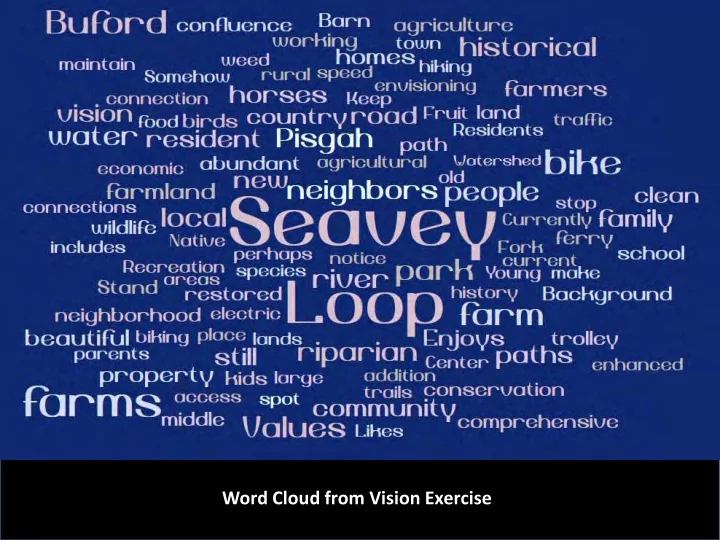
SLIDE 1
Word Cloud from Vision Exercise
SLIDE 2
West Pisgah Community Vision
Round Table Meeting #2
1. Welcome 2. More on Visioning 3. Discuss Options for a Final Product from the Round Table Process 4. West Pisgah Community Heritage 5. Report Back on Zoning and Land Use 6. Non-motorized Transportation 7. Wrap Up
Agenda:
SLIDE 3
Visioning Scenario (Round 2)
You have received an out of state job offer that was too good to pass up and reluctantly leave your southern Willamette Valley home. After being gone for 30 long years, you become sentimental and decide to return home for good. You remember that there had been a visioning effort underway for the West Pisgah area and you decide to visit the area to see how things turned out. You spend an entire day traveling through the area and are absolutely thrilled by everything that you are seeing. Please spend 1-2 minutes describing what you’re envisioning.
SLIDE 4
Context Parks and Conserved Lands and Zoning
SLIDE 5
Lane County Zoning for the West Pisgah Planning Area
SLIDE 6
Zoning Designation Acres E25: Exclusive Farm Use 1,134 RR5: Rural Residential (minimum 5 acre lot) 575 RR2: Rural Residential (minimum 2 acre lot) 84 RR1: Rural Residential (minimum 1 acre lot) 31 RI: Rural Industrial (existing industry or industry relying on rural setting) 76 RPF: Rural Public Facility 15 SG: Sand and Gravel 149 PR: Park and Recreation 126 Total Acres: 2,395
Acres by Category within the West Pisgah Planning Area
SLIDE 7 E25: Exclusive Farm Use
Purpose: to provide areas for the continued practice of agriculture (minimum lot size: 25 acres) Permitted Buildings and Uses:
- Farm uses
- Single family home (1)
- Accessory buildings
- Propagation or harvest of forest
products
- Churches
- Public or private schools
- Commercial activities that are in
conjunction with farm use
- Parks, playgrounds, community
centers
- Private parks and campgrounds
- Flood control or irrigation projects
- Electrical generation
- Personal use airports
- Feedlots
- Golf courses
- Boarding horses for profit
- Site for disposal of solid waste
- Transportation facilities
SLIDE 8
Example of Area Zoned E25
Buford Park Entrance Bridge over Coast Fork Willamette
SLIDE 9 RR5: Rural Residential
Purpose: to provide opportunities for persons who desire to live in a rural neighborhood setting (minimum lot size: 5 acres) Permitted Buildings and Uses:
- Single family home (1)
- Guest home
- General farming including trees, vines,
berries, vegetables, nursery stock, etc.
- Raising cattle, horses, sheep, goats,
bees, poultry, fur-bearing animals, and swine (limits based on acreage)
- Public buildings (e.g. fire station,
substation, wells, etc.)
- Accessory buildings
- Kennel (5 dogs over four months)
Conditional Uses:
- Churches
- Lodges and grange halls
- Public and private schools
- Parks
- Radio and TV transmission towers
- Cemeteries
- Golf courses
- Stables
- Mobile home parks
- Transportation facilities
SLIDE 10
Lane County Zoning for the West Pisgah Planning Area
SLIDE 11
Value of Documenting Local History and Heritage
Seavey-Kienzle Barn - 1952 1964 ~1965 1965
SLIDE 12 Documenting Local Heritage (provided unique story of place)
Kienzle grape arbor (1952)
- Collecting historical photos
- Recording oral histories (written and video)
- Collecting historical maps and photos
- Engage UO graduate student(s)?
- Study landscape change
Kienzle family Kienzle/Seavey home Hop yard
Seavey-Blachley Picnic Area
SLIDE 13
1850s Vegetation
SLIDE 14
Question to the Round Table:
Should we develop a “Vision Element” and some strategies/actions around this topic? Documenting and Celebrating Local Heritage
1955 flood John Seavey farming with horses
SLIDE 15
Transportation Definitions
Multi-Use Path Bicycle Lanes Recreational Trail
SLIDE 16
Rural Roads, Trails, Paths, and Non-Motorized Transportation
Rural Road – with Shoulders Terminology: Rural Road – No Shoulders
SLIDE 17
Rivers to Ridges Vision Map – West Pisgah Area
SLIDE 18
Regional Transportation Plan (2017)
SLIDE 19
Regional Transportation Plan (2017) Multi-Use Path (2030-2034) Route or Shoulder (2020-2024) Striped Lane (200-2034) Multi-Use Path (2025-2029)
SLIDE 20
Seavey Loop Road
Currently the only route to Buford, farm stands, etc. for bikes, walkers, horseback
SLIDE 21
Discuss ideas for connectivity for non-motorized transportation
SLIDE 22 Options for non-motorized access in the West Pisgah area?
- Small Groups: Discuss ideal 30-year
vision for the West Pisgah area
- Report back on your discussion