catex hurricane zachary
play

CATEX Hurricane Zachary EXERCISE, EXERCISE,EXERCISE East Coast - PowerPoint PPT Presentation

CATEX Hurricane Zachary EXERCISE, EXERCISE,EXERCISE East Coast CATEX Power Restoration Functional Exercise 2013 This document was prepared under a grant from FEMA's Grants Programs Directorate, U.S. Department of Homeland Security. Points of


  1. CATEX Hurricane Zachary EXERCISE, EXERCISE,EXERCISE East Coast CATEX Power Restoration Functional Exercise 2013 This document was prepared under a grant from FEMA's Grants Programs Directorate, U.S. Department of Homeland Security. Points of view or opinions expressed in this document are those of the authors and do not necessarily represent the official position or policies of FEMA's Grants Programs Directorate or the U.S. Department of Homeland Security.

  2. Exercise overview  The East Coast CATEX Power Restoration 2013 Functional Exercise is sponsored by the FEMA Region 3 states (VA, DC, WV, MD, DE & PA) through the Regional Catastrophic Preparedness Grant Program (RCPGP). This Participant Guide was produced with input, advice, and assistance from the Exercise Planning Team, which followed guidance set forth by the U.S. Department of Homeland Security (DHS) Homeland Security Exercise and Evaluation Program (HSEEP).  The East Coast CATEX Power Restoration is designed to establish a learning environment for players to exercise emergency response plans, policies, and procedures as they pertain to a 
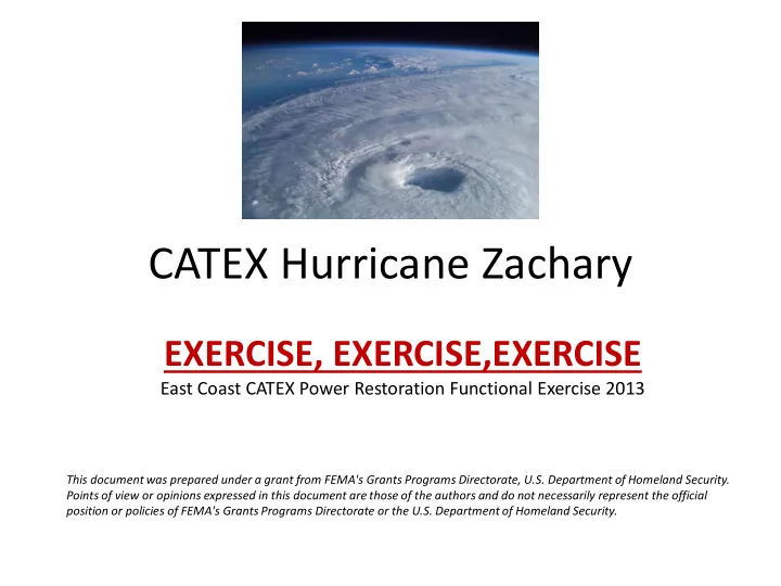
Hurricane. A Hurricane is a complex event that requires detailed planning. To ensure an effective exercise, subject matter experts (SMEs) and local representatives from numerous agencies have taken part in the planning process and will take part in exercise conduct and evaluation.  This Participant Guide was produced with input, advice, and assistance from the East Coast CATEX Power Restoration Exercise Planning Team. This exercise is evidence of the growing public safety partnership between State and local jurisdictions regarding the response to the threat of Hurricane that our Nation and communities face.

  3. Concept and Objectives 1. Fleet Movement Coordination/Reconciliation: Demonstrate the ability to support/reconcile (pre-stage, react, and recover) Power Sector Fleet movement requirements (before, during, and after) a catastrophic event. a. Evaluate the role of the Electric Utility Liaison Officer (ELO): Based on the ESF 12 ELO job description working group and current roles of the ELO, evaluate the effectiveness of the product and the operational use. b. Operational Information Flow: Using centralized frameworks of information to provide real time, relevant, usable and coordinated information across both private and public sectors, to evaluate operational information flow. 2. Regional Transportation Management: Demonstrate the capability of RITIS to support the movement of the supply chain to facilitate continuity of regular commerce (along the edge of the catastrophic zone) during an evacuation event.

  4. Admin instructions • All spoken and written communications will start and end with the statement “E XERCISE , E XERCISE , E XERCISE ” • For an emergency that requires assistance, use the phrase “real-world emergency.” • Each State, Private Sector and Cell location will control entry to exercise venues. • Participate in the Hot Wash at your facility with controllers and evaluators. • Complete the Participant Feedback Form. This form allows you to comment candidly on emergency response activities and exercise effectiveness. Provide the completed form to a controller or evaluator.

  5. Exercise Schedule Personnel [Oct 28, 2013] 0900-1000 Controllers, evaluators, and Exercise Planning Controller and Evaluator Briefing Team members 1100-1130 Private sector electric utility companies and public Participant Brief sector 1300-1400 All Document Distribution Oct 29, 2013 0700 Selected controllers and exercise staff members Exercise site setup 0715 Controllers and evaluators Check-in/virtual 0715 Participants (players, observers, actors) Registration 0730 Controllers and evaluators Commo check 0730 Participants Participant briefings 0800 All Start of exercise (StartEx) 0800 Private sector electric utility companies and public Participant Brief sector 1600 All End of exercise (EndEx) Immediately following EndEx Participants, controllers, and evaluators Hot Wash (individually conducted by location) Oct 30, 2013 1300 Controllers, evaluators, and Exercise Planning Controller and Evaluator Debriefing Team members

  6. Scenario The National Weather Service issued a Hurricane Watch for all counties in Maryland, Virginia, Delaware, Washington DC, West Virginia, and Pennsylvania. Hurricane Zachary was located about 600 miles south-southeast of Cape Hatteras, North Carolina, moving North- Northwest at 8 mph. The estimated minimum central pressure is 959 MB with maximum sustained winds of 105 MPH with higher gusts, making Zachary a category two hurricane. The storm will make landfall in 72 hrs.

  7. H-72 HURRICANE ZACHARY LOCAL STATEMENT NATIONAL WEATHER SERVICE BALTIMORE MD/WASHINGTON DC DATE/TIME: H-48 ...A HURRICANE WATCH IS IN EFFECT FOR ALL COUNTIES IN MARYLAND, VIRGINIA, DELAWARE, WASHINGTON DC, WEST VIRGINIA, AND PENNSYLVANIA. AT 11 AM EDT HURRICANE ZACHARY WAS LOCATED NEAR 27.4 NORTH LATITUDE AND 71.2 WEST LONGITUDE OR ABOUT 600 MILES SOUTH-SOUTHEAST OF CAPE HATTERAS NORTH CAROLINA...MOVING NORTH NORTHWEST AT 8 MPH. ESTIMATED MINIMUM CENTRAL PRESSURE IS 959 MB WITH MAXIMUM SUSTAINED WINDS OF 105 MPH WITH HIGHER GUSTS. THIS MAKES ZACHARY A CATEGORY TWO HURRICANE. ...PREPAREDNESS ACTIONS... PERSONS LOCATED IN AND NEAR THE POSTED HURRICANE WATCH AREA SHOULD PREPARE FOR HIGH WINDS AND SIGNIFICANT COASTAL FLOODING. PEOPLE INLAND SHOULD PREPARE FOR STRONG WINDS...HEAVY RAIN...AND POTENTIAL SMALL STREAM AND RIVER FLOODING. ...RAINFALL AND INLAND FLOODING... RAINFALL TOTALS OF 3 TO 6 INCHES ARE EXPECTED IN THE BALTIMORE - WASHINGTON AREA...OVER THE CHESAPEAKE BAY AND ACROSS SOUTHERN MARYLAND. FOR THE PIEDMONT AND MOUNTAIN AREAS OF MARYLAND...VIRGINIA AND WEST VIRGINIA AND PENNSYLVANIA AND DELAWARE...RAINFALL TOTALS OF 6 TO 10 INCHES ARE POSSIBLE WITH ISOLATED AMOUNTS OF 12 INCHES OR MORE. THIS COULD CAUSE SERIOUS FLASH FLOODING AND MUDSLIDES WITH POTENTIALLY MAJOR FLOODING OF SOME RIVERS. ...STORM SURGE...WAVES AND TIDAL FLOODING... THE THREAT OF STORM SURGE WILL BE ON THE INCREASE LATE THURSDAY NIGHT INTO EARLY FRIDAY. ALONG THE WESTERN SHORE OF THE CHESAPEAKE BAY TIDAL SURGES OF 3 TO 5 FEET ARE POSSIBLE. THIS SURGE WOULD BE ON TOP OF THE NORMAL TIDE AND THEN WAVES OF 4 TO 5 FEET MAY OCCUR ON TOP OF THAT. ALONG THE NORTH SHORE OF THE TIDAL POTOMAC IN CHARLES AND ST MARYS COUNTIES A STORM SURGE OF 4 TO 6 FEET IS POSSIBLE. THE REMAINDER OF THE TIDAL POTOMAC COULD SEE SURGES OF 3 TO 5 FEET. ...WIND INFORMATION... TROPICAL STORM FORCE WINDS OF 40 TO 60 MPH WILL BEGIN AFFECTING SOUTHERN MARYLAND MIDDAY THURSDAY AND WILL SPREAD INLAND THROUGH THE AFTERNOON AND EVENING. STRONGER WIND GUSTS TO HURRICANE FORCE WILL BE POSSIBLE THURSDAY NIGHT INTO FRIDAY MORNING AS THE CENTER OF THE STORM PASSES. THESE WINDS MAY CAUSE DAMAGE TO TREES AND UTILITY LINES. THE NATIONAL WEATHER SERVICE ADVISES RESIDENTS IN THE AFFECTED AREA TO CONTINUE MONITORING NOAA WEATHER RADIO AND THE MEDIA FOR UPDATES ON HURRICANE ZACHARY. ADDITIONAL INFORMATION CAN ALSO BE FOUND ON OUR WEBSITE: HTTP://WWW.ERH.NOAA.GOV/LWX

  8. H-72

  9. H-72

Download Presentation
Download Policy: The content available on the website is offered to you 'AS IS' for your personal information and use only. It cannot be commercialized, licensed, or distributed on other websites without prior consent from the author. To download a presentation, simply click this link. If you encounter any difficulties during the download process, it's possible that the publisher has removed the file from their server.

Recommend


More recommend