
SLIDE 1
1 AMS 40th Conference on Broadcast Meteorology, Operational Forecasting 3, Boston, MA August 22-24, 2012
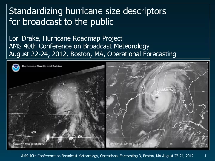
Standardizing hurricane size descriptors for broadcast to the public - - PowerPoint PPT Presentation
Standardizing hurricane size descriptors for broadcast to the public Lori Drake, Hurricane Roadmap Project AMS 40th Conference on Broadcast Meteorology August 22-24, 2012, Boston, MA, Operational Forecasting AMS 40th Conference on Broadcast
1 AMS 40th Conference on Broadcast Meteorology, Operational Forecasting 3, Boston, MA August 22-24, 2012
2 AMS 40th Conference on Broadcast Meteorology, Operational Forecasting 3, Boston, MA August 22-24, 2012
3 AMS 40th Conference on Broadcast Meteorology, Operational Forecasting 3, Boston, MA August 22-24, 2012
HURRICANE ALEX ADVISORY NUMBER 21 NWS TPC/NATIONAL HURRICANE CENTER MIAMI FL AL012010 400 PM CDT WED JUN 30 2010 ...ALEX HEADING TOWARD NORTHEAST MEXICO WITH 90 MPH WINDS... ALEX IS A LARGE TROPICAL CYCLONE AND HURRICANE FORCE WINDS EXTEND OUTWARD UP TO 70 MILES...110 KM...FROM THE CENTER...AND TROPICAL STORM FORCE WINDS EXTEND OUTWARD UP TO 205 MILES...335 KM PRIMARILY TO THE NORTHEAST OF THE CENTER....
4 AMS 40th Conference on Broadcast Meteorology, Operational Forecasting 3, Boston, MA August 22-24, 2012
5 AMS 40th Conference on Broadcast Meteorology, Operational Forecasting 3, Boston, MA August 22-24, 2012
6 AMS 40th Conference on Broadcast Meteorology, Operational Forecasting 3, Boston, MA August 22-24, 2012
64 KT.......110NE 90SE 55SW 75NW. 50 KT.......160NE 160SE 80SW 100NW. 34 KT.......240NE 200SE 150SW 170NW. 12 FT SEAS..425NE 425SE 270SW 150NW. WINDS AND SEAS VARY GREATLY IN EACH
MILES ARE THE LARGEST RADII EXPECTED ANYWHERE IN THAT QUADRANT.
7 AMS 40th Conference on Broadcast Meteorology, Operational Forecasting 3, Boston, MA August 22-24, 2012
2008 Ike “unusually large” Forecast Disc 46 240 Forecast Adv 46 1996 Fran “large” TC Report 250 Ext Best Track 1999 Floyd “large” Forecast Disc 30 250 Forecast Adv 30 1961 Carla “large” HPC 300 Preliminary Report 2003 Isabel “large” TC Report 300 Ext Best Track 2010 Igor “particularly large” Public Adv 40 300 Forecast Adv 40 2007 Gabrielle “very small” Forecast Disc 8 40 Forecast Adv 8 2007 Humberto “small” TC Report 50 Ext Best Track 2007 Lorenzo “very small” Forecast Disc 11 60 Forecast Adv 11 1999 Bret “small” Forecast Disc 7 90 Forecast Adv 7 2004 Charley “small” TC Report 100 Ext Best Track 2007 Felix “relatively small” Forecast Disc 16 100 Forecast Adv 16 2008 Cristobal “small” NASA 110 Forecast Adv 11 1992 Andrew “relatively small” TC Report 120 Ext Best Track 1969 Camille “small” Preliminary Report 125 HRD H-Wind 2001 Iris “small” TC Report 125 Ext Best Track STORM DESCRIPTION DESCRIPTION 34-KT WINDS DATA SOURCE SOURCE (OUTERMOST, NM) 1999 Dennis “larger than average” TC Report 140 Ext Best Track 1998 Earl “fairly large” Forecast Disc 6 150 Forecast Adv 6 2004 Frances “large” Forecast Disc 35 160 Forecast Adv 35 2008 Gustav “large” Public Adv 27 175 Forecast Adv 27 2005 Rita “large” TC Report 180 Ext Best Track 2007 Dean “large” Forecast Disc 25 180 Forecast Adv 25 1995 Opal “large” Forecast Disc 20 200 Forecast Adv 20 1998 Bonnie “large” Public Adv 28 200 Forecast Adv 28 2005 Katrina “very large” Public Adv 25/26 200 Fcst Adv 25/26 2004 Ivan “large” Public Adv 52 225 Forecast Adv 52 2005 Wilma “large” Public Adv 37 225 Forecast Adv 37 2009 Bill “large” Public Adv 21 225 Forecast Adv 21
8 AMS 40th Conference on Broadcast Meteorology, Operational Forecasting 3, Boston, MA August 22-24, 2012 STORM 34-KT WINDS NHC ROCI ATL SIZE /ROCI (OUTERMOST, NM) DESCRIPTION (NM) DEG LAT (ROUNDED) 2001 Iris 125 “small” 100 small 2° 2004 Charley 100 “small” 100 small 2° 2007 Lorenzo 60 “very small” 100 small 2° 1999 Bret 90 “small” 120 small 2° 2007 Gabrielle 40 “very small” 120 small 2° 2007 Humberto 50 “small” 120 small 2° 1992 Andrew 120 “relatively small” 125 small 2° 1969 Camille 125 “small” 140 small 2° 2008 Cristobal 110 “small” 140 small 2° 2007 Felix 100 “relatively small” 150 medium 3°
1996 Fran 250 “large” 250 large 4° 1999 Floyd 250 “large” 300 large 5° 2008 Ike 240 “unusually large” 300 large 5° 1961 Carla 300 “large” n/d large > 4° 2003 Isabel 300 “large” 300 large 5° 2010 Igor 300 “particularly large” 400 large 7° 1999 Dennis 140 “larger than average” 175 medium 3° 1998 Earl 150 “fairly large” 200 medium 3° 2004 Frances 160 “large” 200 medium 3° 2004 Ivan 225 “large” 200 medium 3° 2007 Dean 180 “large” 200 medium 3° 2009 Bill 225 “large” 240 large 4° 1998 Bonnie 200 “large” 250 large 4° 2008 Gustav 175 “large” 275 large 5° 2005 Rita 180 “large” 300 large 5° 2005 Wilma 225 “large” 300 large 5° 2005 Katrina 200 “very large” 350 large 6° 2005 Opal 200 “large” 360 large 6°
9 AMS 40th Conference on Broadcast Meteorology, Operational Forecasting 3, Boston, MA August 22-24, 2012
50 75 100 125 150 175 200 225 250 275 300 325
10 AMS 40th Conference on Broadcast Meteorology, Operational Forecasting 3, Boston, MA August 22-24, 2012
11 AMS 40th Conference on Broadcast Meteorology, Operational Forecasting 3, Boston, MA August 22-24, 2012
12 AMS 40th Conference on Broadcast Meteorology, Operational Forecasting 3, Boston, MA August 22-24, 2012
08/13/04 1635 UTC Max winds: 125 kt (Cat-4) Central pressure: 947 34-kt radii: 40 75 75 50 ROCI: 100 nm 08/11/04 1815 UTC Max winds: 65 kt (Cat-1) Central pressure: 993 34-kt radii: 90 75 0 75 ROCI: 100 nm 08/12/04 1555 UTC Max winds: 90 kt (Cat-2) Central pressure: 980 34-kt radii: 90 90 40 90 ROCI: 100 nm
9/7/08 1630 UTC Max winds: 105 kt (Cat-3) Central pressure: 946 34-kt radii: 145 125 100 125 ROCI: 200 nm 9/12/08 1605 UTC Max winds: 95 kt (Cat-2) Central pressure: 954 34-kt radii: 240 210 150 180 ROCI: 300 nm 9/4/08 1440 UTC Max winds: 115 kt (Cat-4) Central pressure: 940 34-kt radii: 105 95 90 85 ROCI: 180 nm
13 AMS 40th Conference on Broadcast Meteorology, Operational Forecasting 3, Boston, MA August 22-24, 2012
08/13/04 1635 UTC Max winds: 125 kt (Cat-4) Central pressure: 947 34-kt radii: 40 75 75 50 ROCI: 100 nm 08/11/04 1815 UTC Max winds: 65 kt (Cat-1) Central pressure: 993 34-kt radii: 90 75 0 75 ROCI: 100 nm 08/12/04 1555 UTC Max winds: 90 kt (Cat-2) Central pressure: 980 34-kt radii: 90 90 40 90 ROCI: 100 nm
9/7/08 1630 UTC Max winds: 105 kt (Cat-3) Central pressure: 946 34-kt radii: 145 125 100 125 ROCI: 200 nm 9/12/08 1605 UTC Max winds: 95 kt (Cat-2) Central pressure: 954 34-kt radii: 240 210 150 180 ROCI: 300 nm 9/4/08 1440 UTC Max winds: 115 kt (Cat-4) Central pressure: 940 34-kt radii: 105 95 90 85 ROCI: 180 nm
14 AMS 40th Conference on Broadcast Meteorology, Operational Forecasting 3, Boston, MA August 22-24, 2012
15 AMS 40th Conference on Broadcast Meteorology, Operational Forecasting 3, Boston, MA August 22-24, 2012