1
SAN MARTIN BOULEVARD OVER RIVIERA BAY PROJECT DEVELOPMENT & - - PowerPoint PPT Presentation
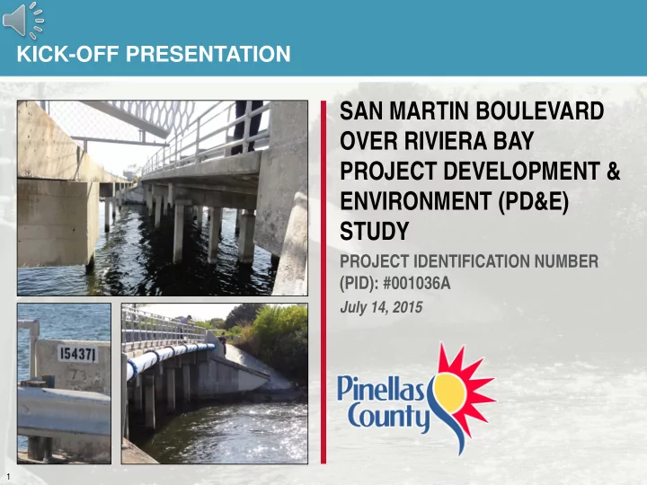
KICK-OFF PRESENTATION SAN MARTIN BOULEVARD OVER RIVIERA BAY PROJECT DEVELOPMENT & ENVIRONMENT (PD&E) STUDY PROJECT IDENTIFICATION NUMBER (PID): #001036A July 14, 2015 1 PRESENTATION OVERVIEW Provide Your Input 1 Introduction 2
2
Provide Your Input
PRESENTATION OVERVIEW
Introduction San Martin Blvd. Bridge Replacement
1 2 3 4
North Bay Trail Extension Evaluation Project Schedule
3
PROJECT LOCATION
4
PROJECT HISTORY
1960 1970 1980 1990 2000 2010
1962 ǀ San Martin Blvd. Bridge Built 2001 ǀ Load Testing Evaluation 2012 ǀ Pinellas
County Initiates Bridge Replacement Study
2014 ǀ Pinellas
County Initiates PD&E Study
Bridge Inspections and Monitoring
2003 ǀ City Trails
Program Initiated
5
- Address the bridge deficiencies
- Built in 1962 (53 years old)
- Does not meet current design standards for pedestrians
and bicyclists per American with Disabilities Act (ADA) because of width
- Based on 2013 bridge inspection the bridge is not
structurally deficient.
- Provide trail and pedestrian features consistent
with the City’s Trails Program & Pinellas County 2040 Long Range Transportation Plan
- Provide Connection from North Bay Trail (Macoma Dr.) to
Friendship Trail (Gandy Blvd.)
- Determine Bridge Configuration for Trail
- Identify Safe Crossing Locations
- Develop Environmental Documentation Necessary
to Maintain Funding Opportunities
PROJECT OBJECTIVES
6
- Document as PD&E for Bridge
Replacement and Evaluate Trail Enhancements
- Simplify Level of Documentation
- Address Different Funding Sources
- San Martin Blvd. Over Riviera Bay Bridge
Replacement PD&E Study
- Meet Federal National Environmental Policy Act
(NEPA) Requirements
- Evaluate Three Alternatives:
- No Build
- Rehabilitate
- Replacement
- North Bay Trail Extension Evaluation
- Evaluate Alignment Alternatives
- Evaluate Crossing Locations
PROJECT LIMITS & SCOPE
7
PD&E APPROACH
Environmental/ Engineering Data Collection Alternatives Development Alternatives Analysis and Evaluation Development of Technical Documents Alternatives Public Meeting with Stakeholders Select Recommended Alternative Public Hearing (Optional) Finalize NEPA Documents Location and Design Concept Approval
8
- Stakeholders
- Pinellas County Government
- City of St. Petersburg
- Neighborhood Associations
- Residents
- Boaters
- Weedon Island
- Organized Recreational Users
- Duke Energy
- Florida Department of Transportation
- Tampa Bay Estuary Program
- Documentation Agencies
- Federal Highway Administration
- US Army Corps of Engineers
- United States Coast Guard
- Southwest Florida Water Management District
STAKEHOLDER INVOLVEMENT
9
- Proactive Public Engagement
- Project Specific Public Involvement
Program
- Alternatives Workshop
- Outreach Through Community
Media Sources
- Project Website
PUBLIC OUTREACH
San Martin Boulevard Project Development and Environment Study
http://www.pinellascounty.org/sanmartinbridge
10
- Community Considerations
- Community Cohesion
- Right-of-Way Relocation Potential
- Archaeological and Historical Sites
- Channel Navigation Needs During Construction
- Environmental Considerations
- Wetlands
- Protected Species/Habitat
- Section 4 (f) (Public Use Facilities)
- Weedon Island Preserve
- Tampa Bay Outstanding Florida Waters
- Physical Environment
- Air or Water Quality Impacts
- Noise (Traffic & Construction)
- Contamination or Hazardous Materials Involvement
KEY ISSUES
11
- Original, East & West Shifted Alignments
- Maintaining Original Alignment Necessitates Closing the Road During Construction
- Shifted Alignments Evaluated to Maintain Road Open During Construction
ALIGNMENT ALTERNATIVES
12
- High Level (± 70 ft. of Clearance)
- Mid Level (± 45 ft. of Clearance)
- Low Level (± 20 ft. of Clearance)
- Highest Constrained (± 18 ft. of Clearance)
- Constrained by Adjacent Intersections (Tallahassee Drive and Weedon Drive)
- Maintaining Traffic on Bridge During Construction Impacts Clearance Attainable
- Movable Option Evaluated for Cost Comparison
PROFILE ALTERNATIVES
Existing Clearance = ± 10 ft.
13
- Determine Best Trail
Configuration
- Provide Connectivity to Adjacent
Trails & Weedon Island Preserve
- Minimize Environmental Impacts
- Evaluate Safe Locations for
Trail Crossings
- North Bay Trail Existing Terminus
- Weedon Island/Duke Energy Trail
- Savona Dr. Trail
- Gandy Blvd. Friendship Trail
NORTH BAY TRAIL EXTENSION EVALUATION OBJECTIVES
Duke Energy Trail (Future) San Martin North Bay Trail Extension (Future) Friendship Trail (Existing) Savona Drive Trail (Existing) Weedon Island Community Trail (Future) North Bay Trail (Existing)
14
- Macoma Drive to Weedon Island Drive
- Curb and Gutter Roadway with Trail on West/North due to R/W Constraints
- Minimal Environmental Impacts
- Maintain Existing Pavement While Adding Trail and Sidewalk
NORTH BAY TRAIL EXTENSION EVALUATION TYPICAL SECTIONS
15
- Weedon Island Drive to Gandy Blvd.
- Rural Roadway with Unpaved Shoulders
- Trail Location Affected by Environmental Constraints and Connectivity
- Add Paved Shoulders, Trail and Sidewalk
NORTH BAY TRAIL EXTENSION EVALUATION TYPICAL SECTIONS
16
SCHEDULE
TASK 2014 2015 2016 2017 D J-M A-J J-S O-D J-M A-J J-S O-D J-M Receive Survey Data from County Public Involvement Alternatives Workshop Public Hearing (Optional Service) Engineering Data Collection Engineering Analysis/Documents Environmental Data Collection/ Analysis/Reports Prepare Environmental Document Submit Final Docs to FDOT for FHWA FHWA Review/Issue LDCA FHWA Review/Issue LDCA
- Construction Programmed in County CIP for 2018/2019
- Schedule contingent on acquisition of 50% grant funding.
- Actual construction time frame will be dependent on acquisition, timing and
amount of available grant funding.
17