
SLIDE 1
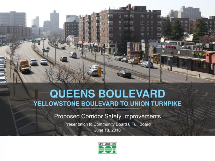
QUEENS BOULEVARD
YELLOWSTONE BOULEVARD TO UNION TURNPIKE Proposed Corridor Safety Improvements
Presentation to Community Board 6 Full Board June 13, 2018 1
QUEENS BOULEVARD YELLOWSTONE BOULEVARD TO UNION TURNPIKE Proposed - - PowerPoint PPT Presentation
QUEENS BOULEVARD YELLOWSTONE BOULEVARD TO UNION TURNPIKE Proposed Corridor Safety Improvements Presentation to Community Board 6 Full Board June 13, 2018 1 QUEENS BLVD PROJECT LIMITS & GOALS QN CB 3 QN CB 7 QN CB 4 QN CB 2 PROJECT
Presentation to Community Board 6 Full Board June 13, 2018 1
nyc.gov/dot
2
QN CB 2 QN CB 4 QN CB 6 QN CB 5 QN CB 9 QN CB 3 QN CB 7
PROJECT GOALS:
existing lanes)
enhance the sense of place
connect neighborhoods
nyc.gov/dot
3
Crashes and Injuries One-Year After Analysis, Queens Blvd (Roosevelt Ave to Eliot Ave)
Before Average (2012-2015) After Average (2017-2018) Change Average Percent
Total Crashes 798.7 648.0
Crashes w/ Injuries 148.3 123.0
Motor Vehicle Occupant
149.3 118.0
Pedestrian
40.3 18.0
Cyclist
14.0 18.0 4.0
29%
Total Injuries 203.7 154.0
Each before year period is the 24-month period beginning July 1 and ending June 30. The 1-yr after period is January 1, 2017 to December 31, 2017. The implementation period of July 1, 2015 to December 31, 2016 is excluded. Source: NYPD AIS/TAMS Crash Database
nyc.gov/dot
4
Project Year Source Feedback Solution 2018
Community Drivers have difficulty seeing
slip lanes Modified design of stop-controlled slip lanes to improve visibility for drivers
Business Owners Existing loading zones remove customer parking Adjusted timing and locations of loading zones
2016
Traffic Analysis, Community Congestion near the Queens Place Mall Installed additional curbside travel lane to facilitate traffic flow
2015
Community Drivers and cyclists have difficulty distinguishing between traffic signals at 63rd St Adjusted signal location to improve visibility for drivers and cyclists
Community Drivers cutting across pedestrian space at 60th St Added granite blocks to physically protect the pedestrian space
nyc.gov/dot
5
Blvd & Continental Ave/71st Ave
mile corridor (2012-2016)
nyc.gov/dot
attendees (January 2018)
& survey (Fall 2017 – Spring 2018)
+10 locations along corridor (Fall 2017)
surveys (January and April 2018)
6
nyc.gov/dot
7
nyc.gov/dot
8 Continue previous design with pedestrian path & bicycle lane along service road medians
South Sidewalk South Sidewalk South Sidewalk North Sidewalk North Sidewalk North Sidewalk
nyc.gov/dot
9 Survey respondents are most likely to bicycle on protected bicycle lanes
creates predictable movements
Capital build out
Average weekday cycling volumes in Rego Park increased from 101 in April 2017 to 227 in April 2018, an increase
Eastbound Queens Blvd service road at 63rd Dr, looking east: pedestrian path, buffered bike lane with vertical delineators, stop-controlled slip lane
nyc.gov/dot
10
Lack of pedestrian space at busy intersections Requests to address driver failure to yield at intersections Long distances between safe crossings for pedestrians
access to pedestrian generators
discourage speeding and slow turns
Queens Blvd and Eliot Ave, looking south: signalized pedestrian crossing, pedestrian space with granite blocks
nyc.gov/dot
11
Requests to improve safety at slip lanes to reduce speeding and highway-like environment DOT updated design of stop- controlled slips for 2018 project to improve visibility
transitions between mainline and service road
pedestrian path and bike lane
Westbound Queens Blvd service road approaching 58th St: stop controlled slip lane, pedestrian path, buffered bike lane, pedestrian crossing
nyc.gov/dot
12
2018 2017
Continue use of stop-controlled slip lanes with updated design to improve transition between main line and service road
nyc.gov/dot
13 Continue pedestrian path and bicycle lanes against service road medians Extend median tips and widen crosswalks Continue installation of mall-to-mall crossings
70th Rd
nyc.gov/dot
14 Install additional pedestrian space between medians and restrict southbound left turns onto the eastbound service road at 71st Rd Maintain access onto and
existing slip lanes
nyc.gov/dot
15 Create painted pedestrian space in existing channelization, to enhance the pedestrian environment and maintain access for emergency vehicles Paint curb extension to encourage slower, safer turns onto 112th St “This is required to allow fire trucks to get through, but the intersection is way too wide, and therefore, it is hard to cross.”
FDNY Fire Station
nyc.gov/dot
16 Add missing crosswalk at 78th Ave and Queens Blvd Install right turn only lane on Grand Central Pkwy service road at 77th Ave to maintain
encourage distribution
77th Ave 78th Ave
Grand Central Pkwy Service Rd Forest Hills South
Add speed humps on Grand Central Pkwy service road between 77th Ave and 78th Ave
Forest Hills South and Queens Borough President Melinda Katz requested traffic calming around the Grand Central Parkway Service Road, 77th Ave, and 78th Ave in February 2018
Install lane designations, Leading Pedestrian Interval, & flashing yellow left turn arrow
nyc.gov/dot
17 Add signal for eastbound vehicles and cyclists at transition to Queens Blvd Install kwik kurb at entrance to protected lane and create connection from westbound Kew Gardens Rd Create contra-flow protected bike lane between 80th Rd and Union Turnpike Install bicycle ramps on existing island and allow cyclists to continue on Queens Blvd or to turn onto Kew Gardens Rd Create designated right turn lane and red turning arrow to clarify vehicle movements
nyc.gov/dot
18
Contra-flow bike lane 177th St, Manhattan
Buffered contra-flow lane from 80th Rd to Union Turnpike with bicycle signal Bicyclist cue box and bicyclist signal Markings guide cyclists across Queens Blvd Protected bike lane in approaching Union Turnpike/78th Crescent
nyc.gov/dot
19
Ascan Ave Yellowstone Blvd
Extend westbound left turn bays at Yellowstone Blvd and at Ascan Ave to accommodate more vehicles and improve vehicle mobility
Current storage: 4 cars Proposed storage: 10 cars Current storage: 4 cars Proposed storage: 10 cars
nyc.gov/dot
20 Approximately 4,420’ of parkable space against the median (220 spaces) Approximately 4,280’ of parkable space against the curb (215 spaces) Other curb uses: bus stops, fire hydrants, driveways, & slip lane clearance Approximately 575’ of dedicated truck access (20 spaces)
nyc.gov/dot
21
68% of people shopping on Queens Blvd arrive by foot and 21% arrive by transit Majority of businesses do not control when they receive deliveries Loading zones take space away from customer parking Finding parking is a challenge for shoppers and residents Double parked trucks block traffic and create congestion
nyc.gov/dot
22 Remove 4,420’ of parkable space against the median (220 spaces) Maintain 4,280’ of parkable space against the curb (215 spaces) Add 10 spaces for truck loading and unloading and update hours of existing truck loading zones Add 22 parking spaces curbside
Austin St, and 112th St
nyc.gov/dot
23
crossing distances and extend the pedestrian network
service road, and reduce highway-like feeling on Queens Blvd
nyc.gov/dot
24
NYCDOT nyc_dot nyc_dot NYCDOT