morrissey boulevard redesign for reconstruction dcr
play

MORRISSEY BOULEVARD REDESIGN FOR RECONSTRUCTION DCR Public Meeting - PowerPoint PPT Presentation

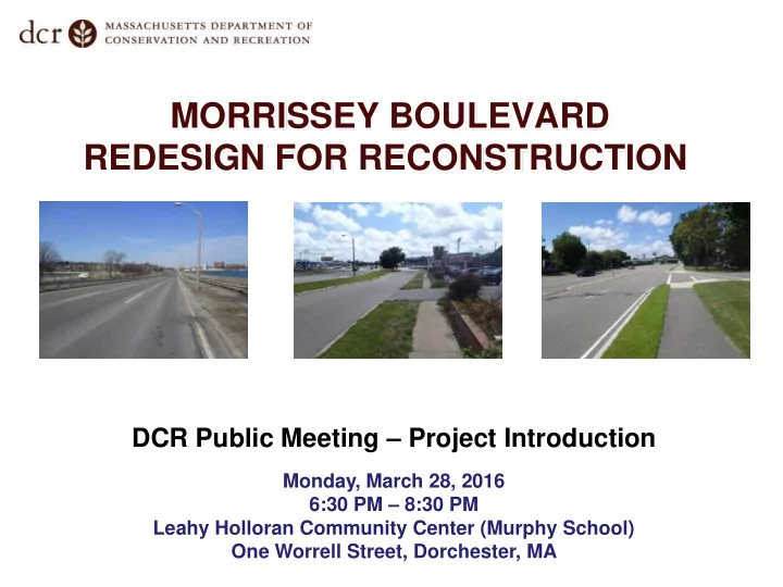
MORRISSEY BOULEVARD REDESIGN FOR RECONSTRUCTION DCR Public Meeting Project Introduction Monday, March 28, 2016 6:30 PM 8:30 PM Leahy Holloran Community Center (Murphy School) One Worrell Street, Dorchester, MA Commonwealth of


  1. MORRISSEY BOULEVARD REDESIGN FOR RECONSTRUCTION DCR Public Meeting – Project Introduction Monday, March 28, 2016 6:30 PM – 8:30 PM Leahy Holloran Community Center (Murphy School) One Worrell Street, Dorchester, MA

  2. Commonwealth of Massachusetts Governor Charles D. Baker Lieutenant Governor Karyn E. Polito Energy and Environmental Secretary Matthew A. Beaton Department of Conservation and Recreation Commissioner Leo Roy

  3. DCR Mission Statement To protect, promote and enhance our common wealth of natural, cultural and recreational resources for the well-being of all.

  4. Tonight’s Meeting - Purpose • Introduce the Project - Project Goals - Design Team - Scope and Schedule - Initial Observations and Data Collection • Obtain Public Input on Key Issues and Concerns

  5. Project History • Environmental work and preliminary design completed in 1990s

  6. DCR Projects Completed in Area • Beades Bridge • Pattens Cove Culvert • Mt. Vernon Street Bridge

  7. Primary Project Goals • Stormwater and flooding : Provide stormwater improvements and climate resiliency • Transportation : Provide safe, convenient, and inviting pedestrian and bicycle accommodations, balanced with appropriate vehicular accommodations • Landscape & Urban Design : Enhance parkway character and strengthen connections to recreational facilities, natural resource areas, and neighborhoods

  8. Design Team Overall Project Management, Direction and Guidance Civil & Structural Engineering; Drainage & Coastal Design Stormwater & Flood Control Strategy; Green Infrastructure Landscape Architecture & Urban Design Transportation Analysis & Design Environmental Permitting Geotechnical & Geoenvironmental Survey & Right-of-Way

  9. Design Project Scope • Conceptual through final design and construction • Public involvement process • Environmental permits • Drainage, transportation, and urban design upgrades • Safety improvements • New traffic signals and roadway lighting

  10. Major Items Accomplished to Date • New topographic and right-of-way survey of entire corridor • Transportation data collection and analysis • Modeling of existing drainage system • Coastal and flood-risk modeling and analysis • Urban design and landscape assessment

  11. Potential Project Phasing • Design is fully funded ($3.2 million) • “Middle” segment is most vulnerable today and will be prioritized first for construction • Construction of all segments subject to funding availability

  12. Design Project and Public Process Timeline Public Public Public Meeting #1 – Meeting #2 – Meeting #3 – Project Presentation Presentation Introduction of Design of 25% and Listening Concepts* Design* Session March 28, 2016 May 2016 July 2016 Public Public Meeting #4 Meeting #5 Pre- – – Construction Presentation Presentation Public of 75% of Final Meeting*** Design** Plans** October 2016 December 2016 May 2017 * Entire Corridor Length ** Phase 1 (Middle) if phased *** Pending Funding

  13. Project Goal: Stormwater and Flooding • Provide Stormwater Improvements and Climate Resiliency

  14. Stormwater and Flooding Why does Morrissey Boulevard flood? • Physical Characteristics  Low elevation  Coastal exposure  Size, location, and condition of drainage infrastructure (catch basins, pipes, outfalls) • Flood Sources  Precipitation falling directly on the roadway  Stormwater from “uphill” areas (in pipes and on surface)  Coastal processes (tides/wind/waves/storm surge)

  15. Stormwater and Flooding Why will it get worse? • Sea Level Rise (SLR)  “ New Normal” of higher tides restricts free flow of stormwater from roadway to Boston Harbor • More frequent and stronger coastal storms  Higher water = further restrictions on flow through drainage system  Direct flooding due to wind and waves • Increased rainfall intensity  Can overwhelm the drainage system, even without coastal impacts

  16. Stormwater and Flooding How much worse? • Increasingly sophisticated modeling and studies have been performed for the Boston area

  17. Stormwater and Flooding How much worse? Year 2070 – 10% Probability* Morrissey Boulevard *There is a 1 in 10 chance that sometime in year 2070 the flood depths shown on this map will be reached or exceeded

  18. Stormwater and Flooding How much worse? Year 2070 – 1% Probability* Morrissey Boulevard *There is a 1 in 100 chance that sometime in year 2070 the flood depths shown on this map will be reached or exceeded

  19. Stormwater and Flooding Potential Adaptation Tools: Shoreline Protection “Hard” Solutions “Soft” Solutions Source: Delewarestuary.org

  20. Stormwater and Flooding Potential Adaptation Tools: Roadway Elevation and/or Flood Walls Full Roadway Existing Elevation Roadway Partial Roadway Elevation Existing Roadway

  21. Stormwater and Flooding Potential Adaptation Tools: Green Infrastructure (GI) GI tools such as biofiltration and pervious surfaces can both reduce total runoff and improve water quality.

  22. Stormwater and Flooding Potential Adaptation Tools: Capacity and Conveyance Tide Gate at Drainage Outfall Backflow Prevention Device at Drainage Outfall These tools can store water in the system when tides are too high to discharge and can prevent ocean water from backing up onto the roadway Cutaway View of Temporary Underground Stormwater Storage

  23. Project Goal: Transportation • Provide safe, convenient, and inviting pedestrian and bicycle accommodations, balanced with appropriate vehicular accommodations

  24. Transportation Transportation: Study Area • Covers entire project limits • Includes:  8 signalized intersections  6 unsignalized locations  2 pedestrian bridges

  25. Transportation General Transportation Context • Corridor plays both regional and local role • 3 distinct and diverse Segments • Heavily influenced by peak hour Expressway congestion • Not presently conducive to bicycle and pedestrian travel either along or across

  26. Transportation North: Kosciuszko Circle to Bianculli Boulevard  Columbia Point  Evolving land uses and multimodal users  Large student population  Frontage roads and non-standard designs  9+ Lanes = Reduction opportunities

  27. Transportation Middle: Bianculli Boulevard to Freeport Street  Savin Hill  Recreational uses  Environmentally sensitive  Consistent 6-lane section  Limited width at Beades Bridge  Signals at each end limit capacity

  28. Transportation South: Freeport Street to Neponset Circle  Commercial land uses  6-lane section  Narrow, unattractive median  Frontage road at northerly end  Intermittent residential abutters  Multiple pedestrian crossings

  29. Transportation Vehicular Volumes • Peak Hours:  Higher volumes northbound  Higher volumes north of I-93

  30. Transportation Pedestrian and Bicycle Volumes • Peak hours (AM/PM) • Highest volumes at JFK/UMass • Limited bicycle volume south of Freeport Street • Low volumes probably not reflective of potential demand

  31. Transportation Existing Analysis • Peak hours • Vehicle delay: Level-of-Service A (best) thru F (worst) • Heaviest congestion at Freeport Street; UMass, and Mt. Vernon Street • Little delay at other intersections

  32. Transportation Transit • Limited bus service on Morrissey – Route 201 & 202 variations only • Important connection to JFK/UMass Station

  33. Transportation * Crash Analysis * • All intersections below * 3-year totals state average crash rate, except Freeport Street • Freeport Street slightly worse than state average • Design will look to incorporate safety improvements

  34. Transportation Bicycle and Pedestrian Goals • Provide facilities along entire corridor • Minimize conflicts between bicycles and pedestrians and between bicycles, pedestrians, and vehicles • Integrate with surrounding bicycle/pedestrian network

  35. Transportation Bicycle and Pedestrian Challenges • Existing roadway is space-inefficient in places and presents more conflicts than necessary • Constrained areas including bridge and underpass “pinch points”

  36. Transportation Transportation Analysis • Next Steps:  Develop projections of future volumes for all modes  Develop conceptual designs and assess them against project goals  Refine the alternatives  Perform more detailed design analysis

  37. Project Goals: Landscape and Urban Design • Enhance parkway character and strengthen connections to recreational facilities and natural resource areas

  38. Landscape / Urban Design Landscape and Urban Design • Other Projects Influencing Morrissey Boulevard  Columbia Point Master Plan  Mt. Vernon Street Columbia Point Master Plan  Neponset River Greenway Proposed Mt. Vernon Street Design

  39. Landscape / Urban Design Neponset River Greenway

  40. Landscape / Urban Design Neponset River Greenway • Bicycle and pedestrian connections between Tenean Beach and the proposed trail at National Grid may be along Morrissey Boulevard • Connections north of the proposed trail at National Grid are along Morrissey Boulevard

Download Presentation
Download Policy: The content available on the website is offered to you 'AS IS' for your personal information and use only. It cannot be commercialized, licensed, or distributed on other websites without prior consent from the author. To download a presentation, simply click this link. If you encounter any difficulties during the download process, it's possible that the publisher has removed the file from their server.

Recommend


More recommend