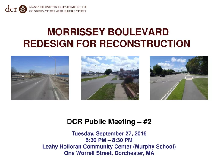
SLIDE 1
MORRISSEY BOULEVARD REDESIGN FOR RECONSTRUCTION
DCR Public Meeting – #2
Tuesday, September 27, 2016 6:30 PM – 8:30 PM Leahy Holloran Community Center (Murphy School) One Worrell Street, Dorchester, MA
SLIDE 2
Commonwealth of Massachusetts
Governor
Charles D. Baker
Lieutenant Governor
Karyn E. Polito
Energy and Environmental Secretary
Matthew A. Beaton
Department of Conservation and Recreation Commissioner
Leo Roy
SLIDE 3
DCR Mission Statement
To protect, promote and enhance our common wealth of natural, cultural and recreational resources for the well-being of all.
SLIDE 4 Tonight’s Meeting - Purpose
- Focus on “Functional Design Concept”
- Vehicle / Pedestrian / Bicycle Facilities
- Intersection Layouts and Operations
- Enhanced Neighborhood Connections
- Review Project Development
- North Area – Mt. Vernon to Pattens Cove Bridge
- Middle Area – Pattens Cove to I-93
- South Area – I-93 to Neponset Circle
- Obtain Public Input on Key Issues and Concerns
SLIDE 5 Primary Project Goals
- Stormwater and flooding: Provide
stormwater improvements and climate resiliency
- Transportation: Provide safe, convenient,
and inviting pedestrian and bicycle accommodations, balanced with appropriate vehicular accommodations
- Landscape & Urban Design: Enhance
parkway character and strengthen connections to recreational facilities, natural resource areas, and neighborhoods
SLIDE 6 Design Team
Civil & Structural Engineering; Drainage & Coastal Design
Stormwater & Flood Control Strategy; Green Infrastructure Landscape Architecture & Urban Design Transportation Analysis & Design Environmental Permitting Geotechnical & Geoenvironmental Survey & Right-of-Way
Overall Project Management, Direction and Guidance
SLIDE 7 Design Project Scope
Pattens Cove Bridge Interstate 93/Freeport St. Neponset Circle North Area Middle Area South Area
SLIDE 8 Potential Project Phasing
funded ($3.2 million)
most vulnerable due to flooding conditions and will be prioritized first for construction
segments subject to funding availability
SLIDE 9 Design Project and Public Process Timeline
Public Meeting # 1 – Project Introduction and Listening Session Public Meeting # 2 – Presentation
Concepts* Public Meeting # 3 – Presentation
Design*
Public Meeting # 4 – Presentation
Design* * Public Meeting # 5 – Presentation
Plans* * Pre- Construction Public Meeting* * * March 28, 2016 September 27, 2016 January 2017 May 2017 October 2017 March 2018
* Entire Corridor Length ** Phase 1 (Middle) if phased *** Pending Funding
SLIDE 10 What You Told Us….
- Corridor-Wide
- Reduce traffic speeds
- Connect neighborhoods to parks / shore
- Provide dedicated bicycle and pedestrian facilities
- Change character from highway to urban boulevard
- Enhance aesthetics and landscaping
- Specific Locations
- Intersection operations for all users
- Driveway safety
- Additional crosswalks; U-turns; left-turns
- Enhance/take advantage of natural features
(beaches, wetlands, open space)
SLIDE 11 General Concept Features
- Reduced number of through lanes from 3 to 2
- Provides additional turning lanes at intersections
- Design and Posted Speed of 35 mph (versus 40 mph
maximum today)
- Separate bicycle and pedestrian facilities where feasible
- Bicycles:
- Sidewalk level paths
- Combination of one-way paths (running with direction of
roadway traffic) and two-way paths (in “recreational” areas)
SLIDE 12
Proposed Bicycle & Pedestrian Facilities
SLIDE 13
Proposed Bicycle & Pedestrian Facilities Sidewalk with One-Way Cycle Track (Adjacent)
SLIDE 14
Proposed Bicycle & Pedestrian Facilities Sidewalk with Two-Way Cycle Track
SLIDE 15
Proposed Bicycle & Pedestrian Facilities
SLIDE 16
Proposed Bicycle & Pedestrian Facilities “Ocean Parkway” Area
SLIDE 17
Proposed Bicycle & Pedestrian Facilities
SLIDE 18
Proposed Bicycle & Pedestrian Facilities Sidewalk with One-Way Cycle Track (Separated)
SLIDE 19 Traffic Design Goals
- Improve safety
- Reduce operating speeds
- Incorporate ped/bike facilities
- Maintain comparable vehicle capacity and
- perations
- Improve efficiency
SLIDE 20 Traffic Design: Focus Locations
- Existing Conditions
- Proposed Roadway Layout
- Proposed Design Features
SLIDE 21
SLIDE 22
SLIDE 23 Signalized Service Road 1 Lane on Service Road 2 Southbound Thru Lanes Old Colony Terrace Deceleration Lane Elimination of Jug Handle Revised Geometry Reduced Cycle Length/Improved Efficiency
SLIDE 24 MALIBU BEACH AREA - EXISTING
SLIDE 25 MALIBU BEACH AREA – PROPOSED ROADWAY LAYOUT
SLIDE 26 Southbound Left Turn and Ped Crossing Additional Ped/Bike Crossing (HAWK) 2 Travel Lanes per Direction
SAVIN HILL YACHT CLUB
Provide wider boat launch driveway / relocate further north
MALIBU BEACH AREA - PROPOSED
SLIDE 27 High-Intensity Activated CrossWalK (HAWK)
- Dark until pedestrian button is pushed
- Flashing yellow then solid yellow
- Solid red simultaneous with Walk symbol
- Flashing red (stop control) simultaneous with
flashing “Hand” symbol
- Dark until next activation
SLIDE 28
SLIDE 29
SLIDE 30 2 Travel Lanes per Direction Improved Crossing Improved Service Road Geometry Southbound Left Turn Relocated to Victory Road Reduced Cycle Length/Improved Efficiency Improved Ped/Bike Crossings
SLIDE 31
SLIDE 32
SLIDE 33 Southbound Left Turn and Ped Crossing 2 Travel Lanes per Direction Providing a Pedestrian and Bicycle Connection Access Management
SLIDE 34
SLIDE 35
SLIDE 36 Eliminate U-Turn to Improve Safety Eliminate Short Weave Provide Accel/Decel Lane Improved Ped/Bike Crossing (HAWK) 2 Travel Lanes per Direction
SLIDE 37
Bringing it All Together…Existing
SLIDE 38
Bringing it All Together…Future Vision
SLIDE 39
Bringing it All Together…Existing
SLIDE 40
Bringing it All Together…Future Vision
SLIDE 41
Bringing it All Together…Future Vision
SLIDE 42
Bringing it All Together…Future Vision
SLIDE 43
SLIDE 44 Enough from us…let’s hear from you!
- General Questions & Answers (15 minutes)
- Table Discussions (40 minutes)
- North Area
- Middle Area
- South Area
How to provide feedback tonight:
SLIDE 45 Enough from us…let’s hear from you!
http://www.mass.gov/eea/agencies/dcr/public-
- utreach/submit-public-comments/
- Write: Department of Conservation and Recreation
Office of Public Outreach 251 Causeway Street, Suite 600 Boston, MA 02114
- Deadline: Comments will be accepted through Tuesday,
October 18, 2016
- Note: Public comments submitted to DCR may be
posted on the DCR website in their entirety
How to provide feedback after tonight:
SLIDE 46
General Questions?
SLIDE 47
Table Discussions
SLIDE 48 For m ore inform ation:
- See m aterials relative to this m eeting posted under
“Materials From Past Public Meetings 2 0 1 6 ” at
http: / / www.mass.gov/ eea/ agencies/ dcr/ public-outreach/ public-meetings/
I f you have questions or concerns or w ish to subscribe to a DCR general inform ation or project-related listserv: contact DCR’s Office of Community Relations at 617-626-4973 or Mass.Parks@state.ma.us.
Additional Information