Improving Commercial Fleet Safety and Performing High-Def Mapping At - - PowerPoint PPT Presentation

improving commercial fleet safety and performing high def
SMART_READER_LITE
LIVE PREVIEW

Improving Commercial Fleet Safety and Performing High-Def Mapping At - - PowerPoint PPT Presentation

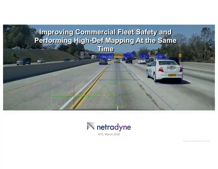
Improving Commercial Fleet Safety and Performing High-Def Mapping At the Same Time GTC, March 2018 Netradyne Confidential & Proprietary The Safety Challenge The Dynamic Mapping Road Accidents are the leading Challenge cause of loss of


slide-1
SLIDE 1

Netradyne Confidential & Proprietary

GTC, March 2018

Improving Commercial Fleet Safety and Performing High-Def Mapping At the Same Time

slide-2
SLIDE 2

Netradyne Confidential & Proprietary

The Safety Challenge

Road Accidents are the leading cause of loss of life & property

  • [Globally] est. 1.25M fatalities

annually

WHO

  • [US] ~$800B financial loss due

to road accidents in 2010

NHTSA, “Traffic Safety Facts”, Feb, 2015

  • 94% of accidents are due to

driver related reasons

NHTSA, “Traffic Safety Facts”, Feb, 2015

The Dynamic Mapping Challenge

L2+ to L5 autonomous vehicles leverage HD maps that need to be updated frequently.

  • [US] ~$2B estimate to HD-Map the

US once using existing approaches

  • Raquel Urtasun, Uber ATG, NIPS Dec 2016
slide-3
SLIDE 3

Netradyne Confidential & Proprietary

Netradyne Solution

  • A Deep Learning AI driven IoT solution focused on improving commercial vehicle &

driver safety

  • And in the process continuously collect vast amounts of rich, vision based data

Leverage this data to create

  • Dynamic HD Maps
slide-4
SLIDE 4

Netradyne Confidential & Proprietary

Quad HD Cameras 360 Degree, 120 dB HDR NVIDIA TX1 Deep Learning Processor Inertial Sensors 9 Axis Accelerometer, Gyro, and Magneto sensors Communication Channels 4G LTE / Wi-Fi / BT / GPS Integrated with CAN Bus (J1939/OBD II) Storage Up to 50 Hours of Video on device

DriveriTM

Vision-Based IoT Driving Monitoring System DriveriTM uses Edge Computing to analyze every second of driving

slide-5
SLIDE 5

Netradyne Confidential & Proprietary

The most extensive collection of Rich, Vision Based Driving Data

Ride Sharing Commercial Fleets Rich, Vision Based Driving Data

In 2018: 100M miles/month In 2020: 1B+ miles/month Dynamic 3D HD Maps 22M US, 150M globally Several million and growing …

slide-6
SLIDE 6

Netradyne Confidential & Proprietary

Real-time edge-computing to fully analyze the visual scene.

Scene Examples

slide-7
SLIDE 7

Netradyne Confidential & Proprietary

slide-8
SLIDE 8

Netradyne Confidential & Proprietary

slide-9
SLIDE 9

Netradyne Confidential & Proprietary

slide-10
SLIDE 10

Netradyne Confidential & Proprietary

Netradyne US Miles Analyzed via IDMS

slide-11
SLIDE 11

Netradyne Confidential & Proprietary

Netradyne Miles Analyzed – Urban Coverage

Netradyne Phoenix Coverage Netradyne San Diego Coverage

slide-12
SLIDE 12

Netradyne Confidential & Proprietary

Dynamic 3D HD Maps

slide-13
SLIDE 13

Netradyne Confidential & Proprietary

Road Boundaries

Lane Markings

Traffic Signs

Road Hazards

  • Autonomous cars (Level 2-5) use HD maps to

understand the road environment

  • Maps need to be updated dynamically to reflect

changes in the road environment

  • Sometimes the road geometry needs to be inferred
  • Inferred lanes when lanes are poorly marked
  • Stop location for stop signs, traffic lights
  • Intersections can be very challenging

Autonomous Driving with Dynamic HD Maps

slide-14
SLIDE 14

Netradyne Confidential & Proprietary

Current Methods for Generating HD Maps

  • Very expensive. Dynamic updates of

hours/days/weeks impractical

  • Not enough information to provide ‘inferred’ road

geometry.

Test Vehicles with LiDAR Crowdsourcing from autonomous cars

  • It will be a very long time before there is sufficient

penetration of autonomous cars to provide a comprehensive crowd-sourced map.

  • No means to gather human driving patterns to aid in

map-making

slide-15
SLIDE 15

Netradyne Confidential & Proprietary

Netradyne Dynamic 3D HD Maps

First Person View of SLAM-based Mapping

  • Method: Generate real-time, crowd sourced, “High Definition”

maps using the commercially deployed Driveri devices.

  • 3D localization with target <10 cm relative accuracy
  • Dynamic Update: Develop SLAM approaches to crowd source

and quickly update for accidents, road construction, and other changes.

  • Inferred Drivable Surface:
  • Use Deep Learning & crowd-sourcing to generate accurate

‘inferred’ lanes & road boundaries even when the lane markings are poor or absent.

  • Use crowd-sourced analysis of human driving patterns to

aid in inferring the road geometry.

  • Edge Computing: Real-time, edge computing. Small BW

usage Everyday objects & lanes become navigation landmarks

slide-16
SLIDE 16

Netradyne Confidential & Proprietary

slide-17
SLIDE 17

Netradyne Confidential & Proprietary

Visible / Inferred Lane Road Boundary Ego Left / Ego Right Yellow Carpool

Detecting marked & inferred lanes

slide-18
SLIDE 18

Netradyne Confidential & Proprietary

Crowd-sourced Behavioral Models for HD Maps

‘Where to park?’ ‘Where to stop?’

  • Learn the implicit ‘Rules of the

road’ from human-drivers

  • Co-exist with human drivers

Probability of traffic light violation

slide-19
SLIDE 19

Netradyne Confidential & Proprietary

Example Generated Map

slide-20
SLIDE 20

Netradyne Confidential & Proprietary

Thank you

Web: www.netradyne.com