
SLIDE 1
16 January 2007 1 DigitalGlobe An Imaging and Information Company
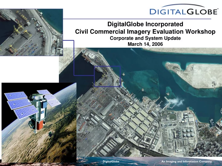
DigitalGlobe Incorporated Civil Commercial Imagery Evaluation Workshop
Corporate and System Update March 14, 2006
DigitalGlobe Incorporated Civil Commercial Imagery Evaluation - - PowerPoint PPT Presentation
DigitalGlobe Incorporated Civil Commercial Imagery Evaluation Workshop Corporate and System Update March 14, 2006 16 January 2007 1 DigitalGlobe An Imaging and Information Company DigitalGlobe operates the worlds highest resolution
16 January 2007 1 DigitalGlobe An Imaging and Information Company
DigitalGlobe Incorporated Civil Commercial Imagery Evaluation Workshop
Corporate and System Update March 14, 2006
16 January 2007 2 DigitalGlobe An Imaging and Information Company
16 January 2007 3 DigitalGlobe An Imaging and Information Company
QuickBird Specifications
Launched Oct. 2001; Fully Operational Jan. 2002 60cm (2-foot) panchromatic resolution (at nadir)
450-900 nm (grayscale)
2.44 meter multispectral resolution (at nadir)
450-520 nm (blue) 520-600 nm (green) 630-690 nm (red) 760-900 nm (near IR)
60cm (2-foot) digital color (natural or near-IR)
Image Detail Comparable to 1-foot film
Collection capacity: 15 orbits/day; ~57 scenes/orbit;
= ~27 million mi2 (70 million km2) per year
Large 10.3 x 10.3 mi (16.5 x 16.5 km) scene/footprint 11 bit dynamic range
16 January 2007 4 DigitalGlobe An Imaging and Information Company
QuickBird Imagery Types QuickBird Imagery Types
– 60 Centimeter Resolution – 11-bit Dynamic Range – 450-900 nm Spectral Range
– 2.4 Meter Resolution – 11-bit Dynamic Range – 4 Spectral Bands
– 11-bit or 8-bit dynamic range – Natural Color (3 Bands) – Color Infrared (3 Bands) – 4 Bands
Forbidden City, Beijing, China Port-au-Prince, Haiti Abu Dhabi, UAE
16 January 2007 5 DigitalGlobe An Imaging and Information Company
QuickBird--16.5 km
Ikonos--11 km OrbView 3--8 km Eros 1A – 12.5 km
Landsat 7
Large Imaging Footprint
interest per scene
Library faster
Mosaicking
area collection
Air Photo
16 January 2007 6 DigitalGlobe An Imaging and Information Company
Latitude 15 off-nadir 30 off-nadir 45 off-nadir 9.8 5 2.7 10 10.7 4.9 2.7 20 9.4 4.5 2.6 30 8.9 4.2 2.3 40 7.6 3.2 2.1 50 6.9 2.2 1.7 60 6.9 1.5 1.3 70 5.1 0.9 0.8 Revist Days to a point
QuickBird Satellite Revisit
16 January 2007 7 DigitalGlobe An Imaging and Information Company
A Growing Imagery Library A Growing Imagery Library
16 January 2007 8 DigitalGlobe An Imaging and Information Company
16 January 2007 9 DigitalGlobe An Imaging and Information Company
16 January 2007 10 DigitalGlobe An Imaging and Information Company
Stennis Space Center, MS
2-foot Resolution Natural Color QuickBird Imagery 1:20,000 2-foot Resolution Natural Color QuickBird Imagery 1:2,000
16 January 2007 11 DigitalGlobe An Imaging and Information Company
Louisiana Superdome
Relief /Rescue Helicopters Relief /Rescue Helicopters
Metairie, LA: Rescue Staging Base at Zephyr Field
Zephyr Field
A Plea for Help: Downtown New Orleans
16 January 2007 12 DigitalGlobe An Imaging and Information Company
10
N N
Exit 236C E x i t 2 3 6 B
Military Helicopters Parked on Interstate Military Helicopters Parked on Interstate
Flooded Residential Area Flooded Residential Area
QuickBird Natural Color Image September 3, 2005
16 January 2007 13 DigitalGlobe An Imaging and Information Company
QuickBird Natural Color Image September 3, 2005
Hammond Highway
Storm Debris Piled up At Bridge Levee Break
Construction Equipment
Probable Sandbags For Levee Repair Flooded Residential Area
16 January 2007 14 DigitalGlobe An Imaging and Information Company
DigitalGlobe Data and Extracted Information: Suitability for Many Civil Govt. Applications
– For virtually ALL applications, rapid response and long term planning
– Landcover III, Wetlands, Land Classification and Management, and Sensitive Areas
16 January 2007 15 DigitalGlobe An Imaging and Information Company
Primary Forestry Applications
16 January 2007 16 DigitalGlobe An Imaging and Information Company
Crown Mapping
high resolution imagery provide the basis for most automated and semi- automated forest assessment applications.
recognition as applied to forest resource assessment
derived from crown maps and classified according to size and species
Crown Mapping with Ground Verified Diameter Breast Height Data Crown mapping with four size classification based on crown diameter and ground verified sample data Source: Native Communities Development Corporation
16 January 2007 17 DigitalGlobe An Imaging and Information Company
Tree/Stem Diameter
Source: Native Communities Development Corporation
Diameter at Breast Height (DBH), is inferred from size of Crown area.
component in determining timber volume in a given stand
16 January 2007 18 DigitalGlobe An Imaging and Information Company
Species Classification
spectral depth necessary for species-level classification
Source: Native Communities Development Corporation Aspen Light Oak Ponderosa Ponderosa Dense Oak Aspen Light Oak Ponderosa Ponderosa Dense Oak
16 January 2007 19 DigitalGlobe An Imaging and Information Company
Forest Composition Mapping
are derived from canopy density analyses
degree of canopy closure
mapping thinning projects
zone maps
Timber Density Mapping
High density larger diameter stands in dark green and high density smaller diameter stands in red with moderate to low density timber illustrated in bright green as minimum tree units. Source: Native Communities Development Corporation
16 January 2007 20 DigitalGlobe An Imaging and Information Company
QuickBird Natural Color Image QuickBird Natural Color Image 27 October 2003 27 October 2003
Lytle Creek, California Lytle Creek, California
16 January 2007 21 DigitalGlobe An Imaging and Information Company
Lytle Creek, California Lytle Creek, California
QuickBird Color Near-Infrared Image QuickBird Color Near-Infrared Image 27 October 2003 27 October 2003 Clear delineation
Clear delineation
16 January 2007 22 DigitalGlobe An Imaging and Information Company
1-Foot Resolution Traditional Orthophoto vs. 2-Foot Resolution QuickBird Orthoimage 1-Foot Traditional Orthophoto 2-Foot QuickBird Orthoimage
16 January 2007 23 DigitalGlobe An Imaging and Information Company
DigitalGlobe Dynamic DOQQ Product
QuickBird Dynamic DOQQ Specifications
footprint as USGS DOQQs
RMSE)
projections available
DigitalGlobe Dynamic DOQQ 2-Foot Natural Color
16 January 2007 24 DigitalGlobe An Imaging and Information Company
DigitalGlobe ImageLibrary™ DOQQs
..... and counting
16 January 2007 25 DigitalGlobe An Imaging and Information Company
USGS DOQQ, I meter, Pan
16 January 2007 26 DigitalGlobe An Imaging and Information Company
DigitalGlobe DOQQ, 2-foot, Color
16 January 2007 27 DigitalGlobe An Imaging and Information Company
CitySphere Overview
– Current off-the-shelf orthomosaics of high resolution QuickBird imagery for 200 pre-selected cities worldwide
CitySphere Madrid
16 January 2007 28 DigitalGlobe An Imaging and Information Company
What is CitySphereTM
– ~50 US and ~150 International
– High Resolution QuickBird data – 60 cm (2 foot) resolution – Accurate – 1:4800 orthomosaics
– Basemap GIS - Color (RGB), 8 bit – Basemap Advanced – 4 band (NRGB), 16 bit
– Each city will be updated every year – Imagery no older than 24 months
16 January 2007 29 DigitalGlobe An Imaging and Information Company
available
available by May 2006
released every month
www.digitalglobe.com for updates
City Nam e Country
Aguas Calientes Mexico Albuquerque USA Anchorage USA Atlanta USA Austin USA Boise USA Charlotte USA Colorado Springs USA Fairbanks USA Guadalajara Mexico Halifax Canada Helena USA Honolulu USA Las Vegas USA Los Angeles USA Oakland USA Oklahoma City USA Orlando USA Portland USA Quebec Canada Regina Canada San Antonio USA San Francisco USA San Jose, California USA Saskatoon Canada Spokane USA Tucson USA Vancouver Canada Winnipeg Canada
City Name Country
Amman Jordan Athens Greece Baghdad Iraq Barcelona Spain Basra Iraq Belgrade Serbia and Montenegro Belo Horizonte Brazil Brasilia Brazil Brisbane Australia Canberra Australia Cape Town South Africa Casablanca Morocco Durban South Africa Fortaleza Brazil Guadalajara Mexico Istanbul Turkey Karachi Pakistan Lima Peru Lisbon Portugal Madrid Spain Naples Italy Perth Australia Reval Estonia Rio de Janeiro Brazil Rome Italy San Salvador El Salvador Santiago Chile Santo Domingo Dominican Republic Skopje Macedonia Tunis Tunisia Windhoek Nambia
Currently Available CitySphere™ Cities
International North America
16 January 2007 30 DigitalGlobe An Imaging and Information Company
CitySphere Product Example
Downtown San Francisco
16 January 2007 31 DigitalGlobe An Imaging and Information Company
16 January 2007 32 DigitalGlobe An Imaging and Information Company
DigitalGlobe Satellite Comparison
Operational Altitude 450 km 450 km 770 km Weight Class 2000 lbs 5700 lbs 5700 lbs Pan / MS GSD (nadir) 0.6 / 2.4 m 0.5 / 2.0 m 0.5 / 2.0 m Standalone CE90 (avg / max) 13 m / 23 m 7 m / 9 m 11 m / 14 m Avg revisit at 1m resolution (40 deg latitude target) 2.5 days 1.7 days 1 day Swath width 16.5 km 16 km 16 km Monoscopic area capacity 1 X > 3.5 X Single-Pass Mono Area Coverage (scenes) 1 x 10 (< 30 deg off nadir) 4 x 4 (< 40 deg off nadir) 1 x 10 (< 40 deg off nadir) Single-Pass Stereo Area Coverage (scenes) 1 x 1 (< 10 deg off nadir) 2 x 2 (< 30 deg off nadir) 1 x 10 (< 30 deg off nadir) Attitude Control Reaction Wheels Control Moment Gyros Onboard Storage 128 Gbits 1600 Gbits Wideband Link Rate 320 Mbps 800 Mbps
QuickBird WorldView-60 WorldView-110
16 January 2007 33 DigitalGlobe An Imaging and Information Company
QuickBird Geolocation Accuracy
The CE90s of recent QB imagery have gotten uncomfortably close to our 23 meter spec.
some absolute geolocation accuracy statistics:
16 January 2007 34 DigitalGlobe An Imaging and Information Company
QuickBird Geolocation Accuracy
What kills the geolocation accuracy?
If star catalog is perfect, then star trackers provide excellent data for attitude solution.
16 January 2007 35 DigitalGlobe An Imaging and Information Company
QuickBird Geolocation Accuracy
What kills the geolocation accuracy?
But a biased star in the catalog skews the attitude solution.
16 January 2007 36 DigitalGlobe An Imaging and Information Company
QuickBird Geolocation Accuracy
Can it be fixed? Absolutely! Just reprocess the attitude… adp216, current adp40, experimental Port Hedland, Australia
4 Aug 2005 02:37 UTM
CE90: 16.97 meters CE90: 3.53 meters
16 January 2007 37 DigitalGlobe An Imaging and Information Company
What Do WV Satellite Enhancements Mean?
– Standalone max CE90 roughly twice as good as QuickBird – Accuracy Transfer improves standalone accuracy significantly (demonstrated better than 6 meter CE90 in testing with QuickBird; WorldView will be better given higher quality gyros)
– Daily revisit at 1 meter resolution or better – Much better chance of collection in high cloud regions
– Over 3.5x the total capacity of QuickBird, so faster collection
– MUCH greater local collection capacity – MUCH greater capacity to collect competing orders within the same region – MUCH faster collection of orders in high competition areas
16 January 2007 38 DigitalGlobe An Imaging and Information Company
WorldView’s CMGs Greatly Reduce Slewing Time
300 km
10 seconds
WorldView-1 For typical target separations, WorldView slew time is 2 to 3 times faster than the next highest performing system
target 1 target 2 Control Moment Gyros Large Propulsion System (>7 yrs fuel) 2 Single Axis Solar Array Wings Large Ni-H Battery Star Tracker, SIRU, GPS WV-60 Telescope (60cm Aperture) Pan only, Dual Direction FPA 2 Terabit Recorder 800 Mpbs Downlink
16 January 2007 39 DigitalGlobe An Imaging and Information Company
0% 20% 40% 60% 80% 100% Fraction Of Passes Target Is Visible From Multiple Satellites Constellation includes: QB, WV-1, WV-2 At least 1 satellite At least 2 satellites 3 satellites At least 1 satellite At least 2 satellites 3
WorldView Constellation (QB, WV-1, WV-2) Offers Many Same-Day Imaging Opportunities For A Variety Of Scenarios
At least 1 satellite At least 2 satellites
Does not include cloud cover, since this varies by region & season
NoDong Missile Site < 1 m GSD Tsunami Coast < 1 m GSD Afghanistan < 20º off-nadir
Point Strip Small Area
Image twice a day on average Image 1.4 times a day on average (either one or two times a day) Image once every two days on average
16 January 2007 40 DigitalGlobe An Imaging and Information Company
Efficient Constellation Tasking Means Quicker Order Fulfillment
QB2
pass
QB2 Alone (today) Time to complete Whole 1° Cells ~ 25 days QB2 + WV-1 (2006) QB2 + WV-1 + WV-2 (2008) QB2 QB2 WV60 WV110 Time to complete Whole 1° Cells ~ 6 days Time to complete Whole 1° Cells ~ 2 days
pass
pass
pass
WV60
pass
pass
vicinity of 1°cell
16 January 2007 41 DigitalGlobe An Imaging and Information Company
Summary
commercial satellite capability in: – Timeliness – Capacity – Agility – Accuracy – Multisourcing – Product Diversity – Integration with NGA Systems – Cost-effectiveness: a better product for a dramatically lower price
– WorldView-60 launch by late-2006 – WorldView-110 launch 12-18 months following WV1
16 January 2007 42 DigitalGlobe An Imaging and Information Company
Thank You
16 January 2007 43 DigitalGlobe An Imaging and Information Company
Thank You
16 January 2007 44 DigitalGlobe An Imaging and Information Company
Brett Thomassie (985) 643-3652 (228) 688-1607