SLIDE 3 Raingauge + GSMaP/NRT AMSR-E/AMSR2 Rainfall Lake area AMSR-E, AMSR2, PALSAR, PALSAR2 Soil moisture, Soil properties Regional Climate Model (RCM) Field survey Agriculture Statistical downscaling and bias correction Climate change real-time information sharing via website capacity building voices at stake- holder meetings
rice growing period rice growing period Present Future
Climate Change Impact Assessment
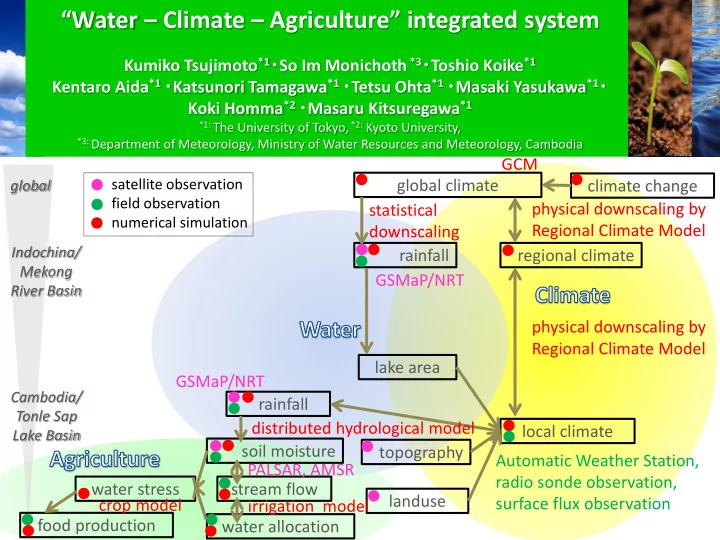
global Indochina/ Mekong River Basin Cambodia/ Tonle Sap Lake Basin
climate change global climate regional climate local climate rainfall rainfall lake area topography landuse soil moisture stream flow water allocation water stress food production physical downscaling by Regional Climate Model physical downscaling by Regional Climate Model Automatic Weather Station, radio sonde observation, surface flux observation statistical downscaling
satellite observation field observation numerical simulation
GSMaP/NRT GCM distributed hydrological model crop model PALSAR, AMSR irrigation model GSMaP/NRT