The Study Team Morrison Hershfield (MH) was the lead consultant for - - PowerPoint PPT Presentation

the study team
SMART_READER_LITE
LIVE PREVIEW

The Study Team Morrison Hershfield (MH) was the lead consultant for - - PowerPoint PPT Presentation

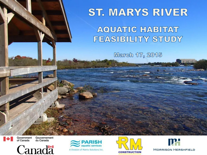
The Study Team Morrison Hershfield (MH) was the lead consultant for the St. Marys River Aquatic Habitat Feasibility Study, filling the roles of Project Manager and Senior Fisheries Biologist. PARISH Aquatic Services , a division of Matrix Solutions


slide-1
SLIDE 1
slide-2
SLIDE 2

Morrison Hershfield (MH) was the lead consultant for the St. Marys River Aquatic Habitat Feasibility Study, filling the roles of Project Manager and Senior Fisheries Biologist. PARISH Aquatic Services, a division of Matrix Solutions Inc., led the geomorphic and hydraulic assessments for the study. R & M Construction served as the specialized watercourse construction Contractor who provided constructability reviews as well as costing for the various enhancement/restoration options. Additional study team support: Environment Canada Garden River First Nation Batchewanwa First Nation

The Study Team

2

slide-3
SLIDE 3

Goal of Study was to assess the: Feasibility Study Goals

3

Physical Feasibility Ecological Feasibility Economic Feasibility Creating New Habitats Augmenting Existing Habitats

  • St. Marys River
  • St. Marys River Rapids
  • St. Marys River Tributaries
slide-4
SLIDE 4

Study Area

4

  • St. Marys River Sites

Big and Little Carp River West Davignon Diversion Channel Fort Creek Root River Garden River Echo River Bar River

  • St. Marys River Tributary Sites

SMR Rapids Whitefish Island Brookfield Tailrace & Fort Creek Confluence SSM Waterfront & St Joseph Island

slide-5
SLIDE 5

Study Area

5

slide-6
SLIDE 6

Methodology

6

Stakeholder Consultation & Background Data Requests Background Reviews & Data Gap Analysis Preliminary Site Surveys & Screening Detailed Field Surveys & Data Analysis Conceptual Design

Constructability & Costing Concerns & Considerations

Feasible Option Selection

slide-7
SLIDE 7

Environment Canada led consultations with the following stakeholders in an effort to collect any new or notable information on the SMR/AOC

Stakeholder Consultation

7

Ministry of Natural Resources and Forestry (MNRF) Fisheries and Oceans Canada (DFO) Environment Canada (EC) Sault Ste. Marie Region Conservation Authority (SSMRCA) City of Sault Ste. Marie U.S. Army Corps of Engineers (USACE) Batchewana First Nation Garden River First Nation

slide-8
SLIDE 8

Background Data Analysis

8

slide-9
SLIDE 9

Data gaps which may require further research or field based studies to properly address habitat restoration/enhancements within the SMR.

Data Gaps

9

Limited topographic mapping Lack of specific fisheries data Lack of fish habitat mapping Limited detailed bathymetry data/mapping Lack of studies to support the link between wetlands and the rapids Understanding of impacts from compensating gate configuration Incomplete reports/data/studies Lack of flow pattern data, velocity and depth information for the rapids Sediment, rock and boulder movement data does not exist

slide-10
SLIDE 10

Each site was evaluated in terms of a general approach of enhancing aquatic habitat through the development of a stable, self-maintaining system with hydraulic variability and appropriate structure.

Preliminary Site Screening

10

Ecological Parameters (Ecological)

  • Fish Community
  • Fisheries Dependence on

Habitats

  • Water Quality

Geomorphic Parameters (Physical)

  • Flow Regime
  • Reach Slope

Habitat Enhancement Potential Proximity of Reach and Benefit to SMR AOC

slide-11
SLIDE 11

Preliminary Site Screening

11

slide-12
SLIDE 12

Detailed Field Investigations & Analysis

12

Fish and Fish Habitat Studies Fish and Fish Habitat Studies

Fish Community Fish Community Aquatic Habitat & Structure Aquatic Habitat & Structure Aquatic Invasive Species & SAR Aquatic Invasive Species & SAR Water Quality & Pollution Water Quality & Pollution

Ecological Field Surveys Studied 4 Major Components

slide-13
SLIDE 13

Detailed Field Investigations & Analysis

13

Geomorphic Studies Geomorphic Studies

Bathymetry Bathymetry Channel Dimensions Channel Dimensions Gradient Gradient Substrate Substrate Floodplain Floodplain Riparian Vegetation Riparian Vegetation

Physical Field Surveys Studied 6 Major Components

slide-14
SLIDE 14

Conceptual Designs were developed using:

Conceptual Designs

14

Background Data & Reporting Geomorphic Principals Ecological Principals Complete Reconstruction Augmentation of Existing Condition Preliminary & Detailed Field Surveys

slide-15
SLIDE 15

Conceptual Designs

15

Conceptual Design Considerations:

Developed for Consideration & Planning Discussions In-depth Field Investigations Required Social and Community Impacts Stakeholder Concerns Property and Site Access Permissions Funding

slide-16
SLIDE 16

Big Rapids

16

Conceptual Design Details

  • Existing rapids would be extended at its downstream limits
  • Graded to concentrate flows to middle of structure
  • Stone mix would vary in size
  • Large stone to act as structural component
  • The mid to lower sized stone have suitable void ratio to limit through

flow (piping) and provide spawning habitat

  • To avoid excessive piping and enhance habitat availability for benthic

invertebrates, the voids would be filled with smaller stone material (coarse gravels and small cobbles)

The approach was to augment the existing rapids to increase the available area for spawning and other habitat uses and enhance productivity and distribution of benthic invertebrates.

slide-17
SLIDE 17

Big Rapids

17

slide-18
SLIDE 18

Brookfield Tailrace & Fort Creek Confluence

18

True rapids habitats not possible within tailrace due to high velocities, substantial water depths and fluctuating ramping rates from hydro facility

Conceptual Design Details

  • A stone berm would be created near the confluence to direct flows.
  • Boulder clusters/rock piles would provide additional roughness, habitat cover
  • pportunities and habitat variability for both fish and other aquatic organisms.
  • Stone mix in nearshore areas would provide roughness and habitat for fish and

also serve to reduce the scour potential along boardwalk.

  • Stone mix installed so thickness and width varies to ensure increased variability
  • f the treatment.
  • Due to flow disturbance during placement of rock, natural variability in shape and

thickness would naturally occur.

  • Broader mix of stone sizes (likely 0.3 -1.0 m plus), variability would be achieved.

Shallow backwater area at Fort Creek confluence provides opportunity to install stone on channel bed to mimic rapids-like substrate

slide-19
SLIDE 19

Brookfield Tailrace & Fort Creek Confluence

19

slide-20
SLIDE 20

Whitefish Island & Channel

20

Whitefish Island can be segmented into two sections: (1) The downstream (east) section, the single channel, and (2) the upper (west) section which has braided wetland/channel features.

Conceptual Design Details

  • Modification of the beaver dam/weir structures to improve fish passage and sediment

transport.

  • Channel bed and bank areas would be restored to a more natural condition including grading

existing materials and seeding and planting to create a more natural transition area and provide additional aquatic habitat.

  • Existing concrete/rock berms used to define the lower portion of the channel would be

replaced with a soil berm with a stony core, planted with native shrubs and vegetation that would overhang the channel.

  • Woody debris would be incorporated along the banks to provide additional cover habitat
  • Wetland features would be created/enhanced on the east end of the island.
  • Wetland creation would increase water retention, improve water quality, add nutrient rich

soils which would result in a more diverse aquatic vegetation community to improve fish, benthic invertebrate and wildlife habitat.

slide-21
SLIDE 21

Whitefish Island & Channel

21

slide-22
SLIDE 22

Whitefish Island & Channel

22

slide-23
SLIDE 23

Fort Creek

23

The conceptual design proposed for Fort Creek is limited to a short reach between the railway crossing immediately south of Bay Street and the confluence with the SMR.

Conceptual Design Details

  • Re-alignment of channel to improve channel sinuosity, improve geomorphic function, diversify

habitats, create variability in flow depth and velocity and increase dissolved oxygen.

  • Bank treatments to promote dense overhanging vegetation growth to provide nearshore foraging

and cover opportunities as well as to stabilize channel banks.

  • At the confluence of Fort Creek and SMR, a rocky feature which would mimic a natural rapids area

is proposed.

  • Creation of a wetland complex connected to the channel via a series of overflow points that would

act as flood control.

  • Wetland graded to have a broad, hummocky profile to provide variability for supporting a broad

range of vegetation types and support spawning activity of northern pike and bass species.

  • Wetland and surrounding lands planted with trees, shrubs and aquatic herbaceous species that

would provide additional benefits to the currently abandoned land.

  • Further enhancements could include public accessibility through the creation of pathways.
slide-24
SLIDE 24

Fort Creek

24

slide-25
SLIDE 25

West Davignon Diversion Channel

25

The overall strategy with the conceptual design is to improve the channel by restoring some

  • f the natural functions lost when the channel was straightened and hardened.

Conceptual Design Details

  • Natural channel design implemented from railway downstream to SMR.
  • Due to the low gradient the bed would be raised gradually to the height of the grade

control structure upstream of Baseline Road to increase energy and sediment transport.

  • Riffles, pools, and improved cross-sectional form and capacity would promote more

natural sediment transport.

  • The improved bedforms would create pools for nursery and overwintering habitat and

riffles for spawning and benthic invertebrate productivity.

  • Bank treatments including Live Cribwalls and Brush Layering would provide long term

bank stability and habitat opportunities.

  • Planting of native species of trees, shrubs and forbs would provide stability, shading,

nutrient and nearshore cover.

  • Barriers (beaver dam/apron) would be removed to provide unobstructed fish passage.
slide-26
SLIDE 26

West Davignon Diversion Channel

26

slide-27
SLIDE 27

Garden River

27

Little opportunity for significant aquatic enhancement and/or restoration in lower Garden River A/OFRC is entering the third year of a multi-year on-going study to determine distribution, spawning activity and habitat usage of lake sturgeon populations within the Garden River. To date, important findings on the numbers and distribution of this species have been found including dispersal of larval lake sturgeon within lower Garden River. This option was carried forward as a means to flag its importance for future considerations to both the SMR AOC, status of a threatened population of lake sturgeon and traditional importance of this fish species to the Garden River First Nation.

slide-28
SLIDE 28

Economic Feasibility and Constructability

28

Constructability Review

  • Determination if concept

designs are constructible

  • Insight into construction

costs

  • General feasibly of

undertakings General Assumptions

  • Estimates of excavations
  • Fill and stone quantities
  • Proposed channel /

treatment dimensions

  • Limits of bank and bed

treatments

  • Access and permissions
  • In-water timing

restrictions General Limitations

  • Challenges of small vs.

large scale projects

  • Protection and

mitigation measures

  • Supply and delivery of

materials

  • Disposal facilities
  • Experience of contactor

undertaking work

  • Unknown soil conditions
slide-29
SLIDE 29

Constructability Review

29

slide-30
SLIDE 30

Constructability Review

30

Big Rapids

  • Very challenging site
  • Significant amount of rock
  • Material storage & delivery
  • Barge access
  • Substantial in-water works
  • In-water timing restrictions
  • High uncertainty
  • Estimated cost between $17M and

$19M

slide-31
SLIDE 31

Whitefish Island

  • Access questionable
  • Disturbance to public areas
  • Material storage areas
  • Smaller equipment
  • Archaeological surveys
  • Community and BFN involvement
  • Estimated cost between $700K

and $900K Constructability Review

31

slide-32
SLIDE 32

Constructability Review

32

Brookfield Tailrace / Fort Creek Confluence

  • Significant amount of rock
  • Access dependent on permissions
  • Depths and flows
  • Use of barges
  • Project overlap
  • Flow fluctuations (hydro)
  • In-water timing restrictions
  • Disruption to recreational pursuits (fishing,

pathways)

  • Estimated cost between $1M and $1.4M
slide-33
SLIDE 33

Constructability Review

33

Fort Creek

  • Complex project
  • Flow control/management
  • Good access
  • Highly disturbed
  • Significant excavations
  • Community involvement
  • Recreational development
  • Possible soil contamination
  • Estimated cost
  • No Soil Contamination - $2M to $2.5M
  • Chemical/Hydrocarbon contamination - $8M to $10M
  • PCB contamination - $25M to $30M
slide-34
SLIDE 34

Constructability Review

34

West Davignon Diversion Channel

  • Typical of natural channel design project
  • Good site access (if permitted)
  • Quality of sub-soils
  • Soil contamination
  • Flow control/management
  • Existing flow controls (dams) may be an advantage
  • Stakeholder approval/buy-in
  • Low community benefit (isolated and inaccessible)
  • Estimated cost between $1M and $1.2M
slide-35
SLIDE 35

Potential challenges and limiting factors that may arise during implementation for the options being investigated:

Concerns & Considerations

35

Stakeholder concerns / Property Substantial field studies required over a variety of disciplines Site access for construction Contamination of soils & water quality impairments Disruption to recreational fishery and recreational pursuits Hydrological considerations (compensating gates, hydro) Difficulty in quantifying success of installed habitats for some designs Increase in Sea Lamprey treatment areas In-water work restrictions/timing Creation of wetlands may lead to more ideal conditions for invasive species Beaver activity may continue to alter and degrade habitats

slide-36
SLIDE 36

Feasible Option Selection

36

The key to identifying a feasible option is finding a sound balance between all considerations in which:

  • ideal conditions exist;
  • there will be a measurable benefit

to the fishery and habitats with the SMR; and

  • that the project cost is reflective of

the anticipated results and overall goals within the RAP and AOC.

slide-37
SLIDE 37

Most Feasible

Should be strongly considered All components of the work fall in-line with the goals and

  • bjectives of the RAP

Would result in a successful restoration project

Moderately Feasible

Should be further considered Would require a more carefully thought out design based on more known factors Could be completed in conjunction with

  • ther sites (cost

efficiencies, overall benefit)

Least Feasible

May have strong benefits in some categories, but are highly lacking in

  • thers

Implementation would likely yield an unfavourable cost- benefit outcome High level of uncertainty.

Feasible Option Selection

37

slide-38
SLIDE 38

Results of Feasibility Analysis

38

slide-39
SLIDE 39

Conclusion

39

Most Feasible Options is: Channel modification and enhancements, and wetland creation

  • n Whitefish Island

Wetland creation, channel realignment, and habitat enhancements on Fort Creek.

slide-40
SLIDE 40

The Whitefish Island project presents a unique situation within the study area.

Conclusion

40

Ability to build on historical enhancements and modifications to help restore natural function Many opportunities to restore access to habitats and increase opportunities for fish and benthic invertebrates Target species present, opportunity to increase overall health and productivity through low impact enhancements Benefits of partnership with First Nations for traditional knowledge, land access and joining of goals and visions for Whitefish Island Opportunity for multiple project and funding partners Highly visible with excellent public exposure for AOC enhancements within a National Historic Site Opportunity to enhance trails, viewing locations and trail signage for First Nation and public use In-line with goals outline in the RAP

slide-41
SLIDE 41