Riverside Drive Road Reconstruction April 3, 2017 Public Meeting - - PowerPoint PPT Presentation

riverside drive road reconstruction
SMART_READER_LITE
LIVE PREVIEW

Riverside Drive Road Reconstruction April 3, 2017 Public Meeting - - PowerPoint PPT Presentation

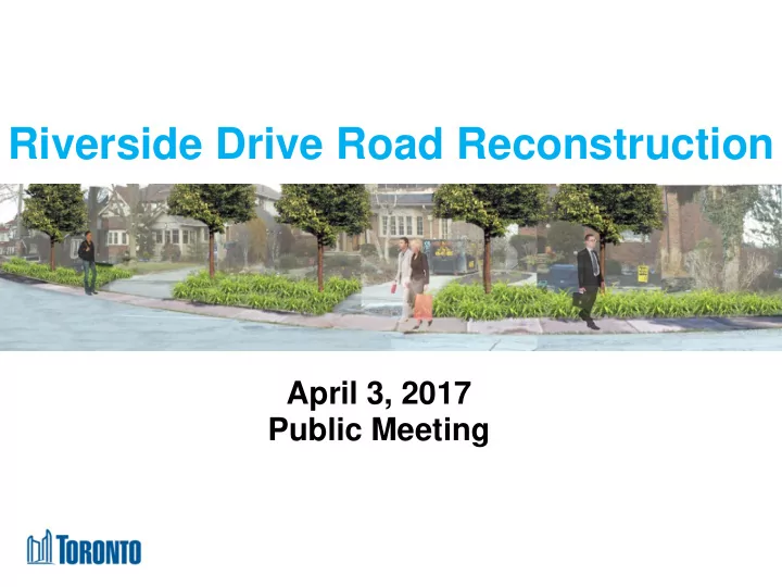
Riverside Drive Road Reconstruction April 3, 2017 Public Meeting Tonights Agenda 7:30 pm Presentation by City Staff 8:00 pm Questions and Answers 8:30 pm Review of Drawings and Discussions with Staff 9:00 pm Meeting Closure 2 Meeting Ground


slide-1
SLIDE 1

Riverside Drive Road Reconstruction

April 3, 2017 Public Meeting

slide-2
SLIDE 2

Tonight’s Agenda

7:30 pm Presentation by City Staff 8:00 pm Questions and Answers 8:30 pm Review of Drawings and Discussions with Staff 9:00 pm Meeting Closure

2

slide-3
SLIDE 3
  • As the neutral facilitator my purpose is to ensure we

have a good meeting, stay on topic, on time with the agenda and finish on time

  • Please show decorum and respect to both your

neighbours and staff. We want to create a safe environment at this meeting to respect all opinions and feedback

  • One speaker or discussion at a time please
  • Please hold all questions until after the presentation

Meeting Ground Rules

3

slide-4
SLIDE 4

Presentation Outline

  • Reasons for Reconstruction of Riverside Drive
  • Our Design Objectives
  • Existing Conditions
  • Initial and Second Designs - what we heard

and improvements made

  • Summary of Final Design Features
  • Timing of Work
  • Monitoring

4

slide-5
SLIDE 5

5

Study Limits

slide-6
SLIDE 6

1.Inspection shows road is past its service life and road base requires full rebuilding 2.Watermain from Riverside Crescent to South Kingsway needs replacement due to high watermain break rates (i.e. end of service life). 3.Retaining wall is under severe distress and corrosion and requires rebuilding

6

Reasons for Reconstruction

slide-7
SLIDE 7

Our Design Objectives

  • Bring road and watermain to a state of good repair
  • Replace retaining wall to stabilize the slope
  • Ensure road is safe and accessible for all users:
  • Incorporate measures to lower vehicle speeds to posted

limits

  • Improve sightlines at intersections
  • Enhance pedestrian safety and improve

neighbourhood connections

  • Provide access for emergency and garbage/snow vehicles
  • Minimize impacts on natural environment and enhance tree

canopy

  • Improve stormwater management
  • Respect the character of the street

7

slide-8
SLIDE 8
  • Speeding, cut-through traffic and high traffic volumes

make the road unsafe

  • Poor visibility at various intersections
  • Maintaining tree canopy a priority
  • Desire for woonerf design with walkways and

permeable pavers

  • Mixed views on sidewalks and placement
  • Interest in bike lanes
  • Need to recognize neighbourhoods special character
  • Desire to reflect historic alignment

8

What Residents Have Told Us

slide-9
SLIDE 9
  • Current road pavement varies from 8.5 metres to 9.5 m
  • Sidewalk from South Kingsway at south end ends mid

block

  • Ditches have been filled in
  • Deteriorating pavement

9

Existing Conditions: Road Features

slide-10
SLIDE 10
  • Traffic volume counts were performed in March 2017
  • Data shows 1,699 – 1,824 vehicles per day travel on

Riverside Drive

  • Volume is within the City standard for a local road

(< 2500 cars per day)

10

Existing Conditions: Traffic Volumes

slide-11
SLIDE 11
  • City has recently introduced measures to address

speeding and cut through traffic:

  • Right turn prohibition from Bloor St was extended

from 9:00 am to 9:30 am

  • Posted speed limit reduced from 40 to 30 km/h –

signs recently installed

  • Additional steps to reduce speed incorporated into new

road design

11

Existing Conditions: Traffic Speed

Location 85th Percentile Speeds Average Speeds South of Mossom Road 48 km/h 39 km/h Lucy Maud Montgomery Park 51 km/h 43 km/h

Speed Studies 2017

slide-12
SLIDE 12

12

(1937-1942) (Today/Planned Future)

  • Design follows the existing curvature of the road

Existing Conditions: Alignment

slide-13
SLIDE 13

Consultation and Design Timeline

2015 2016 2017

Conversations between staff and local residents

Feb 25, 2016 Drop In Event: Preliminary Plans

13

Several meetings with local residents, emails, phone calls, notices, webpage updates Initial Design

slide-14
SLIDE 14

City staff presented an initial design that featured:

  • Road pavement narrowed to 8 metres (from 8.5-9.5m)
  • One concrete sidewalk with standard curb
  • Bump outs and paver strips at intersections
  • Permanent parking
  • Low impact design plantings at various locations

Initial Design: February 2016

14

Initial Design

slide-15
SLIDE 15

Consultation and Design Timeline

2015 2016 2017

Conversations between staff and local residents

Feb 25, 2016 Drop In Event: Preliminary Plans Apr 18, 2016 Drop In Event: Revised Plans

15

Several meetings with local residents, emails, phone calls, notices, webpage updates Second Design Initial Design

slide-16
SLIDE 16

“Narrow the roadway further and add more pavers” Narrowed to 7.2 metres Added 6.0 m pinch points with pavers “Implement additional traffic measures” Added landscaping at strategic locations to narrow field of view Replaced the South Kingsway intersection merge lane with a full stop Raised the intersection at Riverside Trail and added pavers Extended morning turning restriction at Bloor St. W. “Parking not used enough to slow traffic” Added alternating banks of 3-hour anytime on-street parking – effective in the north portion where there are more parked cars

16

What we heard and improvements we made:

Second Design: April 2016

slide-17
SLIDE 17

“Prefer walkways to sidewalk on west side” Used rolled curb instead of traditional barrier curb Lowered the sidewalk profile Added a 1.2 metre treed boulevard Added paved strip alongside retaining wall on west side “Concerns about some proposed Low Impact Design locations” Adjusted locations “Add roundabout at Mossom Road intersection” ─ Narrowed the Mossom Road intersection (a roundabout would not be effective in addressing vehicles travelling the wrong way on Mossom)

17

Second Design: April 2016

slide-18
SLIDE 18

Consultation and Design Timeline

2015 2016 2017

Conversations between staff and local residents

Feb 25, 2016 Drop In Event: Preliminary Plans Apr 18, 2016 Drop In Event: Revised Plans April 3, 2017 Public Meeting: Final Plans

18

Several meetings with local residents, emails, phone calls, notices, webpage updates Second Design Initial Design Final Design

slide-19
SLIDE 19

“Shorter block lengths would help address speeding”  Added five median islands with trees to create shorter block lengths

19

  • Median is 1.25 m wide and 6–10 m long
  • Road narrowed on each side to 3.25 m

Final Design: April 2017

What we heard and improvements we made:

slide-20
SLIDE 20

“Speeding still a concern”  Measures previously introduced to narrow road  Reduced speed limit from 40 km/h to 30 km/h  Addition of median islands “Keep the merge lane vs. change to a full stop”  Retained merge lane at the South Kingsway intersection, with some minor changes. Yield sign will remain and assessed at a later date “Move pinch point & look out to avoid placement in front of homes”  Moved the pinch point & look out “Add pavers at Mossom Place intersection”  Added pavers at intersection

20

Final Design: April 2017

slide-21
SLIDE 21

“Retaining wall shouldn’t block view of Humber River”  Replaced concrete wall with lower railing (1.05 m)

21

Sample of railing

Final Design: April 2017

Concept image only, the final design will change to match site conditions

slide-22
SLIDE 22

22

Summary of Final Design

Narrowed roadway   Pinch points with pavers    Median islands with trees    Narrowed intersection at Mossom Road   Raised intersection with pavers at Riverside Trail    Intersection with pavers at Mossom Place    On-street parking in alternating banks   Rolled curbs and gutters    Continuous concrete sidewalk on east side with treed boulevard    New trees and plantings   Low impact design planting locations   Permeable pavers in front of Lucy Maud Montgomery Park   Paved pathway along retaining wall  Open railing on retaining wall and lookout  Minor improvements to South Kingsway intersection (yield sign remains) 

Design Features

slide-23
SLIDE 23
  • The City is committed to monitoring the

improvements following construction

  • Monitoring speeds and traffic counts will take place 6

months and again 12 months post construction

23

Commitment to Monitoring

slide-24
SLIDE 24

Phase 1 - Retaining wall and watermain

  • Work is set to commence this week
  • Expected to take 6-8 months to complete

Phase 2 – Entire street

  • To commence in Summer 2017
  • Expected to take 6-7 months to complete

Construction Notices with more details will be provided and any updates will be issued

24

Construction Timing

slide-25
SLIDE 25
  • 1. All questions should be directed through the

facilitator who will moderate the Q & A session

  • 2. A roving microphone will be used so everyone can

hear the question/comment and the response

  • 3. The person with the microphone has the floor, please

do not interrupt the speaker who has the floor

  • 4. Please introduce yourself, before your question or

comment for the record of the meeting

  • 5. Please do not interrupt the response to your

question

Q+A Ground Rules

25

slide-26
SLIDE 26

Plan Drawings

Table 1: South Kingsway - #199 Table 2: #199 - #217 Table 3: #217 - #243 Table 4: #243 - #267 Table 5: #267 - #293 Table 6: #293 – Brule Gardens

26