
Areas and lengths in polar coordinates
Different ways of representing curves on the plane
As the set of points satisfying an equation {(x,y) : G(x,y)=0} Example {(x,y) : x2+ y2=25} Given as a function {(x,y), y =f(x)} Example {(x,y) : y =x2+x-0.5 By parametric equation x=f(t), y=g(t), t in [a,b] Example x=sin(t), y=sin(2t), t in [0,2π]
θ = directed angle
Polar axis
r = directed distance
O
Pole (Origin)
P = (r, θ) Fix a point (the pole) and a ray from the point (the polar axis)
- A point P has polar coordinates (r, ϴ) if
- 1. The distance form the pole is |r|.
- 2. ϴ is the measure of the directed angle
starting at the polar axis and ending at the ray from the pole to P.
A different way of representing a point on the plane: polar coordinates
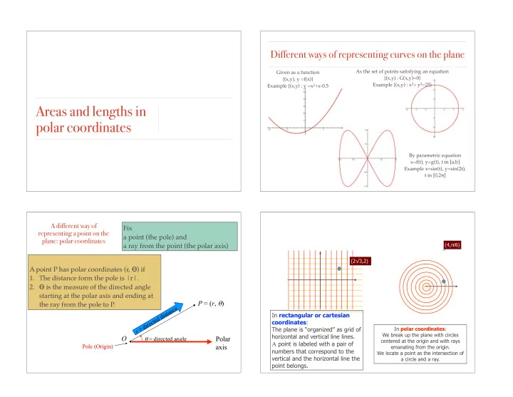
In rectangular or cartesian coordinates: The plane is “organized” as grid of horizontal and vertical line lines. A point is labeled with a pair of numbers that correspond to the vertical and the horizontal line the point belongs.
In polar coordinates: We break up the plane with circles centered at the origin and with rays emanating from the origin. We locate a point as the intersection of a circle and a ray. Coordinate systems are used to locate the position of a point. (2√3,2) (4,π/6)