STATE TE RO ROUT UTE 37 37 RE RESIL ILIE IENT C T CORRID - - PowerPoint PPT Presentation

state te ro rout ute 37 37 re resil ilie ient c t corrid
SMART_READER_LITE
LIVE PREVIEW

STATE TE RO ROUT UTE 37 37 RE RESIL ILIE IENT C T CORRID - - PowerPoint PPT Presentation

ARTBA Western Leadership Team | June 19, 2019 STATE TE RO ROUT UTE 37 37 RE RESIL ILIE IENT C T CORRID IDOR P OR PROGR ROGRAM Integrating transportation, ecology, and sea level rise adaptation into a more resilient SR 37 Image: San


slide-1
SLIDE 1

STATE TE RO ROUT UTE 37 37 RE RESIL ILIE IENT C T CORRID IDOR P OR PROGR ROGRAM

Image: San Pablo Bay National Wildlife Refuge, USFWS

Integrating transportation, ecology, and sea level rise adaptation into a more resilient SR 37

ARTBA Western Leadership Team | June 19, 2019

slide-2
SLIDE 2

SR 37 D DAA: AA: ( (PART 1 1) A A COR ORRIDOR P PLAN F FOR OR T THE ENT HE ENTIRE C COR ORRIDOR + (PART 2 T 2) D DESIGN GN ALTERNA NATI TIVE VES F FOR THE HE PRIOR ORITY S TY SEGMENT NT

2

slide-3
SLIDE 3

100 M MINU NUTES T TO O TRAVEL EL HOM HOME T E TO O SOL OLANO C O CO.

  • O. EV

EVERY D DAY

3

Source: Kimley-Horn, 2017

slide-4
SLIDE 4

6 KNO KNOWN WN WEAK L WEAK LINK NKS, S SOM OME F E FLOO OODED I IN N 2017 AND 2 AND 2019 S STOR ORMS

4

Source: AECOM, 2017

Weak Links

Novato Creek Tubbs Island Mare Island

Spring ng 2017 17 Floods

  • ds

Novato Creek

Spring ng 2019 2019 Flood

  • ods
slide-5
SLIDE 5

30 YEARS F FROM T TOD ODAY SE SEA L LEVEL RISE ISE WILL INUNDATE S SR 3 37

5

Source: UC Davis, AECOM, 2015 Source: SFEI, 2017

2000 2050 2100 2100+

slide-6
SLIDE 6

9 S SPEC ECIAL-STATUS S SPEC ECIES, P PAC ACIFIC F FLYWAY AND M AND MANY ANY AC ACRES OF OF WETLA LANDS NDS A AND BAYLA LANDS NDS

6

Image Sources: Various 2018

slide-7
SLIDE 7

RESILI LIENT C NT CORRIDOR DOR P PROGR GRAM

HIGHWAY TRANSIT Environment Bike/Ped & Public Access Equity

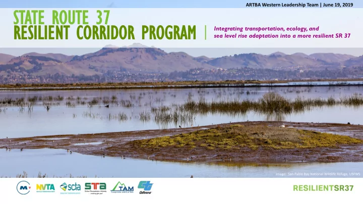
Adapt SR 37 from I-80 to US 101 to Sea Level Rise Microtransit service Advanced mitigation and enhancements Shared use path Means-based transit fare Relieve congestion between Mare Island I/C and SR 121, including near-term

  • perational improvements at

SR 121 and Mare Island interchange Regional express bus service between Vallejo and Novato, including support strategies (commuter parking, etc.) Land acquisition for corridor restoration Public access improvements to open space preserves, public viewing areas, trailhead, etc. Means-based tolls Interchange Improvements: Lakeville Highway, SR 121, Mare Island, Atherton, & Fairgrounds SMART rail service (TBD, to be studied and funded by others independently) Targeted, smaller scale ecological enhancements Grade separation with SMART rail crossing east of SR 121 Larger landscape-scale restoration

7

$5B+ CORRIDOR PROGRAM OVER 25 YEARS

slide-8
SLIDE 8

SR 37 R 37 OPERATIO IONAL E EFFICIE ICIENCY CY IMPROVEMENTS S (N (NEA EAR-TE TERM RM, DE DELI LIVER I R IN N 3-5 Y YEARS ARS)

SR 121 Intersection Improvements and Eastbound Lane Drop Extension

8 Mare Island

Mare Island Interchange Westbound Lane Drop Extension and Ramp Metering

slide-9
SLIDE 9

SR 37 R 37 CONGEST STION ION RE RELIEF P PRO ROJECT: S SR 121 T R 121 TO M MARE ISLAN LAND D (I (INTERIM, DEL ELIVER IN 7 Y YEA EARS)

9

Option 1: 3-Lane Contra-Flow with Moveable Median Barriers Option 2: 4-Lane Highway (requires mitigation for bike access) Existing 2-Lane Segment B

Golden Gate Bridge Example Richmond-San Rafael Bridge Example

Cost Range: $100M to $150M

slide-10
SLIDE 10

Reconstruction Options

SR 37 C COR ORRIDOR S SEA EA LEV EVEL RISE AD E ADAP APTATION PROJ OJECT CT

10

(ULTI ULTIMATE TE L LONG NG-TE TERM RM, DEL ELIVE VER I IN 15 15-20 20 YEARS ARS)

slide-11
SLIDE 11

COLLABORATE WITH RESOURCE AGENCIES AND CONSERVATION ORGANIZATIONS TO FULLY IMPLEMENT LANDSCAPE-SCALE RESTORATION EFFORTS ALONG SR 37 CORRIDOR

11

Lower Novato Creek Cullinan Ranch Skaggs Island/ Haire Ranch

slide-12
SLIDE 12

12

  • SR

R 37 37 Congestion Re Relief P Project ( (SR R 121 121 – Mare I e Islan land)

  • Early E

ly Ecolo logi gical E al Enhan ancem emen ents

  • Reimagi

agine T e Transit With E Emer ergi ging T g Technolo logy gy Environmental - Design - Construction

  • SR

SR 37 Corrido dor SL SLR Ada Adaptation P Project ct ( (I-80 80 – US 101) 101)

  • Bike/P

/Pedestrian/P /Pub ublic Acce Access

  • Reimagine

ne T Trans nsit With T h Tomorrow’ w’s T Techno hnology Environmental - Design - Construction 2025 Today

Early Benefits

Transition

2050 2040

SR 3 37 RESIL ILIE IENT CORRID IDOR OR P PROG OGRAM – PHASE SED I IMPL PLEMENTATIO ION

CONCURRENT PROJECT DEVELOPMENT. DELIVER EARLY COMMUNITY BENEFITS.

slide-13
SLIDE 13

13

SR 37 P PROGRAM C COS OST AND F AND FUND NDING P PLAN AN

Project Cost (2018 $) Funding Source Amount Notes Interim/Congestion Relief Project (Segment B) BATA Rehab RM3 TBD $20M $20M $110M Due diligence to add SR 37 to BATA Per SR 37 Policy Committee Potential Sources: SB1 SCC, STIP, SHOPP, BATA Subtotal $150M $150M Ecological Enhancements (Near-term and Long- term) OBAG2 TBD $300K - $500K $50M - $100M Planning and Prelim. Design Potential Sources: Measure AA – competitive, aim for ~$10M/Yr for 5 years Subtotal ~ $50M-$100M ~ $50M-$100M Ultimate Project/ SLR Resiliency RM3 TBD $58M ~5B Per SR 37 Policy Committee Potential Sources: SB1 SCC, STIP, SHOPP, Federal Grants, BATA Subtotal ~$5B ~$5B

slide-14
SLIDE 14

14

SR 37 HAS HAS $100 M MILLION I IN N REGI EGIONAL M MEAS EASURE 3 3

On November 8, 2018, the SR 37 Policy Committee Agreed to the SR 37 Funding Plan:

Sponsor Amount Description STA $15M Segment C – Fairgrounds Interchange SCTA $20M Interim Segment B SCTA $4M PA&ED for SR 37/SR 121 Intersection Improvements TAM $3M Segments A1 and A2 Levee Study SCTA/TAM $58M Segments A & B Ultimate Improvements

slide-15
SLIDE 15

Resilient SR 37 37 Program MOU OU (February

ry 2019) 2019)

Assignments

  • Segment A (US 101 – SR 121)
  • Segment B (Sears Point – SR 121)
  • Segment C (Mare Island – I-80)

Policy Committee Executive Steering Committee Project Leadership Team Corridor Director Organization Chart Legislation Seek legislation for the segment of SR 37 from Sears Point to Mare Island to become a State-owned bridge, joining the toll bridge financial enterprise administered by BATA