San Pedro Community Plan San Pedro Community Plan Presentation - - PowerPoint PPT Presentation
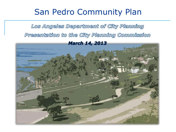
San Pedro Community Plan San Pedro Community Plan Presentation Overview Community Plan Background and Process Overview of Draft Community Plan Proposed Land Use Regulations Next Steps San Pedro Community Plan: Background San
San Pedro Community Plan
Community Plan Background and Process Overview of Draft Community Plan Proposed Land Use Regulations Next Steps Presentation Overview
San Pedro Community Plan
San Pedro Community Plan: Background
35 Community Plans – Land Use Element of City’s General Plan Each plan is a blueprint to guide new development and changes that fit in with existing community
Each plan sets policies for that community and includes a map that shows types of uses allowed on each parcel
- Residential
- Commercial
- Industrial
- Open Space
- Public Facilities
What the Community Plan Contains: Policies
- Housing
- Circulation
- Noise
- Land Use
- Conservation
- Open Space
- Safety
- Historic Preservation & Cultural Resources
- Air Quality
- Public Facilities & Services/Infrastructure
- Framework
What the General Plan Contains: Elements
- Contains Policies,
Programs, and Land Use Designation Map
- Establishes a range of
land uses and intensities
- Underlying zoning
must be consistent with Plan
- Plans updated
individually
- Guided by the
Framework Element
The Community Plan
- Sets a citywide context for the update of
Community Plans
- Contains guiding principles for all community plans
- Hierarchy of commercial Districts and Centers
- Neighborhood District: smaller-scaled development
and pedestrian-oriented providing neighborhood services
- Community Center: medium-scaled development and
uses that serve the larger community
- Regional Center: higher-density, hub of regional
commerce, serves many neighborhoods and as jobs- center with major cultural and civic uses
Framework Guiding Principles
- Area: 11.4 square miles
- Boundaries:
- North - Wilmington
- East - Port of Los
Angeles
- West - Rancho Palos
Verdes and Rolling Hills
- South - Pacific Ocean
- County portion “La Rambla”
Wilmington-Harbor City Port of Los Angeles
San Pedro Community Plan: Context
Rancho Palos Verdes
Community Plan Update Process: 3 Phases
San Pedro Community Plan: Process
Initiation
- Land Use Survey and community engagement
Plan Development
- Staff research and analysis
- Identify areas that need to be addressed through policy, land use designations, zone changes or other tools
- Community engagement
- Public Hearing
Adoption
- Harbor Area Planning Commission
- City Planning Commission
- City Council (PLUM)
- Full City Council
- 1999: Last Plan Update
- 30+ meetings in the community
- 2007 and 2008: Public workshops to review proposed
changes
- 2008-2012: Neighborhood Council and CAC check-ins
- 2012: Open House and Public Hearing
- 2013: Harbor Area Planning Commission
San Pedro Community Plan: Background
1980 2013
San Pedro Community Plan: Then and Now
1962
San Pedro Community Plan Background: Then and Now
- Broader range of topics
- Full spectrum of topics– housing, urban design, mobility,
public services, parks
- Designed for many users
- A collaborative effort
- Organized ease of use
- Photos to illustrate concepts
- Community Vision Statement
- Unique to San Pedro - provides foundation for change
- New Sections: reflect comprehensive approach
- Mobility
- Infrastructure and services
- Implementation
San Pedro Community Plan: Plan Text Overview
New Features of this Plan:
Multi-generational families and a strong sense of camaraderie among residents
Preserve small town character and community spirit
The Downtown should be the “heart” of San Pedro as it once was
Design controls are needed to improve appearance
What We Heard: Enhance Neighborhood Character
- Need for more local employment base
- Need more retail businesses within walking distance of
neighborhoods, and better stores locally
- Industrial jobs and services should be retained
- Cruise ship terminals can provide a source of local jobs and
potential visitors
What We Heard: Improve the Local Economy
- Enhance distinct neighborhoods and
districts
- Expand and preserve housing
- Promote Downtown as San Pedro’s
commercial center
- Improve the local economy
- Strengthen connection to the
Waterfront
- Improve sustainability and health
San Pedro Community Plan: Recommendations
Major Themes:
- Protect neighborhood serving uses and encourage small-
scale local businesses, serve broader community than neighborhood with medium-scale businesses
- Create walkable communities through design and scale
- Encourage mixed-use development - limit stand-alone
residential to preserve commercial areas for services and jobs
- Restrict auto-related uses to protect character
Enhance Neighborhood Districts
San Pedro Community Plan: Recommendations
- Preserve single-family neighborhoods
- Multi-family housing in areas with transit and services:
– Commercial Corridors – Regional Center
- Protect historic districts: Vinegar Hill
- Assure transitions in scale and character between
different types of neighborhoods
Expand and Preserve Housing
San Pedro Community Plan: Recommendations
- Regional Center: Promote varied uses
– Professional offices – Retail – Civic and Cultural – Major health facilities – Tourism uses – Entertainment, and – Residential
- Allow tallest buildings
- Design regulations for preserving views
and addressing pedestrian scale
Promote Downtown as a Commercial Center
San Pedro Community Plan: Recommendations
- Preserve industrial jobs and services– limit
size of stand-alone commercial development
- Height and FAR incentive to encourage
green technology and clean manufacturing
- Transitions for development adjacent to
residential
- Improve aesthetics with design regulations
- Retain existing regulations to address
incompatible uses
Improve the local economy: Industrial Districts
San Pedro Community Plan: Recommendations
- Strengthen Connection to the Waterfront
– Coordinate with Port on Waterfront improvements – Encourage port and cruise visitors to easily access downtown
- Foster Sustainability and Health
– Expand neighborhood parks and open spaces – Increase options for pedestrian, bicycling and transit
San Pedro Community Plan: Recommendations
Concurrent with the Plan
- General Plan Designations and Zoning
- Community Plan Implementation Overlay (CPIO)
- Vinegar Hill Historic Preservation Overlay (HPOZ)
- Modified Streets
Long Range
- Implementation programs
Implementation of the Community Plan
General Plan Designations and Zoning
Implementation of the Community Plan Implementation: Concurrent with the Plan
Implementation of the Community Plan Land Use Revisions: Subarea 260
Revised Recommendation
Retain existing land use and zoning
Existing Preliminary Recommendation
Neighborhood Office Commercial Community Commercial (Q) C2-1XL [Q] C2-1D FAR 1.5:1 FAR 3.0:1
Low Residential P-1XL
Implementation of the Community Plan Land Use Revisions: Subarea 132
Existing Preliminary Recommendation Regional Commercial Regional Commercial C2-2-CDO C2-2-CDO FAR 6.0:1 FAR 6.0:2 Revised Recommendation Community Commercial C2-2-CPIO FAR 4.0:1
Community Plan Implementation Overlay (CPIO)
Implementation of the Community Plan Implementation: Concurrent with the Plan
- Landscaped setbacks, screening, and buffers
- Step backs from contiguous residential zones
- Parking screened
- Signage regulated by size, type, and location
- Utilities and mechanical equipment screened
- Façade transparency
Implementation of the Community Plan CPIO: Regional Commercial District
- Max height 250 feet FAR 6.0:1
- No additional parking required for change of
use
- Building scale, massing, tower spacing, and
exterior surface materials regulated
- First floor height min 12 feet
- Pedestrian plazas and open space required
for large projects
Implementation of the Community Plan CPIO: Central Commercial District
- Max 75 feet; FAR 1.5 - 4.0
- Commercial uses required in A and B
- Residential only uses restricted in D and E
- Automobile uses only allowed in A
- Pedestrian plazas and open space required for
large projects
- Added Design Guidelines (expanded for entire
district)
Implementation of the Community Plan CPIO: Coastal Commercial District
- Max 45 feet; FAR 1.5
- Automobile uses restricted
- Commercial ground floor uses required in B
- Step backs from contiguous residential zones
- Landscaped setbacks and plant screening
along property lines abutting residential uses
- Minimum 50% transparency of exterior wall
- f commercial primary frontage
Implementation of the Community Plan CPIO: Industrial District
- Max 45 feet; FAR 1.5 - 4.0
- Signage, landscaping and fencing
- Step backs for contiguous residential
zones
- Petroleum and propane related uses
prohibited in all
- Clean/Green Tech uses incentivized in
A, B, C
- Project may build to 55 feet, if 75%
- f floor area for Clean/Green Tech
uses
- Vinegar Hill Historic
Preservation Overlay (HPOZ)
- Preservation Plan
Implementation: Concurrent with the Plan
- Modified street designations to mirror existing street
dimensions
- Identified “Priority” streets to address needs for
different users (pedestrians, bikes, cars…..)
- Studied potential for 6th Street
Streets
Implementation: Concurrent with the Plan
- Modified street designations to mirror existing street
dimensions
Streets
Implementation: Concurrent with the Plan
- Consideration by City Council PLUM committee and
full City Council adoption to follow
- Contact Debbie Lawrence at 213-978-1163 or