
SLIDE 1
Recommendations
- f the Expert
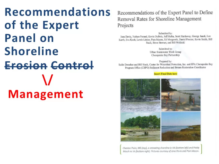
Recommendations of the Expert Panel on Shoreline Erosion Control - - PowerPoint PPT Presentation
Recommendations of the Expert Panel on Shoreline Erosion Control \/ Management Need for the Panel - Update TN, TP, and TSS removal rates based on best available information Shoreline Erosion Loading Rates Source TN TP TSS (lb per foot
Source TN (lb per foot per year) TP (lb per foot per year) TSS (lb per foot per year) Ibison, 1990 1.65 1.27 7,000 Ibison, 1992 0.81 0.66 2,800 Proctor, 2012 (WEG) na 0.38 or 0.29 1,300 MDE, 2011* 0.16 0.11 451 BaCo (mean) 0.36 0.23 974 CBP (2003) 0.02 0.0025 2 CBP (July 2013) 0.20 0.068 54.25
*MDE data based on Baltimore Co. DEPS analysis of 23 individual shoreline restoration projects completed by Baltimore Co. DEPS Capital Projects and Operations. Median values were used. (Nathan Forand presentation to the SEC panel on 2/25/13)
Panelist Affiliation Jana Davis, Ph.D. CBT/HGIT Kevin DuBois, PWS, PWD City of Norfolk, VA Jeff Halka MD Geologic Survey, retired Scott Hardaway, P.G. VIMS Shoreline Studies Program George Janek USACE, Norfolk District Lee Karrh MD DNR Eva Koch, Ph.D. UMCES Lewis Linker CBPO Pam Mason VIMS Center for Coastal Resource Management Ed Morgereth, MS ISS Biohabitats Daniel Proctor, P.E. Stantec (formerly Williamsburg Environmental Group) Kevin Smith MD DNR Bill Stack, P.E. CWP, CBPO Steve Stewart/Nathan Forand Baltimore County Dept. of Environmental Protection and Sustainability Bill Wolinski, P.E. Talbot County Dept. of Public Works
Panel process information is online at:
BMP EXPERT PANEL URBAN STORMWATER WORKGROUP WATERSHED TECHNI CAL WORKGROUP WATER QUALI TY GI T Jan Feb March April May
July Aug Sept Oct Nov End April 2014
experts, and used best professional judgment
recommendations for pollutant load reductions for shoreline management practices that:
the Bay (Protocol 1: Prevented Sediment); and
(Protocol 3: Sedimentation); and
Redfield Ratio).
Prot
Name Units Pollutants Reduction Rate
1 Prevented Sediment Pounds per year Sediment TN, TP
content in sediment prevented.
shoreline erosion with reductions for sand content and bank instability 2 Denitrification Pounds per year TN
denitrification rate associated with vegetated area.
3 Sedimentation Pounds per year Sediment and TP
removal rates associated with vegetated area.
4 Marsh Redfield Ratio Pounds TN, TP
removal rates associated with vegetated area.
(Langland and Cronin, 2003)
Erosion of fastland from unprotected shorelines represents 65% of the total load; nearshore erosion represents 35%.
Living Shorelines
VIMS, Gloucester Point, VA
– Common benchmarks(CBF, 2007; See also MDE, 2008
– Urban considerations – available space for practice,
VA
VIMS, Gloucester Point,
– Threat to coastal areas and need for better
intersect
as a basic qualifying condition(Karrh et al., 2011); did not pass
Shoreline Management
The Practice Must Meet these Criteria for TMDLPractice Pollutant Load Reduction1 Living Shoreline –
sill; and
breakwater
The site is currently experiencing shoreline erosion or is replacing existing
AND When a marsh fringe habitat (a or b) or beach/dune habitat (c) is created, enhanced, or maintained.
Revetment AND Breakwater system without a living shoreline Bulkhead/Seawalls
The site is currently experiencing shoreline erosion. The site was graded, vegetated, and excess sediment was removed or used.2 AND A living shoreline is not technically feasible or practicable as determined by substrate, depth, or other site constraints. AND When the breakwater footprint would not cover SAV, shellfish beds, and/or wetlands. The site is currently experiencing shoreline erosion. AND The site consists of port facilities, marine industrial facilities, or other marine commercial areas where immediate offshore depth (e.g., depths deeper than 10 feet 35 feet from shore) precludes living shoreline stabilization or the use of a breakwater or revetment.
Loading (kg/m/d) State Coarse Total Fines 1.34 2.43 1.02 1.01 0.67 0.34 Sand Reduction Factor 0.551 0.337 Maryland Virginia Source: Chesapeake Bay shoreline characteristics and shoreline erosion mass loading (averaged) (Cerco, 2010).
Shoreline Management Load Reductions per state-basin should not exceed one-third of the WQSTM fine sediment shore erosion load to the state basin: Intended to prevent implementation of shoreline practices in high numbers and/or in areas not suited for the shoreline management practices. However, It’s unlikely that any state basin will exceed 1/3 of the pollutant loads using shoreline management because 85% of the Ches. Bay shoreline is privately owned and 1/3 of the Ches Bay shoreline is already protected. Any state basin exceeding 1/3 of its pollutant load will be assessed on a case by case basis by EPA CBPO.
Source: Tony Watkinson VIMS, Gloucester Point, VA
– 85.02 pounds TN/acre/yr
Source: VA DCR
sedimentation in the top 10 cm for sediment core, horizontal marker, and sediment flux studies
sedimentation rate and converted to pounds TSS/acre/yr and TP/acre/yr
Source: VA DCR
enter the Bay
quantified marsh Redfield ratio and aboveground and belowground production
mean aboveground and belowground biomass, and converted to pounds TN/acre/yr and TP/acre/yr
increase
– See Appendix K Sediment Sampling Protocol
Pollutant Protocol 1 Pollutant Load Reduction (lb/yr) Protocol 2 Pollutant Load Reduction (lb/yr) Protocol 3 Pollutant Load Reduction (lb/yr) Protocol 4 Pollutant Load Reduction (lb)1 Year 1 Total Pollutant Load Reduction (lb/yr)2,3 TN
233 153 NA 369 755
TP
168 NA 9.520 16.2 193
TSS
450,070 NA 12,526 NA 462,596
1Marsh Redfield Ratio pollutant load reduction if a one-time credit. 2The TN and TP totaled here are for the first year and include the one-time credit for the
Marsh Redfield Ratio. In subsequent years there will be no TN or TP pollutant load reduction for this protocol.
3 This practice was 2,610 linear feet, had an erosion rate of 1 and 1.5 ft/yr, had a bank height
description.
Protocol
All Protocols Protocol 1. Prevented Sediment Protocol 2. Denitrification Protocol 3. Sedimentation Protocol 4. Marsh Redfield Ratio
Notes
coordinated with the local and state permitting and reporting authority to ensure compliance
requirements for all projects should be followed
default values are used, these calculations should be reported to the reporting entities specification (e.g., TN, TP, and TSS for sites with site specific sampling data) Records should be kept and available for inspection to relay the data source, calculations made, and other data reported to the state
Parameters to Report
located and/or county
practice
receive these new credits
compliance
Shady Cove Source: Jana Davis, CBT
waters
Scenario Builder
recommendations
Workgroup.
Review panel recommendations and dissenting view document recommendations (remove Protocol 1 - prevented sediment). Based on Dissenting View Document, MD DNR’s opposition to protocol 1, and the USWG discussion on the subject. Vote (yes/no) on the panel recommendations
get approval for the recommendations to be input into the Chesapeake Bay modeling tools and planning tools (e.g., CAST, VAST, MAST)
The full panel report can be found here: http://www.chesapeakebay.net/calendar/event/21151
410.461.8323 xt 222 or 410-267-5717