
SLIDE 1
Packwood Hydroelectric Project Barrier Analysis December 12, 2006 - - PowerPoint PPT Presentation
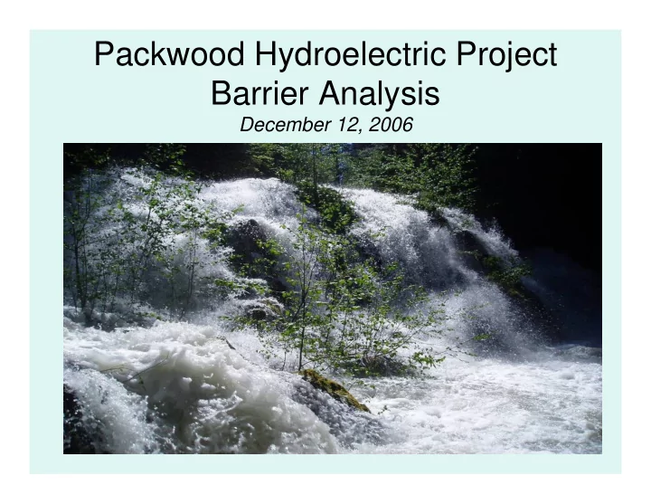
Packwood Hydroelectric Project Barrier Analysis December 12, 2006 Study Area Natural barriers to upstream fish passage on Lake Creek at RM 1.03 and RM 1.95 Snyder Creek culvert under the Project tailrace and upstream of the tailrace on
1.
– “Washington Department of Fish and Wildlife Passage Barrier and Surface Water Diversion Screening Assessment and Prioritization Manual” (TAPPS 2000) – “Design of Road Culverts for Fish Passage” (Bates 2003)
– Are WDNR-mapped type 1-4 waterways; – Have documented presence of fish through visual observation, electrofishing, or verification by local biologists; – Are water courses having ordinary high water widths greater than 0.60 meters (m) and gradients less than 20%; or – Are listed in “A Catalog of Washington Streams and Salmon Utilization” (Phinney and Bucknell 1975).
Type “U” – Unknown Type 5 Water Type “Ns” – Non Fish Seasonal Type 4 Water Type “Np” – Non-Fish Perennial Type 2 and 3 Water Type “F” – Fish-bearing Type 1 Water Type “S” – Shorelines Interim Water Typing Permanent Water Typing Table 3.1 WDNR Water Type Classification Conversion Table
Collect the Information in Table 3a Yes No Is there Natural Streambed Material Throughout the Culvert? Is the Culvert Width at Least 75%
Toe Width? Is the Outfall Drop >0.24 Meters? Yes Barrier Yes Passable No Stream Simulation Model Is the Culvert Slope Greater Than or Equal to 1 Percent? No Level B Analysis Required, Collect the Information in Table 3b Yes Barrier No BARRIER ANALYSIS – LEVEL A Collect the Information in Table 3a Yes No Is there Natural Streambed Material Throughout the Culvert? Is the Culvert Width at Least 75%
Toe Width? Is the Outfall Drop >0.24 Meters? Yes Barrier Yes Passable No Stream Simulation Model Is the Culvert Slope Greater Than or Equal to 1 Percent? No Level B Analysis Required, Collect the Information in Table 3b Yes Barrier No BARRIER ANALYSIS – LEVEL A Collect the Information in Table 3a Yes No Is there Natural Streambed Material Throughout the Culvert? Is the Culvert Width at Least 75%
Toe Width? Is the Outfall Drop >0.24 Meters? Yes Barrier Yes Passable No Stream Simulation Model Is the Culvert Slope Greater Than or Equal to 1 Percent? No Level B Analysis Required, Collect the Information in Table 3b Yes Barrier No BARRIER ANALYSIS – LEVEL A
Any Yes Barrier Status is Unknown No to all Collect the information in Table 3b Calculate the High Fish Passage Design Flow Level B Applicability: Is there a grade break in the culvert? Is the culvert tidally influenced? Is the downstream control inaccessible? Calculate the Depth and Velocity using Manning’s Equation
The culvert is Passable
Does the Calculated Depth and Velocity meet the Criteria for Trout in WAC 220- 110-070? No Do a Backwater Analysis Is the Culvert Backwatered to the Upstream End of the Culvert? The Culvert is a Barrier No Yes Does the Calculated Depth and Velocity at the Upstream End of the Culvert meet the Criteria for Trout in WAC 220-110-070? The Culvert is Passable Yes No The Culvert is a Barrier Yes
Stream Simulation Mode/No Slope Model Does Wcb = 1.2Wch + 2 feet? No Does Wcb = 1.25 X Wch? Yes Is Slope Ratio ≤ 1.25? Sculv = Slope Sch Ratio No Does Not Meet Stream Simulation Criteria No Does Not Meet No Slope Criteria Yes Passes Stream Simulation Criteria Yes Is Slope of Culvert 0% Yes Satisfies No Slope Criteria No Does Not Meet No Slope Criteria Model for Stream Simulation Criteria/No Slope Assessment Abbreviations: Sculv = Slope of culvert Sch = Slope of Channel Wcb = Width of culvert bed Wch = Width of backfull channel
Sources: USFWS 2005 and USDA Forest Service 2005 Spawning gravel patches with > 26% fine particle sizes < 0.85mm in diameter Rearing habitat severely disturbed so that production capabilities are without value to salmonids at this time No Value Spawning gravel patches/riffles show major/widespread signs of instability (scour/filling) and/or > 21% and ≤ 26% fine particle sizes < 0.85mm in diameter Rearing habitat shows signs of major/widespread disturbance likely to cause major reductions in its production capabilities (two or more habitat components missing or severely reduced presence) 1/3 Poor Spawning gravel patches/riffles show moderate/widespread signs of instability (scour/filling) and/or > 16% and ≤ 21% fine particle sizes < 0.85mm in diameter Rearing habitat shows moderate/widespread signs of instability and/or disturbance known to reduce productive capability (one or more habitat components missing or significantly reduced presence) 2/3 Fair Spawning gravel patches have ≤ 16% fine particle sizes that are < 0.85mm in diameter Rearing habitat is stable and in a normal productive state with all components functional 1 Good to Excellent Spawning Habitat Criteria Rearing Habitat Criteria HQM Value Habitat Condition Table 3.2 Criteria Used to Assign Habitat Quality Modifiers (HQM) to Rearing and Spawning Habitat
N/A Yes Yes F/3 Snyder Cr. at Tailrace N/A Yes Yes F/3 Snyder Cr. Above Powerhouse N/A No No Ns/4 Art Lake Creek Culvert N/A No No Ns/5 Pipeline Rd Trail No. 74 Culverts N/A No No Ns/5 0.95 Mile Behind Pipeline Road Gate N/A No No Np/4 Snyder Rd Culvert on Pipeline Road
Listed in Phinney and Bucknell (1975) Wetted Width <.6m; Gradient < 20% Fish Presence DNR Stream Type Culvert Table 4.1 Fish bearing Determination for Culvert Analysis
– The overall length of the culvert was 9.93 ft and had a slope of 10.51 percent. The culvert was dry and had a drop of 2.4 feet to the plunge pool below. Gradient of the areas immediately upstream and downstream of the culvert, however, exceeded 100% and 56%, respectively, and the streambed below the culverts was dry. The lack of perennial flow, high gradient above and below the culvert, and the absence of fish make a full barrier analysis unnecessary.
– The upstream end approximately 1900 ft above the tailrace. The total length of the culvert was 67.9 ft with an outfall drop of 2.87 ft. Water depth inside the culvert was 0.23 ft with no measurable flow. This culvert was determined to be a barrier primarily because of the outfall drop. This culvert is located outside the Project boundary and is not associated with any Project feature; however, it was analyzed since it was the feature which segregated anadromous from resident fish populations.
– This was found to be passable to adult salmonids. Coho salmon fry, as well as juvenile cutthroat trout, were found in the reach above this Project feature. This feature, however, is in need of repair or replacement, because the culvert is nearly full of gravel and cobble that has washed downstream from Snyder Creek. Note: Culvert is now fully plugged and needs cleaning.
Passable Length of the slope < distance the fish can swim Distance/velocity barrier Length of the slope > distance the fish can swim The velocity of the water < fish speed 2 Velocity Barrier If the Velocity of the water > Fish speed 1 Result Condition Table 2 Chute Conditions, Given that Plunge Pool Requirements, Landing Conditions, and Depth of Flow are Sufficient (Powers and Orsborn 1985)
Poor: in the river for a long time; full spawning colors developed and fully mature; very close to spawning grounds 0.50 Good: in the river for a short time; spawning colors apparent but not fully developed; still migrating upstream. 0.75 Bright: fresh out of salt water or still a long distance from spawning grounds; spawning colors not yet developed. 1.00 Fish Condition Cfc Table 3 Fish Condition (Cfc) (from Powers and Orsborn (1985).
* Based on stage-discharge relationship; no actual measurements at these flow levels.
308* 291 May 23, 2006-spill 2 142* 130 May 18, 2006-spill 1 42 33.5
25 16
12 3.26
RM 1.95 308* 291 May 23, 2006- spill 2 142* 130 May 18, 2006-spill 1 46 35 Aug 31, 2004-high 25 13 July 14, 2004-mid 11 3 Sept 2, 2004-base RM 1.03 Flow at Lower Lake Creek Gage (cfs) Flow at Drop Structure (cfs) Date Barrier Location Table 6 Flows Analyzed at Lake Creek Barriers
1/ Measurement not at same location due to safety concerns and lack of purchase
to take measurements 12.391/ 308 cfs 10.511/ 142 cfs 10.8 1/ 46 cfs 13.47 25 cfs 8.30 11 cfs Velocity (ft/s) Lower Lake Creek Flow Table 8 Velocities (ft/s) at the Lip of the Falls at Measured Flows
1/ Not measurable; Velocity calculated from Equation 1 estimates peak of 25.36
ft/sec
2/ Not measured at same location as 11 and 25 cfs due to safety concerns and lack
14.452/ 308 cfs 13.672/ 142 cfs N/A 46 cfs 14.08 25 cfs 7.9 11 cfs Velocity (ft/s) Lower Lake Creek Flow Table 9 Velocities (ft/s) in the Main Portion of the Chute at Measured Flows
– Seems passable for adult steelhead, coho and Chinook salmon
– As long as the depth is 0.4 feet or greater should be passable
– If this is accurate, I have seen spring chinook (15 lbs.) do this at Shepard Falls on the Wind River and then keep swimming.
with a depth of 0.5 feet, or leap a vertical distance of 5 feet with a horizontal of 12 to 13 feet.
– Given the slope of 44% I feel this is too steep to be considered a chute to swim up. So passage would have to by leaping from the shallow pool. A steelhead leaping at 60 degrees could just make it to the crest, but given the shallow pool depth the leaping ability would be
For Coho this would be a barrier. Also, the complexity of the plan view turn would likely reduce leaping capability.
– Seems passable if fish could reach this point, given that from Figure 10 (Powers and Orsborn) a steelhead could swim over 60 feet in this condition. Note: If you used a CFC of 0.5 it would be a barrier regardless of entrained air and turbulence [Emphasis added].”
16-20* 12.51 8.55 Max Velocity 0.22 0.14 0.09 Mean Depth 0.44 0.28 0.19 Max Depth 4 14.58 14.02 9.93 Max Velocity 0.19 0.22 0.16 Mean Depth 0.23 0.27 0.2 Max Depth 3 42 cfs 15 cfs 5 cfs Transect Flow at Lower Lake Cr. Table 11 Summary of Hydraulic Information on Transects Evaluated on the Chute at RM 1.95
Figure 11. Horizontal Profile of Chute at RM 1.95
5 10 15 20 25 20 40 60 80 100 120 Horizontal Distance (ft) Vertical Distance (ft)
– Hall Creek is passable at all flows. The area that Hall Creek drains is extremely low gradient. Hall Creek tends to inundate a wide area laterally. However, Hall Creek does have a main channel and its thalweg, where it crosses under the tailrace flume, was over 3.0 ft in depth. With a cross-sectional area of 100 ft2, the opening under Hall Creek can easily accommodate fish passage at much higher flows without creating any velocity barriers to fish under these conditions.