
SLIDE 1
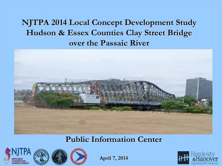
NJTPA 2014 Local Concept Development Study Hudson & Essex Counties Clay Street Bridge
- ver the Passaic River
Public Information Center
April 7, 2014
NJTPA 2014 Local Concept Development Study Hudson & Essex - - PowerPoint PPT Presentation
NJTPA 2014 Local Concept Development Study Hudson & Essex Counties Clay Street Bridge over the Passaic River Public Information Center April 7, 2014 Project Overview and Background Clay Street Bridge was built in 1908. Bridge is in
April 7, 2014
Local Concept Development Local Preliminary Engineering Final Design/ Right
Construction
Purpose and Need Statement Approved Design Exception Report Construction Contract Documents and PS&E package Completed Construction Date Collection and Environmental Screening Report Cost Estimates (Final Design, ROW and Construction) Environmental Reevaluations As-Built Selection of Preliminary Preferred Alternative Approved Environmental Document Environmental Permits Update and Finalize Design Communications Report NEPA Classification Approved Project Plan Acquisition on ROW Close-out Documentation Concept Development Report Preliminary Engineering Report Update Design Communications Report Create Design Communications Report Update Design Communications Report
Photo 1: Bridge Approach Roadway Looking East – note substandard angle point Photo 2: Looking west from bridge – note substandard
Photo 3: East approach to bridge looking west, substandard vertical curve Photo 4: Looking east from bridge – substandard curb height on north side
Photo 5: Looking south from top of bridge Photo 6: South Elevation
Photo 7: Looking north from bridge Photo 8: Substandard bridge railing
Photo 9: South truss bottom chord , severe deterioration to gusset plate, heavy rust throughout connection Photo 10: South truss gusset plate, severe rust with section loss
Photo 11: South truss connection, material loss to member angles connection plates, and lacing bars Photo 12: North truss; section loss in angle leg of member
Photo 13: Localized rusting and material loss to top chords and diagonal truss members Photo 14: Bottom chord of south truss –severe rusting and localized section loss
Photo 15: Severe rusting and hole in bottom flange angle leg of floor beam (FB12) of swing span Photo 16: Floor beams in west half of swing span – corrosion and localized section losses
Photo 17: Section loss in bottom of support girder in swing span Photo 18: Severe rusting and localized section loss of steel stringers supporting sidewalk in swing span
Photo 19: Hole in exterior girder of west approach span Photo 20: Rusting and localized section loss in girders and floor beams of west approach span
Photo 21: East approach span and east abutment Photo 22: East approach span superstructure (pre-stressed concrete box beam)
Photo 23: Northwest approach embankment undermining Photo 24: Undermining of south interior girder at west abutment
Photo 25: Rim bearing assembly of swing span – fair condition with corrosion build on exposed surfaces Photo 26: Swing span drum girders and machinery radial support beams, moderate rusting
FY 2014 HUDSON COUNTY AND UNION COUNTY LOCAL CONCEPT DEVELOPMENT STUDIES ORGANIZATION CHART
PROJECT MANAGER Bruce Riegel, PE QUALITY ASSURANCE / QUALITY CONTROL Tom Faranda, PE CONSTRUCTABILITY REVIEWS Brendan O’Shea, PE STRUCTURAL DESIGN TEAM LEADER David Gerber, PE
NJTPA PROGRAM MANAGEMENT / PROJECT SPONSOR
HYDRAULICS AND HYDROLOGY TEAM LEADER Lee Adams, PE ENVIRONMENTAL SCREENING Robert Piel (ASGEI) William Romaine, PW (ASGEI) WETLANDS DELINEATION William Romaine, PW (ASGEI) CULTURAL RESOURCES Glenn Modica, MA (RGA) ENVIRONMENTAL CONSTRAINTS AND DOCUMENTATION William Romaine, PW (ASGEI) ENVIRONMENTAL SCIENCE TEAM LEADER William Romaine (ASGEI) SUBCONSULTANT KEY
McCormick Taylor (MTA) Stokes Creative Group (SCG) Naik Consulting Group (N) Martine A Culbertson (MC) Amy Greene Environmental (ASGEI) Richard Grubb & Assoc., Inc. (RGA)
PRINCIPAL-IN-CHARGE Glen Schetelich, PE DRAINAGE & STORMWATER MANAGEMENT Lee Adams, PE Nabil Hourani, PE (MTA) BRIDGE SCOUR ANALYSIS Lee Adams, PE Nabil Hourani, PE (MTA) STRUCTURAL ALTERNATIVES David Gerber, PE Joseph Solis, PE Robert Supino, PE STRUCTURAL EVALUATIONS David Gerber, PE George Nickels, PE GEOMETRICS / ROADWAY ALTERNATIVES Michael Swietanski, PE Anthony DiMaggio, PE (MTA) MAINTENANCE & PROTECTION OF TRAFFIC Michael Swietanski, PE Jun Liu ROADWAY DESIGN TEAM LEADER Michael Swietanski, PE SURVEYING / ROW ENGINEERING TEAM LEADER Richard Baron, PLS (N) TRAFFIC ENGINEERING TEAM LEADER Lauren Dimiceli, PE TRAFFIC DATA COLLECTION & CRASH ANALYSIS Lauren Dimiceli, PE Daniel Peterson, PE, PTOE TRAFFIC MANAGEMENT STUDIES & OPERATIONAL ANALYSIS Lauren Dimiceli, PE HIGHWAY LIGHTING ANALYSIS Robyn Eisensmith, PE UTILITY DISCOVERY & COORDINATION Ronald Rotunno, PE (N) UTILITY ENGINEERING TEAM LEADER Ronald Rotunno, PE (N) SUBSURFACE INVESTIGATIONS Raymond Mankbadi, PE Yuanzhi Lin, PhD TEST BORING DRILLER PUBLIC OUTREACH Martine Culbertson* (MC) COMMUNITY INVOLVEMENT Martine Culbertson (MC) Brenda Hunter (SCG) TECHNICAL SUPPORT SERVICES Interactive Communications - Cost Estimation - Primavera Scheduling - MicroStation CADD - Value Engineering
NJDOT LOCAL AID
GEOTECHNICAL TEAM LEADER Raymond Mankbadi, PE MECHANICAL / ELECTRICAL DESIGNS Robert Moses, PE* MECHANICAL ENGINEERING Craig Johnson, PE ELECTRICAL ENGINEERING Alec Noble, PE