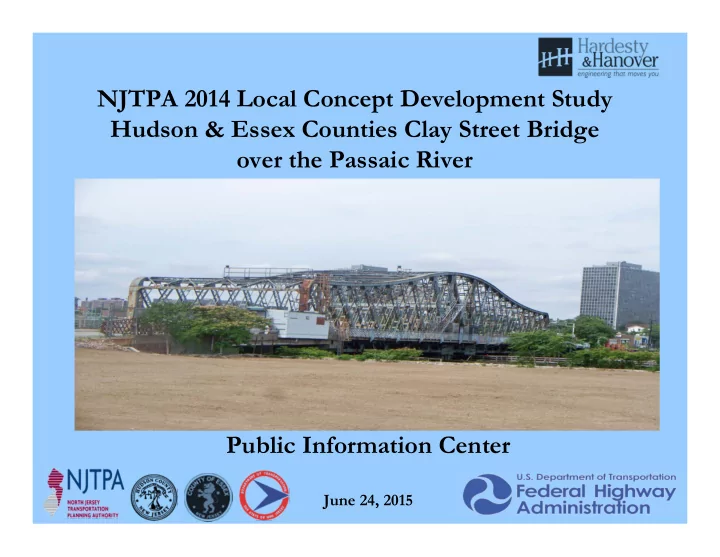
SLIDE 1 NJTPA 2014 Local Concept Development Study Hudson & Essex Counties Clay Street Bridge
Public Information Center
June 24, 2015
SLIDE 2 PROJECT STATUS
- Study Began January 2014
- Data collection competed Spring 2014
- Developed Project Purpose & Need Statement July 2014
- Developed Alternative Concepts, presented to Project
Stakeholders – October/November 2014
- Evaluated Alternatives & Impacts (ROW,
Environmental, Costs, etc.) – Fall 2014/Winter 2015
- Coordination with Regulatory Agencies – March/April
2015
- Selected Preliminary Preferred Alternative - May 2015
SLIDE 3 Project Overview and Background
- Clay Street Bridge was built in 1908.
- Bridge is in need of major rehabilitation or replacement.
- Routine maintenance can no longer address deficiencies.
- NJTPA/Hudson & Essex County Local Concept
Development (LCD) Study initiated January 2014.
- Federally funded process, requires NEPA documentation
- Delivery Process provides opportunity to advance projects
with extensive public input and Regulatory Agency collaboration.
SLIDE 4 Local Project Delivery Process
Local Concept Development Local Preliminary Engineering Final Design/ Right
Construction
Purpose and Need Statement Approved Design Exception Report Construction Contract Documents and PS&E package Completed Construction Data Collection and Environmental Screening Report Cost Estimates (Final Design, ROW and Construction) Environmental Reevaluations As-Builts Selection of Preliminary Preferred Alternative Approved Environmental Document Environmental Permits Update and Finalize Design Communications Report NEPA Classification Approved Project Plan Acquisition of ROW Close-out Documentation Concept Development Report Preliminary Engineering Report Update Design Communications Report Create Design Communications Report Update Design Communications Report
SLIDE 5
Local Concept Development Process
SLIDE 6
Site Location Map
SLIDE 7 Clay Street Bridge Data
- Spans the Passaic River connecting the City of Newark and
the Borough of East Newark
- Located at River Mile 6.0
- ADT = 12,747 (2014), Truck % = 4.1
- Year Built: 1908 (rehab. 1942, 1958, 1975, 1992, & 1997)
- Overall Bridge Length = 328 feet
- Width = 59’-11” (two 18’-4” lanes & 9’-2” sidewalks)
- Bridge type: 3 spans- with a riveted Warren truss rim-
bearing swing center span (236 ft)
SLIDE 8 Clay Street Bridge Data
- Bottom chords of thru-truss are fracture
critical members
- Bridge Opens On-Call (4 hours advance
notice)
- Bridge Clearance in closed position = 8.2’ (at
MHW)
SLIDE 9 Bridge Opening Logs
Clay St Bridge (RM 6.1) & Rt. 7 (Bellville Tpk) Bridge RM 8.9)
Year Clay Street # Openings Route 7 # Openings 2009 36 0 2010 26 0 2011 4 116 2012 5 58 2013 34 56 2014 24 53 2015* 0 0
*January through March
- Openings were primarily for dredging operations and river clean-up
- Recent dredging work (Lyndhurst) completed by Great Lakes Bridge & Dock, LLC
used standard height tugs with flat top barges with excavators on top – operations required no openings for I-280 Stickle Bridge
- Current primary users of river between the two bridges are recreational scull boats
and kayaks
SLIDE 10 Bridge Project Area & Constraints
Photo 1: Bridge Approach Roadway Looking East – note substandard angle point Photo 2: Looking west from bridge – note substandard
SLIDE 11 Bridge Project Area & Constraints
Photo 3: East approach to bridge looking east Photo 4: Looking downstream from bridge – I-280 Stickle Bridge in background
SLIDE 12 Bridge Project Area & Constraints
Photo 5: South Elevation Photo 6: Looking upstream from bridge
SLIDE 13
Bridge Project Area & Constraints
SLIDE 14 Existing Bridge Condition
2012 Bridge Reevaluation Report – Cycle 13
- Bridge in serious overall condition and is Structurally Deficient
- Sufficiency Rating = 33.0 (out of 100)
- Superstructure in serious condition: Rating = 3 out of 10
(localized advanced material losses to steel truss members and to girders & floor beams in swing span)
- Deck = 6 out of 10 (Satisfactory) – isolated spalls in underside
- Substructure = 5 out of 10 (Fair) – spalls in west abutment
- Channel Protection = 4 out of 10 (Poor) – failed bulkhead at
SW channel embankment
SLIDE 15 Existing Bridge Condition (continued)
- Structure is classified as scour critical
- Bridge is susceptible to seismic forces and does not meet
current seismic design criteria
- Mechanical Inspection Report – span drive machinery in fair
condition
- Electrical System – fair to poor condition
- Bridge opening duration (10 minutes) does not meet AASHTO
standards (1 minute to both open and close)
- Needs approx. $ 6M in remedial repairs
SLIDE 16 Existing Bridge Condition
Photo 7: South truss bottom chord , severe deterioration to gusset plate, heavy rust throughout connection Photo 8: South truss gusset plate, severe rust with section loss
SLIDE 17 Existing Bridge Condition
Photo 11: South truss connection, material loss to member angles connection plates, and lacing bars Photo 12: North truss; section loss in angle leg of member
SLIDE 18 Existing Bridge Condition
Photo 13: Localized rusting and material loss to top chords and diagonal truss members Photo 14: Bottom chord of south truss –severe rusting and localized section loss
SLIDE 19 Existing Bridge Condition
Photo 15: Severe rusting and hole in bottom flange angle leg of floor beam (FB12) of swing span Photo 16: Floor beams in west half of swing span – corrosion and localized section losses
SLIDE 20 Existing Bridge Condition
Photo 17: Section loss in bottom of support girder in swing span Photo 18: Severe rusting and localized section loss of steel stringers supporting sidewalk in swing span
SLIDE 21 Existing Bridge Condition
Photo 19: Hole in exterior girder of west approach span Photo 20: Rusting and localized section loss in girders and floor beams of west approach span
SLIDE 22 Existing Bridge Condition
Photo 21: East approach span and east abutment Photo 22: East approach span superstructure (pre-stressed concrete box beam)
SLIDE 23 Existing Bridge Condition
Photo 23: Northwest approach embankment undermining Photo 24: Undermining of south interior girder at west abutment
SLIDE 24 Existing Bridge Condition
Photo 25: Rim bearing assembly of swing span – fair condition with corrosion build on exposed surfaces Photo 26: Swing span drum girders and machinery radial support beams, moderate rusting
SLIDE 25 Controlling Substandard Design Elements
- Minimum Curve Radius (CSDE)
Angle Point between Clay Street and the Bridge over Passaic River (EB/WB) Existing: None Required: 100 feet
- Stopping Sight Distance at Non- Signalized Intersection (CSDE)
- Clay Street at Passaic Street (WB)
Existing Left Turn: 300 feet Required Left Turn: 510 feet Existing Right Turn: 300 feet Required Right Turn: 465 feet
- Outside Shoulder Width (CSDE)
Central Ave. from Bridge over Passaic River to just east of Passaic Avenue Existing: 0 feet Required: 8 feet
SLIDE 26 Crash Analysis
- Crash data associated with the Controlling Substandard Design
Elements (CSDEs) identified within the project limits was obtained for the years 2011 – 2013 for the Clay Street & Passaic Avenue intersection. (There was no data available for the Clay St. & Passaic St. intersection).
- There were a total of 40 crashes reported at the intersection during
those years. The only significant crash pattern is that of same-direction, rear-end crashes; which are frequently the result of congestion.
- Of the 25 rear end crashes reported, 13 occurred on the Southbound
Passaic Avenue approach.
- There were 4 pedestrian crashes during those years (2011-2013).
- The overall analysis of the crash data indicates no significantly statistical
- verrepresented indicator crash rates associated with any of the CSDEs.
SLIDE 27 Utilities
Utility Owner Facilities Electric (Newark & East Newark) PSE&G Utility poles, Overhead and underground primary and secondary electric lines Telephone Verizon Overhead and underground telephone conduits and manholes Cable Cablevision Overhead cable lines Gas PSE&G Underground transmission and distribution Water/Sewer Newark Water & Sewer Utilities Dept. Underground sewer, underground water mains, hydrants, and valves Water City of Newark Underground water mains, hydrants, and valves Sewer City of Newark Underground sewer
SLIDE 28 Environmental Screening
Environmental Screening completed June 2014
Advanced Coordination with SHPO for Cultural Resources completed by Project Team
- Clay Street Bridge eligible for National Register of Historic
Places(NRHP) as rare bridge type (swing span)
- Clark Thread Company (NE Quadrant) – listed on NJ &
NRHP and designated a National Historic Landmark
- Passaic Machine Works (SW Quadrant) – listed on NJ &
NRHP
SLIDE 29
Environmental Screening
SLIDE 30
Environmental Constraints
SLIDE 31 Permits
Agency Approval Hudson, Essex, Passaic Soil Conservation District Soil Erosion & Sediment Control Plan Certification NJ State Historic Preservation Office Determination of No Adverse Effect or Memorandum of Agreement NJDEP Letter of Interpretation NJDEP Water Quality Certificate NJDEP Flood Hazard Area Permit NJDEP Storm Water Management Plan Approval NJDEP Waterfront Development Permit U.S. Army Corps of Engineers Section 10 and Section 404 Permits US Coast Guard, Bridge Administration Division Bridge Permit
SLIDE 32
Environmental Documentation
No significant impacts and with community support for PPA; Categorical Exclusions Document (CED) anticipated
SLIDE 33 Community Outreach
1. Local Officials Briefings: Project Purpose & Need - January 29, 2014 (Borough of East Newark); February 26, City of Newark 2. Stakeholders Meeting No. 1: Purpose & Need - March 24, 2014 3. Public Information Center Meetings (No. 1): Project Purpose & Need - April 7, 2014; 2 to 4 PM (Borough of East Newark) and 6 to 8 PM (City of Newark) 4. Stakeholders Meeting No. 2: Input on Alternatives – October 22, 2014 (City of Newark); November 7, 2014 (Borough of East Newark) 5. Local Officials Briefings: Preliminary Preferred Alternative - June 4, 2015 ( City of Newark & Borough of East Newark)
- 6. Project Website: www.claystbridge.com (300 hits per
month)
SLIDE 34
Additional Project Outreach
1. NJ State Historic Preservation Office (SHPO): APE & List of Interested Consulting Parties – June 24, 2014 2. Regulatory Agency (US Coast Guard, US ACOE, US EPA & FHWA) Coordination Meeting: Concept Alternatives & Alternatives Analysis Matrix – March 3, 2015 3. NJ SHPO: Draft Cultural Resources Report, Concept Alternatives & Alternatives Analysis Matrix – March 9, 2015 4. Harbor Operations Committee: Concept Alternatives & Alternatives Analysis Matrix – April 1, 2015 5. NJDOT Subject Matter Experts (Value Solutions): Project Purpose & Need, Concept Alternatives & Alternatives Analysis Matrix – April 15, 2015
SLIDE 35 Project Purpose & Need Statement
- The purpose of this project is to address the deficiencies of the
structure carrying Clay Street over the Passaic River in order to provide a safer and more efficient crossing.
- The bridge provides a critical transportation connection for
residents and commuters in Hudson County to and from the City
- f Newark’s downtown business district. The existing bridge is
rated in overall serious condition due to the localized advanced material losses to the steel truss members and to the girders and floor beams in the swing span. The bridge was built in 1908, has a Sufficiency Rating of 33.0, and is structurally deficient due to the superstructure, which is rated in serious condition. The bridge is scour critical and does not currently meet seismic design
- standards. The bridge opening duration does not meet desirable
- criteria. Additionally, the bottom chords of the steel truss are
fracture critical members.
SLIDE 36 Project Goals & Objectives
Important issues that should be considered in addressing the project purpose and need are the goals and objectives identified as follows:
- Provide bicycle compatibility and connectivity to the approach
roadways
- Provide ADA compliant pedestrian facilities and crossings as well as
connectivity to the approach roadways
- Upgrade bridge and approach roadway conditions to meet AASHTO
and NJDOT safety standards including new parapets and guide rail
- Correct the controlling substandard design elements
- Avoid or minimize social, economic, and environmental impacts
- Provide for earthquake resistance of the structure so as to meet current
design standards
- Modernize bridge mechanical and electrical components to meet
current standards
SLIDE 37 Project Goals & Objectives (continued)
- Reduce the frequency of major bridge maintenance
activities that disrupt traffic flow
- Maintain traffic operations and volume with minimal
disruption and delay during construction; maintain pedestrian and vehicular access to properties at all times during construction and minimize detours
- Provide accommodations for commercial and
recreational users of the Passaic River
- Address the high rate of vehicular and pedestrian
crashes occurring at the Clay Street & Passaic Avenue intersection
SLIDE 38 Development of Alternative Concepts
- 9 concepts developed along with No Build & Major
Rehabilitation alternatives
- Bridge Replacement Concepts include:
1. Low-level fixed bridge (15’ clearance over MHW over one
- r both of the existing 75’ wide channels)on the same
alignment, on a new alignment to the north; or a new alignment to the south (at President Street) 2. High level fixed bridge (35’ and 135’ clearance over MHW)
- n the same alignment
- 3. Movable bridge on the same alignment
SLIDE 39 Development of Alternative Concepts (cont)
All bridge replacement concepts include:
- New Bridge width = 68-0”; two 12’ EB lanes, one 12’ WB
lane, 6’ sidewalk & 1’-9” parapet on both sides, and 8’
- utside shoulder in each direction
- Addition of an exclusive right turn lane for the Passaic
Avenue southbound approach to Clay Street to address high rate of vehicular crashes
- Intersection improvements (ADA-compatible curb ramps,
pedestrian countdown heads and pushbuttons, crosswalks, etc.) at Passaic Avenue & Clay Street to address high rate of pedestrian crashes
SLIDE 40 Alternative Concepts
- No Build
- Major Rehabilitation
Bridge Replacement Alternative Concepts
- Concept 1 – North Alignment with Low-Level Fixed Bridge
(15’ over MHW – both waterway channels)
- Concept 2A – Existing Alignment with Low-Level Fixed
Bridge (15’ over MHW – both waterway channels)
- Concept 2B – Existing Alignment with Low-Level Fixed
Bridge (15’ over MHW – one waterway channel)
- Concept 3A – Existing Alignment with Movable Bridge
spanning both 75’ wide waterway channels
SLIDE 41 Alternative Concepts (continued)
Bridge Replacement Alternative Concepts (continued)
- Concept 3B – Existing Alignment with Movable Bridge
spanning one 75’ wide waterway channel
- Concept 3C – Existing Alignment with Movable Bridge
spanning a 100’ wide waterway channel
- Concept 4 – South Alignment with Low-Level Fixed Bridge
(15’ over MHW – both waterway channels), and rehabilitate and maintain existing bridge)
- Concept 5 – Existing Alignment with High -Level Fixed
Bridge (35’ over MHW – both waterway channels)
- Concept 6 – Existing Alignment with High -Level Fixed
Bridge (135’ over MHW – both waterway channels)
SLIDE 42 ALTERNATIVES ANALYSIS MATRIX RESULTS
- No Build does not meet Project Purpose & Need –
bridge cannot be load posted nor permanently closed
- Major Rehabilitation dismissed as viable solution
– does not meet Project Purpose & Need (cannot be widen existing bridge to provide bicycle compatibility) – does not address Controlling Substandard Design Elements – Not cost effective (Higher Life Cycle Costs than movable bridge replacement (3B & 3C) Life Cycle Costs
SLIDE 43 ALTERNATIVES ANALYSIS MATRIX RESULTS (cont)
- Concepts 1, 2, 2A, & 4 – Low-level fixed bridge
alternatives (15’ over MHW) dismissed due to not meeting goal and objective for providing accommodations for future commercial users of the Passaic River – 135’ Clearance over MHW needed, per recommendations from Harbor Operations Committee
- Concept 5 – High-level fixed bridge (35’ over MHW)
dismissed due to not meeting goal and objective for providing accommodations for future commercial users
- f the Passaic River and also due to extensive
environmental and Right of Way impacts
- Concept 6 – High-level fixed bridge (135’ over MHW)
dismissed due to highest cost and most extensive environmental and ROW impacts of all alternatives
SLIDE 44 ALTERNATIVES ANALYSIS MATRIX RESULTS (cont)
- Concept 3A – Movable Bridge over both
existing channels dismissed due to higher construction and Life Cycle Costs relative to Concepts 3B & 3C
- Concept 3B – Movable Bridge over one (west)
existing 75’ wide channel dismissed due to not meeting goal and objective for providing accommodations for future commercial users of the Passaic River – 100’ Channel Width needed, per recommendations from Harbor Operations Committee
SLIDE 45 Preliminary Preferred Alternative (PPA) Concept 3C (PPA)
- Meets Project Purpose & Need and all goals and objectives
- Meets the recommendations from the Harbor Operations
Committee for future commercial users of the Passaic River
- Supported by Community Stakeholders as a viable alternative
- Supported by City of Newark & Borough of Newark Officials
- Minimal ROW and Environmental impacts in comparison to all
- ther alternatives
- Eliminates horizontal curve radius controlling substandard design
element
- Significantly less costly and significantly less ROW and
environmental impacts relative to the high level fixed bridge alternatives
SLIDE 46
PPA (Concept 3C) Cost
Roadway $12.6 M Bridge $57.4 M Right of Way $ 0.05M Total: $ 70.0 M
SLIDE 47 NEXT STEPS
- Address Public Information Center comments
- Review/Finalize Preliminary Preferred Alternative
- Preliminary Preferred Alternative Selected
- Obtain Resolutions of Support for PPA (City of Newark,
Borough of East Newark, Hudson & Essex County)
- Complete Local Concept Development Report
- Hold Inter-Agency (FHWA, NJTPA, NJDOT) Review
Meeting for PPA
- Concept Development Phase completed (October 2015)
SLIDE 48 Project Contact Information
- Joseph Glembocki, Hudson County Project Manager,
jglembocki@hcnj.us, (201) 369-4340
- Luis Rodriguez, Essex County Project Manager,
lrodriguez@essexcountynj.org, (973) 226-8500
- Clay Street Bridge Project Web Site address:
- www.claystbridge.com
- The PowerPoint Presentation will be posted on the
Project Web Site
- Written comments towards the Preliminary Preferred
Alternative Selection will be received until Friday, July 24, 2015
SLIDE 49
Questions & Comments