NAVAL AIR STATION WHIDBEY ISLAND AIR TRAFFIC CONTROL FACILITY - - PowerPoint PPT Presentation

naval air station whidbey island air traffic control
SMART_READER_LITE
LIVE PREVIEW

NAVAL AIR STATION WHIDBEY ISLAND AIR TRAFFIC CONTROL FACILITY - - PowerPoint PPT Presentation

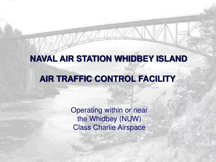
NAVAL AIR STATION WHIDBEY ISLAND AIR TRAFFIC CONTROL FACILITY Operating within or near the Whidbey (NUW) Class Charlie Airspace CLASS C & AIRSPACE BRIEFS IMPROVE AIRSPACE KNOWLEDGE ASK QUESTIONS/EXPRESS CONCERNS


slide-1
SLIDE 1

Operating within or near the Whidbey (NUW) Class Charlie Airspace

NAVAL AIR STATION WHIDBEY ISLAND AIR TRAFFIC CONTROL FACILITY

slide-2
SLIDE 2

➢IMPROVE AIRSPACE KNOWLEDGE ➢ASK QUESTIONS/EXPRESS CONCERNS ➢CURRENT/FUTURE EVENTS OR HOTSPOTS ➢OVERALL IMPROVEMENT TO SAFETY AND PILOT/CONTROLLER S.A. ➢FEEDBACK (TAKE-AWAYS/GIVE-AWAYS)

CLASS “C” & AIRSPACE BRIEFS

slide-3
SLIDE 3

AIR TRAFFIC CONTROL

“WHIDBEY APPROACH”

slide-4
SLIDE 4

Only Naval Air Traffic Control Facility with Class C Airspace Approach services provided twenty-four hours a day, seven days a week Encompasses 2,200 square miles 200,000 operations annually Seven airports with IFR approaches Fifteen additional satellite airports Bordered by Canadian International Airspace as well as Seattle Center and Seattle Approach Approximately 80 military and 9 civilian air traffic control specialists

slide-5
SLIDE 5

Trends

  • OCT-MAR

– Less VFR traffic, increased IFR traffic (poor WX, fog, daylight savings) – Squadrons start/secure from FCLP / CCA earlier ( less A-680 activity but higher altitude entry/exit from/to NUW). – Increased small craft advisories and high wind warnings.

  • APR-SEP

– Increased VFR Traffic, especially General Aviation. – NUW/NRA FCLP/CCA well after midnight (A-680 busy, often very direct and low entry/exit from/to NUW).

slide-6
SLIDE 6

Surface to 9,000 Ft MSL

6,000 to 9,000 Ft MSL

Seattle Approach Surface to 5,000 Ft MSL

slide-7
SLIDE 7
slide-8
SLIDE 8

345 Radial

slide-9
SLIDE 9

FAAO 7110.65 7-8-1. APPLICATION Apply Class C service procedures within the designated Class C airspace and the associated outer area (20nm). FAAO 7110.65 7-8-2. CLASS C SERVICES

  • a. Class C services include the following:
  • 1. Sequencing of all aircraft to the primary airport.
  • 2. Standard IFR services to IFR aircraft.
  • 3. Separation, traffic advisories, and safety alerts between IFR and VFR aircraft.
  • 4. Mandatory traffic advisories and safety alerts between VFR aircraft.
  • b. Provide Class C services to all aircraft operating within Class C airspace.
  • c. Provide Class C services to all participating aircraft in the outer area.
  • d. Aircraft should not normally be held. However, if holding is necessary, inform the

pilot of the expected length of delay.

slide-10
SLIDE 10

Please be as brief and “to the point” as possible. (callsign, type A/C, destination) “Whidbey Approach, Skyhawk 738AW departing Jefferson county VFR to Friday Harbor.” “Skyhawk 738AW, Whidbey Approach, squawk 0440, Whidbey Altimeter two niner-niner two.” Our controllers are monitoring multiple frequencies. Be patient and we will get to you in short order. please listen carefully to your radio for traffic calls. Due to high traffic congestion through the Straits and around Friday Harbor Airport,

slide-11
SLIDE 11
slide-12
SLIDE 12

Admiralty Bay Mining Range (R-6701). Located off the southwest coast of Whidbey Island, south of OLF Coupeville at Admiralty Bay. Chinook Alpha Military Operating Area Chinook B Military Operating Area Located West of R-6701 Located South of R-6701 Both areas are currently not used; however, if the need arises, these areas will be activated by NOTAM. (14 CFR 73)

slide-13
SLIDE 13

ALERT AREA 680

Airspace that may contain a high-volume of pilot training activities Pilots of participating aircraft as well as pilots transiting the area are equally responsible for collision avoidance Field Carrier Landing Practice Helicopter auto rotations This alert area is defined as a 3 nm radius of OLF Coupeville from the surface up to and including 3,000 feet MSL.

slide-14
SLIDE 14

Friday Harbor (FHR)

NDB RWY 34 RNAV (GPS) RWY 34

Bayview - Skagit Regional (BVS)

RNAV (GPS) RWY 11 RNAV (GPS) RWY 29 NDB RWY 11

Port Angeles (William R Fairchild) (CLM)

ILS RWY 8 RNAV (GPS) RWY 8 RNAV (GPS) RWY 26 WATTR Departure

AJ Eisenburg (OKH) RNAV (GPS) RWY 7 Orcus/East Sound (ORS) RNAV (GPS) RWY 34 RNAV (GPS) A RNAV (GPS) 16 (BLI*) Jefferson County (0S9) RNAV (GPS) A

slide-15
SLIDE 15

CLM NOW W28 WA09 0S9 NRA OKH FHR S31 38WA 74S BVS

NAS Whidbey Island Major Satellite Airports

WN07

slide-16
SLIDE 16

Friday Harbor (FHR)

FRIDAY HARBOR >RNAV34 >NDB34

slide-17
SLIDE 17

William R. Fairchild INTL (CLM) (Port Angeles)

WILLIAM R. FAIRCHILD >ILS OR LOC RWY 8 >RNAV RWY 8 >RNAV RWY 26 (WATTR Dep) COAST GUARD PA >COPTER NDB >RNAV RWY 26

slide-18
SLIDE 18

AJ Eisenburg (OKH)

AJ Eisenburg (OKH) >RNAV RWY 7

slide-19
SLIDE 19

Burlington/Skagit Regional (BVS)

SKAGIT REGIONAL >RNAV11 >NDB11 >RNAV29

slide-20
SLIDE 20

“Transition West of Smith Island…” when en route to FHR/SJI area.

  • NUW is Departing RY25 and your altitude and course will place you in

close proximity to departure climb. Tower ‘Auto’ Releases.

  • Weather reports show maintaining VFR at your present altitude won’t

be likely, and descent would again cause conflict with the departures from RY25

“Cross the Whidbey Class Charlie airspace at or above 2,500”.

  • All military departures are initially climbed to 2,000 feet. Crossing
  • ver the top at 2,500 feet ensures Class C separation requirements.
slide-21
SLIDE 21

“Cross the Whidbey Class Charlie airspace at or above 3,500.” Instrument and radar approach patterns are flown at 3,000 feet. General aviation traffic above the pattern ensures proper separation and helps reduce traffic calls. “Remain outside the Whidbey Class Charlie airspace and stand-by.” Typically controllers are communicating on at least 3 frequencies as well as performing inter/intrafacility coordination (push button landlines). Always monitor the appropriate sector frequency and if the controller does not get back to you, reattempt contact after a few minutes. Why do I get asked what side of the island I’m planning to transition up when coming from the south?

  • We know weather/comfort levels of ‘hugging’ shore come into play.

We take your request and NUW departure RY, PIREPS, ‘HOT’ areas, etc. into account to come up with the best transition route possible for both.

slide-22
SLIDE 22

VFR REPORTING POINTS BUSH POINT

➢YOU SAY “HELLO”, I SAY “GOODBYE” ➢USE CAUTION AIR TRAFFIC CONGESTION POINT

slide-23
SLIDE 23
slide-24
SLIDE 24

VFR REPORTING POINTS OTHER POINTS

➢CATTLE POINT ➢PT. WILSON (PT, NOT LIGHTHOUSE) ➢LANGLEY (CITY, NOT THE AIRPORT) ➢SMITH ISLAND (86S) ➢AIRPORTS ➢ELIZA ISLAND

slide-25
SLIDE 25

ACCS Jeff Barkley – Training Branch Chief (M-F, 0730-1600) 360-257-2132 AC1 Ryan Leonard - Radar Branch Chief (M-F, 0730-1600) 360-257-2132 Facility Watch Supervisor ( 24 hrs/day.)…360-257-2887 NAS Whidbey Island Operations Duty Officer ( 24 hrs/day.)… 360-257-2681