Mayaro and Guayaguayare Coastal Protection Stakeholder Consultation - - PowerPoint PPT Presentation

mayaro and guayaguayare coastal protection
SMART_READER_LITE
LIVE PREVIEW

Mayaro and Guayaguayare Coastal Protection Stakeholder Consultation - - PowerPoint PPT Presentation

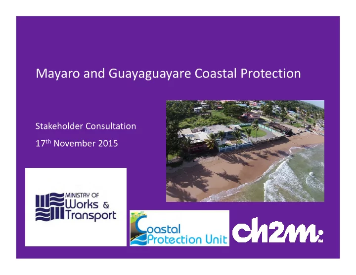
Mayaro and Guayaguayare Coastal Protection Stakeholder Consultation 17 th November 2015 Project Overview & Introductions Appraisal and design of sustainable coastal protection measures to address ongoing coastal erosion and coastal


slide-1
SLIDE 1

Mayaro and Guayaguayare Coastal Protection

Stakeholder Consultation 17th November 2015

slide-2
SLIDE 2

2

Project Overview & Introductions

“Appraisal and design of sustainable coastal protection measures to address ongoing coastal erosion and coastal flooding problems at Mayaro and Guayaguayare”

  • r, WHERE AND HOW DO WE

PROTECT THE COAST FROM EROSION AND FLOODING NOW AND INTO THE FUTURE We invite your feedback on how we manage these risks

slide-3
SLIDE 3

3

Agenda

  • Introduction (5 mins)
  • What have we been doing and what comes

next? (5 mins)

  • What is “at risk” and where should we

prioritise protection? (10 mins)

  • What about your environment and

livelihoods? (5 mins)

  • What can we do to manage risk? (10 mins)
  • Where should we be protecting? (25 mins)
  • Questions on solutions? (50 mins)
slide-4
SLIDE 4

4

Introduction Introduction Introduction Introduction

slide-5
SLIDE 5

5

What does the coastline face in the future?

  • Coastline has evolved
  • This evolution will change in line with

climate change

  • We have tools to predict how the

coastline will change

  • We have methods to protect the coast,

but at what cost?

slide-6
SLIDE 6

6

What might Sea Level Rise mean for the coast?

6

Start with the present day situation The shoreline moves as it always has done

slide-7
SLIDE 7

7

What might Sea Level Rise mean for the coast?

7

As sea level rises, so the beach responds The beach retreats and rises in line with the SLR The retreat is seen as erosion. The water depth near the shore remains the same

Erosion

slide-8
SLIDE 8

8

What might Sea Level Rise mean for the coast?

8

Where we have developments on the coast

slide-9
SLIDE 9

9

What might Sea Level Rise mean for the coast?

9

As sea level rises, and the beach responds Erosion of the beach puts property at risk Where we have property on the coast

Erosion

slide-10
SLIDE 10

10

What will Sea Level Rise mean for the coast?

10

We can build engineering works The beach and shore still respond to SLR But the beach can not retreat or rise, and can be lost The water near the shore becomes deeper increasing the wave heights at the coast

slide-11
SLIDE 11

11

What happens if we harden the shoreline?

11

?

Loss of beaches and other coastal habitats…

slide-12
SLIDE 12

12

What have we been doing and what comes What have we been doing and what comes What have we been doing and what comes What have we been doing and what comes next? next? next? next?

slide-13
SLIDE 13

13

What have we been doing?

  • Collecting existing data and field

measurements

  • Consulting with stakeholders
  • Identifying the problems
  • Mapping the hazards and

identifying everything at risk

slide-14
SLIDE 14

14

Where are we now and what comes next?

  • Appraising how to manage the

risks identified

  • Identifying where appropriate to

act through economic assessment

  • Consideration of different

solutions

  • Technically appraising solutions
  • Consulting with stakeholders
  • Arriving at preferred solutions
  • Detailing the required urgent

schemes ready for construction

slide-15
SLIDE 15

15

What is “at risk” and where should we What is “at risk” and where should we What is “at risk” and where should we What is “at risk” and where should we prioritise protection? prioritise protection? prioritise protection? prioritise protection?

slide-16
SLIDE 16

16

What is out there?

slide-17
SLIDE 17

17

Asset Database – a database of what is out there

  • All “at risk” assets identified

through mapping

  • Asset type, size, condition

identified

  • Market value of assets
  • Exposure to risk identified

(year of loss for erosion,

  • nset of property flooding)
slide-18
SLIDE 18

18

Economics

  • What is at stake if we “do nothing”

to protect assets (what is the damage cost of “No Active Intervention”)

  • Damage costs include business

losses and costs of rebuilding/moving infrastructure.

  • What is the value of “doing

something” (identification of economic benefits of protecting frontages )

  • What is the cost of protection (high

level assessment of costs for “doing something”)

  • Comparison of the two above to

prioritise where to spend money (“Benefit-Cost Ratio”)

slide-19
SLIDE 19

19

What about your environment and What about your environment and What about your environment and What about your environment and livelihoods? livelihoods? livelihoods? livelihoods?

slide-20
SLIDE 20

20

Socio-economic and Environmental Factors

  • Recreation (beach access, H&S, aesthetics)
  • Employment

– Tourism – Fishing – Oil & gas

  • Communities
  • Archaeological & cultural
  • Turtle nesting & manatees
  • Mangroves & native vegetation
  • Bird habitat
slide-21
SLIDE 21

21

What can we do to manage risk? What can we do to manage risk? What can we do to manage risk? What can we do to manage risk?

slide-22
SLIDE 22

22

Recap

  • Many areas are safe now, but this

will change

  • Erosion risk – present and future
  • Coastal flood risk – present and

future

  • Which assets are affected and in

what way

  • Environmental and community

impacts

slide-23
SLIDE 23

23

What are the solutions?

  • Developed an understanding of the

coastline

  • Based on our experience we

considered a range of suitable solutions to manage the risk

  • Looked at pros and cons of various

solutions

  • Need to make the right choices
slide-24
SLIDE 24

24

“Hold the shoreline” – protect with hard engineering

Breakwaters, groynes Seawalls, rock revetments

What can we do?

“No Active Intervention” – let nature take is own course

Give nature space – development controls Move assets

  • r make

them resilient

“Managed realignment” – manage hazard behind the shoreline

Set back structures – eg flood bunds Asset level protection – protect the important bits

“Stabilise the shoreline” – protect with soft engineering

Beach nourishment i.e. build a bigger beach Vegetation planting or

  • yster beds
slide-25
SLIDE 25

25

Examples

slide-26
SLIDE 26

26

How do we chose the right solution?

1. Understand the localised problems 2. Identify possible solutions 3. Do these solutions work? (technically, economically and environmentally) 4. Identify the right solution with stakeholders 5. When to act:

– Short Term (2015 to 2035)? – Medium Term (2035 to 2065)?

slide-27
SLIDE 27

27

Prioritising and Planning

  • Focus is on solutions recommended
  • ver the Short Term (within next 20-

years)

  • Prioritisation on protecting

important assets that are at risk

  • Long term considerations/context
  • Identify who can deliver each

scheme

  • Provide a framework for how

individuals can sensibly protect their assets

slide-28
SLIDE 28

28

Do we need to protect the whole coastline? Do we need to protect the whole coastline? Do we need to protect the whole coastline? Do we need to protect the whole coastline?

slide-29
SLIDE 29

RADIX POINT GALEOTA POINT GRAN CAYO GUAYAGUAYARE MAYARO

slide-30
SLIDE 30

30

Which areas should we monitor and slow Which areas should we monitor and slow Which areas should we monitor and slow Which areas should we monitor and slow erosion? erosion? erosion? erosion?

slide-31
SLIDE 31

M2_P1 & M2_S1B – St Joseph

  • Largely undeveloped/abandoned
  • Some new development with asset level

structural protection

  • Slowing erosion using vegetation may be viable

Non-structural Solutions

M2_P3 – Abandoned Property Cluster

  • Low density development, all derelict
  • Slowing erosion using vegetation may be viable

M5_S1D & M6_S1 – South of Grand Lagon River/BP Compound

  • Beach currently stable, maintaining beach

stability key in Short Term

  • High value assets may justify future scheme

G7_S1A – West Guayaguayare (sports field)

  • High value of assets may justify future scheme
  • Slowing erosion using vegetation may be viable

M4_S1B – Queens Beach

  • Beach currently stable, maintaining beach

stability key in Short Term

  • High value assets may justify future scheme
slide-32
SLIDE 32

32

Which areas may soon require an Which areas may soon require an Which areas may soon require an Which areas may soon require an engineering solution, but not now? engineering solution, but not now? engineering solution, but not now? engineering solution, but not now?

slide-33
SLIDE 33

G4_S1– Fisherman’s Beach

  • Beach currently stabilising around new fishing

facility

  • Monitor beach and intervene with structural

solution as assets threatened (particularly the road)

Structural Solutions – At Assets

slide-34
SLIDE 34

M3_S1A & M3_P1 – Mayaro/Plaisance

  • Increasing erosional pressure but beach

currently stable (particularly to the south)

  • Local wave overtopping risk
  • Significant number of assets at risk in

medium term (50+ by 2065) justify intervention when needed

Structural Solutions – Non Urgent

M10_P1 & M10_P2 – BP Offices

  • BP office is a significant single asset and

economically justified to intervene when existing defence fails G7_P1 – Catholic Retreat

  • Single asset, protect locally when required

G8_P1 – Road

  • Undeveloped, road under increasing risk of

erosion

  • Monitor and intervene when required

G6_S1 – East Guayaguayare

  • Undeveloped, road under increasing risk of

erosion

  • Monitor and intervene when required
slide-35
SLIDE 35

35

Which areas most urgently need an Which areas most urgently need an Which areas most urgently need an Which areas most urgently need an engineering solution? engineering solution? engineering solution? engineering solution?

slide-36
SLIDE 36

36

M2_P2 – Property cluster

  • Eroding shoreline
  • Scheme currently viable at property

cluster only

  • Recommendation: Rock

revetment/berm at top of beach (BCR>2)

Travelling Officers Quarters Property

slide-37
SLIDE 37

37

M6_P1 – Indian Beach/Frontin Road

  • Large number of high value assets at

direct risk

  • Narrow beach and property wall

collapses, unstable ground

  • Recommendation: Revetment or

possibly beach nourishment and groynes (BCR>2)

Coast road River bridge

slide-38
SLIDE 38

38

M9_P1 – Coastguard facility

  • Pipeline and coastguard critical

facility at risk

  • Clearly eroding frontage
  • Recommendation: Rock

revetment (BCR>3)

BP Offices Coastguard

slide-39
SLIDE 39

39

M10_P3 – BP Frontage

  • High value private industrial frontage

with existing failed wall

  • High exposure, avoid reflective solution
  • Little chance of holding beach
  • Poor construction access
  • Recommendation: Leave wall in place

(replace sections where needed) and rock revetment in-front (BCR>4)

BP industrial area

slide-40
SLIDE 40

40

G3_P1 – Calmapass

  • Naturally eroding soft cliff
  • Difficult economic justification for

scheme but community affected

  • Recommendation: Need to consider

cost effective solutions to justify any

  • scheme. If viable, likely to comprise

low rock berm to manage retreat (BCR<1)

Old Road

slide-41
SLIDE 41

41

G5_P1 – Seawall west of new fishing facility

  • Seawall has failed and rock protection

added as emergency measure

  • Coast road and property at risk
  • Option for improved amenity space
  • Recommendation: Rock revetment

with seawall to the east and rock toe protection to the west (BCR>10)

New fishing facility River bridge

slide-42
SLIDE 42

42

G5_P2 – Guayaguayare road

  • Road is high value asset
  • Eroding shoreline, close to road,

threat to bridge.

  • Recommendation: Revetment with

seawall (BCR>15)

Restaurant/bar River bridge

slide-43
SLIDE 43

43

G6_P2 – Guayaguayare seawall

  • Wave overtopping and beach loss at

this vertical wall

  • Wall is not performing, but

modifications could protect assets

  • Recommendation: Modify wall by

including set back wave wall and toe protection as required (BCR>2)

Ends of wall

slide-44
SLIDE 44

44

G6_P1 – East Guayaguayare

  • Seawall stops short of property and

road at risk

  • Recommendation: Extend existing

seawall with toe protection and wave wall (BCR>2)

End of existing seawall

slide-45
SLIDE 45

45

G6_P3 – West Guayaguayare

  • Seawall stops short of property at risk
  • Recommendation: Extend existing

seawall with wave wall and toe protection (BCR>2)

End of existing seawall

slide-46
SLIDE 46

46

G8_P2 – Oil pipelines

  • Headland is also protecting road
  • High value asset and

economically/environmentally justified to intervene when required

  • Recommendation: Identification of

risk only. Rock revetment may be

  • appropriate. (BCR>20)

Coast road Headland

slide-47
SLIDE 47

47

Questions? Questions? Questions? Questions?

slide-48
SLIDE 48

48

Contact: Contact: Contact: Contact: Kim.Ali@CH2M.com Kim.Ali@CH2M.com Kim.Ali@CH2M.com Kim.Ali@CH2M.com Halcrow Group (T&T) Ltd., 4 Rust Street, St Clair Halcrow Group (T&T) Ltd., 4 Rust Street, St Clair Halcrow Group (T&T) Ltd., 4 Rust Street, St Clair Halcrow Group (T&T) Ltd., 4 Rust Street, St Clair