
SLIDE 1
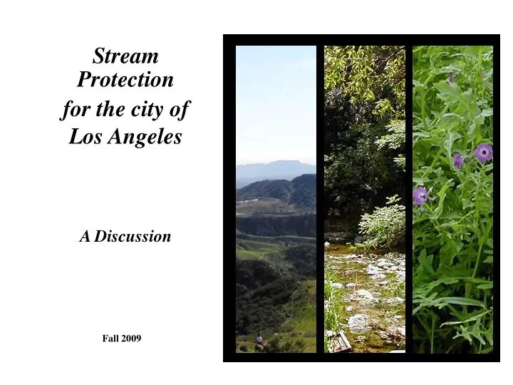
Stream for the city of Los Angeles
Fall 2009
Los Angeles A Discussion Fall 2009 Streams? What streams? In - - PowerPoint PPT Presentation
Stream Protection for the city of Los Angeles A Discussion Fall 2009 Streams? What streams? In Council District 2 Photo: Jessica Hall La Tuna Canyon In Council District 3 Photo: Jessica Hall Bell Creek In Council District 3 Photo:
Fall 2009
Photo: Jessica Hall
Photo: Jessica Hall
Photo: Jessica Hall
Photos: Jessica Hall
From the UCLA Geography Fairchild Air Photography Collection
Flight #H-73 11/29/1929
Photo: Jessica Hall
Photos: G. Haines GoogleEarth
Photo: Jessica Hall
Photo: Natural Channel Design
Photo: Natural Channel Design
Photo: Natural Channel Design
Photo: Natural Channel Design
Photos: Jessica Hall
Photo: Natural Channel Design
Photo: Jessica Hall
From the UCLA Geography Fairchild Air Photography Collection
From the UCLA Geography Fairchild Air Photography Collection
From the Los Angeles Public Library
From the Los Angeles Public Library
“Forty-five acres of ground, now a waste…will be reclaimed for use - when this slough...is filled in. The live stream
Sacatela No. 3 storm drain, leaving no excuse for the gullies and ravine which now exist.”
Courtesy Eco-Village
From the Los Angeles Public Library
Dry Wash Intermittent Perennial Wetlands Early 20th Century Streams 94 miles 312 miles 148 miles 9 sq. miles
Map: Jessica Hall
Image: Jessica Hall
Photo: Jessica Hall Photo: Jessica Hall
Usually look dry Only have water during rainy season Important for water quality, recharge & habitat
Ephemeral Streams Intermittent & Perennial Streams
Usually wet or moist Runs year round or part of year Most people’s idea of a stream Caballero Creek, CD 3 Caballero Creek, CD 3
HIGH TERRACE: Rarely flooded CHANNEL: Carries low flows; bedload sediment GEOMORPHIC FLOODPLAIN: Commonly flooded LOW TERRACE: Infrequently flooded
Slide data from Stream Assessment & Restoration Design Workshop, by Tom Moody, PE, Natural Channel Design, Inc.
Photo: Natural Channel Design
Aliso Creek, CD 12
Photo: Jessica Hall
Wonderland Creek, CD 5
Photo: Jessica Hall
Photos courtesy Wendy Sue Rosen
Mandeville Canyon, CD 11
Helianthus nuttallii parishii Los Angeles Sunflower
http://www.geocities.com/royvandeho ek/losangelessunflower.htm
Potentilla multijuga Ballona Cinquefoil
Courtesy Pasadena Museum of History
Arroyo Seco 1885
Photo: Jessica Hall
Floodplain After Filling Slide from: No Adverse Impact, Association of State Floodplain Managers
Slide from: No Adverse Impact, Association of State Floodplain Managers
Slide from: No Adverse Impact, Association of State Floodplain Managers as measured by:
The City of Los Angeles is also obligated to prevent increases in flood peaks and stream velocities under its MS-4 Permit.
– $10,000 or more in Virginia (Tippett et al., 1999) – Values of Homes Increase as far as 3 Blocks from the Stream (Vince Graham, ION Development) – Property Values 32% Higher for Locations Adjacent to a Greenbelt Buffer in Boulder, Colorado (Correll et al. 1978).
Slide content from: Stream Setbacks and Buffers: Adding Value to Your Community through Stormwater and Natural Resource Conservation, for the Johnson County Stormwater Management Program & Mid-America Regional Council, By: Black & Veatch, Inc., Tetra Tech EMI, and Patti Banks Associates.
Slide content from: Stream Setbacks and Buffers: Adding Value to Your Community through Stormwater and Natural Resource Conservation, for the Johnson County Stormwater Management Program & Mid-America Regional Council, By: Black & Veatch, Inc., Tetra Tech EMI, and Patti Banks Associates.
Not all streams are mapped accurately
Photos: Guangyu Wang
Arroyo del Jardin de los Flores, CD 4
State and Federal laws do not stop streams from being destroyed.
Map and Aerial: Microsoft Terraserver
Creek in the Los Angeles River headwaters (CD 12) at risk.
State and Federal laws do not stop streams from being destroyed.
Photo: Jessica Hall
Kenter Creek, CD 11
edge of banks
streambed
stream channel
“unmapped”
Local jurisdictions should be the front lines of stream protection. ISSUES
Photo: Jessica Hall
Stone Canyon Creek, CD 5 June 4, 2006
Photos: Jessica Hall
Local jurisdictions should be the front lines of stream protection.
Las Virgenes Creek - $1.5 m
Dry Canyon Creek - $500k
Navigate LA
consultations with: California Department of Fish & Game US Army Corps of Engineers Regional Water Quality Control Board
Atwater Creek, CD 4
Photo: Jessica Hall
Identification Zone
Slide content from: Stream Setbacks and Buffers: Adding Value to Your Community through Stormwater and Natural Resource Conservation, for the Johnson County Stormwater Management Program & Mid-America Regional Council, By: Black & Veatch, Inc., Tetra Tech EMI, and Patti Banks Associates.
Slide content from: Stream Setbacks and Buffers: Adding Value to Your Community through Stormwater and Natural Resource Conservation, for the Johnson County Stormwater Management Program & Mid-America Regional Council, By: Black & Veatch, Inc., Tetra Tech EMI, and Patti Banks Associates.
– Buffer includes culverted (piped) streams – No structures with roofs allowed within buffer – 30’ setback from stream centerline
– 2 levels of protected zones: a 20’ and a 100’ setback from top of bank – Creates 4 classes of permit depending on proposed work within each zone. – Permittees must submit a thorough Creek Protection Plan with their building submittals.
– 50’ setback of streams in urban and upland areas (proposed to be widened to 100’), – 100’ setback in lowland streams – 200’ along the Russian River.
– 100’ setback from edge of riparian canopy
Oakland, California Berkeley, California San Diego County, California Santa Cruz, California Napa, California Austin, Texas La Grande, Oregon Charlotte, North Carolina Mecklenberg, North Carolina Cannon Township, Michigan Peabody, Massachusetts Joliet, Illinois Fairfax County, Virginia Kings County, Washington Washoe County, Nevada
The State of New Jersey
Photo: Jessica Hall
Photo: Jessica Hall
Los Angeles River, CD 6
Stream Protection Concepts