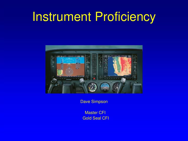
SLIDE 1 Instrument Proficiency
Dave Simpson Master CFI Gold Seal CFI
SLIDE 2 Objectives
- Review IFR procedures
- GPS & WAAS implications for preflight,
approaches and alternates
- Chart quiz
- Common check ride issues
SLIDE 3 Preflight IFR Requirements
91.103 Preflight Action for Flight Under IFR
What you Need to Know Before You Go
- Runway Lengths (VFR Too)
- ATC Delays – required part of standard briefing
- Weather (Icing?)
- Fuel Requirements (What Are They?) 91.167
Fuel requirements for flight in IFR conditions. (a) No person may operate a civil aircraft in IFR conditions unless it carries enough fuel (considering weather reports and forecasts and weather conditions) to-- (1) Complete the flight to the first airport of intended landing; (2) Except as provided in paragraph (b) of this section, fly from that airport to the alternate airport; and (3) Fly after that for 45 minutes at normal cruising speed
- Alternates
- Takeoff & Landing Distances (VFR Too)
Are we done yet?
SLIDE 4 Preflight IFR Requirements
You are about to depart under IFR and find that your VSI is inoperative ….
1.Can you legally depart IFR? 91.205
- 2. Does anything still need be done? 91.213
Are we done yet?
SLIDE 5 Preflight GPS Operations
For GPS Operations – TSO 129 Equipment
- Must do a RAIM Prediction Check
“If TSO-C129 equipment is used to solely satisfy the RNAV requirement, GPS RAIM availability must be confirmed for the intended route of flight (route and time) using current GPS satellite information.” AC 90-100
- Both departure (if flying an RNAV DP) and
destination airports must be checked.
- RAIM must be predicted to exist continuously
during the planned flight
“In the event of a predicted, continuous loss of RAIM of more than five (5) minutes for any part of the intended flight, the flight should be delayed, canceled,
- r re-routed where RAIM requirements can be met.” AC 90-100
SLIDE 6 GPS Operations
How Can A RAIM Check Be Done?
- Call Flight Service (within 24 hours of ETA)
- Go to www.raimprediction.net (FAA Site)
- Complete a RAIM check on your GPS receiver
- GPS provides 10 meter accuracy
OK … But What About WAAS?
SLIDE 7 WAAS Operations
- Certified Under TSO C145 & C146
- Uses the 24 GPS satellites
- 3 Geostationary WAAS Satellites
- 38 Ground Reference Stations
- 2 Master Correction Stations
- 6 Ground Uplink Stations
SLIDE 8 Aircraft
How Does WAAS Work?
38 Ground Stations 6 Ground Uplink Stations 2 Master Stations
1 2 3 4 5
24 GPS Satellites 3 Geostationary WAAS Satellites
SLIDE 9 WAAS Operations
- Faster refresh rates 5x/sec vs 1x/sec for GPS
- Required accuracy 25 feet (vertical and lateral)
- Measured accuracy 3 feet
- Vertical Guidance (3,100 LPV approaches) more
than ILS Approaches
- By 2020 only half of the 967 VOR’s will be in service
- WAAS will fly procedure turns with a roll steering AP
- Can use WAAS as single source navigation (FDE)
- Not required to check for RAIM before flight, unless
flying outside US airspace, or where WAAS coverage doesn’t exist
- Are required to check NOTAMS for WASS outages
with Flight Service
SLIDE 10 GPS and WAAS Operations
What Happens If RAIM is Lost During Flight?
- Must notify ATC immediately AIM 5-3-3
- Must revert to alternate means of navigation AC 90-100
SLIDE 11 GPS and WAAS Operations
What Happens if RAIM is Lost on Approach?
e.g. RAIM Warning Appears on GPS
- If RAIM is lost inside the FAF - no RAIM warnings for 5 min
- If RAIM is lost outside the FAF – there will be a RAIM
warning and you must discontinue the approach AIM 1-1-19
RAIM Availability Computed at 2 NM Before FAF
SLIDE 12 Alternates
You always file an alternate unless you can meet 91.169 123 Rule
- What if destination has no approach?
- What if alternate has no approach?
- Does my equipment affect alternate filing?
1 hr before to 1 hr after ETA 2,000’ ceiling AND 3 miles visibility
SLIDE 13 Alternates
- If destination has no approach, you must file an
alternate regardless of weather FAR 91.169
- If alternate has no approach, you must be able to
descend from the MEA, approach, and land under VFR FAR 91.169
- As of April 4, 2013 if only GPS equipped, you
may plan a GPS approach at your destination or alternate but not both. NOTAM AIM update
- If WAAS equipped, there are no navigation
equipment limitations so a single WAAS receiver is legal AIM 1-1-19
SLIDE 14 Alternates
- If using a WAAS receiver, you may not plan to
use WAAS vertical guidance (LPV) at the alternate. Current alternate airport planning policy explicitly prohibits TSO-C145 and TSO-C146 equipped users (WAAS users) from planning to use WAAS vertical guidance at their alternate airport. Must plan an LNAV approach using non precision alternate weather minimums - AIM 1-1-20
SLIDE 15
Alternates
Scenario: Tower Enroute Practice Approach from MYF to CRQ. Aircraft WASS equipped. Weather at CRQ is 1,500 scattered and 2 miles visibility. Can this flight be conducted legally? Yes No
SLIDE 16
Alternates
Scenario Continues: You determine that under the 123 rule, you need an alternate and have decided that you will file an IFR flight plan and use the LOC D approach at SEE as your alternate. The weather at SEE for your ETA is 1,500 SCT 1,200 OVC 2 SM VIS. Can you legally file SEE as your alternate?
Yes No Depends on the approach
SLIDE 17
SLIDE 18
Alternate Minimums Section
SLIDE 19 SAN DIEGO(EL CAJON), CA GILLESPIE FIELD ............................... LOC-D¹² RNAV (GPS) Rwy 1734 ¹ NA when control tower closed ² Categories A, B, 2400-2; Categories C, D, 2400-3. ³ Categories A, B, 1100-2; Category C, 1100-3; Category D, 1200-3
4 NA when local weather not available
Non Standard Alternate Minimums
SLIDE 20
GPS In Lieu of DME
Can GPS be used as a substitute for DME? Yes, as long as it is WAAS No, if it says DME it must be DME Yes, as long as it is a panel mount, IFR certified receiver (either GPS or WAAS)
SLIDE 21
SLIDE 22 Using GPS to Assist Approaches
Can GPS be used exclusively to fly a non GPS approach where RNAV(GPS) e.g. VOR A OKB, LOC D SEE, ILS 28 MYF? Yes, if the approach is in the database No, under any conditions Yes but only some parts
AIM 1-2-3
Pilots may not substitute for the NAVAID (for example, a VOR or NDB) providing lateral guidance for the final approach segment.
SLIDE 23
Solving Chart Mysteries
SLIDE 24 Chart Mysteries
What does the name on the chart mean
- vs. the notes on the chart?
SLIDE 26
Chart Mysteries
What do the numbers on the following chart mean?
SLIDE 27 Any Change Procedure Change Chart Cycle Paper:56 Days iPad: 28 days VDP “AL” -Approach & Landing “5310” – Airport ID
SLIDE 28 Chart Mysteries
Scenario: You’re 5 miles from OCN (See Following Chart) at 4,000’ on the VOR A and ATC says, cleared VOR A approach.
You are cleared to descend to 2,500 You must fly to OCN at 4,000 then descend to 2,500 You can do either if you’re WAAS equipped
SLIDE 29
SLIDE 30
Chart Mysteries
Scenario: You want to practice approaches and get a TEC clearance to OKB from SEE. Weather at SEE is 900 OVC and 2 mi VIS. You accept the clearance which includes the published departure procedure and are ready for takeoff. Is there anything else you need to check? No, I am cleared to go by ATC No, I am flying Part 91 and can go zero-zero Yes, I must be able to meet the climb gradient
SLIDE 31
SLIDE 32 What are standard takeoff minimums? What criteria requires an ODP to be published?
SLIDE 33
SLIDE 34
SLIDE 35 AIM 5-2-8 Climb gradients greater than 200 FPNM are specified when required to support procedure design constraints, obstacle clearance, and/or airspace restrictions. Compliance with a climb gradient for these purposes is mandatory when the procedure is part of the ATC clearance, unless increased takeoff minimums are provided and weather conditions allow compliance with these minimums. 91.175 (f) Civil airport takeoff minimums. This paragraph applies to persons operating an aircraft under part 121, 125, 129, or 135
- f this chapter.(1) Unless otherwise authorized by the FAA, no
pilot may takeoff from a civil airport under IFR unless the weather conditions at the time of takeoff are at or above the weather minimums for IFR takeoff prescribed for the airport under part 97 of this chapter
SLIDE 36
Chart Mysteries
Scenario: You’re on the ILS at MYF and reach the DA of 623’. You look up a see one approach light. What are your options? TDZE is 423’ FAR 91.175 Immediately conduct a missed approach Descend to 523’ and look again Ask ATC what to do
SLIDE 37
Chart Mysteries
SLIDE 38 Chart Mysteries
Scenario Continued: You have descended to the TDZE of 523’ and now see the runway numbers, threshold lights, and about 1/3 of the runway length of 4,577’. Now what? Immediately conduct a missed approach
- Land. I see one of the required things
Open the FAR/AIM and start reading
FAR 91.175 (C) 2 The flight visibility is not less than the visibility prescribed in the standard instrument approach being used.
SLIDE 39 Chart Mysteries
You’re being vectored onto the localizer at CRQ
- utside ESCON. ATC says “fly heading 250
intercept the localizer, cleared ILS”. The localizer and glideslope both come alive. Can you follow the glideslope without restrictions? Yes, I am established No, I still need to remain above all step down altitudes until glideslope intercept.
SLIDE 40 “If the pilot chooses to track the glide slope prior to the glide slope interception altitude, they remain responsible for complying with published altitudes for any preceding step down fixes encountered during the subsequent descent”. AIM 5-4-5
SLIDE 41
Chart Mysteries
You’re on the ILS at CRQ outside the FAF (CIDRU) and the glideslope flags (or the examiner simulates one) You’re flying with a Garmin 430W and no DME. Can you continue?
SLIDE 42
SLIDE 43
- LOC Waypoints are NOT included in the Garmin database!
- In lieu of DME, enter Direct ICRQ in the GNS 430
- This will provide DME to the step down fixes but erase the
course
- The course must be flown exclusively on the LOC
- The 530/750 has enough screen size to provide DME
information
SLIDE 44
Chart Mysteries
Why is the approach chart course different from that displayed on the GPS receiver?
SLIDE 45 Check Ride Quiz
You expect to do the following approaches during your instrument check ride: Your airplane is equipped with a WAAS receiver. VOR A OKB, ILS 24 CRQ, GPS 28
- MYF. Do these meet PTS standards for an instrument
checkride?
- Yes. You must do 1 precision and 2 non precision approaches
Yes, you must do a circling approach and a GPS approach Even though the above two answers are correct there is something else wrong
SLIDE 46 Safety Pilot
What qualification does your safety pilot need?
Current medical? Pilot certificate with category & class ratings? Current flight review? Current for day or night landings? Qualified to act as PIC in the aircraft? X
FAR 61.3 (c) Required crew member (safety pilot) needs a medical FAR 91.109 (c) 1 Safety pilot needs at least a private pilot certificate with appropriate category & class ratings
X
SLIDE 47 Who Can Log Flights?
Scenario: Dave is a private pilot, instrument rated and current. He
decides to go flying approaches in IMC with his friend Billy Bob who is a private pilot with no instrument rating. They agree that Billy Bob will do all the flying, including takeoff, approaches, and landing. Is this a legal flight? If so who can log it? Not legal. The pilot flying needs an instrument rating Legal, but they’re both crazy
SLIDE 48 Logging vs Acting as PIC
Definition of Pilot in Command (FAR Part 1)
Pilot in command means the person who: (1) Has final authority and responsibility for the operation and safety of the flight; (2) Has been designated as pilot in command before or during the flight; and (3) Holds the appropriate category & class, for the conduct of the flight.
Logging Pilot in Command Time (FAR 61.51 e)
A sport, recreational, private, or commercial pilot may log pilot-in-command time
- nly for that flight time during which that person is the sole manipulator of the
controls of an aircraft for which the pilot is rated
Who Needs an Instrument Rating (FAR 61.3 e)
No person may act as pilot in command of a civil aircraft under IFR or in weather conditions less than the minimums prescribed for VFR flight unless that person holds the appropriate aircraft category, class, type (if required) and instrument rating
- n that person’s pilot certificate
SLIDE 49 Logging vs Acting as PIC
- Logging and acting as PIC have nothing at
all to do with one another.
- To log PIC time you only need to be the
sole manipulator, and have category and class ratings – don’t need a medical, flight review or anything else
SLIDE 50 Lost Com
Do nothing for a minute – try previous, next, FSS freq Squawk 7600 and proceed VFR to land if possible
Route Guidance Assigned - Route assigned in the last clearance Vectors - if radio failure occurred while being radar
vectored, then proceed by a direct route to the fix route,
- r airway specified in the vector clearance
Expect - by the route that ATC advised may be expected Flight Plan – proceed via your flight plan if the above
doesn’t apply
SLIDE 51 Lost Com
Altitude Guidance
Highest of the following altitudes
- Altitude assigned in the last clearance
- Minimum IFR altitude MEA or OROCA
- Altitude ATC advised may be expected
SLIDE 52 Lost Com
Cessna 1234, cleared to the Oceanside airport, after departure turn left heading 270, radar vectors to OCN. Climb maintain 3,000, expect 4,000 in 10 min On a heading of 270, at 3,000’ we lose com What is the route? What is the altitude? Our ETA at OKB is 1700Z. When would we leave the hold at OCN
SLIDE 53 Paper or Plastic Charts?
Are charts of any kind required by regulation? Electronic charts are governed by AC 91-78
- 6. REMOVAL OF PAPER FROM THE COCKPIT FOR OPERATIONS UNDER
PART 91. EFBs/ECDs can be used during all phases of flight operations in lieu of paper reference material when the information displayed meets the following criteria: (1) The components or systems onboard the aircraft which display precomposed or interactive information are the functional equivalent of the paper reference material. (2) The interactive or precomposed information being used for navigation or performance planning is current, up-to-date, and valid. Class 1 Device – Portable Class 2 Device – Mountable Class 3 Device - Installed
SLIDE 54
Notes from Examiners on Orals
SLIDE 55 Pilot Qualifications
- No endorsement for knowledge test deficiency or ground training
- No citizenship verification
Weather Information
- Unable to analyze weather charts – (solution: print your own)
- Unable to read a basic METAR/TAF (ICAO format)
KNKX 0615/0715 VRB06KT 9999 SCT020 SCT080 620509 520004 QNH2983IN TEMPO 0618/0622 16012KT 9000 -RA BR BKN010 OVC020 BECMG 0707/0709 17009KT 9000 RA BR BKN020 OVC035 QNH2975INS Visibility 9,999 meters = 6.2 mi Light turbulence surface to 4,000’ Light icing from 5,000’ to 14,000’
- Unable to describe different types of ice formation (special emphasis area)
- Unable to describe stages of a thunderstorm
SLIDE 56 X-C Flight Planning
- Did not look up Notams and TFRs – (FAA website)
- Used flight planning software they didn’t understand
- No knowledge of RAIM, where to get it, when to get it
- Didn’t know how to translate an ODP climb rate in ft/nm to ft/min
- Didn’t know 123 rule for alternates or how to determine acceptable alternate
- Planned an alternate using a WAAS approach (vertical guidance)
- Didn’t know lost com procedure
- Didn’t know important symbols and their meaning on Enroute & Approach
Charts, & AFD
- MRA vs. MCA Symbols
- T Routes vs. Victor Airways Depiction
- Non Standard Takeoff Minimum Symbol
- Non standard Alternate Minimum Symbol
- VDP Symbol
- AFD airport descriptions and runway diagram symbols
- Approach Chart Symbols – there are some new symbols e.g. THRE
replacing TDZE
SLIDE 57 Aircraft Systems & Instruments
- Couldn’t describe vacuum vs. static instruments?
- Unable to describe how an airspeed indicator works - unable to answer
“what happens to airspeed if your pitot tube ices up in a climb and why”?
- Unable to describe how an altimeter works - unable to answer “what
happens to altitude if you don’t reset from a high to low pressure area OR high to low temperature area and why?
- Couldn’t describe how a VSI works and why there is a calibrated leak?
- Answered incorrectly the question “What do the wings of the turn coordinator
- indicate. Do they indicate bank?
- Couldn’t explain the errors of a magnetic compass when turning from 270°
to 360°and where would you rollout?
- Couldn’t explain the voltage coming out of the battery and out of the
alternator and why there is a difference
- On a G1000 system couldn’t explain what is controlled by AV Bus 1 and 2
SLIDE 58 Flight Portion Checkride Busting Issues Examiner Notes
Wow, you wouldn’t believe what I saw on today’s flight!!!
SLIDE 59
- Lost com on missed approach – didn’t think about MSA for altitude
- Turned the wrong way on holds – learn a good solid method for hold entries
- No discussion of how wind will affect hold entry
- ATC said “maintain 3,500 until established” but descended before needle alive
- Student had no plan to land out of a circling approach
- Electrical emergency – no use of checklists (SRM)
- Did not identify navaids
- Not listening to tower/ATC instructions – if examiner has to take control (FAIL)
Flight Portion Checkride Issues Examiner Notes
SLIDE 60
- No reporting entering a hold (required report) AIM 5-3-3
- Wrong radial selected on a VOR approach
- Wrong radial selected for crossing radial
- Descended below a step down altitude or MDA/DA
- Failed to initiate missed approach in a timely manner (4 C’s)
- Failed to climb at VY a timely manner on missed approach
- Never cleaned up airplane on missed – need memorized checklist
- Descended from MDA before MAP and before declaring airport
environment in sight
SLIDE 61 Scenarios – Get Ready For Them
- Encountering icing over high terrain such as LHS or GMN
- Vacuum system degradation and eventual failure in IMC at night
- Lost com while on departure in IMC from an uncontrolled airport
- Missed approach at destination due to wx. Filed alternate is within range but
weather is marginal there
- Approach Scenario: “Anytime you’re ready, you can tell Socal you’re ready for the
approach.
SLIDE 62
This presentation can be downloaded at www.takeflightsandiego.com