
SLIDE 1
Geotechnical Engineering Applications US Territorial Peer Exchange - - PowerPoint PPT Presentation
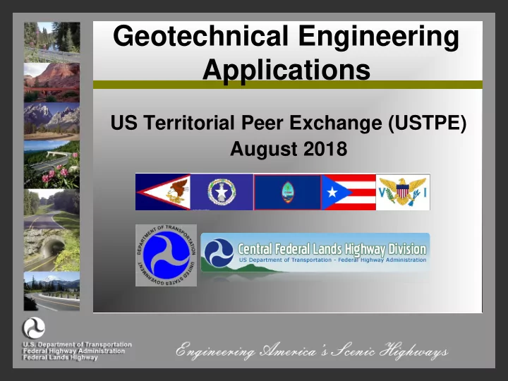
Geotechnical Engineering Applications US Territorial Peer Exchange (USTPE) August 2018 Outline FHWA Geotechnical Resources Geotechnical Challenges for the Territories FHWA/NHI Guidance Documents Geotech Tools Website GRS-IBS
FHWA Geotechnical Resources
– Geotechnical Challenges for the Territories – FHWA/NHI Guidance Documents – Geotech Tools Website
GRS-IBS Design and Construction Unstable Slope Management Program
Rockfall Mitigation
May not have geotechnical experience
Limited availability of geotechnical
Limited capabilities to perform site
No support for specifications No support during construction
FHWA website with numerous guidance
https://www.fhwa.dot.gov/engineering/geotech/library_listing.cfm
We can
https://www.fhwa.dot.gov/engineering/geotech/library_listing.cfm
Embankment, Ground Improvement &
Project Development and Delivery Options
Fact Sheets Design Procedures Cost Estimating Tools Bibliography Case Histories Photographs QA/QC Procedures Specifications
Aggregate Columns
Beneficial Reuse of Waste Materials
Bio-Treatment for Subgrade Stabilization
Blast Densification
Bulk-Infill Grouting
Chemical Grouting/ Injection Systems
Chemical Stabilization of Subgrades & Bases
Column-Supported Embankments
Combined Soil Stabilization with Vertical Columns
Compaction Grouting
Continuous Flight Auger Piles
Deep Dynamic Compaction
Deep Mixing Methods
Drilled/Grouted & Hollow Bar Soil Nailing
Electro-Osmosis
Excavation & Replacement
Fiber Reinforcement in Pavement Systems
Geocell Confinement in Pavement Systems
Geosynthetic Reinforced Construction Platforms
Geosynthetic Reinforced Embankments
Geosynthetic Reinforcement in Pavement Systems
Geosynthetic Separation in Pavement Systems
Geosynthetics in Pavement Drainage
Geotextile Encased Columns
High-Energy Impact Rollers
Hydraulic Fill + Vacuum Consolidation + PVDs
Injected Lightweight Foam Fill
Intelligent Compaction
Jet Grouting
Light Weight Fills
Mechanical Stabilization of Subgrades & Bases
MSE Walls
Micropiles
Onsite Use of Recycled Pavement Materials
Partial Encapsulation
PVDs & Fill Preloading
Rapid Impact Compaction
Reinforced Soil Slopes
Sand Compaction Piles
Screw-In Soil Nailing
Shoot-In Soil Nailing
Shored MSE Walls
Traditional Compaction
Vibrocompaction
Vibro-Concrete Columns
1.
Evaluate transportation system use and needs; target USMP implementation
2.
Rate identified transportation corridors based on maintenance input
3.
Prioritize Rated Slopes
4.
Develop conceptual designs and estimates by geotechnical specialist for highly rated slopes only
5.
Evaluate benefit-costs and reprioritize rated slopes for proactive project selection
6.
Track slopes in USMP; watching for trends of deterioration that require proactive risk reduction intervention
Prioritize & manage unstable slopes Includes soil and rock slopes Developed for low or medium volume roads
Uses proven unstable slope systems Generate one standard set of criteria Efficient field survey process (Form or App) Monitor and track deterioration Prioritize preventative maintenance
Allows for a
Includes five
Has links to:
– History of edits – All site photos – All files uploaded
Many
Photos and
Rapid
assessment tool to limit time spent at a good slope
Three landslide
hazard ratings and two risk rating categories required
Intended for any
employee to provide basic information about new unstable slope events
Simplified
maintenance information is documented
This information
with periodic re- rating information provides expenditures and deterioration rates for slope assets
92 Mile Denali
Primary access 141 USMP sites
Apps only include the rating, new slope
Final Android and iOS apps are available at
Collect data and photos in offline mode and
6-minute video on “Why the USMP for
40-minute video that shows “How to Rate
Training presentations for the three, two-
https://westerntransportationinstitute.org/research_projects/development-of-unstable- slope-management-program-for-federal-land-management-agencies-phase-2/
Assessment Design Tools Decision Tools Rock and Soil Failure Modes Rockfall Mitigation Methods Mitigation Projects
Richie Ditch Criteria- 1960’s ODOT- Rockfall Area Catchment
Colorado Rockfall Simulation Program
RocScience Software
Where should you use your funds? Rating Systems
Rockfall Hazard Rating System (RHRS) Colorado Rockfall Hazard Rating System
Unstable Slope Management System
Two intersecting discontinuities with line of intersection daylighting out of the slope
Discontinuity dip steeply into the slope
Rock in soil matrix or heavily fractured rock with no defined structural pattern
Where erosion of soil exposes and
Often initiated by excavating the slope
Realignment
Condition improvement
Stabilization Measures
Shift
EXISTING Ditch Width: 2 FT Ditch Shape- FLAT PROPOSED Ditch Width: 20 FT Ditch Shape: 1V:4H
EXISTING CONDITIONS Ditch Width: 2 FT Ditch Shape- FLAT Est Containment (%) 15%
PROPOSED CONDITIONS Ditch Width: 20 FT Ditch Shape: 1V:4H Est Containment (%) 99%
EXISTING CONDITIONS Ditch Width: 2 FT Ditch Shape- FLAT PROPOSED CONDITIONS Ditch Width: 20 FT Ditch Shape: 1V:4H % Improvement Est Containment (%) Est Containment (%) 15% 99% 84%
Realignment
Condition improvement
Stabilization Measures
Realignment
Condition improvement
Stabilization Measures
collection ditch area.
and snow loads on anchors.
ft rock.
High rockfall frequency Over steepened Colluvial Slopes 150 feet tall
Boulders up to 20 feet “Hanging” on the
High rockfall frequency
Over steepened Colluvial Slopes 150 feet tall
Boulders up to 20 feet “Hanging” on the
High rockfall frequency
Over steepened Colluvial Slopes 150 feet tall
Boulders up to 20 feet “Hanging” on the
200 CUYD
Planar Failure in rock cut
More potential failures exposed
Factor of Safety 1.00 Driving Forces 7.08t/ft Resisting Forces 7.08t/ft Wedge Weight 9.43t/ft Wedge Volume 130.0 ft3/ft Shear Strength 6.78t/ft2 Normal Force 3.57t/ft Seismic Force 0.47t Plane Waviness 5◦ Water Force on Failure Plane 2.68 t/ft Water Force on Tension Crack 0.11t/ft
SAFETY FACTOR = 1.0
Factor of Safety 1.50 Driving Forces 7.08 t/ft Resisting Forces 10.62 t/ft Wedge Weight 9.43 t/ft Wedge Volume 130.0 ft3/ft Shear Strength 8.42 t/ft2 Normal Force 6.41 t/ft Seismic Force 0.47t Plane Waviness 5.0 deg. Passive Bolt Force 3.28 t Passive Bolt angle 15.0 deg. Bolt Length 14.0 ft Anchor Length 4.58 ft Water Force on Failure Plane 2.68 t/ft Water Force on Tension Crack 0.11 t/ft
SAFETY FACTOR = 1.5
Ground Anchor Design
Based on Post Tensioning Institute Publication "Recommendations for Prestressed Rock & Soil Anchors" Fourth Edition - First Printing, 2004 Ground Anchor Properties Ground Anchor Capacity, (P) 8.33kips Drill Hole Diameter, (D) 2.50in Yield Strength of Reinforcing Bar, Fy 33.00kips #6 Bar/Grade75 Nominal Bar Diameter, (d) 0.75in Compressive Strength of Grout, (f'c) 3,000.00psi Ultimate Stress of Steel, (fut) 100,000.00psi Area of Steel, (As) 0.44in2 Geotechnical Design Geo-strata 1 ultimate bond stress, tu1 = 125.00psi Geo-strata 2 ultimate bond stress, tu2 = 0.00psi Geo-strata 3 ultimate bond stress, tu3 = 0.00psi Geo-strata 4 ultimate bond stress, tu4 = 0.00psi Soil-Grout Bond, α1 = 11.78kips/ft Soil-Grout Bond, α2 = 0.00kips/ft Soil-Grout Bond, α3 = 0.00kips/ft Soil-Grout Bond, α4 = 0.00kips/ft Total Anchor Length = Lb=P/(0.4*α) 1.77ft Use Min. 2 ft bond 0.4 =FS of 2.5
Structural Design
8 ft Tensile Capacity, Pt = (0.6*Fy) 19.8kips OK (> 8.33 kips) Shear Capacity, Fu = N(As)(fut) 26.4kips
Ground Anchor Connection Design
Based on Post Tensioning Institute Publication "Recommendations for Prestressed Rock & Soil Anchors" Fourth Edition - First Printing 2004 TENSION Check Cone Shear Service Load, (P) 8.33kips Compressive Strength of Concrete, (f'c) 3,000.00psi Plate Width, (Pb) 6.00in Concrete Cover, (hc) 12.00in From face to back Equivalent Diameter, (d1) 6.77in
Bottom of Cone Diameter, (d2) 30.77in Acp = 0.25π(d22-d12) 707.60in2 Pcone strength = 4 X (f'c)(0.5) X Acp 155.03kips Pcone design strength = 0.67*Pcone strength 103.87kips OK PLATE THICKNESS Plate Area, (Ap) 36.00in2 Yield Stress, (fy) 36.00ksi Bearing Compression, wbp = P/Ap 231.39psi Mmax = (wbp*(b/2)^2)/2 1041.25lb-in Sx = Mmax/(.55*fy) 0.05in3 Plate Thickness, t = [(6*Sx)/(b/2)]^0.5 0.32in 1/2"x6"x6"