Designing Soils for Infiltration, Drainage, and Stormwater Treatment - - PowerPoint PPT Presentation
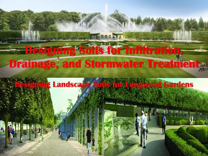
Designing Soils for Infiltration, Drainage, and Stormwater Treatment Designing Landscape Soils for Longwood Gardens Reference Book Kays, Barrett L. 2013. Planting Soils for Landscape Architectural Projects, LATIS Series Publication,
Reference Book
Kays, Barrett L. 2013. Planting Soils for Landscape Architectural Projects, LATIS Series Publication, American Society of Landscape Architects
- www.asla.org menu: learn tab: LATIS
Sand-Based Soil Design Projects
Great Lawn in Central Park, NY, NY
- Central Park Conservancy, Inc., NY, NY
Nelson Rockefeller Hudson River Park, NY, NY
- Battery Park City Authority, Inc., NY, NY
Dwight D. Eisenhower Memorial, Washington, DC
- Gehry Associates + AECOM JV, Los Angeles, CA & Arlington, VA
NC Museum of Art Garden Expansion, Raleigh, NC
- Civitas, Inc., Denver, CO & Stewart, Inc., Raleigh, NC
Moore Square Design, City of Raleigh, NC
- Sasaki Associates, Cambridge, MA
Main Fountain Garden, Longwood Gardens, PA
- West 8, New York, NY
National Air & Space Museum, Washington, DC
- AECOM, Arlington, VA
Attributes of Planting Soil for Longwood Gardens
Aeration & Infiltration > 5-inches/hour Zero runoff for 100-year frequency Soil that remains porous after compaction Plant Available Water 20 to 35% Soil Depth 3-feet or deeper if needed Soil pH 6.5 to 7.5 Soil Fertility, CEC, BS, & nutrients Organic humus > 3% Rich microbe flora and population Easy to install and cannot be overly compacted
Designing Soils
Create a design soil that’s contains all of the above attributes Create a soil that drains well when saturated and stops draining to storage as much water as a silt loam textured soil Such a soil does not occur in nature, so typically we have it manufactured from locally available components
Maximum Density Curves
1.35 1.40 1.45 1.50 1.55 1.60 1.65 1.70 1.75 1.80 1.85 5 10 15 20 25
Bulk Density, grams/cm3 Water Content, Percent 95% CBR 85% CBR < 2%
- r > 21%
Sandy Loam Loam Clay Loam 95% CBR Sand-Based Structural Soil 0 to 35% Moisture
Central Park Great Lawn in 1984
Fate of Urban Parks Significant Soil Compaction Limited Infiltration High Percent Runoff High Erosion Lake Sedimentation
Restoration of Great Lawn in Central Park, NY, NY for Central Park Conservancy, Inc.
Nelson Rockefeller Hudson River Park for Battery Park City Authority, NY, NY
Dwight D. Eisenhower Memorial for Gehry Associates + AECOM, Washington, DC
Soil Particle Sizes
Particle size diameters
- Very coarse sand – 1.00 to 2.00 mm
- Coarse sand – 0.50 to 1.00 mm
- Medium sand – 0.25 to 0.50 mm
- Fine sand – 0.125 to 0.25 mm
- Very fine sand – 0.050 to 0.125 mm
- Silt – 0.002 to 0.50 mm
- Clay - < 0.002 mm
Well graded sands – good in concrete; very bad in soils
- 0.05 to 1.00 mm – very fine sand to coarse sand
- Particles pack together and create less porosity and smaller
effective pore diameters
Uniformly graded sands – good for infiltration
- 0.25 to 1.00 mm – medium and coarse sand; remove particles <
0.25 mm and particles > 1.00 mm
- Particles do not tightly pack and create more porosity and larger
effective pore diameters
Ideal Design Soil:
A Marriage of Conflicting Goals
Rapidly drainage:
- Saturated infiltration rate of 5-inches per hour
- Zero runoff for 10-inch rainfall or 100-year event
Excellent moisture retention:
- Plant available water of 20 to 35%
- PAW equivalent to silt loam soil
Soil remains porous at 95% compaction
Plant Available Moisture (PAM)
Saturation Plant Available Moisture (PAM) Wilting Point
Sat.
- t. Hyd
Hydra rauli lic c Condu ductivi ctivity ty v. P . PAM
y = 685.8e-0.203x R² = 0.8714
20 40 60 80 100 120 140 2 4 6 8 10 12 14 16 18 20 22 24 26 28 30
- Sat. Hydraulic Conductivity, cm/hr
Percent Plant Available Moisture (PAM)
Si Six Pr Prin inciples ciples of Wate f Water r Movement vement in in So Soil ils
Principles of Water Movement: Sandy Soil over Gravel Layer
P-1: When saturated to the surface water flows in proportion to size of pores, head, and drains readily into the gravel layer
- When the soil is completely saturated it is at zero negative
pressure,
- The gravel layer has large pores which are also at zero negative
pressure, so
- Water can flow from the soil layer into the gravel layer.
Principles of Water Movement – Sandy Soil over Gravel Layer
P-2: Uniformly graded coarse and medium sand conducts water faster when saturated than well graded sands
- Uniformly graded sands have had all of the finer sand particles
removed, so all of pores are large and about the same size
- Well graded sands a variety of sizes of sand particles. The
finer sands will pack into the voids around the larger sand particles and restrict the flow.
Analysis of Large Stormwater Systems
Principles of Water Movement: Sandy Soil over Gravel Layer
P-3: When unsaturated, water stops flowing into gravel layer, due to the greater negative pressures in the sandy soil
- After a small amount of water drain out of the sandy soil, it is no
longer saturated and pore pressures in the soil become negative.
- When unsaturated water always flows in the direction of the
greatest negative pressures and since the pressure in the gravel is still zero, the water cannot move downward.
- The gravel layer acts to impede unsaturated water movement
from moving downward, thus leaves considerably more plant available water in the soil.
Change in Water Content After Initial Drainage
Drainage Saturation Plant Available Moisture (PAM) Wilting Point
Principles of Water Movement: Sandy Soil over Gravel Layer
P-4: When unsaturated more water is held in the sandy soil with uniformly graded medium and coarse sand, than in well graded sands
- More water is held in the uniformly graded sands because it
has a higher porosity due to same size of pores
- Well graded sands have a variety of sand sizes that pack
together, have a lower porosity, and water moves more slowly
Principles of Water Movement: Sandy Soil over Loamy Layer
P-5: When unsaturated water continues to drain from the sandy soil because the underlying loamy soil has a greater soil moisture tension
- When unsaturated water flows in the direction of the greatest
negative pressures (greatest soil moisture tension) and since the tension in the loamy soil is greater, the water continues to move downward until the sandy soil is dry
Change in Water Content After Drainage
Drainage
Wilting Point
1.
- 1. Which profile will drain the
fastest when fully saturated?
Medium Sand
0.25 to 0.50 mm
Coarse Sand
0.50 to 1.00 mm
Very Fine to Coarse Sand
0.05 to 1.00 mm
Medium Sand Fine Gravel Fine Sand Coarse Sand Coarse Sand
Profile #1 Profile #2 Profile #3
All profiles have free drainage at base.
2.
- 2. Which profile will hold the
most moisture after draining?
Medium Sand
0.25 to 0.50 mm
Coarse Sand
0.50 to 1.00 mm
Very Fine to Coarse Sand
0.05 to 1.00 mm
Medium Sand Fine Gravel Fine Sand Coarse Sand Coarse Sand
Profile #1 Profile #2 Profile #3
All profiles have free drainage at base.
Layered Soil Systems
Layered systems are used to hold moisture in the rooting zone and prevent downward water movement; the gravel layer impedes drainage unless the soil is completely saturated Used for structural soils, high infiltration rates, high quality lawn systems, high traffic areas, golf greens Standards for layer soil systems
- Bridging Factor – allows bridging of a layer of finer particles over a
layer of coarser particles; comparison of two layers
- Uniformity Factor – determines whether layer is narrowly enough
graded
- Permeability Factor – determines the saturated hydraulic rate of a
layer
Constructing Layered Soil System
Compacted Subgrade M-78 Gravel Over Drain Lines Sandy Planting Soil
Longwood Gardens 2015
Longwood’s Main Fountain Garden
Longwoo
- od Garden
dens s 2016 16 Terr rrac ace e Landsca cape pe Bed
Gra raved ved-Bas Based ed Structu ructural ral Soi
- il
l Under er Dri rive ve
Insta stallati llation
- n of
- f Bo
Boxw xwoo
- od
d Hed edge ge
Cost t of St f Storm rmwater ter Str trate tegi gies
es
Construction Construction Cost/Gallon Cost/Acre Preserving natural areas $0.03 to 0.05 Enhanced infiltration $0.05 to 0.10 $5K to $10K Stormwater wetland ponds $0.25 to 1.25 Sand/peat infiltration swales $0.50 to 0.75 Sand based infiltration system $0.25 to 2.75 $10K to $125K Rainwater harvesting $0.50 to 2.50 Sand/peat filtration $2.50 to 3.50 Recirculating sand/peat filtration $4.50 to 7.50 Renovation of urban streets $5.00 to $12.50
Designing Landscape Soils for Longwood Gardens
2015 NC ASLA Meeting Sunset Beach, NC by Barrett L. Kays, Ph.D., FASLA, CPSS Landis, PLLC, Raleigh, NC