
SLIDE 1
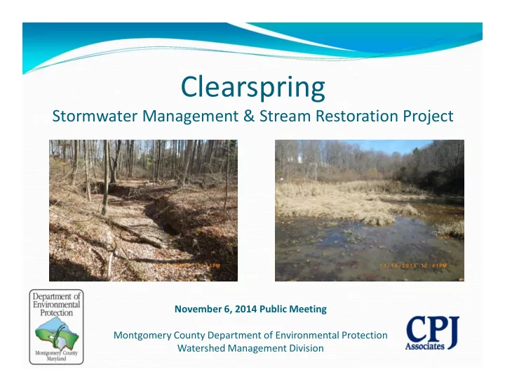
Clearspring
Stormwater Management & Stream Restoration Project
November 6, 2014 Public Meeting Montgomery County Department of Environmental Protection Watershed Management Division
Clearspring Stormwater Management & Stream Restoration Project - - PowerPoint PPT Presentation
Clearspring Stormwater Management & Stream Restoration Project November 6, 2014 Public Meeting Montgomery County Department of Environmental Protection Watershed Management Division Todays Agenda Introductions Rebecca
November 6, 2014 Public Meeting Montgomery County Department of Environmental Protection Watershed Management Division
Introductions
Rebecca Winer-Skonovd – Project Manager; Montgomery
County DEP/JV
Paul Bogle– Senior Engineer; Montgomery County DEP Jeff Blass – SWM Project Designer; Charles P. Johnson &
Associates, Inc.
Gabrielle Myers – Stream Project Designer
Background Information – Why County is Doing This Stormwater Management Overview Project Objectives Project Costs and Benefits Design and Permitting Timeline What to Expect During Construction
2
3
District of Columbia
Impervious: Not allowing water to soak through the ground.
500 sq. miles 1,000,000 people
Second only to Baltimore City within
Maryland in average people per square mile
184 languages spoken
About 12% impervious surface overall
About the size of Washington DC
Over 1,500 miles of streams Two major river basins:
Potomac Patuxent
Eight local watersheds
Chesapeake Bay Eight local watersheds Neighborhood (to a storm
drain)
4
Water that does not soak into the ground becomes surface runoff. This runoff flows over hard surfaces like rooftops, driveways and parking lots collecting potential contaminants and flows:
streams
streams
Two Major Issues: Volume/Timing of Runoff Water Quality
6
Stream in a Watershed with 20% Impervious Cover Stream in a Watershed with 8% impervious cover. Stream in a Watershed with 30% impervious Cover.
What is the County doing to
Must meet regulatory requirements
Federal Clean Water Act permit program MS4 = Municipal Separate Storm Sewer System
Applies to all large and medium Maryland jurisdictions County Programs
Restore our streams and watersheds
Add runoff management
Meet water quality protection goals
Reduce pollutants getting into our streams
Educate and engage all stakeholders
Individual actions make a difference
Focus on watersheds showing greatest impacts
Montgomery County is responsible for:
DEP is adding stormwater management for 20 % of
impervious surfaces
(4,292 acres = 6.7 square miles)… About three times the
size of Takoma Park. That’s equivalent to 3,307 football fields!
9
Specific Project Information
http://www.montgomerycountymd.gov/DEP/Restoration /clearspring-manor.html
General Information
Living a Green Life: My Green Montgomery http://montgomerycountymd.mygreenmontgomery.org/
Ponds constructed in early 1980s Located in a key watersheds
Ponds are at or near the end of
Meet current safety and design
Opportunity for water quality
10
11
Asset #11423
12
Project Area Stormdrain Pipes (DPS) WSSC Sewer Pipe (Gravity)
13
Stream Length: 801 Linear Feet | Stream USE Class: I-P
Clearspring Tributary Restoration Limits Flow Upper Magruder Branch Park Stormwater Pond
14
Drainage Area: 55 Acres | Impervious: 23% |
Building WSSC Sewer Pipe Stormdrain Pipe Drainage Area Boundary
15
channel
stream channel are actively downcutting
is an unstable multi- thread channel
and easily eroded
Current State
Probable Stream Type Changes over time
16
Severely Eroded Bank with Vegetation Loss
riparian buffers in the headwaters
(i.e. culverts)
development
highly entrenched
velocity
Deep Headcut Moving Upstream
Headcut
17 Pre-Development Post-Development
Flood Flood
Ground Water Ground Water
18
reconnecting the stream to its floodplain
channel
and sediment supply
Channel Realignment: Glenora Tributary. City of Rockville. Construction 2014 Glenora Tributary: Previous Condition
19
reproduce natural stream conditions
glides create a variety
invertebrates
such as darters, cattisflies, midges, damsselflies, and dragonflies likely to return
Glenora Tributary: Constructed Riffle
20
access during storm events
to establish
to the floodplain slow water velocities and reduce stress on the banks
21
control structures are implemented to reduce bank erosion
and reduce water velocity
and material loads
22
Stream bank vegetation increases floodplain and in-stream habitat, stabilizes banks and helps maintain stream temperatures by providing shade during hot summer months
Donnybrook Tributary: Riparian Planting 2014 Wilde Lake Reach D: Riparian Planting
Red Maple
23
Trees:
Shrubs: Live stakes: Sycamore Buttonbush Spicebush Black Willow Silky Dogwood
Images Source: http://plants.usda.gov
24
11423 Gunners Branch
STORMWATER MANAGEMENT
Increase permanent pool for water quality
STREAM PROTECTION
Modify outlet works to better regulate pond discharge and protect
Magruder Branch and Seneca Creek streams
MAINTENANCE
Replace existing riser with a water-tight structure Replace dam embankment and install impervious core Install internal drain in downstream embankment
AESTHETICS/ENVIRONMENT
Landscape the pond to improve aquatic habitat and aesthetics Augment existing environmental features such as forest and
wetlands where possible
25
Clearspring Pond (Asset #11423)
66.14 Acres 23.5% Impervious
26
Stormwater Management
16’ High Earth
Embankment Dam
Adjacent residential
properties
Does not meet current
SWM requirements to achieve any MS4 credit.
Heavily silted
27
Large amount of sediment buildup in pond Existing Metal Outlet Structure
28
Proposed Pond Access Replace Metal Riser Remove Sediment Buildup from Pond
Increase permanent
pool storage to provide maximum water quality treatment
Modify outlet works
to provide maximum channel protection treatment
29
Modify outlet works to
better regulate pond discharge and protect Magruder Branch and Great Seneca Creek
Achieve full water
quality and channel protection treatment
30
Replace existing riser
Install impervious core
Install internal drain in
31
Sod and landscape
32
Trees:
Red Maple American Hornbeam Black Gum White Oak Swamp White Oak
Shrubs:
Winterberry Arrowhead
Aquatic Emergents:
Blue Flag Purple Stem Aster Soft Rush
33
Red Maple American Hornbeam Winterberry Blue Flag
Financial – estimated cost of $1,242,000 financed
Forest – tree clearing to comply with state dam
Traffic – construction traffic enter and exit roadways
Neighborhood – construction traffic and noise will
34
Water – improved water quality and stream water
Environmental – reduced downstream discharge
Recreational – increased aesthetic appeal of ponds Maintenance – safer operating structure that will
35
Design – November 2013 – October 2015 Approvals – September/October 2015 Permits – November 2015 Bidding –December 2015 Construction (estimated) – Jan. 2015– May 2015
36
Duration
Approximately 5 months
Construction Hours
Monday through Friday, 7AM – 4PM
Safety
Open sides of site will be fenced with orange construction safety fence to
separate construction from residents.
Traffic
Minor impacts to traffic from entering and exiting construction traffic and
contractor parking during the day.
Noise
Contractor is required to comply with Montgomery County Noise
Ordinance – site elevation will help alleviate noise pollution.
Sediment
Contractor will be required to comply with Montgomery County Sediment
Control Permit and not track dirt onto roads
37
Rebecca Winer-Skonovd 240-499-8531,
rebecca.winer-skonovd@montgomerycountymd.gov