
SLIDE 1
Sabin Point Park, East Providence Sabin Point stormwater - - PowerPoint PPT Presentation
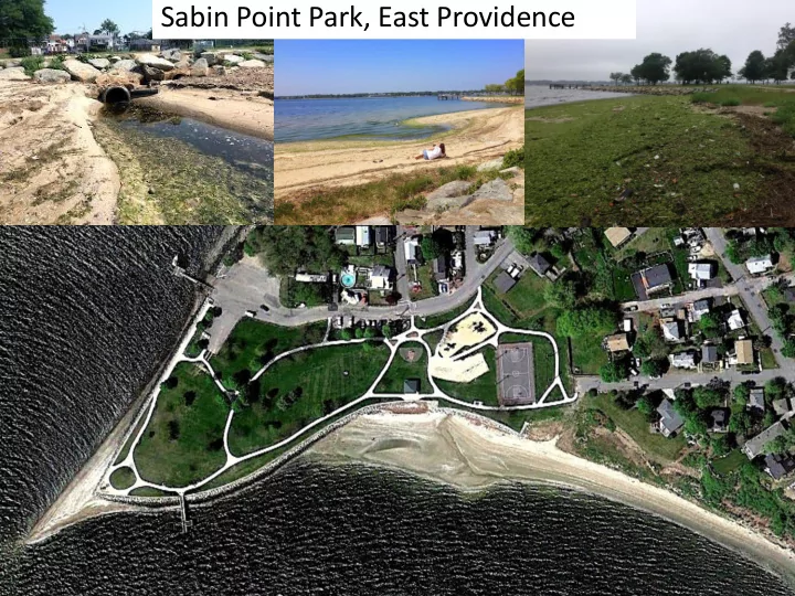
Sabin Point Park, East Providence Sabin Point stormwater infiltration and buffer conceptual plan by Save The Bay (2014) Infiltrate stormwater in Locust St. ROW Daylight stormwater and infiltrate in Middle St. ROW Infiltrate stormwater from
Daylight stormwater and infiltrate in Middle St. ROW Goal to remove pipes at beach Infiltrate stormwater from Shore Rd and parking lot in park
Infiltrate stormwater in Locust St. ROW Area in park to create wetland End of road retrofit at Knowlton Ave Install buffer of native grasses to reduce use of park by geese
area prior to installation
drain
2: Former storm drain that discharged directly to beach
Direction of runoff
Stormwater filtration area inlet structure and forebay Stormwater overflow flows through existing pipe
and direct surface runoff to right of way
and underground infiltration trenches in 2018
~ area of proposed gravel wetland ~ area of proposed grass conveyance swale for
Proposed sand filter area in knotweed; proposed gravel wetland area in foreground