
SLIDE 1
City of Nanaimo Waterfront Walkway Implementation Strategy Design - - PowerPoint PPT Presentation
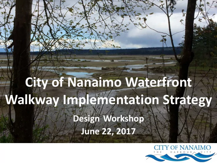
City of Nanaimo Waterfront Walkway Implementation Strategy Design Workshop June 22, 2017 AGENDA 1:00 2:15 Welcome, Project Introduction and Context Survey Results Visioning 2:15 3:00 Design Workshop BEGINS Table Rotation #1 (45
1:00 – 2:15 Welcome, Project Introduction and Context Survey Results Visioning 2:15 – 3:00 Design Workshop BEGINS Table Rotation #1 (45 Minutes) 3:00 – 3:15 Break (Refreshments) 3:15 – 3:45 Table Rotation #2 (30 Minutes) 3:45 – 4:15 Table Rotation #3 (30 Minutes) 4:15 – Wrap-Up Summary Input and Perspectives Open discussion 4:45 – Next Steps and Thank you 5:00 – 7:00 Opportunity for information sharing and additional public input
0% 7% 34% 14% 23% 7% 14%
1. Snuneymuxw First Nation 2. Mayor and Council 3. Land owners and tenants 4. Neighbourhood Association Members 5. Community Members 6. Designers 7. Government representatives
3% 36% 36% 24% 0%
1. 2. 1-5 3. 6-10 4. 10+ 5. Everyone!
extended waterfront walkway can be completed in a timely manner as well as complete five small, but important sections of the walkway in 2018.
Estuary.”
Spring 2017
Consultant team collects background information Public Open Houses May 17, 18 & 20 TODAY’S EVENT Design Workshop June 22
September 2017 Public Open House to present draft plan October 2017 Final Plan presented to Council
Summer 2017 Consultant considers all input and prepares draft Implementation Plan We are here
During this stage of engagement and planning, we want to obtain input on:
Boat ramp, Maffeo Sutton Park, Boat Basin, Assembly Wharves)
shallow (e.g., Brechin Mine, Douglas Mine, Nanaimo No. 3 Mine)
What this means: Variable design needed, constraints to some design options, cost uncertainty. Geotechnical investigations needed to better understand geotechnical constraints and design parameters.
Applicable Legislation Federal Provincial Municipal Fisheries Act Environmental Assessment Act (EAA) OCP, Development Permit Areas for Environmental Protection Navigational Protection Act Water Sustainability Act (WSA) Zoning bylaws Management and Protection of Trees Bylaw
Green Shores is based
principles: 1. Preserve or restore physical processes—water and sediment movement 2. Maintain or enhance habitat function and diversity 3. Prevent or reduce pollutants entering the aquatic environment 4. Avoid or reduce cumulative impacts
More intense precipitation during fall and winter:
Sea level rise and storm surge In Nanaimo, an 80 to 100 cm sea level rise can be expected by 2100. With intense storm activity, an increased risk
expected.
entitled to access to and from the water
lake, or the sea where there is contact with the property frontage
able to access the water from their property and cannot be prevented from doing so by an obstruction erected in the foreshore
foreshore requires ‘consent’ from the owner
There are archaeological sites along the entire length of Nanaimo’s waterfront. Provincial Legislation: Heritage Conservation Act Encourages and facilitates the protection and conservation of heritage property in British Columbia. Local Policy
encourage public awareness, understanding and appreciation of Nanaimo’s cultural and architectural history (including interpretive signage and brochures)
including the waterfront walkway
These costs are Order of Magnitude only
Which section of the waterfront walkway would you like to see developed or upgraded first?
Which sections of the walkway would you like to see developed or upgraded first?
Upgrade existing sections of the waterfront walkway before new sections are built Build new sections of the waterfront walkway before upgrading existing sections 17% 83%
1. Upgrade existing sections of the waterfront walkway before new sections are built 2. Build new sections of the waterfront walkway before upgrading existing sections
Would you rather that the City of Nanaimo…
Alternate Alignment around Nanaimo Shipyard
Alternate Alignment around Nanaimo Shipyard
Alternate Alignment around Nanaimo Shipyard
Council has identified five key connections along the walkway to be completed in the short term. In what order would you like to see these key connections prioritized?
22% 9%10% 12% 12% 8% 5% 10% 5%7%
1. Continuous walkway 2. Narrow – walking only, no bikes 3. Gathering spaces, cafes, commercial 4. Highly accessible 5. Pedestrian and bike 6. As natural as possible 7. Heritage art/ interpretation/ aboriginal 8. Safe at all times 9. High quality materials
18% 12% 15% 10% 10% 5% 8% 3% 10% 8%
information / public art
Tables 1A and 1B Table 1A: Departure Bay north of Battersea Rd Table 1B: Departure Bay south of Battersea Rd to BC Ferries
Things to consider Opportunities to keep in mind Currently pedestrian only (where pathway exists) Beach access Limited space Potential improvements to Kinsmen Park Riparian property rights Boardwalk potential Archaeological impacts Green Shores considerations Connections and accessibility to pathway Wayfinding improvements & overall community connectivity Intersection at Stewart Avenue Connection to BC Ferries Terminal
Things to consider Opportunities to keep in mind Suncor overpass is low Connects Departure Bay to Downtown Nanaimo Right of way needed for walkway High pedestrian and vehicle volumes (boat launch and summer markets) Existing pathway is narrow and in poor condition in come places Interim options until property can be acquired Geotechnical conditions (slope stability, etc.) Retail revitalization Some segments considered final design Observation opportunities for marine activities and lookout locations for Newcastle Island Few access points along existing sections Potential for improvements through future development
Things to consider Opportunities to keep in mind Currently pedestrian only Muffeo Sutton is a destination for the city Interim design in place Connection to Newcastle Ferry Accommodation of high volume seasonal events Connections to marine activities Archaeological impacts must be accomodated Waterfront observation opportunities, marine activities and lookout locations for Newcastle and Protection Islands Maffeo Sutton Park Plan in place Potential cycling connection to Front Street
Table 3
Things to consider Opportunities to keep in mind Currently pedestrian only Segment design considered final No cycling connections Improvements to public spaces Popular year-round – accommodation of all users could be a challenge Improve cycling connection to Front Street Walkway constrained by adjacent businesses Connection to Gabriola Ferry Terminal Private property and privacy impacts Connection to waterfront businesses Geotechnical considerations at McGregor Park Observation opportunities to waterfront, marine activities, businesses, and lookout locations
Table 3
Things to consider Opportunities to keep in mind No existing walkway Connections to cruise terminal No defined alignment Viewpoints to Duke Point, Gabriola, Newcastle and Protection Islands Safety concerns regarding industrial activities, rail crossings and barge ramps Industrial presence and activities offer educational
Things to consider Opportunities to keep in mind New existing walkway and no defined alignment Unique mix od residential, industrial, commercial, and recreational opportunities Archaeological impacts must be accommodated Scenic environment Active railroad corridor and industrial activity Educational opportunities Improving access to estuary could have impact on sensitive habitats Potential long-term extension to Dike Point
design and implementation of the walkway
13% 18% 16% 4% 5% 5% 11% 4% 5% 18%
1. Lighting all the way 2. Multi-use all the way 3. Width based on conditions/use (not nec 7) 4. Incorporate viewpoints 5. Artistic component/theme 6. Celebration of gateways 7. Regular washrooms/garbage 8. Use practical materials in interesting ways 9. Make cycling access easy (facilities) 10. Get it started (can upgrade later)
22% 27% 14% 13% 15% 9%
1. Departure Bay to BC Ferries 2. BC Ferries to Millstone River 3. Maffeo Sutton Park to Pacifica 4. Boat Basin to Cameron Island 5. Cameron Island to South Downtown 6. South Downtown to Nanaimo Estuary
13% 18% 23% 13% 13% 8% 13%