
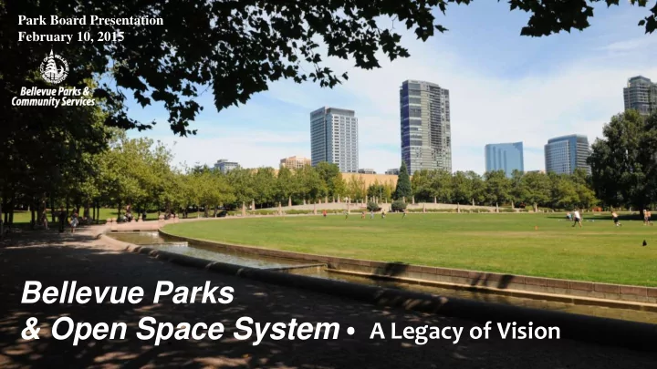
SLIDE 1
- A Legacy of Vision
Bellevue Parks & Open Space System
Park Board Presentation February 10, 2015
Bellevue Parks & Open Space System A Legacy of Vision A City - - PowerPoint PPT Presentation
Park Board Presentation February 10, 2015 Bellevue Parks & Open Space System A Legacy of Vision A City in a Park Create an open space system of impressive natural habitats that complement the urban landscape Provide access
Park Board Presentation February 10, 2015
Create an open space
Provide access to a
Approximately 70 Acres
Meydenbauer Beach Park, Clyde Beach Park, Pikes Peak Greenbelt, Mercer Slough Nature Park, Killarney Glen Park, Waterfront Street Ends
Aerial of Bellevue from the west, ca. 1955. (From the collections of Eastside Heritage Center, 1998.25.49)
Approximately 220 Acres
Mercer Slough Nature Park, Hidden Valley Sports Park, Clyde Beach Park, Bellevue Municipal Golf Course, McCormick Park, Goddard Park, Enatai Neighborhood Park, Cherry Crest Park, Newcastle Beach Park, Bovee Park, Ardmore Park, Northwest Center, and Wilburton Hill Park
Approximately 630 Acres Acquired,
Chism Beach Park, Crossroads Community Park, Enatai Neighborhood Park, Forest Hills NGPA, Highland Park, Hillaire Park, Ivanhoe Park, Kelsey Creek Park, Lake Hills Greenbelt, Mercer Slough Nature Park, Newcastle Beach Park, Robinswood Community Park, Tam O’Shanter Park, Westwood Highlands NGPA, Wilburton Hill Park, Woodridge Open Space
Approximately 260 Acres
Bellevue Downtown Park, Crossroads Community Park, Several NGPA tracts, Goldsmith Neighborhood Park, Kelsey Creek Park, Lake Hills Greenbelt, Mercer Slough Nature Park, N Bellevue Community Center, Robinsglen Nature Park, Robinswood Park, Wilburton Hill Park
Approximately 515 Acres
Lewis Creek Park, Bellevue Downtown Park, Bellevue Golf Course, Bellevue Marina, Crossroads Community Park, Several NGPA tracts, Kelsey Creek Park, Lake Hills Greenbelt, Lattawood Park, Mercer Slough Nature Park, Viewpoint Park, Spady Property, Richards Valley Greenway properties
Approximately 793 Acres
Carrigan Property, Coal Creek Natural Area, Several NGPA tracts, Eastgate Park, Lakemont Open Space, Lewis Creek Park, Meydenbauer Bay Properties, Richards Valley Open Space, Sunrise Park, Surrey Downs Park, Weowna Park, Wilburton Hill Park, Forest Glen Greenway, Mercer Slough Nature Park (Moon-Ross), Woodridge Open Space, Newport Hills Property (Tyler), Bridle Trails (Paschinsky/Bridle Trails Corner Park & Ginzburg), NE 2nd Properties (Future Park)
(With levies and grants)
28.81 Acres Acquired (and counting),
–
City of Bellevue Comprehensive Plan “The city directs its acquisition efforts toward achieving a coordinated and connected system of open space and greenways that protects significant environmental features, preserves habitat, and provides the land needed for park-related facilities and activities. Property acquisition is often driven by availability and affordability.” Parks & Open Space System Plan - 2010 “Priority will be placed on acquiring land adjacent to existing parkland, along shorelines, environmentally sensitive land, or linkages that provide connections between parks and open space areas. Priority will also be given to increasing park access for neighborhoods that are less served than others.”
Parks REET, 42% General CIP, 24% Leveraging, 24% Voter Initiatives, 10% Parks REET, 18% General CIP, 0% Leveraging, 21% Voter Initiatives, 61%
(Approximately $63M
(Approximately $11M
Acquisitions require leveraging resources from
King County Conservation Futures King County Parks Levy Washington State Recreation and Conservation Office Federal Land & Water Conservation Funds Community Trade & Economic Development Private donations
Expand the NE
NE 2nd Linear Park NW Quadrant of
Bridle Trails Corner Park (Now Open)
Meydenbauer Bay Park Expansion – Bayvue Village Airfield Park – Bellevue School District Lakewood Property
Botanical Garden Expansion – The Bellevue Botanical Garden Society donated $200K toward the acquisition of the City/Koh property
Crossroads Park Lewis Creek Headwaters Eastgate Park Expansion
Examples:
Meydenbauer Bay/Wilburton/Richards Valley/
Weowna Park/Lake Sammamish Trail Connections
Pedest edestrian rian Cor Corridor ridor To Mey
denbauer Bay Connecti Connection
to Regional T gional Trail ail
Bellevue’s byways are routes throughout the city where you can expect a unique experience, broadening our focus of the Right of Way system by integrating aesthetic, recreation, historical, and cultural and branding elements into specific segments.
Great Streets Gateways Neighborhood Identity Exceptional Streetscapes Arboretum The Changing Seasons Historical and Cultural Scenic Beauty Fit & Active Bellevue
Spady/ Carrigan Properties Vasa Park (Private – Pay Public Access) To Bellevue City Limits To Idylwood Park (City of Redmond)
6.6 miles of shoreline with only
access point in Bellevue
Lake Sammamish has a long history of recreational access to its shorelines. Over time, many, but not all, of these public access sites have converted to private use.
Vasa Park Idylwood Beach Camp Sambica Pickering’s Gateway Grove Orchard Park Pete’s Place Shady Beach List & photo courtesy of Eastside Heritage Center
“Leaving Bellevue the route takes you . . . Along three miles of the scenic shore line of Lake Sammamish, noted for its fine fishing, bathing, boating, dancing and camping accommodations” Only these three remain
Parkways are broadly defined as:
Open and landscaped Roadway in a park, or connecting to a park Scenic From the Collections of Eastside Heritage Center (ORL79.79.183) From the Collections of Eastside Heritage Center (L88.27.10)
Urban Park System
Waterfront Access
Fill gaps in existing neighborhoods Greenways & Corridors
Connection