
SLIDE 1
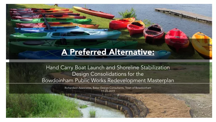
A Preferred Alternative:
Hand Carry Boat Launch and Shoreline Stabilization Design Consolidations for the Bowdoinham Public Works Redevelopment Masterplan
Richardson Associates, Baker Design Consultants, Town of Bowdoinham 11-20-2019
A Preferred Alternative: Hand Carry Boat Launch and Shoreline - - PowerPoint PPT Presentation
A Preferred Alternative: Hand Carry Boat Launch and Shoreline Stabilization Design Consolidations for the Bowdoinham Public Works Redevelopment Masterplan Richardson Associates, Baker Design Consultants, Town of Bowdoinham 11-20-2019 Meeting
Hand Carry Boat Launch and Shoreline Stabilization Design Consolidations for the Bowdoinham Public Works Redevelopment Masterplan
Richardson Associates, Baker Design Consultants, Town of Bowdoinham 11-20-2019
Review Public Design Feedback from 9-17-2019
* Plans and Sections * Hand Carry Elements
* Areas of Stabilization Strategies * General Planting Palette * Sections and Character of Stabilization Strategies
First Public Hearing Held on 9-17-2019
Negative for the Park; Safe and Functional Bank Structure Is Important.
Off Points, Fishing Compatible)
Maine Central R.R. Philip Mailly Waterfront Park & Boat Launch
Existing Shoreline with less impacts Mailly Waterfront Park Boat launch Existing Unstable Shore line and debris
Phase 1 Recommendations
and Storage Racks
1 Y R F L O O D P L A I N 75’ NRPA SETBACK DELINEATED WETLANDS Masterplan Line Work for Reference Temporary Gravel Drive Future Access Drive (8) Kayak Racks (3) Bollards Pre-Cast Concrete Planks Paved Approach (5% Max. Slope) 4’ Wide Path (4) 6’x16’ Floats + 12’x16’ Boat Launch Float (2) ADA Parking Spaces Parking Space Proposed Tree, TYP . ADA Boat Trailer Parking Space (Future Option)
(4) 6’x16’ Floats w/ (1) ADA Boat Launch Float 4’ Depth –Riprap Stabilization
18” x 12’ Pre-Cast Concrete Planks w/ curbing each side of ramp Riverbed Cleanup Area Paved Walkway (5% Max Slope) Delineated Wetlands Boundary & 75’ NRPA Setback (3) Kayak Storage Racks – 8 Boats / Rack (2) ADA Parking Spaces (1) ADA Boat Trailer Parking (2) Facility Use Signage (3) Traffic Bollards Temporary Access Drive Redevelopment Masterplan Linework for Reference, TYP Final Boat Launch Access Drive (Future Phase) Floating Dock in River Profile 4’ Wide Access Path, Typ. FEMA 100 Yr Flood Zone Highest Annual Tide Line
1 Y R F L O O D P L A I N DELINEATED WETLANDSFloats Paved Launch Approach Pre-Cast Concrete Plank Boat Ramp
HIGHEST ANNUAL TIDE 2.9’ FEMA 100YR FLOODPLAIN 8.0’
Boat Ramp Section
60’-8”
Hand-Carry Elements Accessible Launch Section
Wetland Garden LEGEND Marsh Restoration Armored Slope Rootwad Stabilization Vegetated Retaining Wall Overlook Terminus/ Signage Locations Boat Launch 30’ Walkway Bridge 4’ Wide Shore Access Path Paired Bench Seating Overlook Spur Single Bench Seating Overlook Spur History Signage Shoreline Restoration Signage Wetland Vegetation Signage Temporary Gravel Drive Masterplan Line Work for Reference D e l i n e a t e d W e t l a n d s FEMA 100YR FLOODPLAIN Water Fowl & Fish Signage
Shoreline Stabilization
Shoreline Trail Landscape Architectural Elements
(Benches: backless or backed, materials, setting locale)
(Materials, Locations, Themes)
(Type of Material, Construction Approach, Character)
General Deign Principles:
Backed - Wood Backless - Wood or Composite Backless - Wood
Small Novelty Fixture Large Site Sign Structure Attached
Rustic - Wood, simple $ Engineered - High Span $$$$ High Span - Steel, simple $$
Planting Principles for planting selections:
(rooting structure and growth characteristics)
(Seasonal qualities, fmowering, texture, form)
(Planting Responds to Merry Meeting Bay plant communities and native Maine plants)
(Food, cover, nesting, behavioral needs)
(Maintenance needs and park design intentions) *Plants with a * by their name indicate species recommended by Maine Natural Areas Program
Trees Shrubs Perennials
Trees Shrubs Perennials
Red maple* Acer rubrum Yellow birch Betula alleghaniensis Speckled alder* Alnus incana Shadblow serviceberry Amelanchier canadensis Common witchhazel* Hamamelis virginiana Arrowwood viburnum Viburnum dentatum Huckleberry Gaylussacia baccata Highbush blueberry Vaccinium corymbosum Hay-scented fern Dennstaedtia punctilobula Sweetfern* Comptonia peregrina Bluejoint* Calamagrostis canadensis Broadleaf meadowsweet* Spiraea latifolia
Trees Shrubs Perennials
Trees Shrubs Perennials
Black willow* Salix nigra Red maple* Acer rubrum Speckled alder* Alnus incana Gray birch Betula populifolia Silky dogwood* Cornus amomum Sweet gale myrica gale Sheeps Laurel Kalmia angustifolia Winterberry Ilex verticillata Bluejoint Calamagrostis canadensis Lowbush blueberry Vaccinium angustifolium Goldenrod Solidago canadensis Sweet-scented joe-pye-weed Eutrochium purpureum
Grasses Perennials Feature Perennials
Softstem bulrush* Schoenoplectus tabernaemontani Chair-maker’s rush Scirpus americanus Bluejoint Calamagrostis canadensis Northern Wild Rice* Zizania palustris (where appropriate) Common Arrowhead* Sagittaria latifolia Parker’s pipewort Eriocaulon parkeri Nodding beggartick Bidens cernua Northern Water plantain* Alisma triviale Pickerelweed* Pontederia cordata Cardinal fmower Lobelia cardinalis Blue iris Iris versicolor Yellow pond-lily Nuphar lutea
Grasses Perennials Feature Perennials
Wetland Garden LEGEND Marsh Restoration Armored Slope Rootwad Stabilization Vegetated Retaining Wall Overlook Terminus/ Signage Locations Boat Launch 30’ Walkway Bridge 4’ Wide Shore Access Path Paired Bench Seating Overlook Spur Single Bench Seating Overlook Spur History Signage Shoreline Restoration Signage Wetland Vegetation Signage Temporary Gravel Drive Masterplan Line Work for Reference D e l i n e a t e d W e t l a n d s FEMA 100YR FLOODPLAIN Water Fowl & Fish Signage
Shoreline Stabilization
Vegetated Retaining Wall Section
Existing Wood Cribwork Ends Removed 4’ Wide Path and Overlook Spur
20’ Upland Vegetated Buffer
4” Topsoil, Wetland Seed Mix Covered with Jute Matting Stone Filled Vegetated Geotextile Retaining Wall Interpretive Signage Coir Logs with Helical Anchors Highest Annual Tide 2.9’ Existing Grade FEMA 100YR 8.0’
Vegetated Retaining Wall
Marsh Restoration Section
Existing Wood Cribwork & Fill Removed 4’ Shore Access Path
10’ - 15’ Upland Vegetated Buffer 15’ - 20’ Freshwater Tidal Wetland
4” Topsoil, Wetland Seed Mix Covered with Jute Matting Reinforced Mat with Anchors Coir Logs with Wooden Stakes Highest Annual Tide 2.9’ Existing Grade FEMA 100YR 8.0’
Marsh Restoration
4’ PATH 25’ VEGETATED BUFFER 4” TOPSOIL, BROADCAST WETLAND SEED MIX & COVER WITH JUTE MATTING BURY BOTTOM 1/3 - 1/2 OF ROOTWAD INTO RIVER BED NATIVE PERENNIALS, SHRUBS, & TREES TREE ROOT WADS (DEBRIS MAY REQUIRE FULL DEPTH EXCAVATION VS. DRIVING TREES TO INSTALL)
LARGE BOULDER TO ANCHOR ROOT WAD
FRESHWATER WETLAND RESTORATION & UPLAND BUFFER SHORE LINE TRAIL
Former Public Works Garage
PAVILLION APPROXIMATION OF HAND BOAT LAUNCH / LIMITS OF LIVING SHORELINE RESTORATION WORK
FEMA 100 YR FLOOD ZONE HIGHEST ANNUAL TIDE LINE DELINEATED WETLANDS BOUNDARY 75’ NRPA SETBACK
Rootwad Stabilization Section
Existing Wood Cribwork Ends Removed 4’ Wide Path
25’ Upland Vegetated Buffer
4” Topsoil, Wetland Seed Mix Covered with Jute Matting Large Boulder to Anchor Root Wad Interpretive Signage Tree Root Wads Highest Annual Tide 2.9’ Existing Grade FEMA 100YR 8.0’
Rootwad Stabilization
Armored Slope Section
Existing Wood Cribwork Ends Removed
25’ Upland Vegetated Buffer
4” Topsoil, Wetland Seed Mix Covered with Jute Matting Large Boulder Revetment Highest Annual Tide 2.9’ Existing Grade FEMA 100YR 8.0’
Armored Slope
Schedule Review* if Funding Becomes Available