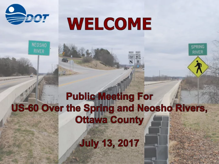
PURPOSE OF THIS MEETING is to Discuss the Need and Present the - - PowerPoint PPT Presentation
PURPOSE OF THIS MEETING is to Discuss the Need and Present the Preferred Alternative N for US-60 over Spring and Neosho Twin Bridges State Park Rivers in Ottawa County Spring River Neosho River Ottawa County, Oklahoma PURPOSE OF THE
PURPOSE OF THIS MEETING
…is to Discuss the Need and Present the Preferred Alternative for US-60 over Spring and Neosho Rivers in Ottawa County
Ottawa County, Oklahoma Twin Bridges State Park Spring River Neosho River
N
PURPOSE OF THE PROJECT
…is to Correct the At-Risk Bridges on US-60 Over the Spring and Neosho Rivers and Improve Geometrics at the SH-137 Intersection
PROJECT DEVELOPMENT PROCESS
Initial Alternative Screening Develop Preliminary Alternatives Initial Data Collection Identify Problem Stakeholder Input TODAY Public Meeting
- Existing Conditions - Roadway
− US-60
- Rural Minor Arterial
- 12' Lanes With 6' Shoulders
- Posted Speed 55 mph
- Existing Deficiencies
- Shoulder Width
- Superelevation on Horizontal Curve at
West
− SH-137
- Rural Major Collector
- 12' Lanes With no Shoulders
- Posted Speed 35mph
- Existing Deficiencies
- Shoulder Width
- Horizontal Curves
- Steep Grade
- Sight Distance
EXISTING CONDITIONS
- Existing River Bridges
– Built in 1940 (Approx. 75 years) – Neosho River – 605’ – Spring River – 550’ – Multiple I-Beam Girder System – 28' Clear Roadway Width – Condition Ratings
- Deck: 7/10
- Superstructure: 5/10
- Substructure: 5/10
Neosho River Bridge Spring River Bridge Peninsula Length = 605’-10” Length = 666’-2” Length = 550’-10” SH-137 US-60
EXISTING CONDITIONS
- Existing River Bridges
– Built in 1940 (Approx. 75 years) – Neosho River – 605’ – Spring River – 550’ – Multiple I-Beam Girder System – 28' Clear Roadway Width – Condition Ratings
- Deck: 7/10
- Superstructure: 5/10
- Substructure: 5/10
Neosho River Bridge Spring River Bridge Peninsula Length = 605’-10” Length = 666’-2” Length = 550’-10” SH-137 US-60 Clear Roadway = 28’-0”
EXISTING CONDITIONS
- Existing River Bridges
– Built in 1940 (Approx. 75 years) – Neosho River – 605’ – Spring River – 550’ – Multiple I-Beam Girder System – 28' Clear Roadway Width – Condition Ratings
- Deck: 7/10
- Superstructure: 5/10
- Substructure: 5/10
Neosho River Bridge Spring River Bridge Peninsula Length = 605’-10” Length = 666’-2” Length = 550’-10” SH-137 US-60
EXISTING CONDITIONS
- Existing Conditions - Traffic
− Volumes (2014)
- US-60: 6,240 veh./day
- 30% Trucks
- SH-137: 3,040 veh./day
- 6% Trucks
− Level of Service (LOS)
- Mainline: LOS C
- Intersection: LOS C
- Both meet standards for
current volumes.
− Characteristics/Observations
- Skewed Intersection at SH-137
- Overlapping Intersections
- Conflicts Between Slow and
Fast Moving Vehicles
EXISTING CONDITIONS
- Existing Conditions - Traffic
− Collision Data (10 Year)
- Total 36
- 20 Personal Property Damage
- 15 Injury
- 1 Fatal
- Spot Areas of Higher
Concentration
- Curve to West
- Intersection
EXISTING CONDITIONS
EXISTING CONDITIONS
EXISTING CONDITIONS
- Potential Environmental
Considerations
– Twin Bridges State Park [Section 4(f) and Section 6(f)] – Compensatory Flood Storage – Extensive Wetlands – Threatened and Endangered Species – GRDA Lands – Cultural Resources
- Detailed Environmental Studies will
Be Completed in the Next Phase
ENVIRONMENTAL CONSIDERATIONS
- Parks and Tribal/State Properties
- GRDA
- Twin Bridges State Park
- Section 4(f)
- Section 6(f)
- Indian Trust and Tribal Properties
- Wyandotte Nation
- Seneca Indian School
- Wyandotte Cemetery
PARK AND GRDA LANDS
FLOOD STORAGE
Much of the Project Area is Within the Flood Pool and May Require Compensatory Flood Storage
- Waters
- Wetlands
- Impaired waterbodies
- Public/Private water
Supply/Source water protection area/wellhead protection areas
- Aquatic Resource of Concern
for OKR10
WETLANDS
- Threatened and Endangered Species
– American Burying Beetle – Piping Plover – Red Knot – Gray Bat – Northern Long-Eared Bat – Ozark Big-Eared Bat – Neosho Mucket – Winged Mapleleaf – Neosho Madtom – Ozark Cavefish
THREATENED AND ENDANGERED SPECIES
American Burying Beetle Ozark Cavefish Piping Plover Neosho Madtom Northern Long-Eared Bat Neosho Mucket
- Future Traffic (2038)
– 50% Growth From Existing – US-60: 9,240 veh./day (6,240) – SH-137: 4,500 veh./day (3,040)
- No Build Conditions
– LOS D on US-60 and SH-137 – US-60/SH-137 Intersection:
- LOS E/F Conditions on SH-137 during
peak periods
- Proposed Improvements
– 2-Lane Mainline Roadway – Turn Lanes on All Approaches
– US-60 EB Left – US-60 WB Right – SH-137 SB Left
DESIGN CONSIDERATIONS
Simulation of “No Build” with Future Traffic
DESIGN CONSIDERATIONS
Simulation of Existing Conditions/Future Traffic
- Future Traffic (2038)
– 50% Growth From Existing – US-60: 9,240 veh./day (6,240) – SH-137: 4,500 veh./day (3,040)
- No Build Conditions
– LOS D on US-60 and SH-137 – US-60/SH-137 Intersection:
- LOS E/F Conditions on SH-137 during
peak periods
- Proposed Improvements
– 2-Lane Mainline Roadway – Turn Lanes on All Approaches
– US-60 EB Left – US-60 WB Right – SH-137 SB Left
DESIGN CONSIDERATIONS
Simulation of “No Build” with Future Traffic
- Roadway/Traffic
- US-60
– 2-Lane w. 8 foot Shoulders – Design Speed = 65 mph – Clear Zone = 30 feet
- SH-137
– 2-Lane w. 4 foot Shoulders – Design Speed = 40 mph – Clear Zone = 22 feet
- Bridge & Retaining Walls
– Evaluated different beam types and bridge layouts – Retaining walls used to avoid storage/wetland impacts – Assumed transition to retaining walls at 15ft
- Hydraulics
– 50 year Design for Overtopping Roadway – ODOT Criteria – 100 year Design for Bridge (FEMA Zone A - 1 foot max rise)
PROPOSED DESIGN CRITERIA & METHODOLOGY
FEMA Mapped Flood Zone
DEVELOPMENT OF PRELIMINARY ALTERNATIVES
- Constraints and Considerations
- Alternative 1 – On-Existing Alignment
- Alternative 2 – Partial South Offset
- Alternative 3 – Raised Crossing with SH-137 Connection at Peninsula
- Alternative 4 – Raised Crossing with Relocated SH-137 Connection
– Park Impacts – GRDA Lands – Flood Storage Impacts – Wetland & Stream Impacts – Construction Costs – Bridge Length and Maintenance – Retaining Walls and Maintenance – Facility User Impacts – Relocations
DEVELOPMENT OF PRELIMINARY ALTERNATIVES
- Alternative 1 – On-Existing Alignment
– Minimalist Alternative with Regards to Impacts, Cost, and Construction Duration – Replace Bridges on Existing Alignment near Same Elevation – No Turn Lanes or Changes to SH-137 Grade – No Improvements to Horizontal Curve – Detours Likely During Construction
DEVELOPMENT OF PRELIMINARY ALTERNATIVES
- Alternative 2 – Partial South Offset
– Replace Bridges 26’ South of Existing Centerline (cut to the north) – US-60 Raised 5’ at Peninsula to Improve SH-137 Grade – US-60 Raise impact on Marina Drive – Retaining Walls along US-60 – Includes Turn Lanes at Intersection – Reconstruction of Curve to West – Staged Construction – Maintain Two Lanes of Traffic
DEVELOPMENT OF PRELIMINARY ALTERNATIVES
- Alternative 3 – Raised Crossing with SH-137 Connection at Peninsula
– Replace Bridges With One Longer Bridge Over the Peninsula – US-60 Raised Approximately 25’ at Peninsula to Improve SH-137 Grade – Elevated “T” Intersection, Shifted East From Existing – Shifts Marina Access to SH-137 – Includes Turn Lanes at Intersection – Staged Construction - Maintain Two Lanes of Traffic
DEVELOPMENT OF PRELIMINARY ALTERNATIVES
- Alternative 4 – Raised Crossing with Relocated SH-137 Connection
– Eliminates Intersection at Peninsula, Creates New Intersection to West – Creates New SH-137 Alignment and Bridge Across the Neosho River – Existing SH-137 Becomes County Road to Access Park – Replace US-60 Bridges With One Longer Bridge Over the Peninsula – US-60 Raise 25’ to provide Vertical Clearance at Marina
N
PREFERRED ALTERNATIVE
- Meeting was Held With ODOT to Discuss the 4 Preliminary Alternatives
- Alternatives Were Eliminated That:
- Did not address capacity issues
- Did not improve steep grade on SH-137
- Caused greater impacts on properties and the environment
Alternative Meets Purpose and Need Total Cost ($millions)* GRDA Property (Acres) Right-of-Way (Acres) Number of Relocations Park Impacts (acre) Wetlands (acre) Compensatory Storage (cubic yard) US-60 Maintenance
- f Traffic
(Lanes Closed)
* Costs DO NOT include mitigation
3,000 0.2 4,500
4 YES
$36.0 52 11 0.02 2,300 2.3 0.2
3 YES
$31.4 2 1.1 0.2
2 YES
$23.1 3 1
US-60 over Spring and Neosho Rivers, Ottawa County Alternative Impact Matrix
1 NO
$9.0 1-2
PREFERRED ALTERNATIVE
- Meeting was Held With ODOT to Discuss the 4 Preliminary Alternatives
Alternative Meets Purpose and Need Total Cost ($millions)* GRDA Property (Acres) Right-of-Way (Acres) Number of Relocations Park Impacts (acre) Wetlands (acre) Compensatory Storage (cubic yard) US-60 Maintenance
- f Traffic
(Lanes Closed)
* Costs DO NOT include mitigation
3,000 0.2 4,500
4 YES
$36.0 52 11 0.02 2,300 2.3 0.2
3 YES
$31.4 2 1.1 0.2
2 YES
$23.1 3 1
US-60 over Spring and Neosho Rivers, Ottawa County Alternative Impact Matrix
1 NO
$9.0 1-2
- Alternative 3 is Preferred Because it Corrects the Bridges, Improves
the Grades and Safety on SH-137 and on US-60, and Balances Costs with Minimizing Impacts to Properties and the Environment
STAKEHOLDER MEETING
- ODOT Presented to Key Project Stakeholders – October 24, 2016
- Stakeholders Included Agencies with Jurisdiction over Resources in
the Area
- U.S. Army Corps of Engineers
- U.S. Fish and Wildlife Service
- Wyandotte Nation
- Ottawa County Commissioner
- Oklahoma Tourism and Recreation Department
- Grand River Dam Authority
- Feedback from Stakeholders Included
- Need to keep US-60 open during construction
- Any closures should be coordinated with Twin Bridges State Park and attempt to
avoid spoonbill season
- Will need to coordinate with Tourism and Recreation Department on any
acquisition needed from the Park
- Prefer aesthetic treatment of retaining walls
- Appreciate the minimization of impacts to wetlands
PREFERRED ALTERNATIVE (ALTERNATIVE 3)
- Raised Crossing with SH-137
Connection at Peninsula
– Reconstructs Curve at West – Alignment Offset 26’ South of Existing – US-60 Raised 25’ at Peninsula – Replace Bridges With One Longer Bridge Over the Peninsula – Elevated “T” Intersection with Turn Lanes, Shifted East From Existing – Shifts Marina Access to SH-137
- Raised Crossing with Existing SH-137 Connection
– Replace Existing Bridges With One Longer Bridge Over the Peninsula – Bridge from West Causeway to East Causeway – Elevated SH-137 Connection
Spring and Neosho River Bridge Spring River Bridge Neosho River Bridge Peninsula
PREFERRED ALTERNATIVE (ALTERNATIVE 3)
SH-137 US-60 SH-137 US-60 EXISTING CONDITION PROPOSED CONDITION
- Raised Crossing with Existing SH-137 Connection
– Bridge Extension and General Lane Configuration (Tapers and Turn Lanes). – Slab on Girder (Two Bridges) with Retaining Walls. – 26’ Partial South Offset Distance to Existing US-60. – US-60 (2600’ with 19 Spans). SH-137 (60’ with 1 Span).
PREFERRED ALTERNATIVE (ALTERNATIVE 3)
- Raised Crossing with Existing SH-137 Connection
– Bridge Tapers for Turning Lanes. Safety Rail. Fill and Sloped Embankments. – Marina Drive Vertical and Horizontal Clearance. – Cut Retaining Walls Along SH-137 and Marina Drive.
PREFERRED ALTERNATIVE (ALTERNATIVE 3)
- Raised Crossing with Existing SH-137 Connection
– Bridge Tapers for Turning Lanes. Safety Rail. Fill and Sloped Embankments. – Marina Drive Vertical and Horizontal Clearance. – Cut Retaining Walls Along SH-137 and Marina Drive.
PREFERRED ALTERNATIVE (ALTERNATIVE 3)
- Raised Crossing with Existing SH-137 Connection
– Marina Drive Access and Rendered View
PREFERRED ALTERNATIVE (ALTERNATIVE 3)
- Raised Crossing with Existing SH-137 Connection
– Marina Drive Access and Rendered View
PREFERRED ALTERNATIVE (ALTERNATIVE 3)
Marina Drive
PREFERRED ALTERNATIVE (ALTERNATIVE 3)
- Raised Crossing with SH-137
Connection at Peninsula
– Reconstructs Curve at West – Alignment Offset 26’ South of Existing – US-60 Raised 25’ at Peninsula – Replace Bridges With One Longer Bridge Over the Peninsula – Elevated “T” Intersection with Turn Lanes, Shifted East From Existing – Shifts Marina Access to SH-137
- Raised Crossing with SH-137 Connection at Peninsula
– Construction Sequencing and Traffic Control – US-60 – Maintain Two Lanes of Thru Traffic – Temporary Pavement Widening Required at Tie-in Points – SH-137 – Temporary Closures and Require Detours
PREFERRED ALTERNATIVE (ALTERNATIVE 3)
- Raised Crossing with SH-137 Connection at Peninsula
PREFERRED ALTERNATIVE (ALTERNATIVE 3)
- Construction Sequencing – SH-137
– Marina/Park Access Open at All Times but may Require Detour – Attempt to Coincide Construction Sequence with Local Considerations – Anticipated Duration of Closure and Detour is 6 Months.
- Temporary Detour Route
PREFERRED ALTERNATIVE (ALTERNATIVE 3)
Neosho River Bridge Spring River Bridge
24 Mile Detour
State Highway 125 State Highway 137 State Highway 10
19 Mile Detour
State Highway 10 State Highway 137 State Highway 10
- Alternative 3 is Preferred by ODOT Due to Better Grades, Safer
Intersection with SH-137, and Reduced Impacts
- Impacts to Wetlands and Flood Storage have been Minimized with
the use of Retaining Walls – these will be Investigated Further during Design
IMPACTS SUMMARY
Meets Purpose and Need Total Cost ($millions)* Right-of-Way (Acres) GRDA Property (Acres) Number of Relocations Park Impacts (Acres) Wetlands (Acres) Compensatory Storage (Cubic Yards) US-60 Maintenance
- f Traffic
(Lanes Closed)
*costs DO NOT include mitigation
$31.4 2 1.1 0.2 3,300
US-60 over Spring and Neosho Rivers, Ottawa County Impact Summary - Preferred Alternative
YES
ENVIRONMENTAL NEXT STEPS
- Detailed Environmental Studies Will be
Performed
- Archaeological and Historic Survey
- Wetland Delineations
- Biological Assessment – USFWS
Consultation
- Hazardous Waste Investigation
- ODOT will Coordinate with the OK Dept
- f Tourism and Twin Bridges State Park
- n Impacts to the Park
- Studies Will be Summarized in an