
SLIDE 1
City of Beverly Waterfront Resiliency
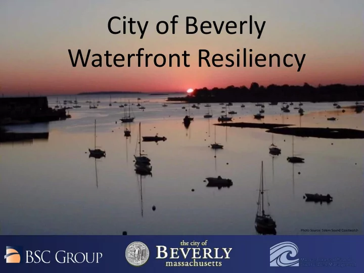
Photo Source: Salem Sound Coastwatch
Waterfront Resiliency Photo Source: Salem Sound Coastwatch - - PowerPoint PPT Presentation
City of Beverly Waterfront Resiliency Photo Source: Salem Sound Coastwatch Community Workshop #2 Agenda 7:00 PM Community Resiliency Fair 7:30 PM Brief Presentation on Critical Asset Vulnerability Assessment 7:45 PM Question & Answer
Photo Source: Salem Sound Coastwatch
7:00 PM Community Resiliency Fair 7:30 PM Brief Presentation on Critical Asset Vulnerability Assessment 7:45 PM Question & Answer Opportunity 8:00 PM Community Resiliency Fair (cont.)
Station 1
Salem Sound CoastWatch Sustainable Local Projects
Station 2
Mass Audubon Regional Projects
Station 3
Great Marsh Project Overview
Station 4
BSC Group – Beverly Flood Map Viewer
Station 5
Endicott College Sustainable Endicott
Station 6
Endicott College Resiliency Case Studies
Additional Resiliency Community Members (Located in Entry/Hall):
Beverly DPW - HMP/Beverly Open Space Committee/Beverly Harbor Management
Massachusetts Office of Coastal Zone Management (CZM)
$119,985
Total Project Cost $89,981
Grant Amount
$30,004 (in services)
In Kind Match
1) Vulnerability and Risk Assessment 2) Public Education and Communication 3) Local Bylaws, Adaptation Plans, and Other Management Measures
Photo Source: Salem Sound Coastwatch
beaches, etc.)
drain systems, sewer)
stations
Infrastructure
Photo Source: Salem Sound Coastwatch
setup, river discharge, sea level rise, future climate scenarios)
Beverly Harbor Chubbs Brook Beverly Cove Bass River Beverly Farms
Photo Sources: Salem Sound Coastwatch Wikimedia Commons MAPC Fletcher6 Beverly Health Dept.
Utility Infrastructure Name Type of Facility Location Sewer Pump Station-Marsh Sewer Pump Station 20 Marsh Avenue Sewer Pump-Beach St Sewer Pump Station 12 Beach Street Sewer Pump St. SESD Sewer Pump Station near 127 Water St. Sewer Pump-Bailey Sewer Pump Station Bailey Ave near Fosters Pt. Sewer Pump-Hobart Sewer Pump Station 21 Hobart Ave Sewer Pump-Bass Sewer Pump Station 32 Riverview St Sewer Pump-Chapmans Corner Sewer Pump Station 285 Hale St Sewer Pump-Lynch Sewer Pump Station 55 Ober St Stormwater Pump Station-Margin St Storm Pump Station 4 McPherson Drive National Grid Facility Utility 44 River Street Facility Name Type of Facility Location Lynch Park Cultural Resource 55 Ober St Lower Shoe Pond Dam Dam Elliot St City of Beverly Harbor Mgmt Marina 11 Cabot St Bass Haven Yacht Club Marina (Private) 10 McPherson Drive Beverly Port Marina Marina (Private) 15 Water Street Jubillee Yacht Club Marina (Private) 127 Water Street
Public Coastal Structure ID (per CZM 2009) Type of Structure Structure Material Location Earliest Structure Record 005-001-000-085-100 Bulkhead/Seawall/Bulkhead/Seawall Concrete/Wood Harbor Center East 1981 005-001-000-086-100 Bulkhead/Seawall Stone Beverly Harbor Unknown 005-001-000-087-100 Bulkhead/Seawall Stone Beverly Harbor Unknown 005-002-000-091-100 Bulkhead/Seawall Concrete Quincy Park East Unknown 005-002-000-094-100 Bulkhead/Seawall Concrete Quincy Park West Unknown 005-002-000-118-100 Groin/Jetty Stone Water Street 1947 005-004-000-040-100 Bulkhead/Seawall Stone Ward Two Playground Unknown 005-005-000-459-100 Bulkhead/Seawall & Revetment Stone/Stone Washington Street 1954 005-005-000-462-100 Bulkhead/Seawall Stone Independence Park 1947 005-005-000-462-200 Groin/Jetty Stone Wilson Avenue 1952 005-005-000-462-300 Bulkhead/Seawall Stone Wilson Avenue Unknown 005-006-000-031-100 Bulkhead/Seawall Concrete Ocean Avenue 1954 005-006-000-035-100 Bulkhead/Seawall Stone Abbott Street 1958 005-007-000-007A-100 Bulkhead/Seawall Stone Bay View Avenue Unknown 005-012-000-238-100 Bulkhead/Seawall/Revetment Concrete/Stone Lyons Park Beach 1957 005-012-000-238-200 Groin/Jetty Stone Lyons Park 1957 005-012-000-238-300 Coastal Beach Sand Lyons Park Beach 1957 005-013-000-050A-100 Bulkhead/Seawall Stone Woodbury Unknown 005-013-000-213A-100 Bulkhead/Seawall Stone Ober Street Unknown 005-013-000-219-100 Bulkhead/Seawall/Revetment Stone/Stone Lynch Park 1963
Photo Sources: City of Beverly Dewberry
Newburyport/Rockport Line
Name of Natural/Cultural Asset Type of Asset Acreage Chubbs Creek Marshes Wetland 37.67 Hospital Point Coastal Bank Wetland 1.77 Obear Park Salt Marsh Wetland 0.6 West Beach Beach 24.51 Mingo Beach Beach 0.5 Dane Street Beach/Percy Lyons Beach Beach 4.21 Obear Beach/Park Beach 0.98 Rices Beach Beach 1.68 Woodbury Beach Beach 1.13 Sandy Point Beach Beach 1.16
Photo Source: Salem Sound Coastwatch
Impact on Vulnerable Populations Service Loss Cost to Repair/Replace Economic Impact Public Safety Impact Public Health Impact Service Area
Station 1
Salem Sound CoastWatch Sustainable Local Projects
Station 2
Mass Audubon Regional Projects
Station 3
Great Marsh Project Overview
Station 4
BSC Group – Beverly Flood Map Viewer
Station 5
Endicott College Sustainable Endicott
Station 6
Endicott College Resiliency Case Studies
Additional Resiliency Community Members (Located in Entry/Hall):
Beverly DPW - HMP/Beverly Open Space Committee/Beverly Harbor Management