
SLIDE 1
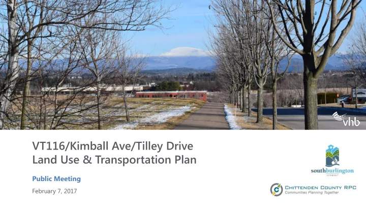
VT116/Kimball Ave/Tilley Drive Land Use & Transportation Plan
Public Meeting
February 7, 2017
VT116/Kimball Ave/Tilley Drive Land Use & Transportation Plan - - PowerPoint PPT Presentation
VT116/Kimball Ave/Tilley Drive Land Use & Transportation Plan Public Meeting February 7, 2017 Presentation Overview Introductions Project Overview Study Goals, Study Area & Project Timeline Existing Conditions Natural
Public Meeting
February 7, 2017
– Study Goals, Study Area & Project Timeline
– Natural Resources, Land Use, Traffic
– ECOS Plan, Comprehensive Plan – Current Development Plans – Future “No Build” Traffic Conditions
To develop a comprehensive Land Use and Transportation Plan to evaluate potential land development in the study area, to identify multimodal transportation infrastructure improvements needed to accommodate planned growth, and identify
connections between the existing and future development in the area.
– Approximately 1,000 acres – Bisected by I-89 – Mix of residential, office, light industrial, and open space
– Kick-Off March 2016 – Existing Conditions April - August – Stakeholder Outreach May - June – Future No Build Sept - December – Public Meeting Tonight – Alternatives Evaluation February – April 2017 – Public Outreach April - May – Preferred Alternative May - June – 2035 Area Plan July - August
UVM Landscape Change Program: http://www.uvm.edu/landscape/
1961
UVM Landscape Change Program: http://www.uvm.edu/landscape/
1961 1962 1964
UVM Landscape Change Program: http://www.uvm.edu/landscape/
1962
– Most of study area in Potash Brook Watershed
– Limited extent of mapped natural resources in study area. – Primarily wetlands, stream buffers, and rare species/communities.
Very Rare/Rare Invertebrate Rare Invertebrate Wetlands Wetlands Wetlands Rare Natural Community
– High quality, large-lot office, light industrial and research uses. – High-quality planned developments that preserve the generally open character of the district, and enhance the visual quality of approaches to the City while providing suitable locations for employment and business growth. – The location and architectural design of buildings in a manner that preserves these qualities is strongly encouraged.
– General industrial and commercial activity in areas of the City served by major arterial roadways with ready access to Burlington International Airport. – Major commercial uses, such as supermarkets and shopping centers shall not be permitted.
– General retail at specific intersections in the city, to serve nearby residential areas. These commercial areas are intended to serve the convenience shopping needs of local residents and employees. Their location and design are intended to make them accessible both by motorized vehicle and by foot.
– Low-density single-family residential uses to protect scenic views and cultural resources, and to provide compatibility with adjacent natural
permitted at a maximum of four units per acre.
– High-density residential use. The district is located in areas that are near shopping areas, schools, and public transportation facilities. – Offices and other commercial uses may be permitted within the district in locations that have direct access to arterial and collector streets and that will not adversely affect residential properties.
– Hinesburg Road North – Dorset Park
View Protection Zone View Protection Zone Airport Approach Cone Transit Overlay District Flood Plain Traffic Overlay – Zone 2 Traffic Overlay – Zone 1 Traffic Overlay – Zone 1
Route 12 UMall/Airport Route 1 Williston Route 116 Commuter On-Demand Tilley Drive Shuttle
– Across I-89 – Along VT 116 south of I-89 – Old Farm Road – Kimball Ave
– 8 on Kimball Ave – 5 on VT 116 – 4 on Kennedy Drive – 1 on Meadowland Drive – 1 on Tilley Drive
# Reported Crashes (2011-2015) High Crash Location Segment (#387) High Crash Location Intersection (#97)
2,600 18,700
– Enterprise: Areas that accommodate a future concentration of employment uses that attract workers from the County and multi- county region. – Metro: Areas that accommodate jobs and housing in a compact development pattern that supports transit service & pedestrian activity.
– Project area primarily in Northeast Quadrant and Southeast Quadrant zones
– Future use of land should continue to focus on employers and ancillary services. – Future development should maximize efficiency of land use and support multi-modal transportation. – This area should have clear, efficient access to City Center as part of an integrated, urbanized high activity, pedestrian and transit friendly east-west corridor.
– An important consideration for the future land use is the potential for a new Interstate interchange (“12B”) in the vicinity of Hinesburg Road. – With an interchange, properties would gain substantially improved access; with no interchange, the overall transportation and development capacity of the area could be limited.
– Objective 53: Provide a balanced mix of recreation, resource conservation, and business park opportunities in the south end of the Quadrant. – Strategy 121: Encourage well planned, clustered, compact and infill business park development that integrates contiguous open space areas in business park design. – Strategy 122: Focus City resources in support of the build out of high density business, technology and mixed use centers to include the greater Tilley Drive – Tech Park – O’Brien Brothers – Meadowlands & adjacent properties. Recognize this central area of the community as critical to the economic and employment growth of the City and work to encourage full build out of available capacity.
– One of the most difficult issues for South Burlington has been the provision of east-west connector roads between Spear Street, Dorset Street, and Hinesburg Road, and provision of connections between adjacent subdivisions. – The lack of east-west roadways means, effectively, that the SEQ presently has over 1,000 housing units and regional traffic moving through a farming community’s roadway network. The lack of east-west connections increases travel times and miles traveled.
– Strategy 132: Evaluate the allowable activities on the western portion of the Industrial-Open Space District and consider enabling the development of a residential neighborhood with density from transferred development rights from conserved properties in the SEQ. – Strategy 133: Revise the LDRs to ensure that all truck- intensive uses in the IO district are located a sufficient distance away from residentially-zoned lands to prevent adverse noise, air quality, light, and visual impacts.
– Majority of study area categorized as Medium to Higher Intensity – Principally Non-Residential – Western area primarily Medium Intensity – Residential to Mixed-Use
Tilley Dr Extension Swift St Extension I-89 Interchange
Code Land Use Unit Developer Size City Size North of I-89 Technology Park 310 Hotel rooms 250 35 110 General Light Industrial ksf 428 60 710 General Office Building ksf 429 60 UVM - MC 720 Medical-Dental Office Building ksf 200 37 720 Medical-Dental Office Building ksf 217 40 O-Brien Farm 231 Low-Rise Res. Condo. / Townhouse units 700 161 310 Hotel rooms 130 13 710 General Office Building ksf 25 3 820 Shopping Center ksf 15 2 932 High-Turnover (Sit-Down) Restaurant ksf 5 1 934 Fast-Food Restaurant W/ Drive-Through Windo ksf 5 1 South of I-89 Meadowland PUD 110 General Light Industrial ksf 120 64 710 General Office Building ksf 30 16 Rye 210 Single-Family Detached Housing units 22 5 231 Low-Rise Res. Condo. / Townhouse units 16 4 210 Single-Family Detached Housing units 14 3 710 General Office Building ksf 20 9 Hill Farm 210 Single-Family Detached Housing units 85 19 231 Low-Rise Res. Condo. / Townhouse units 580 133 310 Hotel rooms 140 9 710 General Office Building ksf 435 27 820 Shopping Center ksf 159 10 Dynapower 710 General Office Building ksf 140 11 720 Medical-Dental Office Building ksf 80 7 820 Shopping Center ksf 184 15 SUMMARY
Hotel rooms 520 57 Office/Light Industrial ksf 2,124 335 Retail ksf 368 28 Residential units 1,417 325 2035 PM Peak Trips trips 7,000 2,750
Swift Street Extension Tilley Drive Extension Tilley/Kimball Connector Cider Mill Extension
0.8 0.8 1.0 1.5
2016 2035 No Build 2035 Moderate Build + Connections 2035 Full Build + Connections
0.6 2.5 10+ 10+ 0.6 0.9 1.0 1.8 0.7 0.9 1.1 1.5 0.6 1.9 6.3 10+ 0.4 0.4 0.9 9.4 0.3 0.3 2.9 10+ 1.0 1.4 1.8 2.2 0.4 3.5 10+
Package #1: Walking & Transit Focused
& walking by investing in frequent transit service and constructing new buildings close to bus stops
to frequent local, express, and circulator bus routes
Package #3: Interchange Access
full access to and from Kennedy Drive/Dorset Street and I-189
Package #2: Connected Streets
bike paths
all users at critical intersections - including new signs and striping, new signals, additional turn lanes, roundabouts, etc)
Package #4: Modest Improvements
system.
lanes, traffic signals, or paths at key locations
community