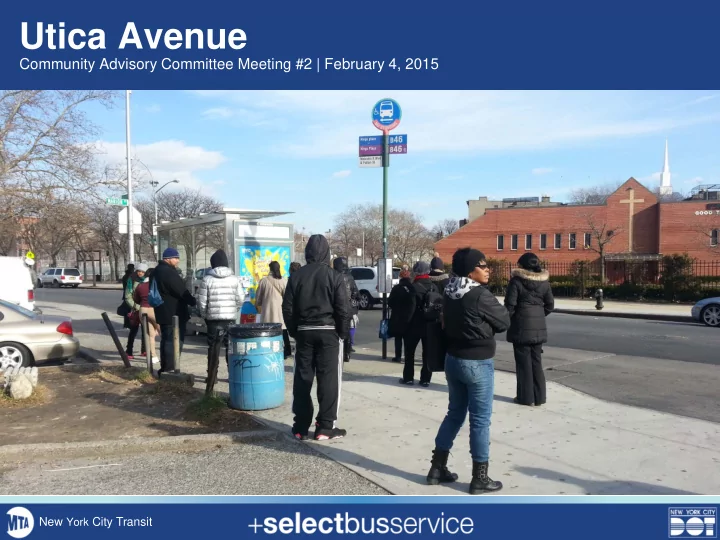
Utica Avenue Community Advisory Committee Meeting #2 | February 4, - - PowerPoint PPT Presentation

utica avenue
SMART_READER_LITE
LIVE PREVIEW

Utica Avenue Community Advisory Committee Meeting #2 | February 4, - - PowerPoint PPT Presentation

Utica Avenue Community Advisory Committee Meeting #2 | February 4, 2015 New York City Transit Meeting Objectives 1. Provide an update about the project to date 2. Present draft service plan for B46 SBS and B46 local 3. Discuss service plan and


slide-1
SLIDE 1

Utica Avenue

Community Advisory Committee Meeting #2 | February 4, 2015

New York City Transit

slide-2
SLIDE 2
  • 1. Provide an update about the project to date
  • 2. Present draft service plan for B46 SBS and

B46 local

  • 3. Discuss service plan and identify key

comments and issues

Meeting Objectives

2

slide-3
SLIDE 3

Introductions Presentation

  • 1. Project Background
  • 2. Initial Data Analysis Results
  • 3. Proposed Service Plan
  • 4. Next Steps

Group Discussion

Agenda

3

slide-4
SLIDE 4

Select Bus Service in New York City

Select Bus Service (SBS) is New York City’s brand name for Bus Rapid Transit: an improved bus service that offers fast, frequent, and reliable service on high-ridership bus routes. SBS has brought:

  • 15-23% faster bus speeds
  • About 10% increase in ridership
  • More reliable service
  • Customer satisfaction of 95%
  • Safer streets / reduction in crashes

There are 7 Select Bus Service routes serving all 5 boroughs.

4

slide-5
SLIDE 5

Improved fare collection Transit signal priority Passenger information Improved station amenities Bus lanes Pedestrian safety improvements

5

Select Bus Service Features

slide-6
SLIDE 6

Project Background

  • Ranked by community as one of two

corridors most in need of improvements

  • Characterized by slow and crowded trips
  • Second-busiest bus route in NYC, carrying

nearly 50,000 passengers per day

  • Crucial connection to 34AC trains and

30 bus routes

  • Bus lanes implemented in 2014 in portion
  • f corridor, improving bus and vehicle

travel times

6

Source: 2008-2012 ACS 5-Year Estimates ¼ mile from Utica corridor

61% 24% 10% 5%

Residents Mode to Work

Transit Driving Walk / Bicycle Other

The Utica Avenue B46 corridor was identified as a potential candidate for Select Bus Service in the 2009 Bus Rapid Transit Phase II Study.

slide-7
SLIDE 7

Offset Bus Lane Curbside Bus Lane Left Turn Bay

2014 Bus Priority and Safety Improvements

7

slide-8
SLIDE 8

2014 Bus Priority and Safety Improvements

Sections where bus lane was installed

  • B46 Limited and local

travel times decreased 8% to 15%*

  • Vehicle travel times

decreased 20% to 25% in peak direction*

*during AM and PM weekday peaks

*AM and PM peak

8

slide-9
SLIDE 9

Corridor has among the highest rates of injury from motor vehicle crashes in Brooklyn.

  • 18 fatalities and 250 severe injuries between

2009 and 2013

  • 60% of vehicles travel above the speed limit

(30 mph at time of observation) High Crash Intersections (2009-2013)

Project Background

Safety Concerns

Persons Killed or Severely Injured 9

Intersection Fatalities Severe Injuries Eastern Pkwy 2 11 Avenue U 1 10 Church Av 1 10 Flushing St 9 Avenue H 8 Winthrop St 2 5

Flushing Av Church Av Eastern Pkwy Winthrop St Ave H Ave U

slide-10
SLIDE 10

Utica Avenue Select Bus Service

B46 Limited to be upgraded to B46 SBS, which will include:

  • Off-board fare collection
  • Dedicated bus lanes (possible extension

south of Church Avenue)

  • Transit signal priority
  • Service changes to improve reliability
  • Capital improvements at SBS stations
  • Real-time passenger information
  • Bus bulbs (sidewalk extensions at bus stops)
  • Pedestrian safety enhancements at complex

intersections

  • New shelters, plantings, benches, etc.

10 2014 Bus Lanes

Williamsburg Bridge Plaza Kings Plaza

slide-11
SLIDE 11

11

Utica Avenue Outreach

Outreach for the 2014 Bus Improvement Project (2013-2014)

  • Meetings with Community Boards, local businesses, and elected officials

v

Outreach for Select Bus Service

  • Community Advisory Committee Meeting #1 (September 2014)
  • Public Workshop #1 (November 2014)
  • Presentation to CB8 - Transportation Committee (November 2014)
  • Community Advisory Committee Meeting #2 (February 2015)
slide-12
SLIDE 12

12

Transit Concerns

  • Crowding (especially during rush hour)
  • Bus bunching / reliability
  • Amount of service to Williamsburg
  • Lack of real-time information

Traffic Concerns

  • Double parking
  • Congestion / slow bus trips
  • Bus lane being blocked / lack of enforcement

Safety Concerns

  • Pedestrian safety at complex intersections
  • Dangerous driver behavior / speeding
  • Lighting at night

Public Workshop #1

What We Heard

slide-13
SLIDE 13

13

Collected and analyzed a large amount of data in order to:

  • Understand how the corridor works as a whole
  • Guide discussion about specific areas
  • Inform street design and service pattern decisions

Types of data collected:

  • Bus speeds
  • Bus delay
  • Bus ridership per stop
  • Traffic volumes
  • Parking activity
  • Crash data

Data Collection

slide-14
SLIDE 14

14

Ridership

Northbound

  • High ridership at many existing B46

Limited stops, particularly those with subway/bus transfers

  • Largest percentage of riders are traveling

north to or south from 34 at Eastern Pkwy or AC at Fulton St

  • Only 9% of riders travel between

Broadway and the rest of the route

Top 5 Busiest Stops Top 5 Least Busy Stops Eastern Pkwy Broadway & Arion Pl Fulton St Broadway & Boerum St Church Ave Broadway & Willoughby Empire Blvd Broadway & Malcolm X Ave H Broadway & Hooper St

slide-15
SLIDE 15

15

Bus Speeds

On average, the B46 LTD runs

at 7.5 mph during the AM peak and 6.5 mph during the PM peak

Causes of slow speeds are:

  • Busy stops
  • Delay due to double-parking,

turning vehicles, etc.

  • Congestion
  • Red lights

B46 LTD average weekday 6-10 AM B46 LTD average weekday 4-7 PM

Bus Speeds (mph)

slide-16
SLIDE 16

16

Bus Delay

B46 LTD, 4-7 PM

Source: IVN data, 10/28/14 – 11/20/14 T/W/Th

48% 8% 20% 24%

Red Lights In Motion Bus Stops “Crawl” Speed

(<2.5 mph)

slide-17
SLIDE 17

17

Current B46 Local and LTD Service Pattern

  • B46 LTD generally travels between

Kings Plaza and Williamsburg Bridge Plaza

  • B46 LTD makes all local stops north
  • f DeKalb Ave and south of Ave H
  • B46 Local generally travels between

Kings Plaza and DeKalb Ave

slide-18
SLIDE 18

18

  • Maintain high-ridership Limited stops and key transfers
  • SBS will make Limited stops south of Avenue H, as it will

elsewhere

  • Extend local service to full corridor, 24 hours per day
  • Northern terminal of SBS will be DeKalb Ave to increase

reliability and better serve busiest portion of route

  • Only 9% of riders travel between Broadway and the rest of the route,

yet Broadway section is 24% of route miles and has the slowest speeds

Proposed B46 SBS Stations and Service Pattern

slide-19
SLIDE 19

19

Proposed B46 SBS Stations

slide-20
SLIDE 20

Winter 2015

  • Finalize service plan for B46 SBS and B46 local
  • Develop conceptual street design changes south of Church Avenue

and north of St John’s Place (if any)

  • Present service and design plans to Community Boards
  • CAC: Nostrand Ave SBS Tour

Spring 2015

  • Public Open House
  • Develop corridor plan
  • Develop implementation plan

20

Next Steps

slide-21
SLIDE 21

Station Locations and Service Planning Discussion

New York City Transit

slide-22
SLIDE 22

22

Ridership

Southbound

slide-23
SLIDE 23

3 4 A C J Z

FLATBUSH AV KINGS HWY OCEAN AV ATLANTIC AV LINDEN BL BELT PKWY FLATLANDS AV F L U S H I N G A V BROADWAY OCEAN PKWY NOSTRAND AV EASTERN PKWY J A M A I C A A V 65 ST PENNSYLVANIA AV BAY PKWY JACKIE ROBINSON PKWY ROCKAWAY PKWY PROSPECT EXWY EASTERN PKWY EX PARKSIDE AV MC DONALD AV ATLANTIC AV FULTON ST F U L T O N S T

Proposed SBS stops

750 / 43

On / Offs:

Local stops

Existing B46 Limited stops will either be converted to SBS stops or local stops:

Proposed Local stops

Existing B46 Local stops will remain:

Bushwick Flatlands Weeksville Williamsburg East Flatbush Crown Heights Bedford Stuyvesant

Kings Plaza Av T F i l l m

  • r

e A v Av O Av N Av M Av L Av K Av J Av I Av H Av D Church Av Winthrop St Empire Blvd Eastern Parkway St Johns Place-----> Fulton St Halsey St G a t e s A v D e K a l b A v L a w t

  • n

S t

  • >

W i l l

  • u

g h b y A v J e f f e r s

  • n

S t A r i

  • n

P l a c e P a r k S t F l u s h i n g A v C

  • k

S t L e

  • n

a r d S t L

  • r

i m e r S t B

  • e

r u m S t M

  • n

t r

  • s

e A v H

  • p

e r S t M a r c y A v W i l l i a m s b u r g B r i d g e P l a z a 1161 / 0 450 / 26 3 8 5 / 3 4 219 / 16 278 / 30 329 / 28 678 / 167 419 / 39 527 / 58 421 / 49 2059 / 562 1610 / 505 3328 / 1252 1171 / 504 2106 / 998 2199 / 7518 <----802 / 858 1325 / 3777 277 / 1094 287 / 1081 1 9 2 / 1 6 1 <

  • 5

9 / 8 5 3 / 6 8 2 2 3 / 4 4 5 3 9 / 5 9 1 / 6 7 3 2 4 / 5 4 2 7 2 / 1 3 5 5 8 / 9 7 7 5 / 1 6 2 3 2 / 7 3 1 2 / 3 2 7 4 / 1 3 4 1 7 / 4 8 7 / 4 4 6

EXISTING B46 NORTHBOUND STOPS AND RIDERSHIP

Prospect Park Holy Cross Cemetary

slide-24
SLIDE 24

U T I C A A V U T I C A A V MALCOLM X BLVD BROADWAY FLATBUSH AV

The B46 Local will be extended to Williamsburg Bridge Plaza, making all stops along Broadway 24 hours per day. The northern terminal of the B46 SBS will be at DeKalb Av. The B46 SBS will not make local stops south of Avenue H. The B46 Local will continue to make all local stops from DeKalb Av to Avenue U (Kings Plaza). The B46 SBS will make SBS stops from DeKalb Av to Avenue U (Kings Plaza).

PROPOSED SBS STOP LOCATIONS