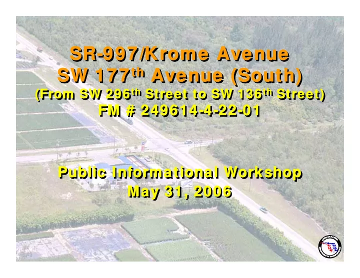
sr 997 krome avenue sr 997 krome avenue sr 997 krome
play

SR-997/Krome Avenue SR-997/Krome Avenue SR-997/Krome Avenue - PowerPoint PPT Presentation

SR-997/Krome Avenue SR-997/Krome Avenue SR-997/Krome Avenue SR-997/Krome Avenue th Avenue (South) th Avenue (South) SW 177 th SW 177 Avenue (South) SW 177 th SW 177 Avenue (South) th Street to SW 136 th Street) th Street to SW 136 th Street)


  1. SR-997/Krome Avenue SR-997/Krome Avenue SR-997/Krome Avenue SR-997/Krome Avenue th Avenue (South) th Avenue (South) SW 177 th SW 177 Avenue (South) SW 177 th SW 177 Avenue (South) th Street to SW 136 th Street) th Street to SW 136 th Street) (From SW 296 th Street to SW 136 th (From SW 296 Street) (From SW 296 th Street to SW 136 th (From SW 296 Street) FM # 249614-4-22-01 FM # 249614-4-22-01 FM # 249614-4-22-01 FM # 249614-4-22-01 Public Informational Workshop Public Informational Workshop Public Informational Workshop Public Informational Workshop May 31, 2006 May 31, 2006 May 31, 2006 May 31, 2006

  2. Project Phases Project Phases Project Phases Project Phases PLANNING PROJECT DEVELOPMENT & ENVIRONMENT STUDY (PD & E) DESIGN RIGHT OF WAY ACQUISITION CONSTRUCTION

  3. What is a PD& E Study? What is a PD& E Study? What is a PD& E Study? What is a PD& E Study? • Identification of study area • Identification of study area • Corridor definition and analysis • Corridor definition and analysis • Environmental analysis and assessment • Environmental analysis and assessment – Wetlands, Endangered Species, Cultural Features, – Wetlands, Endangered Species, Cultural Features, Contamination Assessment, Air/Noise, and Parks/Recreation Contamination Assessment, Air/Noise, and Parks/Recreation • Community Features assessment • Community Features assessment – Schools, Churches, Cemeteries, Emergency facilities, etc. – Schools, Churches, Cemeteries, Emergency facilities, etc. • Preliminary conceptual engineering • Preliminary conceptual engineering • Coordination with federal, state and local agencies and • Coordination with federal, state and local agencies and governmental entities governmental entities • Public Involvement Process • Public Involvement Process

  4. PD& E Study Process PD& E Study Process PD& E Study Process PD& E Study Process Diagram Diagram Diagram Diagram

  5. Location Map Location Map Location Map Location Map • From SW 296 th Street • From SW 296 th Street to SW 136 th Street to SW 136 th Street END END • Approximately 10 • Approximately 10 PROJECT PROJECT miles miles • Rural Principal • Rural Principal Arterial Arterial • Land Uses • Land Uses BEGIN BEGIN • Agricultural • Agricultural PROJECT PROJECT • Commercial • Commercial • Residential • Residential • Protected Land • Protected Land

  6. Project Corridor Project Corridor Project Corridor Project Corridor End Project Begin Project

  7. Need for the Project Need for the Project Need for the Project Need for the Project • Florida Intrastate Highway System (FIHS) • Florida Intrastate Highway System (FIHS) • Strategic Intermodal System (SIS) • Strategic Intermodal System (SIS) • Krome Avenue is the only north-south artery on the western • Krome Avenue is the only north-south artery on the western fringes of Miami-Dade County fringes of Miami-Dade County • Important route for hurricane evacuation and post-disaster • Important route for hurricane evacuation and post-disaster recovery recovery • Transitions with projects at both ends of the corridor • Transitions with projects at both ends of the corridor • Corridor consistently fails crash Safety Ratios • Corridor consistently fails crash Safety Ratios

  8. Need for Improvement Need for Improvement Need for Improvement Need for Improvement Physically and Functionally Deficient Areas Physically and Functionally Deficient Areas Physically and Functionally Deficient Areas Physically and Functionally Deficient Areas Physically and Functionally Deficient Areas Physically and Functionally Deficient Areas • Roadway Safety • Roadway Safety • Traffic Mobility • Traffic Mobility • Roadway Capacity • Roadway Capacity • Traffic Congestion & Delays • Traffic Congestion & Delays • Travel Time Delays • Travel Time Delays • Intersection Geometry & Operations • Intersection Geometry & Operations • Access Management • Access Management • Water Quality & Drainage Issues • Water Quality & Drainage Issues • Bicycle/Pedestrian Facilities • Bicycle/Pedestrian Facilities • Economic - Transport of Goods & Services • Economic - Transport of Goods & Services • Regional Connectivity • Regional Connectivity

  9. Traffic Volumes Traffic Volumes Traffic Volumes Traffic Volumes 2004 (2030) (2030) 2004 2004 (2030) No- -Build Conditions Build Conditions No No-Build Conditions END END PROJECT PROJECT SW 136 th St. SW 136 th St. 17,300 17,300 17,300 (31,400) (31,400) (31,400) SW 184 th St. SW 184 th St. 14,800 14,800 (27,900) (27,900) BEGIN BEGIN SW 232 nd St. SW 232 nd St. 15,700 15,700 PROJECT PROJECT (20,800) (20,800) SW 296 th St. SW 296 th St. 13,900 13,900 (21,600) (21,600) Percent Trucks 16.9% Percent Trucks 16.9%

  10. Crash Data Summary Crash Data Summary Crash Data Summary Crash Data Summary from 1999 to 2004 from 1999 to 2004 from 1999 to 2004 from 1999 to 2004 Number of Number of Number of Number of Number of Crashes Injury Injuries Fatal Fatalities Year Crashes Crashes 1999 97 63 120 2 2 2000 94 64 120 3 3 2001 116 74 157 3 4 2002 91 60 106 2 2 2003 106 61 134 2 3 2004 121 68 125 0 0 TOTAL 625 390 762 12 14 Avg./Year 104 65 127 2 2.2 SOURCE: FDOT Crash Analysis Reporting (CAR) System SOURCE: FDOT Crash Analysis Reporting (CAR) System

  11. 2.152 2004 Safety Ratio = 1.0 2.052 2003 Safety Ratios Safety Ratios Safety Ratios Safety Ratios 1.932 2002 YEAR 2.432 2001 Safety Ratio 2.077 2000 2.211 1999 3 2.5 2 1.5 1 0.5 0 Safety Ratio

  12. Crash Rates Crash Rates Crash Rates Crash Rates (Crashes/MVM) (Crashes/MVM) (Crashes/MVM) (Crashes/MVM) 3 2.336 2.5 2.211 1.891 Crash Rate (per MVM) 1.835 1.799 2 1.707 1.5 1 0.677 0.665 0.623 0.615 0.615 0.615 0.5 0 1999 2000 2001 2002 2003 2004 YEAR Corridor Crash Rate Statewide Crash Rate

  13. Project Consistency Project Consistency Project Consistency Project Consistency The proposed project has been found consistent with: The proposed project has been found consistent with: � Florida Department of Community Affairs (DCA) � Florida Department of Community Affairs (DCA) approved Miami-Dade Comprehensive Development approved Miami-Dade Comprehensive Development Master Plan Master Plan � Miami-Dade MPO Long Range Transportation Plan � Miami-Dade MPO Long Range Transportation Plan (LRTP) (LRTP) � 2004 Miami-Dade MPO Transportation Improvement � 2004 Miami-Dade MPO Transportation Improvement Plan (TIP) Plan (TIP) � FDOT Work Program � FDOT Work Program � Miami-Dade MPO-approved Congestion Management � Miami-Dade MPO-approved Congestion Management System System

  14. Project History Project History Project History Project History Krome Avenue Krome Avenue Action Plan Action Plan • R/W Protection • R/W Protection • Rural Character Preservation • Rural Character Preservation • Environmental Preservation • Environmental Preservation • Access Management • Access Management • Intersection Improvements • Intersection Improvements Corridor split into 5 segments Corridor split into 5 segments Short-term improvements Short-term improvements • • Long-term improvements Long-term improvements • • MPO approved 1999 MPO approved 1999 MPO approved 1999

  15. Existing Typical Section Existing Typical Section Existing Typical Section Existing Typical Section 2- -Lane Undivided Roadway Lane Undivided Roadway – – Typical Section Typical Section 2

  16. Action Plan Typical Section Action Plan Typical Section Action Plan Typical Section Action Plan Typical Section

  17. Short-Term Improvements / Current Projects Short-Term Improvements / Current Projects Short-Term Improvements / Current Projects Short-Term Improvements / Current Projects Scope includes: Scope includes: Safety Enhancements, Intersection & Signal Modification, Safety Enhancements, Intersection & Signal Modification, Limited Access Management, Shoulder Widening, Pavement Limited Access Management, Shoulder Widening, Pavement Markings, Resurfacing, Drainage Improvements. Markings, Resurfacing, Drainage Improvements. th Street To 288 th Street Resurfacing- - 296 296 th Street To 288 th Street Resurfacing Letting April 2006 Letting April 2006 Intersections – – 288th, 216th, 200th, & 184th 288th, 216th, 200th, & 184th Intersections Streets Streets Letting April 2006 Letting April 2006 Intersections - - SW 272nd, 256th, 192nd, SW 272nd, 256th, 192nd, Intersections 168th & 136th Streets 168th & 136th Streets Construction Complete 2005 (Design- -Build) Build) Construction Complete 2005 (Design

  18. Four Alternative Typical Sections Four Alternative Typical Sections Four Alternative Typical Sections Four Alternative Typical Sections Best Fit Alignments Best Fit Alignments Best Fit Alignments Best Fit Alignments • Two-Lane Rural • Two-Lane Rural • Three-Lane Rural • Three-Lane Rural • Passing Zones • Passing Zones • Four-Lane Rural • Four-Lane Rural • Florida Intrastate Highway System • Florida Intrastate Highway System • Four-Lane Rural • Four-Lane Rural • Plans Preparation Manual • Plans Preparation Manual

  19. Alternative #1 Alternative #1 Alternative #1 Alternative #1

  20. Alternative #2 Alternative #2 Alternative #2 Alternative #2

  21. Alternative #3 Alternative #3 Alternative #3 Alternative #3

Download Presentation
Download Policy: The content available on the website is offered to you 'AS IS' for your personal information and use only. It cannot be commercialized, licensed, or distributed on other websites without prior consent from the author. To download a presentation, simply click this link. If you encounter any difficulties during the download process, it's possible that the publisher has removed the file from their server.

Recommend


More recommend