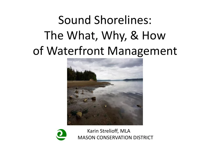
SLIDE 1 Sound Shorelines: The What, Why, & How
Karin Strelioff, MLA MASON CONSERVATION DISTRICT
SLIDE 2
. . . and PLANTS
SLIDE 3 Part I: the “Big Picture”
- A need for change in how we
manage our waterfront property– and why
What is at risk?
SLIDE 4 Graphics / Data: Alaska Coastal Rainforest Center
Forest cover loss:
During the past 150 years, Puget Sound lost at least 2/3 of its remaining old growth forests . . .
Puget Sound Partnership Vital Signs, 2016
SLIDE 5
Continued development replaces forest with homes, roads, and impervious surfaces
Cumulative Impacts of Deforestation?
SLIDE 6 Impacts of Development
- Permanent forest loss
- Impervious surfaces increase
- Loss of wildlife habitat/ decline of
species
- Hydrologic changes above and
below land surface
- Stormwater runoff volumes, flows
increase
- Pollution impairs water quality
Natural Condition Developed Condition
- Mature forest canopy
- High infiltration rates
- Wildlife habitat
- Ground water recharge
- Stormwater runoff volumes small
- Water quality protected
SLIDE 7 Why Does My Shoreline Matter?
Wildlife - aquatic + terrestrial Native plants – and their habitats Puget sound processes – natural bluff erosion sediment availability hydrologic processes
SLIDE 8
Property value, costs, and peace of mind
SLIDE 9
Preserving a “sense of place”
SLIDE 10 Øyvind Holmstad, Wikimedia Commons
What does it take for a “sense of place” to disappear?
SLIDE 11
The next generation of waterfront residents Our challenge: accept the gift and the responsibility of “living on the edge”
SLIDE 12 The “Big Picture” - Benefits
“Sound” shoreline management
- Peace of mind
- Giving back
- Property value & costs
- Contributing to a sense of place
SLIDE 13
Our challenge:
Finding “the right way” to create and maintain: Ecologically functional landscapes Beautiful & Useful Landscapes
SLIDE 14 How? Plants on the Shoreline
Thoughtful vegetation & drainage management are two of the easiest - and most effective – ways for homeowners to help their properties, and Puget Sound.
SLIDE 15 Role of Vegetation on the Shoreline
- Water management
- Nutrient uptake
- Slope stabilization
- Food
- Shade
- Microclimate
- Large woody debris
SLIDE 16 MESSY = COMPLEXITY = LIFE
- 1. Adopt a Puget Sound Aesthetic
SLIDE 17
MESSY = COMPLEXITY = LIFE
A Place of Remarkable Beauty
SLIDE 18
MESSY = COMPLEXITY = LIFE
SLIDE 19
MESSY = COMPLEXITY = LIFE
SLIDE 20
MESSY = COMPLEXITY = LIFE
SLIDE 21
- 2. Treat plants like the INFRASTRUCTURE
they are: stability, stormwater, habitat
Source: The Importance of Root Strength and Deterioration Rates Upon Edaphic Stability in Steepland Forests By O’Loughlin and Ziemer
SLIDE 22 Capture the Rain
Rain is captured on leaf surfaces at different heights. Leaves transpire and water evaporates away. Rain slows as it drips through vegetation to the ground, allowing the soil time to absorb it. Plant roots suck up gallons of water from the soil and make room for more water. “A PNW conifer intercepts and transpires as much as 30%
- f the rain that falls on it each year.” (Herrera Environmental Consultants, 2008)
SLIDE 23 Things Change. Shoreline vegetation does help
WA Coastal Atlas, 2007 image of Case Inlet shoreline
SLIDE 24
Avoid topped trees; yard waste; storage on edge
SLIDE 25
- 1. Save time (low maintenance once established)
- 2. Save money (few inputs, bareroot = inexpensive)
- 3. Protect your property (erosion, stormwater, weeds)
- 4. Help the neighbors (repeat above)
- 5. Protect our local economy (water quality, recreation)
- 6. Conserve natural resources for your children . . .
and their children…
- 3. Preserve Existing Native Vegetation
SLIDE 26 Trees and views are compatible.
- Work with skilled certified
arborists The cost of maintenance pruning = infrastructure maintenance
About views
SLIDE 27
Native vegetation (& stability) lost for a view…..
SLIDE 28
Limbing Up
SLIDE 29
Maintain View Corridors
SLIDE 30 How much do you love to mow? [scale]
- 5. Add more vegetation. Reconsider lawn.
What happens to the stormwater management, site stability, and habitat services that were lost?
SLIDE 31
Lawn to the edge?
SLIDE 32 Image: Washington State Coastal Atlas Map
SLIDE 33 Image: Washington State Coastal Atlas Map
Lines of defense
SLIDE 34
- 6. Avoid unnecessary interruptions to
processes and habitat
SLIDE 35
- 7. Shorelines are dynamic spaces.
Change is constant
SLIDE 36
Recognize shorelines as dynamic settings. Avoid unnecessary stress
SLIDE 37
- 8. Location matters . . .
Fine Gardening Magazine
Bluff top irrigation/high intensity gardens are risky
SLIDE 38
Reduce Use Of Herbicides & Fertilizers
a lot of it ends up in Puget Sound
SLIDE 39
- 9. Landscape is infrastructure
- Vegetative cover - rich, layered
- Stormwater management
- Surface water runoff - minimal
- Mechanical stabilization of slopes
- Biodiversity supported
- Shoreline - natural erosion rates,
- Sediment accretes and moves on
- Water quality protected
SLIDE 40 Image: H. Shipman
- 10. Celebrate, honor, and respect our region
SLIDE 41 ED BOOK PHOTO HOOD CANAL, DABOB & QUILCENE BAYS