
SLIDE 1
Slauson Avenue Revitalization Public Scoping Meeting December 3, - - PowerPoint PPT Presentation
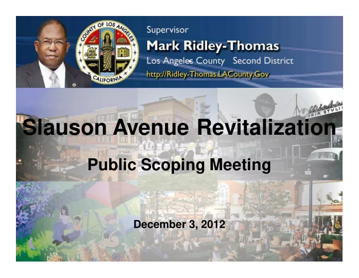
Slauson Avenue Revitalization Public Scoping Meeting December 3, 2012 Introduction Welcome From The Office Of Supervisor Mark Ridley-Thomas Project Limits La Brea Avenue to Angeles Vista Boulevard Project Limits Quality Of Life
foot to 12-foot
travel lanes
median
lighting
On each side of street, provides a 12-foot sidewalk, 8-foot parallel parking lane, 14-foot outside lane signed for a bicycle route, and an 11- foot inside lane. A 10-foot raised median will also be provided.
to 16-foot
lanes
median
lighting On each side
street, provides a 16-foot sidewalk, 18-foot
lane that accommodates unrestricted parallel parking, and an 11- foot inside lane. A 10-foot raised median will also be provided.
median
lighting
On each side
street, provides a 8-foot sidewalk, 14-foot outside peak period travel lane signed for a bicycle route, 12-foot middle lane, and an 11-foot inside lane. A 10-foot raised median will also be provided.
12-foot
median
lighting On each side of street, provides a 12-foot sidewalk, 12-foot
10-foot middle lane, and an 11- foot inside lane. A 10-foot raised median will also be provided.
to 20-foot
median
lighting
On each side
street, provides a 20-foot sidewalk, 8- foot parallel parking lane, 5- foot class II bicycle lane, and a 12-foot traffic lane. A 10-foot raised median will also be provided.
project
be analyzed in the EIR
18
19
TASK DATE
Task Order/Issuance of Notice to Proceed Completed Develop Project Description/ Draft Initial Study Completed Notice of Preparation Completed NOP Public review Period Nov 16 – Dec 15, 2012 Draft EIR (Public Review) Apr – May 2013 Final EIR/Mitigation Monitoring Report Program/Finding& Statement of Overriding Considerations Aug 2013 Board Approval Process Aug – Oct 2013 Notice of Determination Oct 2013
– Air Quality – Cultural Resources – Geology/Soils – Greenhouse Gas Emissions – Hazards/Hazardous Materials – Land Use and Planning – Noise – Transportation/Traffic
20
– Existing Conditions – Opening Year (2016) – Horizon Year (2035)
21
Study Intersection Study Roadway
23
24
Study Intersections 2016 No Lane Removals (Options B-1 & B-2) 2016 With 1 Lane Removal (Options A-1 & A-2) 2016 With 2 Lanes Removal (Option C) AM Peak Hour PM Peak Hour AM Peak Hour PM Peak Hour AM Peak Hour PM Peak Hour
Fairfax Ave/Slauson Ave F F F F F F La Brea Ave/Slauson Ave E E F F F F Overhill Dr/Slauson Ave D E E F F F Angeles Vista Blvd/Slauson Ave D D D F F F Fairfax Ave/62nd St E A F C F D La Brea Ave/62nd St F F F F F F Overhill Dr/62nd St B A D B E B BucklerAve/62nd St A A B D C F Fairfax Ave/64th St A A A A A A La Brea Ave/64th St E C F D F D Overhill Dr/64th St F F F F F F BucklerAve/64th St A A A A A B La Brea Ave/Fairview Blvd F F F F F F Overhill Dr/Fairview Blvd D D E D F D BucklerAve/Fairview Blvd B A C A C A
Roadway Segment From To 2016 No Lane Removals (Options B-1 & B- 2) 2016 With 1 Lane Removal (Options A-1 & A- 2) 2016 With 2 Lanes Removal (Option C) Volumes Volumes Volumes Slauson Ave Fairfax Ave La Brea Ave 45,420 38,405 36,202 Slauson Ave La Brea Ave Overhill Dr 40,436 33,310 31,026 Slauson Ave Overhill Dr Angeles Vista Blvd 42,561 35,724 33,572 Fairfax Ave Slauson Ave 59th St 6,063 9,960 11,186 BucklerAve Slauson Ave 62nd St 1,755 7,549 9,008 62nd St Overhill Dr BucklerAve 817 2,808 3,443 64th St Fair Pl BucklerAve 698 1,780 2,133 Fairview Blvd Fair Pl BucklerAve 4,853 5,969 6,334 64th St Eucalyptus Ave La Brea Ave 4,751 6,596 7,183
26
EnvironmentalReview* November 2013 November 2013 Design March 2014 June 2014 Utility Relocations July 2014 October 2014 Construction Begins January 2015 April 2015 Construction Completed July 2015 April 2016
* One environmental document shall be developed to cover all project alternatives Note – Project will require coordination with City of L.A.
November 16, 2012 through December 15, 2012
County of Los Angeles Department of Public Works Programs Development Division, 11th Floor Attention: Ms. Reyna Soriano P.O. Box 1460 Alhambra, CA 91802-1460 rsoriano@dpw.lacounty.gov Phone: (626) 458-5192
27
– Will be used to develop Draft EIR and to select a preferred alternative
28