
SLIDE 1
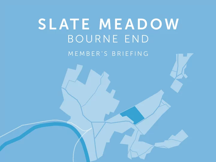
SL ATE ME ADOW
BOURNE END
M E M B E R ’ S B R I E F I N G
SL ATE ME ADOW BOURNE END M E M B E R S B R I E F I N G - - PowerPoint PPT Presentation
SL ATE ME ADOW BOURNE END M E M B E R S B R I E F I N G CONTENTS INTRODUCTION SETTING THE SCENE DEVELOPMENT OBJECTIVES CONCEPT MASTERPLAN ADHERENCE TO DEVELOPMENT BRIEF TIMEFRAMES AERIAL WITH SITE BOUNDARY INTRODUC TION APPLICANTS
M E M B E R ’ S B R I E F I N G
INTRODUCTION SETTING THE SCENE DEVELOPMENT OBJECTIVES CONCEPT MASTERPLAN ADHERENCE TO DEVELOPMENT BRIEF TIMEFRAMES
AERIAL WITH SITE BOUNDARY
APPLICANTS
WORK TO DATE
14.03.15: Community Workshop 08-09.09.2017: Public Consultation 08.2017: Draft Development Brief 13.10.2017: Meeting with WDC offjcers 15.11.2017: Presentation to Members 27.11.2017: Presentation to Liaison Group
CROUDACE STRATEGIC WYCOMBE DISTRICT COUNCIL AVANT HOMES THIRD PARTY OWNERSHIP PLAN
Development
sites on 17th November 2014
Prepared by Wycombe District Council to review the context, setting and character of the land at Slate Meadow, Bourne End. Conclusions are drawn with the presentation of a set of development principles and guidance Public Consultation undertaken on the Draft Brief between 21st August and 2nd October 2017. Drop in exhibitions held at St Dunstan’s Church Hall on the 8th and 9th September 2017. Contents of development brief:
SITE BOUNDARY RIVER WYE FLOOD RISK ZONE 10M LANDSCAPE BUFFER TO RIVER CORRIDOR VILLAGE GREEN DENSE CONTINUOUS SCRUB TREE PRESERVATION ORDERS
green
spaces
and hedgerows
Primary School and vehicular issues
landscape alongside River Wye
proposed dwellings
WOODLAND STANDS/MATURE HEDGEROW AND SCATTERED TREES EXISTING FRONTAGE RESPONSE TO REAR OF EXISTING DEVELOPMENT CONGESTION ISSUES RELATED TO ST PAUL’S PRIMARY SCHOOL VIEWS INTO SITE FROM SURROUNDING HILLSIDES
space to maintain strategic gap
architectural idiom
green
locations
between development and River Wye
routes through the site, linking existing and new residential areas
shrub planting
at school drop-ofg time
ditches to support ecology
SITE BOUNDARY EXISTING DEVELOPMENT RIVER WYE POTENTIAL DEVELOPMENT AREAS KEY DEVELOPMENT FRONTAGE TO VILLAGE GREEN (UP TO 3 STOREYS) KEY DEVELOPMENT FRONTAGE TO RIVER WYE VILLAGE GREEN HABITAT ENHANCEMENT POTENTIAL VEHICULAR ACCESS POINTS EXISTING AND POTENTIAL PEDESTRIAN ACCESS POTENTIAL PEDESTRIAN CONNECTION EXISTING PUBLIC RIGHT OF WAY POTENTIAL SCHOOL DROP OFF POINT OPPORTUNITY TO RETAIN VIEWS TO WIDER COUNTRYSIDE
R I V E R W Y E CORES END S T R A T F O R D D R I V E B R O O K B A N K DISUSED RAILWAY LINE
DEVELOPMENT AREA KEY DEVELOPMENT EDGE BACK TO BACK DEVELOPMENT VILLAGE GREEN GREEN SPACES GREEN CORRIDOR INDICATIVE NODAL SPACES DISUSED RAILWAY BUFFER/BOUNDARY AND LINKS RIVER WYE CORRIDOR INFORMAL MOVEMENT AND LINKS CONNECTIONS VEHICULAR ACCESS KEY VIEWS
02 GREEN INFRASTRUCTURE 04 ACCESS & MOVEMENT 05 PLACEMAKING - LANDSCAPE & APPEARANCE 03 ECOLOGY 01 WATER KEY DEVELOPMENT BRIEF OBJECTIVES ARE OUTLINED
CONCEPT MASTERPLAN, BEFORE GOING ON TO DESCRIBE HOW EACH OBJECTIVE HAS BEEN MET UNDER THE FOLLOWING HEADINGS
Stratford Drive
frame key views north towards countryside
around the periphery
routes link key spaces
drop-ofg loop proposed
enclosing central area of open space and internal streets
periphery are of a lower density
KEY FEATURES
01 WATER
Flood Zone 1 and a part of Flood Zone 2
to address peak predicated fmood levels
100 year plus 35% for climate change, with a 450mm freeboard
into development to ‘manage’ surface waters
incorporated within new wetland areas
monitored – working to worst case scenario – no current evidence of ground water fmooding
WR WALLINGFORD FLOOD RISK FIGURE OVERLAID ONTO CONCEPT MASTERPLAN
02 GREEN INFRASTRUCTURE
reinforced through green routes linking to key spaces
extend south towards River Wye
cycle routes run through the site, linking to existing footpath network
DEVELOPMENT BRIEF GREEN INFRASTRUCTURE PLAN
03 ECOLOGY
green with 'species rich', tussocky grassland. Protect reptiles and nesting birds
to west and south to create integrated open spaces
ecological corridors: bat transect lines, river corridor and continuous scrub and woodland edge habitats
Corridor and creation of wetland area
plan: maintenance and protection of common areas
ECOLOGY PLAN OVERLAID ONTO CONCEPT MASTERPLAN
04 ACCESS & MOVEMENT
Stratford Drive
hierarchy
drop-ofg loop
roads around periphery of the site
cycle routes link into existing footpath network
PRINCIPAL ACCESS POINT PRIMARY ROUTE SECONDARY ROUTE TERTIARY ROUTE SCHOOL PICK-UP/DROP-OFF LOOP PROPOSED PEDESTRIAN ROUTE EXISTING FOOTPATH
05 PLACEMAKING - LANDSCAPE
UP TO 2 STOREY UP TO 2.5 STOREY UP TO 3 STOREY INDICATIVE STOREY HEIGHTS PLAN AND LONG SECTION
05 PLACEMAKING - APPEARANCE
The streetscene for this edge adopts a more rural architectural character, with the materials varying to those in the north. In this important location, the scale and massing of the proposed units has been lowered to reduce any adverse visual efgects on views of the wider countryside to the north, with most units 1.5 – 2 storeys This edge contains a limited number
2.5 storey dwellings provide a gateway entrance to the north-south green route. The architectural character has a traditional formal feel, with contemporary detailing to the windows and doors.
Northern edge overlooking Village Green Southern edge overlooking River Wye
NORTHERN STREETSCENE S O U T H E R N S T R E E T S C E N E
LOCAL ARCHITECTURAL PRECEDENTS
05 PLACEMAKING - APPEARANCE
NORTHERN EDGE ELEVATION DETAIL
GATEWAY BUILDINGS VIEW SOUTH
SOUTHERN EDGE ELEVATION DETAIL
GATEWAY BUILDINGS VIEW NORTH
CONSULTATION OUTLINE PLANNING APPLICATION
EA FLOOD MAP
FLOOD ZONE 2 FLOOD ZONE 3
HR WALLINGFORD’S CONCLUSION PLAN
RIVER CORRIDOR BUILDINGS SITE BOUNDARY FLOOD DEPTH (M) VALUE 0.001 - 0.100 0.101 - 0.200 0.201 - 0.400 0.401 - 0.600 0.601 - 1.000 HIGH : 40 LOW : 28
SUSTAINABLE DRAINAGE SYSTEM
Surface waters (including groundwater) will drain across the site from the north- east generally towards the west/south-
assist in carrying the surface water towards attenuation areas adjacent to the fmoodplain. Surface and ground waters will be addressed within a detailed Flood Risk Assessment that will be submitted in support of a planning
from fmuvial fmood waters, which arise when the River Wye exceeds its capacity. This is addressed in section 2.8 of the brief. The surface and ground waters will be accommodated in ponds, some of which will be seasonal, providing visual amenity and habitat enhancements. During storm events they will provide water attenuation before the managed discharges of storm water into the existing fmoodplain/River Wye. Where appropriate storm water can also be infjltrated into the ground. The latter will carefully be controlled with the input of the Environment Agency. Within the green corridor linking the River Wye corridor to the disused railway line and village green will be additional features, which act as part of a comprehensive drainage network given the fmood-sensitivity
SPECIES RICH NEUTRAL SEMI-IMPROVED GRASSLAND GRAZED NEUTRAL SEMI- IMPROVED GRASSLAND UNGRAZED NEUTRAL SEMI-IMPROVED GRASSLAND DENSE CONTINUOUS SCRUB SCATTERED TREES RIVER WYE AMENITY GRASSLAND VERGE WOODLAND STANDS/ MATURE HEDGEROW ECOLOGICAL TARGET NOTES HIGH BAT POTENTIAL TREE BAT TRANSECT LINES