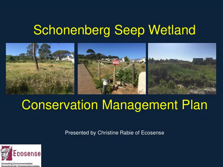
Schonenberg Seep Wetland Conservation Management Plan Presented by Christine Rabie of Ecosense
Introduction The speaker The project The presentation …
Introduction The presentation The project site location and description What is wrong with the area anyway? The challenge What are we trying to achieve? The plan What happens next? Q&A
What is a seep? A wetland Associated with geological formations and topography that cause groundwater to discharge to the land surface or rain- derived water that ‘seeps’ down -slope as subsurface interflow. SANBI Biodiversity Series 22 (2013)
Project Site Location Seep Conservation Area
Site Description
What's wrong with the area anyway? Exotic plant infestation Derelict landscape elements
What's wrong with the area anyway? Stormwater management challenges Lack of a clear landscape and management vision WE NEED A PLAN!
The Challenge Differing opinions and approaches and visions - landscaped, natural, how natural, access no access? Confusion on what is permitted Site conditions e.g. weed infestation, lack of irrigation Work load vs resources
So what informs the chosen approach?
What informs the chosen approach Legislation e.g. NWA; NEMA Brainstorm a vision Opportunities and constraints Approval conditions OEMP and audit results Contravention Notices
What informs the chosen approach Resources available financial, labour, skills Site conditions: the transformed nature and resulting practicalities Workshop with landscape maintenance contractor Input of freshwater ecologist Dean Ollis and vegetation restoration specialist Deon van Eeden
All things considered: What are we trying to achieve? Protect and increase the conservation value on site in terms of the wetland and dryland elements on and the habitat it may provide for animal species e.g. frogs and birdlife. Increased aesthetic value to residents of the area — increasing property values A desirable park area/recreation asset Maximizing path network opportunities – balance no – go areas with access opportunities
All things considered: What are we trying to achieve? Avoid creating undue/expensive maintenance burdens Ongoing removal of weed species and replacement with suitable indigenous species that will eventually outcompete the weeds and reduce required weeding interventions Hand weeding is favored over potentially harmful herbicides in this sensitive conservation area
All things considered: What are we trying to achieve? Ensure the effectiveness of the stormwater system Fire management/risk considerations — reduce fire damage risks to properties and provide an access plan for fire fighting vehicles and teams Environmental awareness for residents; get kids excited about conservation
The Approach A phased systematic approach a common vision Good design is a simple solution Divide area into management zones and year on year priorities Eat the elephant one spoon at a time - implementation not a quick fix
THE PLAN
Management areas and order of priority 1. Fire Wise Buffer Zone 2. Re-instate/Clean up/New Pathways 3. Upgrade Access Nodes 4. Upgrade Underutilized/Unloved “Park zones” 5. Indigenous Pioneer Species into Wetland Transition Zones 6. Manmade Stormwater Channel & Pond System 7. Core Natural Seep and Pan
1. Fire-wise Plot Interface Zone
1. Fire-wise Plot Interface Zone Approx 5 m wide strip along plot boundaries Succulent, mostly indigenous and low, water-wise fire resistant plants Pleasing aesthetic Year 1 priority – outside in approach
2. Upgrade Pathway Network
2. Upgrade Pathway Network Reinstate access to “lost opportunity areas” for residents enjoyment Facilitate fire fighting access Stay out of sensitive “no - go” areas Neaten up path network Natural grass mown pathways where practical
3. Upgrade Access Nodes
3. Upgrade Access Nodes Beautiful landscaping at ”gateway areas” Irrigated and neatly maintained Year 1 priority
4. Park Zones
4. Park Zones Upgrade under-utilized identified “park” landscaping areas in the buffer zone improve the aesthetics and enjoyment of the area for those accessing the path network – planting, seating areas etc. Upgrade and supplement remnants of the original development landscaping that have become derelict in these areas and unkempt and create a poor impression
4. Park Zones
5. Wetland Transition Zone
5. Wetland Transition Zone Sowing of pioneer indigenous plant seed to increase biodiversity and cover Natural transition zone between the seep and the more structured landscaped access nodes, fire wise buffer and “park” zones.
6. Stormwater Channel and Ponds
6. Stormwater Channel and Ponds Manmade and separate from seep wetland Polishing system Ensure flow and stability, minimize erosion and sedimentation Rock packing and stabilizing planting Sediment removal Habitat for aquatic species
7. Seep and pan – core conservation zone
7. Seep and pan – core conservation zone Disturb as little as possible Retain habitat integrity No planting nearby that is potentially invasive or disturbs the hydrological attributes Weed control No-go area Introduce new species only under supervision of fresh water ecologist
What happens next? Phased implementation over 5 years minimum Order of priority – inside out approach Acknowledge challenges, setbacks Monitor and adapt
Thank You! Questions?
Recommend
More recommend