
SLIDE 1
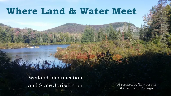
Where Land & Water Meet
Wetland Identification and State Jurisdiction
Presented by Tina Heath DEC Wetland Ecologist
Where Land & Water Meet Wetland Identification and State - - PowerPoint PPT Presentation
Where Land & Water Meet Wetland Identification and State Jurisdiction Presented by Tina Heath DEC Wetland Ecologist VT Wetland Definition Those areas of the state that are inundated by surface or ground water with a frequency
Presented by Tina Heath DEC Wetland Ecologist
“Those areas of the state that are inundated by surface or ground water with a frequency sufficient to support significant vegetation
soils conditions for growth and reproduction.” (VWR § 2.38)
Hydric Soils Hydrophytic Vegetation Hydrology
Primary indicator examples: actual
saturation, high ground water table, algal mat, oxidized root channels, hydrogen sulfide odor, or inundation visible on aerial imagery. Secondary indicator examples: water- stained leaves, stunted or stressed plants, geomorphic position, drainage patterns
Criteria: Inundation or saturation to within soil surface for at least 5% of growing season in most years
Wetlands are often associated with streams or lakes
Hydric organic soils are very dark, almost black Hydric mineral soils have gray colors with
mottling
Wetland plants, or hydrophytic "water loving" vegetation, are those plants which have adapted to growing in the low-oxygen (anaerobic) conditions associated with prolonged saturation or
their tolerance of wetland conditions. When you have a dominance of water loving plants you have met the plant criteria for wetland identification
Education & Research Exemplary Community Erosion Control Water Quality Protection Endangered & Rare Species Recreation & Economics Wildlife Habitat Open Space & Aesthetics Storm & Flood Water Storage Fish Habitat
University of Vermont Studies Wetlands & floodplains protected Middlebury from as much as $1.8 million in flood damage during Tropical Storm Irene. AND Researchers analyzed 10 flood events to estimate the economic value of the Otter Creek floodplain/wetlands near Middlebury. They found the natural barrier saves the town up to 78% of potential damages, or between $126,000 to $450,000 per year on average.
UVM study looked at Charlotte and Hinesburg. Used the aerial imagery with double the original resolution. Results Number of wetlands increased from 383 (4.7%) to 1791 (7.7%). NWI missed smaller wetlands and forested wetlands
Class I Wetland: Exceptional or irreplaceable in its contribution to VT’s natural heritage and merits the highest level of protection (via rulemaking)
8 Class I wetlands- all are mapped Standard 100-foot upland buffer, can be more
Class II Wetland: Merits protection, either taken alone or in conjunction with other wetlands
Can either be mapped or not 50-foot buffer zones
Class III Wetland: Neither Class I or Class II wetland
Non-jurisdictional under VWR
Any wetland on the VSWI map Any wetland contiguous or connected to the VSWI mapped wetland Any wetland that is the same type and size as what is on the VSWI maps (1/2 acre or larger) Wetlands over or under a half acre that are:
adjacent to a stream, lake, pond, or river vernal pools special and unique wetlands like bogs or fens headwaters above 2,500 feet elevation
Width changes with state wetland classification:
quality& wildlife habitat; prevention of invasive species spread
Area of upland around a wetland which provides protection to function and value
Class I = 100-ft buffer or larger Class II = 50-ft buffer
http://anrmaps.vermont.gov/websites/WetlandProjects/default.html Disclaimer: NOT accurate and up to 46 %
mapped but may be jurisdictional.
Exempt Activities (Section 3.1) Allowed Uses (Section 6) Permitting (Section 9)
Farming exemption- The growing of food or crop in connection with farming activities
Limitation: only areas that have been in ordinary rotation since the effective date of the VWR (1990). The exemption expires whenever the area is no longer used to grow food or crops or in ordinary rotation.
Existing constructed features- the following man-made features, which when constructed in uplands may exhibit wetland characteristics:
Stormwater conveyance, treatment and/or control systems Wastewater treatment ponds and sludge lagoons Manure storage and treatment ponds Irrigation and active farming-related ponds Snowmaking ponds Other similar constructed ponds created in uplands.
Permitted public highway projects- only if it has received an Act 250 permit prior to VWR (1990).
Allowed Use 6.12- “the maintenance, reconstruction or routine repair of structures and facilities… or additions to structures or facilities that do not involve substantial expansion or modification” Non-substantial modification or expansion = 250 sf of additional impact outside of structure’s footprint
“The following uses shall be allowed in a Class I or Class II wetland and in its buffer zone without a permit, provided that the configuration of the wetland's outlet or the flow of water into or out of the wetland is not altered and that no draining, dredging, filling, or grading occurs except as may be provided for in subsections 6.01, 6.02, 6.03, 6.04, 6.07, 6.08, 6.12, 6.13, 6.14, 6.15, 6.16, and 6.22”
dredging
tree cutting or conversion
Qualifications
project and BMPs
*see limitations on coverage (VT Wetland General Permit 3-9025 §3) *conditions are already defined
Activity exceeds thresholds of GP Activity was in violation Activity has an undue adverse impact Activity in Class I wetland or buffer Site has RTE species Site has special wetlands Site has headwater wetlands
Qualifications How IP differs from GP
Requires an approved professional wetland delineation Requires a Functions and Values evaluation Has a longer notice period Requires a complete distribution to abutters
Must demonstrate there is no other practicable alternative on property
Must use project design to avoid impacts to wetlands, buffers and their functions and values to the greatest extent possible Must offset potential impacts if they are unavoidable through minimization or restoration
Limited to specific practices that are intended to improve WQ:
Eligible activities are limited by:
Self-verification of avoidance and minimization, and therefore no undue adverse impacts to the wetland and its functions
primarily for vehicular travel and access. A road structure is measured from the filled toe
prism.
may be constructed and maintained. VWR applies.
distinguished from the adjacent area (e.g., is the same or similar to the native ground) or if 4-foot tall woody vegetation is growing within the route, or it is impassable. VWR applies.
under normal conditions all seasons of the year. Class 4 roads may become naturalized. VWR apply to all activities within most Class 4 roads.
material (not previously filled). VWR applies
qualify as maintenance, reconstruction, or repair. "Maintenance and repair" includes resurfacing, grading, clearing shoulders, replacing culverts, and patching potholes.
does not include the rebuilding of naturalized roads. The rebuilding of a road that has been destroyed or damaged by an event is considered reconstruction.
substantial expansion or modification in a wetland or buffer. Any one-time addition to a road involving less than 250 square feet of new impact does not constitute a substantial expansion and qualifies as an allowed use under this section.
Project: Upgrade existing travel way for safety purposes at the Ethan Allen Firing Range
no imported fill, could not be easily distinguished Entire travel way through wetland and buffer required a permit.
determine if eligible based on the project purpose and impact thresholds.
within existing footprint and does not exceed 250 sf of additional impacts)
Project: VTrans stabilization/ storm pipe replacement
culvert replacement considered AU 6.12 (bank is part of road prism)
impact at outlet for clearing and riprapping- needed permit.
footprint than previously existed may either be considered an Allowed Use
system may qualify as an Allowed Use.
me involved early in the process
NRGP.
modification of existing stormwater pond to meet requirements of FRP
existing footprint not considered impacts
from access road and additional grading
Vermont Wetlands Program Homepage hosts: http://www.watershedmanagement.vt.gov/wetlands.htm
http://dec.vermont.gov/watershed/wetlands/contact
Our Services are Free!
wetland permit
manner
Activity Wetlands Class II, 50 foot buffer Shorelands 250 feet from mean water level Allowed Use Permit Exempt Activity Permit Installing septic system yes yes Gravel foot trail yes yes (1 6-ft wide trail) Greater than 6-ft wide, depends on where it is located Clearing woody vegetation yes Vegetation Protection Standards Yes, in excess of VPS Trimming or removing dead trees yes yes Boardwalk/
yes (follow BMP’s) yes Raised flower beds yes yes Creating beach/swimming area yes If site is previously cleared and all beach area is above mean water level Yes, only for public recreation area Gazebo, wood/garden shed, patio yes yes