
SLIDE 1
- - PowerPoint PPT Presentation
rxabuse.maps.arcgis.com/apps/MapJournal/index.html?appid=19bb8941c04648e78b296a61333b004a&webmap=eebc43edd3ab4f1197b7e12bc533164f
rxabuse.maps.arcgis.com/apps/MapJournal/index.html?appid=19bb8941c04648e78b296a61333b004a&webmap=eebc43edd3ab4f1197b7e12bc533164f
Communicating – crafting a story
toprxabuse.maps.arcgis.com/apps/MapJournal/index.html?appid=19bb8941c04648e78b296a61333b004a&webmap=eebc43edd3ab4f1197b7e12bc533164f
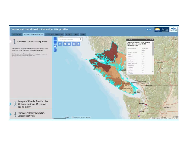
Framing the problem
Identifying demographic patterns
Distribution of resources - accessibility
Data drives decisions and communications – improves access
http://www.coephtmaps.dphe.state.co.us/cdphe_maps/briefingbook/?bookId=d55f496aa4c548a98ff607006004ceee
Briefing Book
Preparing for and Responding to Disasters
Flooding
Texas
Fires
Africa
Real-time Monitoring
Severe Weather
Illinois
Modeling Risk
Pipeline Rupture
US Philippines India
Water Resources Landslides
Massachusetts
Hurricane Surges Typhoons
Philippines
Earthquakes
Hypocenters
Philippines
Epicenter
Nepal
Citizen Alerts
USGS
http://50.112.45.253/briefingbook/default.htm
jd-uc15_compiled_v23-vc
Rain, Coastal Flooding Slam Eastern US Despite Joaquin Well Offshore
http://nces.ed.gov/programs/maped/
Education – Preparing the Next Generation
GIS Day—November 18, 2015
Project Highlight – School District Finance
boundaries and provides this information to DASC as updates are made
impact of budgetary or policy decisions
Visualization on KANSAS House Floor -- Proposed School Finance Policy Impact
Youth documenting Biodiversity of the Waterville Plateau The Waterville Elementary School developed a 5-year plan to inventory and map the biodiversity of the Waterville Plateau.
Diane Petersen's 4th grade and Cathy Nelson's 2nd grade classes
Adopt a Farmer
Partners Outdoors-Gov Geringer
Students as active learners, not passive participants
SANTIAGO, CHILE Third grade student shares her project documenting the life cycle and migration of salmon.. Third grade student finds the established spot (pencil driven into ground) and verifies with GPS in advance of taking serial documentary photo..
http://www12.statcan.gc.ca/nhs-enm/2011/as-sa/map-carte/pdf/2011-99012-005-001-003-01-eng.pdf
Story Maps
Native American History
US
Haiti Earthquake
Haiti
Train Derailment
Illinois
Hometown Heroes
California
Parks Map Tour
California
Recreational Opportunities
BLM—Oregon
Habitat Assessment
Gulf of Mexico
Petroleum Briefing
UK
Survey Status
NOAA
Marine Sanctuary
California
Esri Finland
Helsinki
Train Tracking Maintenance and Asset Management
Lucity
Gilbert
Field Operations
3-GIS
US
Code Enforcement
Accela
Alameda
Mobile Workforce……
School Safety
CitySourced
Los Angeles
Work Order Management
Blue Dot Solutions
UK
Incident Reporting
Latitude Geographics
Culver City
Leica Geosystems
Germany
Surveying
Open Data and Citizen Engagement
Polling Centers
Texas
Citizen Science (Gravity)
Global
Community TIGER White House Maps
US
Crowdsourcing
Abu Dhabi, UAE
Open Data Portals
National
US Dept. of Education Maryland
State
US Wisconsin
Public Comment Crime Reporting
California
Field Office Public
Easy, Focused, and Ready-to-Use
Making ArcGIS Available Everywhere
Story Maps Open Data Crowdsourcing Photo Survey Maps for Office ArcGIS for AutoCAD Configurable Solutions That Work Together Mobile
(Connected & Disconnected)
Navigator Collector Survey123 Workforce Explorer ArcGIS Earth Dashboard
Citizen Engagement and Crowdsourcing
Request for Service
California
Tour Maps
US National Arboretum Minnesota
Polling Place Locator Social Networking Budget Transparency
State of Maryland
Public Survey
Los Angeles, CA
Funding
Crowdsourcing
Philippines
Disaster Reporting
Umatilla Tribe, Mission, OR
Public Comment App
. . . Fully Supported, Open Source, and Free
Helping Users Be Successful
Apps, Maps, and More
Parks and Gardens
Local and State Government Public Safety and Emergency Management Utilities and Telecommunications
Military and Security 500,000+ Downloads
Provide Focused Applications
Production Mapping & Charting Decision Support Specialized Areas
Bathymetry Roads and Highways (LRS) Business Analyst GeoPlanner Map Maritime Chart Geoportal Airpo Aeronautical Chart Community Analyst ArcPad
Web GIS Transforms Organizations
Opening Access and Engaging Everyone Management Planning Operations
Networked Hierarchical
Creating Shared Information and Facilitating Collaboration
Shared Geographic Understanding Stovepiped Data
One of the key challenges we face in the 21st century is that, in many cases, we are measuring – and thus managing – the wrong
attention on what matters to us as a community, and to measure, thus manage, what matters. __Dr. Trevor Hancock, U of Victoria
Leveraging the Value of Shared Data
Web GIS Creates New Connections Across Organizations
Providing an Open Platform for Collaboration and Innovation
Open Data Open Services Schools Start-Ups Businesses Utilities NGOs Citizens
Local Government
Governments
__Roger Tomlinson, Thinking About GIS
a smart person who understands the whole.
80
SCPNT Gov Geringer