
SLIDE 1
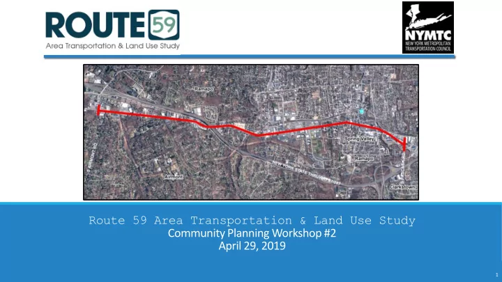
Route 59 Area Transportation & Land Use Study Community Planning Workshop #2 April 29, 2019
1
Route 59 Area Transportation & Land Use Study Community Planning - - PowerPoint PPT Presentation
Route 59 Area Transportation & Land Use Study Community Planning Workshop #2 April 29, 2019 1 Welcome Why are we here today? We want to hear from you regarding land uses and vision for Route 59 3 Project Approach & Schedule 2019
Route 59 Area Transportation & Land Use Study Community Planning Workshop #2 April 29, 2019
1
3
We want to hear from you regarding land uses and vision for Route 59
4
January February March April May June July August September October November December January February March
Task 1: Study Outreach Program Task 2: Existing Conditions Task 3: Focus Area Analysis Task 5: Draft Study Report Task 6: Public Review Task 7: Final Study Report
2019 2020
1 2 3 4
Outreach Program Document Socio-Economic Profile Draft Study Report Final Study Report How do you use Route 59? Focal Area Examination & Brainstorm Solutions Evaluate Land Use & Roadway Visualizations Identify Draft Recommendations Public Review
5
Heavy congestion throughout the day Identified several hotspots Rapid population and development growth Zoning Codes not consistent Safety on corridor an issue
6
Cluster the hotspots into focal areas Show examples from neighboring towns / similar conditions Would those examples work on Route 59?
7
Pedestrian Safety Improvements including installation of sidewalks,
Expected to be complete in the fall of 2019
2 bus shelters remaining to be installed 3 curb ramps currently installed and 10 more by the fall of 2020
8
Expected to be completed in 2019-2020
Traffic signals and detectors Traffic cameras Variable Message Signs (VMS)
9
10
11
Challenges:
intersections
Food Fair Fresh Market
Food Fair Fresh Market
15
Signalized crosswalks
A signalized pedestrian crosswalk on Rt 119 in Elmsford, NY
16
Curb extension
Main St @ Central Ave in Ossining, NY – Painted curb extensions Short curb extensions/reduce crossing distances on Rt 11 in Canton, NY Intersection curb extensions on Main St in Bismarck, ND
Access management
Access management to a shopping plaza on Rt 110 in Huntington, NY Access management to a shopping plaza on Rt 9, Poughkeepsie, NY Access management to a shopping plaza on Rt 110 in Huntington, NY Access management to a shopping plaza on Rt 9, Poughkeepsie, NY
Eastern Parkway in Brooklyn, NY – Photo by Evan Bindelglass
18
Wider Sidewalks
Eastern Parkway in Brooklyn, NY Improved & widened sidewalks along Rt 9N in Lake George, NY Improved & widened sidewalks along Rt 9N in Lake George, NY
Midblock crossings
https://nacto.org/publication/urban-street-design-guide/intersection-design-elements/crosswalks-and-crossings/midblock-crosswalks/
Mid-block pedestrian crossing with HAWK signal, Rt 9, Lake George NY
https://nacto.org/publication/urban-street-design-guide/intersection-design-elements/crosswalks-and-crossings/midblock-crosswalks/
Evergreen Kosher Market Mandarin Fusion Steakhouse Park-and-Ride
Challenges:
Continuous sidewalks
Continuous sidewalk along Rt 9N in Lake George, NY Continuous sidewalk along Main St in New City, NY
22
Safer-curb cuts
Safer curb cuts along the Indianapolis Cultural Trail, IN
http://urbankchoze.blogspot.com/2015/05/sidewalks-and-driveways-is-it-time-to.html
Safer & accessible bus stops
A safe & accessible bus stop on Cleveland Ave in Columbus, OH A safe & accessible bus stop on Rt 9 in Tarrytown, NY
Wendy’s Shop Rite Wal-Mart Sutter’s Mill
Challenges:
discontinuous and narrow sidewalks on the south side
Airmont Diner
Wider, continuous sidewalks
26
Curb extensions
Curbed extensions on Rt 110 in Huntington, NY
Bike racks at bus stops
https://cyclesafe.com/bike-parking/bike-racks/bike-u-rack-crossbar/ https://www.strongtowns.org/journal/2017/8/28/college-town-and-the-money-island
Sutter’s Mill
Could this intersection be reimagined as a mixed-use gateway to Airmont?
Compact & pedestrian-friendly mixed-use development
Airmont – Wal-mart & Shop Rite
Monsey – Town Square Shopping Center
Vehicle-centric & an abundance of parking
A higher & better use at the southeast corner of Town Square Shopping Center?
Older shopping centers could be integrated with new mixed-use development
What is the appropriate vision for the areas of transition along the corridor?
Small-scale, contextual & pedestrian friendly
Iconic landmarks integrated with traffic improvements
41
Ali Mohseni Project Manager New York Metropolitan Transportation Council Phone: (845) 431-5768 Email: Ali.Mohseni@dot.ny.gov