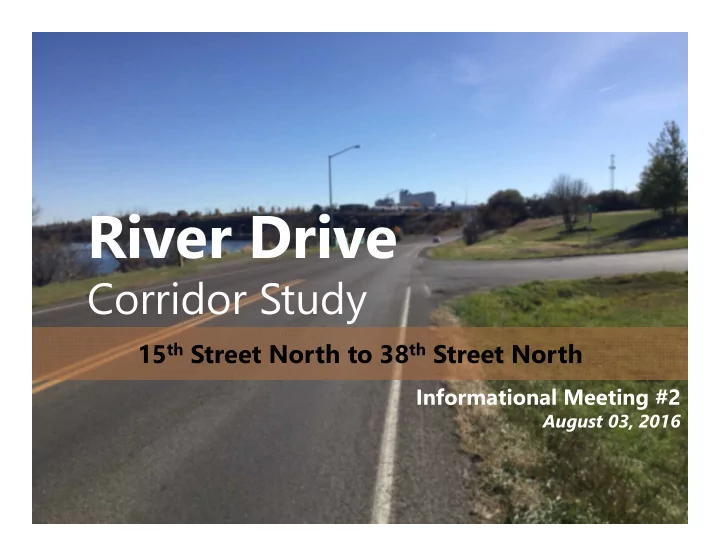
River Drive Corridor Study 15 th Street North to 38 th Street North - - PowerPoint PPT Presentation

river drive
SMART_READER_LITE
LIVE PREVIEW

River Drive Corridor Study 15 th Street North to 38 th Street North - - PowerPoint PPT Presentation

River Drive Corridor Study 15 th Street North to 38 th Street North Informational Meeting #2 August 03, 2016 Welcome and Introductions This meeting is held pursuant to Title VI of Title VI Considerations the 1964 Civil Rights Act which


slide-1
SLIDE 1

River Drive

Corridor Study

15th Street North to 38th Street North

Informational Meeting #2

August 03, 2016

slide-2
SLIDE 2

Welcome and Introductions

slide-3
SLIDE 3

River Drive Corridor Study Slide: 3

This meeting is held pursuant to Title VI of the 1964 Civil Rights Act which ensures that no person shall be excluded from participation in, denied the benefits of, or

  • therwise be subjected to discrimination on

the basis of a protected status during any MDT project.

Title VI Considerations

slide-4
SLIDE 4

River Drive Corridor Study Slide: 4

Presentation

  • What is a Corridor Study?
  • Areas of Concern
  • Transportation System
  • Environmental Considerations
  • Needs and Objectives
  • Recommended

Improvement Options

  • Next Steps

Discussion Period

Meeting Agenda

slide-5
SLIDE 5

What is a Corridor Study?

slide-6
SLIDE 6

River Drive Corridor Study Slide: 6

What is a Corridor Study?

Planning

Project Development /NEPA Design Construction Maintenance Operations

Transportation Agencies Resource Agencies Public

A corridor study is conducted before design, right-of-way acquisition, environmental compliance, and construction.

slide-7
SLIDE 7

River Drive Corridor Study Slide: 7

BEGIN RP 3.4 END RP 5.4 4 5 M i s s
  • u
r i R i v e r 1 4 T H S T N 1 5 T H S T N 15TH ST NE RIVER DR N SMELTER AVE NE 25TH ST N 25TH AVE NE 38TH ST N 26TH ST N 8TH AVE N N R I V E R R D GIANT SPRINGS RD 7TH AVE N CHICAGO AVE 29TH ST N 28TH ST N 27TH ST N N RIVER RD BUTTE AVE 17TH ST NE 34TH ST N 24TH ST N 19TH ST NE 30TH ST N MONTANA AVE NE 1 9 T H S T N 6TH AVE N 23RD ST NE 12 ST 21ST ST NE 17TH ST N 19TH ST N 16TH ST N 23RD ST N 18TH ST N 14TH ST NE 21ST ST N 22ND ST N 20TH ST N 32ND ST N 33RD ST N 3 5 T H S T N 3 1 S T S T N 3 6 T H S T N 3 7 T H S T N 1 3 T H S T N 10TH AVE N 1 3 T H S T N E 3RD AVE N 9TH AVE N WIRE MILL RD 1 2 T H S T N E 5TH AVE N 4TH AVE N COLORADO AVE NE 10TH AVE N 9 T H A V E N 9 T H A V E N FAIRWAY DR N STAR BLVD V I G I L A N T E D R MONTANA AVE NE 10TH AVE N W I R E M I L L R D 12TH AVE N 1 8 T H A V E N N R I V E R R D 3 R

Map Legend

500 1,000 1,500 250 Feet Study Area Study Corridor Railroad City Boundary Reference Post River Drive N Great Falls 226 228 225 227 200 200 3 87 89 87 89 315 15 BEGIN RP 3.4 END RP 5.4 4 5 M i s s
  • u
r i R i v e r 1 4 T H S T N 1 5 T H S T N 15TH ST NE RIVER DR N SMELTER AVE NE 25TH ST N 25TH AVE NE 38TH ST N 26TH ST N 8TH AVE N N R I V E R R D GIANT SPRINGS RD 7 T H A V E N CHICAGO AVE 2 9 T H S T N 2 8 T H S T N 2 7 T H S T N N RIVER RD BUTTE AVE 1 7 T H S T N E 3 4 T H S T N 2 4 T H S T N 1 9 T H S T N E 3 T H S T N M O N T A N A A V E N E 1 9 T H S T N 6 T H A V E N 2 3 R D S T N E 1 2 S T 2 1 S T S T N E 1 7 T H S T N 1 9 T H S T N 1 6 T H S T N 2 3 R D S T N 1 8 T H S T N 14TH ST NE 2 1 S T S T N 2 2 N D S T N 2 T H S T N 3 2 N D S T N 3 3 R D S T N 3 5 T H S T N 3 1 S T S T N 3 6 T H S T N 3 7 T H S T N 1 3 T H S T N 1 T H A V E N 1 3 T H S T N E 3 R D A V E N 9 T H A V E N WIRE MILL RD 1 2 T H S T N E 5 T H A V E N 4 T H A V E N COLORADO AVE NE 1 T H A V E N 9 T H A V E N 9 T H A V E N FAIRWAY DR N STAR BLVD V I G I L A N T E D R MONTANA AVE NE 10TH AVE N W I R E M I L L R D 12TH AVE N 1 8 T H A V E N N R I V E R R D 3 R

Map Legend

500 1,000 1,500 250 Feet Study Area Study Corridor Railroad City Boundary Reference Post River Drive N Great Falls 226 228 225 227 200 200 3 87 89 87 89 315 15

River Drive North (2 miles)

  • 15th Street North (RP 3.4)
  • 38th Street North (RP 5.4)

Study Area

slide-8
SLIDE 8

River Drive Corridor Study Slide: 8

Past Planning

  • Past LRTPs
  • Feasibility Study

completed in 2009

  • 2014 LRTP
  • Conduct a Corridor Study

Existing Concerns

  • Congestion
  • Intersections
  • Safety

Future Concerns

  • Growth
  • Development

Background

slide-9
SLIDE 9

River Drive Corridor Study Slide: 9

Goals and Purpose of Study

  • Identify needs and objectives
  • Identify potential impacts

and constraints

  • Identify short- and long-

range improvements

  • Develop planning level cost

estimates

  • Develop information and

data to be forwarded into the environmental process if a project moves forward from the study (dependent on available funds)

slide-10
SLIDE 10

Areas of Concern

slide-11
SLIDE 11

River Drive Corridor Study Slide: 11

Principal arterial roadway

  • National Highway System
  • Designated truck route

Part of US Hwy 87 Bypass

  • Connects 10th Ave S to 15th St N

Existing constraints

  • Missouri River
  • River’s Edge Trail
  • Park and recreational land
  • Development

Two travel lanes

  • Generally 4’ shoulders
  • Fair pavement condition

35 to 45 mph speed limit

Physical Characteristics

slide-12
SLIDE 12

River Drive Corridor Study Slide: 12

Geometrics

Steep slope Steep grade

Looking W Looking West Near T st Near Trailhead ailhead

slide-13
SLIDE 13

River Drive Corridor Study Slide: 13

Businesses between 15th St N and 19th St N

  • 7 approaches

Caboose Trailhead Big Stack Mobile Home Court approach

  • On a hill
  • Difficult to see

Business access west of 25th St N

  • Businesses closely front

roadway

  • No defined parking or access

Scenic pull-outs

Access and R/W

slide-14
SLIDE 14

River Drive Corridor Study Slide: 14

Rail

  • At-grade crossing
  • New development

Freight

  • Designated truck route
  • 7.2% heavy vehicle traffic

Freight and Rail

slide-15
SLIDE 15

River Drive Corridor Study Slide: 15

River’s Edge Trail

  • North side of roadway
  • Between 15th St N and Giant

Springs Rd

  • Shared use path

19th St N crossing

  • Trail spur terminates at

19th St N intersection

  • No crossing treatments

Caboose Trailhead

  • Parking area and access

for River’s Edge Trail

East of Giant Springs Road

  • Shared use path
  • Connects River’s Edge

Trail to 38th St N

Non-motorized

slide-16
SLIDE 16

River Drive Corridor Study Slide: 16

Traffic Operations

14,400 12,580 10,770

Existing Conditions Existing Conditions

D | C | C D | C | F A | A | A

slide-17
SLIDE 17

River Drive Corridor Study Slide: 17

Traffic Operations

19,690 17,200 14,720

Pr Project

  • jected Conditions

ed Conditions

E | C | E F | F | F B | A | B

slide-18
SLIDE 18

River Drive Corridor Study Slide: 18

5 years of data*

  • No fatal
  • Two incapacitating

injury

  • Six non-

incapacitating injury

113 total reported crashes

  • 79% multi-vehicle
  • 48% rear-end
  • No environmental

trends noted

Safety

Crash Type Statistics 48% 13% 10% 8% 10% 9% 2% 1%

Percent of all Crashes

Multi-vehicle Crashes Single vehicle Crashes

*Jan 01, 2010 to Dec 31, 2014

slide-19
SLIDE 19

River Drive Corridor Study Slide: 19

Safety

Noted clusters:

  • 15th Street North
  • Big Stack Mobile

Home Court

  • 25th Street North
  • Scenic Pull-out
  • Giant Springs Rd
4 5 M i s s
  • u
r i R i v e r 1 4 T H S T N 1 5 T H S T N 15TH ST NE RIVER DR N SMELTER AVE NE 25TH ST N 25TH AVE NE 38TH ST N 26TH ST N 8TH AVE N N R I V E R R D GIANT SPRINGS RD 7 T H A V E N CHICAGO AVE 2 9 T H S T N 2 8 T H S T N 2 7 T H S T N N RIVER RD BUTTE AVE 1 7 T H S T N E 3 4 T H S T N 2 4 T H S T N 1 9 T H S T N E 3 T H S T N M O N T A N A A V E N E 1 9 T H S T N 6 T H A V E N 2 3 R D S T N E 16TH 12TH ST NE 21ST ST NE 1 7 T H S T N 1 9 T H S T N 1 6 T H S T N 2 3 R D S T N 1 8 T H S T N 14TH ST NE 2 1 S T S T N 2 2 N D S T N 2 T H S T N 3 2 N D S T N 3 3 R D S T N 3 5 T H S T N 3 1 S T S T N 3 6 T H S T N 3 7 T H S T N 1 3 T H S T N 1 T H A V E N 13TH ST NE 3 R D A V E N 9 T H A V E N WIRE MILL RD 12TH ST NE 5 T H A V E N 4 T H A V E N COLORADO AVE NE 1 T H A V E N 9 T H A V E N 9 T H A V E N FAIRWAY DR N STAR BLVD V I G I L A N T E D R MONTANA AVE NE 10TH AVE N W I R E M I L L R D 12TH AVE N 1 8 T H A V E N N R I V E R R D 3 R D

41 6 31 19 1 11 1 1 7 1 7 4 1 1 5 1 2

*January 01, 2010 to December 31, 2014

Map Legend

500 1,000 1,500 250 Feet Study Area Study Corridor Railroad City Boundary Reference Post

Crashes*

1 5 10 4 5 M i s s
  • u
r i R i v e r 1 4 T H S T N 1 5 T H S T N 15TH ST NE RIVER DR N SMELTER AVE NE 25TH ST N 25TH AVE NE 38TH ST N 26TH ST N 8TH AVE N N R I V E R R D GIANT SPRINGS RD 7 T H A V E N CHICAGO AVE 2 9 T H S T N 2 8 T H S T N 2 7 T H S T N N RIVER RD BUTTE AVE 17TH ST NE 3 4 T H S T N 2 4 T H S T N 19TH ST NE 3 T H S T N M O N T A N A A V E N E 1 9 T H S T N 6 T H A V E N 23RD ST NE 16TH 12TH ST NE 21ST ST NE 1 7 T H S T N 1 9 T H S T N 1 6 T H S T N 2 3 R D S T N 1 8 T H S T N 14TH ST NE 2 1 S T S T N 2 2 N D S T N 2 T H S T N 3 2 N D S T N 3 3 R D S T N 3 5 T H S T N 3 1 S T S T N 3 6 T H S T N 3 7 T H S T N 1 3 T H S T N 1 T H A V E N 13TH ST NE 3 R D A V E N 9 T H A V E N WIRE MILL RD 12TH ST NE 5 T H A V E N 4 T H A V E N COLORADO AVE NE 1 T H A V E N 9 T H A V E N 9 T H A V E N FAIRWAY DR N STAR BLVD V I G I L A N T E D R MONTANA AVE NE 10TH AVE N W I R E M I L L R D 12TH AVE N 1 8 T H A V E N N R I V E R R D 3 R D

41 6 31 19 1 11 1 1 7 1 7 4 1 1 5 1 2

*January 01, 2010 to December 31, 2014

Map Legend

500 1,000 1,500 250 Feet Study Area Study Corridor Railroad City Boundary Reference Post

Crashes*

1 5 10
slide-20
SLIDE 20

River Drive Corridor Study Slide: 20

Environmental Resources

Physical Environment

  • Soil Resources and Prime Farmland
  • Geologic Resources
  • Water Resources
  • Air Quality
  • Hazardous Substances

Biological Environment

  • Vegetation
  • General Wildlife
  • Threatened and Endangered Species
  • Species of Concern

Social and Cultural Environment

  • Population Demographics and Economics
  • Land Ownership
  • Recreational Resources
  • Cultural Resources
  • Noise
  • Visual Resources
slide-21
SLIDE 21

Needs and Objectives

slide-22
SLIDE 22

River Drive Corridor Study Slide: 22

Needs and Objectives

Need 1: Improve the Safety

  • f the Corridor

Objectives (To the Extent Practicable)

  • Reduce the frequency and severity of

crashes.

  • Improve roadway elements to current

design criteria.

  • Reduce vehicle conflicts.
slide-23
SLIDE 23

River Drive Corridor Study Slide: 23

Needs and Objectives

Need 2: Accommodate Existing and Future Demands

Objectives (To the Extent Practicable)

  • Reduce corridor congestion.
  • Improve operations to achieve LOS

standards.

  • Accommodate large vehicles and

freight movements.

  • Accommodate non-motorized use.
slide-24
SLIDE 24

River Drive Corridor Study Slide: 24

Needs and Objectives

Need 3: Minimize Adverse Impacts to the Environmental Characteristics of the Study Area

Objectives (To the Extent Practicable)

  • Minimize adverse impacts to the Missouri

River and surrounding wetlands.

  • Avoid or minimize adverse impacts to

historic, cultural, archaeological, and recreational resources.

  • Preserve the scenic character of the corridor.
slide-25
SLIDE 25

River Drive Corridor Study Slide: 25

Needs and Objectives

Other Considerations

  • Local and regional planning efforts
  • Funding availability
  • Construction feasibility and physical

constraints

  • Impacts to existing residents and

businesses in the area

slide-26
SLIDE 26

Recommended Improvement Options

slide-27
SLIDE 27

River Drive Corridor Study Slide: 27

  • 1. 15th Street North

Intersection

  • Extend WB right-turn

lane

  • 2. 19th Street North

Intersection

  • Enhanced non-

motorized crossing treatment(s)

Spot Improvements

slide-28
SLIDE 28

River Drive Corridor Study Slide: 28

  • 3. Big Stack Mobile

Home Court Approach

  • Reconstruct or

relocate

  • 4. Business District

Access

  • Reconstruct roadway

Spot Improvements

slide-29
SLIDE 29

River Drive Corridor Study Slide: 29

  • 5. 25th Street North

Intersection

  • Traffic signal or

roundabout

Spot Improvements

Service Layer Credits: Source: Esri, DigitalGlobe, GeoEye, Earthstar Geographics, CNES/Airbus DS, USDA, USGS, AEX, Getmapping, Aerogrid, IGN, IGP, swisstopo, and the GIS User Community

100 200 300 50 Feet

Service Layer Credits: Source: Esri, DigitalGlobe, GeoEye, Earthstar Geographics, CNES/Airbus DS, USDA, USGS, AEX, Getmapping, Aerogrid, IGN, IGP, swisstopo, and the GIS User Community

100 200 300 50 Feet

Service Layer Credits: Source: Esri, DigitalGlobe, GeoEye, Earthstar Geographics, CNES/Airbus DS, USDA, USGS, AEX, Getmapping, Aerogrid, IGN, IGP, swisstopo, and the GIS User Community

100 200 300 50 Feet

Service Layer Credits: Source: Esri, DigitalGlobe, GeoEye, Earthstar Geographics, CNES/Airbus DS, USDA, USGS, AEX, Getmapping, Aerogrid, IGN, IGP, swisstopo, and the GIS User Community

100 200 300 50 Feet

For conceptual purposes only

slide-30
SLIDE 30

River Drive Corridor Study Slide: 30

  • 6. Eagle Falls Golf

Club Access

  • New access along

River Drive

  • 7. Railroad Crossing
  • Diagnostics review of

crossing

Spot Improvements

slide-31
SLIDE 31

River Drive Corridor Study Slide: 31

  • 8. River Drive North

Reconstruction

  • One travel lane in

each direction

  • Center left-turn lane

(where appropriate)

  • Non-motorized

accommodations

Spot Improvements

Segment 1 (15th Street North to 25th Street North) Segment 2 (25th Street North to 38th Street North)

slide-32
SLIDE 32

River Drive Corridor Study Slide: 32

  • 1. Segment 1 (15th Street

North to 25th Street North)

  • 15th Street North – Extend WB

right-turn lane

  • 19th Street North – enhanced

non-motorized crossing treatment

  • Big Stack Mobile Home Court

Approach – reconstruct or realign

  • Business District Access –

reconstruct

  • 25th Street North – traffic

signal or roundabout

  • River Drive North

Reconstruction

Combined Options

slide-33
SLIDE 33

River Drive Corridor Study Slide: 33

  • 2. Segment 2 (25th Street

North to 38th Street North)

  • Eagle Falls Golf Club Access –

new access

  • River Drive North

Reconstruction

Combined Options

slide-34
SLIDE 34

Conclusion and Next Steps

slide-35
SLIDE 35

River Drive Corridor Study Slide: 35

Next Steps

  • Receive and consider comments on draft

corridor study report from:

  • Public
  • Stakeholders
  • Resource agencies
  • Review with study planning team
  • Prepare final corridor study report
  • Post to study website, distribute, and

conclude process

Comment period runs from July 29, 2016 through August 31, 2016

slide-36
SLIDE 36

River Drive Corridor Study Slide: 36

Implementation

  • Depends on availability of funds.
  • Required steps:
  • Identify and secure a funding source(s)
  • Follow MDT guidelines for project nomination

and development

  • r
  • Coordinate with MDT via the System Impact

Action Process (SIAP)

36

slide-37
SLIDE 37

River Drive Corridor Study Slide: 37

  • Comment sheets
  • Study website:

www.mdt.mt.gov/pubinvolve/riverdrive

  • Study Contacts:

Corrina Collins MDT Project Manager (406) 444-9131 ccollins@mt.gov

  • Info on newsletter

Submit Comments

Dave Hand MDT Great Falls District Administrator (406) 454-5880 dhand@mt.gov