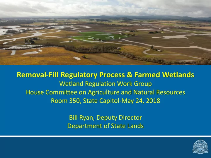
SLIDE 1
Removal-Fill Regulatory Process & Farmed Wetlands
Wetland Regulation Work Group House Committee on Agriculture and Natural Resources Room 350, State Capitol-May 24, 2018 Bill Ryan, Deputy Director Department of State Lands
SLIDE 2
Why do we regulate wetlands?
Willamette Valley wetlands, streams and riparian corridors create ecological value.
SLIDE 3 The Willamette Valley is a high functioning watershed: what’s that?
- A watershed is an area of
land that drains rainwater
such as a stream, lake or
have floodplains.
important because the surface water features and stormwater runoff within a watershed ultimately drain to other bodies of water.
SLIDE 4 Willamette River is a living system with a history; wetlands are part of that
➢ Historical and active channels, showing the dynamic river movements ➢ Many of the old meanders are now wetlands and ponds
TOP: Monmouth and Independence CENTER: Luckiamute River flows into the Willamette from the left, and the Santiam River flows in from the right.
SLIDE 5
Flood plain dynamics—Willamette River in its channel near Salem
SLIDE 6 100-year flood plain, same location
(1 percent chance of occurring in any given year)
SLIDE 7
Willamette River seasonal flooding, high water tables and connections between wetlands and waters sustain crops, stream meanders and wetlands
SLIDE 8
Wetlands and streams interact hydrologically
SLIDE 9 Wetlands support the watershed
➢ Physical: water storage and delay, sediment retention ➢ Filtration: Filter nitrogen (N), phosphorus (P) and
➢ Transport and Transform chemicals: N and P biochemical cycles change the chemical forms and move materials ➢ Habitat support: Fish, amphibians, and other water dependent species ➢ Ecosystem support
SLIDE 10 Wetlands are regulated because of their importance in the landscape and because they are disappearing
- Oregon has lost an estimated 38 percent of its
- riginal wetlands
- In the Willamette Valley, approximately 57 percent of
wetlands have been lost and the valley continues to lose wetlands
- Existing state and federal regulatory programs have
slowed wetland loss substantially but losses continue because some activities and management practices are exempt under both state and federal law and as a result of unlawful activities.
SLIDE 11 History of state and federal wetland regulation-
Removal-Fill Law (statutory)
➢ 1967--State statute regulated the removal of gravel to protect streams – waters of this state ➢ 1971--placement of fill is added to protect estuaries ➢ 1977—intermittent stream jurisdiction added and wetland jurisdiction added by Attorney General opinion that “other bodies of water” included freshwater wetlands ➢ 1989—comprehensive bill protected all Waters of the State
Section 404 Clean Water Act (constitutional)
➢ 1972—Congress created a Federal regulatory plan to control the discharge of dredged or fill materials into wetlands and other waters
➢ 1977—Real launch of federal program--Corps issued final regulations
SLIDE 12 Legal Definition of Wetland
(Photo: Mark Knaupp, Mud Slough Mitigation Bank)
“Wetlands” means those areas that are inundated
- r saturated by surface or
ground water at a frequency and duration sufficient to support, and that under normal circumstances do support, a prevalence of vegetation typically adapted for life in saturated soil conditions.
SLIDE 13 State versus federal wetland regulation
State
➢ Removal-Fill Law (ORS 196.795- 990) regulates removals and fills in “waters of this State” ➢ 50 cubic yard exemption – except in essential anadromous salmonid habitat (ESH) ➢ Wetlands Conservation (ORS 196.668-692) – wetlands policy, statewide wetlands inventory, wetland conservation plans.
Federal
➢ Section 404 of the Clean Water Act (CWA) establishes a program to regulate the discharge of dredged and fill material into “waters of the United States” ➢ Section 10 of the Rivers and Harbors Act of 1899 (33 USC 403) prohibits the obstruction or alteration of navigable waters of the United States without a permit from the Corps of Engineers.
SLIDE 14
Differences between state and federal wetland regulation-- program administration
Removal-Fill Law Department of State Lands ➢ DSL Director has full authority ➢ DSL has enforcement and rulemaking authority ➢ Legislature can amend or repeal the Removal-Fill Law—makes state program more accountable Federal Section 404 CWA U.S. Army Corps of Engineers ➢ Administers day-to-day program, including individual and general permit decisions ➢ Develops policy and guidance but limited enforcement; EPA has the lead on enforcement ➢ Hard for citizen to hold Corps program accountable
SLIDE 15
Comparison of state and federal wetland regulation
➢ Both regulate wetlands identified using the 1987 federal wetland delineation manual. ➢ Jurisdictional status of federal Waters of the U.S. has less certainty than state jurisdiction as a result of court cases. ➢ Only the state has a robust wetland planning program to identify possible wetlands areas in advance and plan ahead for economic development ➢ State and federal agricultural exemptions are very similar
but function in different ways ➢ State exemptions have more sideboards than federal exemptions; easier to tell if regulated or not by the state
SLIDE 16
State agricultural and related exemptions
SLIDE 17 Most agricultural activities are exempt
Certain Activities on EFU Zoned Land: ➢ Drainage/maintenance of farm/stock ponds ➢ Maintenance of existing roads ➢ Subsurface drainage by deep ripping, tiling or moling, on converted wetlands Agricultural activities in Essential Salmon Habitat (ESH) <50 CY exempt Normal farming and ranching
➢ Plowing ➢ Grazing ➢ Seeding ➢ Planting ➢ Cultivating ➢ Conventional crop rotation ➢ Harvesting
SLIDE 18 Exempt change in point of diversion
Exempt if:
change in the location of the surface water; and
Oregon Water Resources Department.
SLIDE 19
Exempt agricultural drainage ditch maintenance
➢ Exempt maintenance of agricultural drainage ditches under OAR 141-085-0530(4) includes disposal of dredged material in a thin layer on converted wetlands, provided such disposal does not change wetland to upland. ➢ “Ditch” means a manmade water conveyance channel. ➢ Channels that are manipulated streams are not considered ditches.
SLIDE 20 Non-exempt agricultural drainage channels (manipulated streams)
Channels that have: ➢ Food or game fish ➢ Free and open connection to other waters of State
✓ A “free and open connection” means a connection by any means, including but not limited to culverts that allow the interchange of surface flow ✓ At bankfull stage or
SLIDE 21 Maintenance/reconstruction of water control structures—conditionally exempt
Agricultural ➢ Drainage ditches ➢ Irrigation ditches ➢ Tile drain systems Other structures such as
✓ Culverts ✓ Dikes ✓ Dams ✓ Levees ✓ Groins ✓ Riprap ✓ Tidegates
In-kind replacement of an existing culvert in same footprint-exempt
SLIDE 22 Conditions for state maintenance or reconstruction exemptions
- The project meets the definition of maintenance;
- r
- The project meets the definition of
reconstruction;
- The structure was serviceable within the past five
years; and
- The maintenance or reconstruction would not
significantly adversely affect wetlands or other waters to a greater extent than original construction
SLIDE 23 Federal program agricultural conditional exemptions
Fills associated with normal farming, ranching, or silviculture activities such as
- plowing
- cultivating
- minor drainage
- harvesting for the
production of food, fiber, and forest products
conservation practices If an activity listed as exempt represents
- a new use of the water or
- the activity would result in a
reduction … or impairment
including wetlands,
regulated (i.e. recaptured)
SLIDE 24
Removal-Fill Permitting Process
SLIDE 25 Removal-Fill Process Overview
✓Wetland Land Use Notice ✓Offsite or Onsite Wetland Determination ✓Mapped wetlands and waters Advance notice that wetlands may be present If delineation report required need ~120 days +/- for review
Impacts avoided?
Activity not exempt
Permitting alternatives:
Timelines may run concurrently with delineation report review General Authorization 30 days General Permit ~70 days Individual Permit 120 days
Project impacts wetlands
No Permit Required!
SLIDE 26 Wetland Land Use Notice (WLUN) process Local planning uses the SWI or LWI as a screening tool
Local Government receives application for impacts proposed in the vicinity of wetlands or waters
Within five working days submits WLUN to DSL
DSL responds to the notice received from local governments within 30 days Everyone is aware of next steps and on the same page
SLIDE 27 DSL Individual Permit Process
Total time to decision—120 days--mandated by statute ➢ 30-day completeness review ➢ Complete application ➢ 30-day public comment period ➢ 60-day technical review ➢ Decision
SLIDE 28
Statewide Wetlands Inventory
➢Authority: 196.668 et seq. Wetland Conservation Plans ➢Directs DSL to compile and maintain a Statewide Wetlands Inventory … Initial inventories shall be based upon the National Wetlands Inventory… ➢…the department shall develop, by rule, a system for uniform wetland identification, delineation and comprehensive mapping… ➢shall revise the inventory maps as new or more complete information becomes available
SLIDE 29 National Wetlands Inventory vs Local Wetlands Inventories
Limitations of NWI
- The Oregon NWI is based primarily
- n aerial photos; many flown in the
1980’s
- The NWI typically does not map
wetland polygons (areas) smaller than one acre
- NWI may miss smaller, seasonal, flat
and forested wetlands
- The new NWI stream layer only
maps streams > 15 feet wide
- By policy, the NWI does not map
farmed wetlands
How LWIs address those limitations
- LWIs part of Statewide Planning
Goal 5 work
- LWIs are field-verified to the extent
possible
- All wetlands and waters are mapped
- Functional assessments are used to
determine which wetlands are significant
- Since 2009 the goal for boundary
accuracy is approximately 5 meters
SLIDE 30 SWI web map, in development
➢ SWI will reduce the challenges with current mapping sources
✓ The SWI web map brings all data sources into one place ✓ Using all data sources together will reduce the number of wetlands missed ✓ Website is continuously updated with latest data
➢ Will improve communication and provide information for the public, including potential buyers and sellers ➢ Will make the Wetland Land Use Notice process easier for local governments by providing the best mapping in one location ➢ Can be used by the public and small local municipalities without access to GIS software
SLIDE 31 SWI web map, in development
Data included in the SWI:
- USFWS National Wetlands Inventory (NWI) – wetlands
- USGS National Hydrography Dataset (NHD) – streams, lakes
- Local Wetlands Inventories (LWI), 90 approved
- Wetland Conservation Plan (WCP), 1 approved
- USDA Natural Resource Conservation Service (NRCS) – soil units
that are predominantly soil types that retain water longer (“hydric”) – this will reduce false negatives in WLUN and public screening process
SLIDE 32 Wetland Land Use Notice (WLUN) process triggered by using the SWI or LWI as a screening tool
Local Government receives application for impacts proposed in the vicinity of wetlands or waters
Within five working days submits WLUN to DSL
DSL responds to the notice received from local governments within 30 days Everyone is aware of next steps and on the same page
SLIDE 33
South Corvallis (Mary’s River & Muddy Creek missing in NWI—NW Corner)
SLIDE 34 SWI in South Corvallis
NWI and SWI + Soils (>50% hydric components) Current SWI build has wetlands and soils. Water features (NHD) are shown on this image. LWIs will be added later.
SLIDE 35
Contact information
Department of State Lands 775 Summer St. NE, Suite 100 Salem, OR 97301-1279 8:00 AM - 5:00 PM Phone: 503-986-5200 Bill Ryan, Deputy Director – Operations Division Eric Metz, Planning and Policy Manager