
SLIDE 1
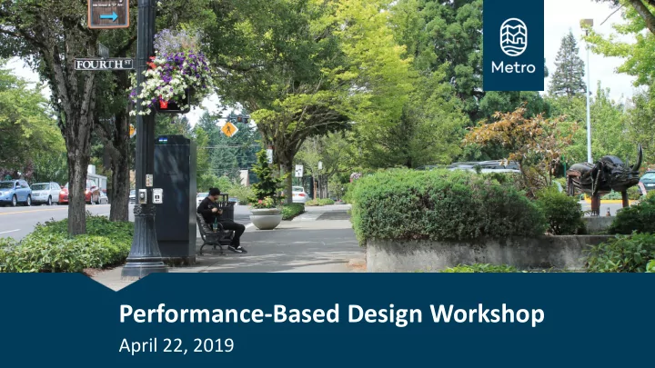
Performance-Based Design Workshop
April 22, 2019
Performance-Based Design Workshop April 22, 2019 Workshop Outline - - PowerPoint PPT Presentation
Performance-Based Design Workshop April 22, 2019 Workshop Outline Welcome and Introductions Overview from Metro Overview of Performance- Based Design and Decision- Making Framework Interactive Session Closing
April 22, 2019
2
3
4
Projects funded with regional funds must use the guidelines and performance-based planning framework
5
6
Regional multimodal transportation facilities and services including the following:
1. Regional System Design 2. Regional Motor Vehicle Network 3. Regional Transit Network 4. Regional Freight Network 5. Regional Bicycle Network 6. Regional Pedestrian Network 7. Regional System Management and Operations/ Demand Management
7
Different designs apply to different classifications
Regional street design classifications dictate how throughways and arterials in the RTP should be designed:
8
Freeway and highway design classifications emphasize long-distance motor-vehicle and high-capacity transit travel, connect major activity centers and are separated from the surrounding land
travel are provided on separate facilities. Freeways are completely grade separated, while highways have some at-grade access and turns.
Shaded areas optional based on available width
9
Regional and community boulevard classifications are applied to roadways within 2040 centers, station communities and to main streets. Boulevards serve major centers of urban activity and emphasize access and mobility for public transportation and people walking and bicycling.
Shaded areas optional based on available width
10
Regional and community street classifications are applied to transit corridors, main streets, industrial and employment areas and neighborhoods with designs that integrate all modes of travel and provide accessible and convenient pedestrian, bicycle and public transportation travel.
Shaded areas optional based on available width
11
Industrial street classifications are applied to roadways that serve intermodal facilities such as airports, and to roadways in industrial and employment areas. Designs primarily serve freight mobility and access while integrating multi-modal travel and access to transit.
Shaded areas optional based on available width
12
& Trails Guide
Decisions
Project Example
13
NACTO, NCHRP, State DOT
14
“ A principles-based approach that looks at the outcomes of design decisions as the primary measure of design effectiveness.”
NCHRP Report 785, Performance-Based Analysis of Geometric Design of Highways and Streets
15
“ A principles-based approach that looks at the outcomes of design decisions as the primary measure of design effectiveness.”
NCHRP Report 785, Performance-Based Analysis of Geometric Design of Highways and Streets
16
17
2019 Metro Designing Livable Streets & Trails Guide 2014 NCHRP Report 785: Performance-based Analysis of Geometric Design of Highways & Streets 2016 AASHTO Standing Committee on Highways Resolution 2018 NCHRP Report 855 2018 AASHTO Green Book, 7th Edition 2019 Green Book, 8th Edition visioning complete
First nationwide best practices guide introduced Refinement of best practices Land use considerations Official adoption by industry leaders MOR MORE FL E FLEXIB EXIBILE, ILE, MUL MULTIMOD TIMODAL AL DESIGN DESIGN PRA PRACTIC CTICES ES Metro adopts Performance- Based Design
18
19
20
21
22
23
– NEW CONSTRUCTION PROJECTS – RECONSTRUCTION PROJECTS – PROJECTS ON EXISTING ROADS
23
24
Based on NCHRP Report 855 Two Rural: Rural and Rural Town Three Urban: Urban, Urban Core and Suburban
24
25
Classification System for Highways and Streets
26
Classification System for Highways and Streets
27
28
– Green Book 8 (GB8) Vision – Potential GB8 Document Framework – Roadmap for Implementation
29
– Input from Outreach Meetings
considerations
– Explicit reference documents
29
30
– Integrating Planning and Design – Understanding the Project Development Process – Document Framework and Design Model
31
– Introduction Chapters – Performance-Based Design Evaluations
– Roadway Planning and Geometric Design – Facility Type
– Activities to advance the GB8 Vision – Identifying partnerships and early adopters
32
33
Achieve Outcomes
decision-making
making framework contributes to systemwide networks and regional outcomes.
clear objectives.
34
1. Purpose and how to use the guidelines 2. Policy framework and desired outcomes 3. Design functions and classifications 4. Design elements, recommendations, considerations 5. Visualizations, street illustrations 6. Performance-based decision making framework
35
36
37
With performance- based design, design elements support street functions to achieve desired
38
39
– Complete street attributes – Economic revitalization
– Accommodating multiple modes; – Illustrating tradeoffs between modes; and – Consider the constrained physical environment.
40
Step 1: Affirm Context and Policy Direction
– Verify that the design is staying true to:
41
– Business community stakeholders – Transit riders, pedestrians and bicyclists – Local residents and existing motorists
– Improve the road user experience – Provide access to road users not previously served – Enhance the economic vitality and activity
– Multimodal Level of Service (MMLOS) – Crash frequency and conflict points – Type and presence of facilities and transit service characteristics – Average travel time
42
Step 2: Assess Existing Conditions and Confirm Functions
– Preparation for the development and evaluation of project alternatives in Steps 3 and 4. – Focused on:
served
43
– Urban arterial – North-south connection between the downtown and university – AADT volume 22,000 vehicles per day – Three different fixed transit routes - 45% of riders within the City – Frequently used by bicyclists – Posted speed on Cascade Avenue is 35 mph
Alternative 1 – Existing Conditions
44
– Initiate the development of design alternatives to address the project need, contribute to systemwide
confirmed in Step 2. – Guidance considers:
45
Regional Design Classifications
<10 foot lanes 10 foot lanes 11 foot lanes 12 foot lanes >12 foot lanes Two-way left-turn lanes Turn lanes at intersections Transit or Business Access/Transit Lanes
Freeways Highways Regional Boulevard Community Boulevard Regional Street Community Street Industrial Street
Preferred condition Typical condition Not a typical/preferred condition Motor Vehicle Travel Lanes
46
Regional Design Classifications
Shared street/ shared lanes* Standard 6' bike lane* Buffered bike lane Separated Bike Lanes (one-way) Separated Bike Lanes (two-way) Multi-use path (shared alignment) Parallel facility (path or street)
Freeways Highways Regional Boulevard Community Boulevard Regional Street Community Street Industrial Street
Preferred condition Potential condition Not a preferred condition Bicycle Facility
47
Regional Design Classifications
Exclusive Transitways Transit-only Lanes Peak-Hour Transit-only Lanes Transit Approach Lane Queue Jumps Transit Signal Priority Signal Progression
Freeways Highways Regional Boulevard Community Boulevard Regional Street Community Street Industrial Street
Preferred condition Potential condition Not a preferred condition Transit Priority Treatment
48
influence the performance measures
– Lane width – Number of automobile through lanes – Bicycle facility presence and type – Sidewalk width – Landscaped buffer between sidewalk and travel lanes – On-street parking – Bus only lanes – Central roadway median
49
– More pedestrian space – Removal of on-street parking
– Allocating lanes for specific modes – Transit-only lane – Providing bicycle lanes and wider sidewalks for pedestrians – Including a central landscaped median
50
Alternative 1 – Existing Conditions Alternative 2 – Transit Oriented
51
Alternative 3 – Bicycle and Pedestrian Oriented Alternative 4 – Hybrid of Transit, Pedestrian and Bicycle
52
– Use a performance-based analysis to evaluate the alternatives developed in Step 3 and using the performance measures selected in Step 2.
53
– Within the existing 82 feet of right-of-way width – Require changing the existing curb locations – Reduce the capacity for automobiles – Remove on-street parking – Increase sidewalk width for pedestrians
54
– Amount of space designated for bicyclists – Presence of a central median – Presence of a physical buffer for pedestrians and bicyclists from autos – Type of space allocated for transit vehicles
55
– Evaluation resources
55
56
Performance Evaluation Results
Alternative Safety Mobility: Average Travel Time (min) Reliability: Variation in Travel Time Accessibility Quality of Service: MMLOS #1 – Existing Condition Pedestrian Low
D Bicycle Low
F Transit Low 4.43 3.68 to 5.26 Moderate D Auto Low 2.67 2.42 to 3.17 High A #2 – Transit Oriented Pedestrian High
C Bicycle Moderate
E Transit High 4.40 3.68 to 4.76 High B Auto High 3.43 3.35 to 3.60 Low C #3 – Bicycle and Pedestrian Oriented Pedestrian High
B Bicycle High
C Transit High 4.80 3.97 to 6.00 Moderate D Auto High 4.80 3.80 to 6.10 Low D #4 – Hybrid of Transit, Bicycle and Pedestrian Pedestrian Low
C Bicycle Moderate
D Transit Moderate 4.38 3.65 to 4.78 High B Auto Low 3.45 3.32 to 3.56 Low C
57
– Identify the planning level cost of each alternative
Alternative Cost per Mile Alternative #1 – Existing Condition $0 Alternative #2 – Transit Oriented $1.4 million Alternative #3 – Bicycle and Pedestrian Oriented $1.6 million Alternative #4 – Hybrid of Transit, Bicycle and Pedestrian $1.0 million
58
– Provides guidance on how to refine design decisions for one or more alternatives to lead to selection and development of a preferred design concept in Step 6. – Draw on the alternatives evaluation from Step 4 to further refine the design of one
59
Alternative 2 – Transit Oriented Alternative 3 – Bicycle and Pedestrian Oriented Alternative 4 – Hybrid of Transit, Pedestrian and Bicycle
60
61
– Provides improved safety, reliability, access, and quality of service for transit riders, pedestrians and bicyclists.
– City plans to integrate Alternative 3 attributes into Alternative 2
Alternative 2 – Transit Oriented
62
– Developed based on the preferred design concept. – The final design and implementation should serve the identified functions, contribute to systemwide networks and further regional
63
– The project is constructed and becomes part of the transportation system. – Operations and maintenance are key aspects of ensuring that the street serves the intended functions. – A performance evaluation and ongoing monitoring following construction can help contribute to best practices for future projects.
64
65
Now it’s your turn!
NE 102nd Avenue Corridor April 22, 2019
67
– Reduce deadly and serious injury crashes for all people, using all modes
– Slow motor vehicle operating speeds – Provide safe access and crossings for people riding bicycles and walking and taking transit
102nd Avenue Safety Project
68
– City jurisdiction over half of 102nd, Fremont to Prescott
– Critical project area at Sandy Blvd is owned by ODOT
– Owned by ODOT – Maintained by PBOT
102nd Avenue Corridor
Corridor length: 1.75 miles Speed limit : 35 mph
102nd Avenue Corridor
existing crossing meets standards existing crossing does not meet standards existing signal
102nd Avenue Corridor
5 37 159 153
Crash Severity
Injury "A" (Severe) Injury "B" Injury "C" Property Damage Only
Total Crashes: 354 Pedestrian Crashes: 9 Bicycle Crashes: 9
102nd Avenue Corridor 20 40 60 80 100 120
Reckless Inattention Too Fast Improper Turn Failure to Avoid Vehicle Ahead Improper Lane Change Other Disregarded Signal or Traffic Control Too Close Failure to Yield Number of Crashes
102nd Avenue Safety Project
102nd Avenue Corridor
20 40 60 80 100 120 Sandy Prescott Fremont Weidler Halsey Bikes Pedestrians
102nd Avenue Corridor
200 400 600 800 1000
Vehicles per Hour
NE Sacramento Street Daily Volume Profile
Northbound Southbound 200 400 600 800 1000
Vehicles per Hour
NE Shaver Street Daily Volume Profile
Northbound Southbound 102nd Avenue Corridor
500 1000 1500 2000 2500 3000
1-26 27-29 30-32 33-35 36-38 39-41 42-44 45-47 48-50 51-53 54-56 57-59 Number of Vehicles in One Day Speed in MPH
Posted Speed: 35 mph Average Speed: 36 mph 85th Percentile Speed: 40 mph % Above Speed Limit: 55.2% % 10mph Over: 2.2%
102nd Avenue Corridor
Speed limit
500 1000 1500 2000 2500 3000
1-26 27-29 30-32 33-35 36-38 39-41 42-44 45-47 48-50 51-53 54-56 57-59 60-999
Number of Vehicles in One Day Speed in MPH
Posted Speed: 35 mph Average Speed: 37 mph 85th Percentile Speed: 42 mph % Above Speed Limit: 63.1% % 10mph Over: 5.2%
102nd Avenue Corridor
Speed limit
NE 102nd Avenue Corridor
81
– Who are you trying to serve? – What are you trying to achieve?
– What are the options? And compromises?
– How would you allocate the space?
– Did you document your design decisions?
Small Group Debrief
NE 102nd Avenue Corridor
Closing Remarks
NE 102nd Avenue Corridor