
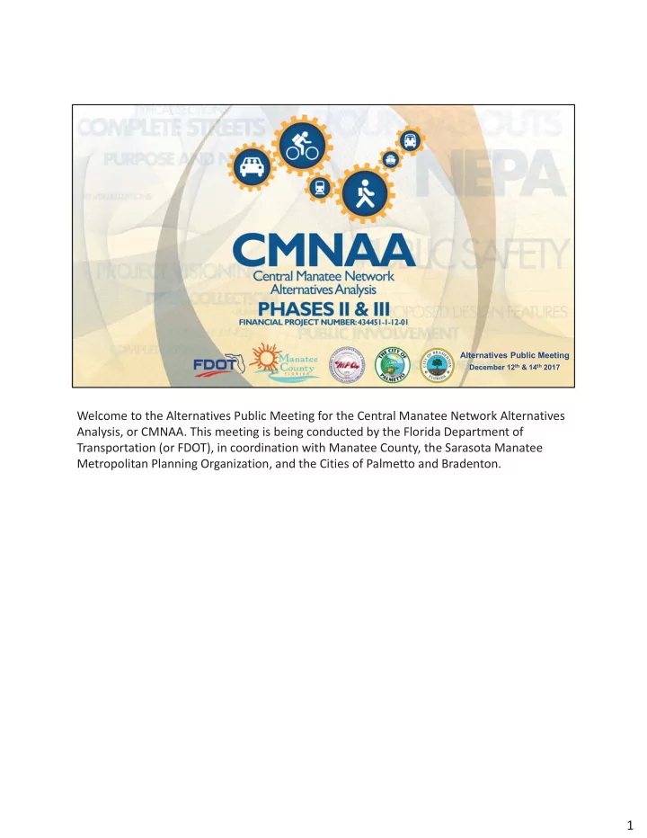
SLIDE 1
Northe rn limit: 17 th Stre e t We st E - - PDF document
17th Stre e t We st
E a ste rn limit:
E lle nto n Gille tte Ro a d
Southe rn limit:
17th Ave nue We st
We ste rn limit:
26th Stre e t We st Ma na te e County City of Pa lme tto City of Bra de nton
Co nsiste nt with future visio n F
E
nha nc e c o mmunity c o he sio n
Short- te rm proje c ts
5-10 ye a rs
Mid- te rm proje c ts
10-15 ye a rs
L
15+ ye a rs
“L
ruit”
0-5 ye a rs
pra c tic a l / imple me nta b le so lutio ns
I de ntify a nd unde rsta nd the issue s De ve lo p a nd e va lua te pro je c t a lte rna tive s
With input fro m the pub lic & sta ke ho lde rs
I de ntify ne xt ste ps (a dditio na l study, o r de sig n) T iming is de pe nde nt o n a va ila b le funding
De sign Right-of-Way (if ne e de d) Constr uc tion PD&E Study (if r e quir e d) Planning
Unde rsta nding c urre nt ope ra tions & c ong e stion
US 41/ 301 (T a mia mi T ra il): Sig na l pha sing re duc tion, a dde d north- south throug h c a pa c ity, othe r minor c ha ng e s
BUS 41: Re duc e sig na l pha se a nd provide a dditiona l northbound c a pa c ity
with 2017 Ve hic le Volume s E xisting Roa dwa y Ne twor k (in hr s) Short- te rm Impr
(in hr s) Impr
% from E xisting AM Pe a k Hour (from 7 to 8)
182 116 36%
PM Pe a k Hour (from 5 to 6)
221 125 43%
pa tte rns a nd future g ro wth Pro viding fo r future tra ve l se rvic e ne e ds Pro viding c o nsiste nc y with the Co mmunity Visio n
44,000 E xisting F uture Ye a r 2040 35,000
102,000 64,500
* Assume s De soto Bridg e is re pla c e d with a ne w 6- la ne bridg e .
11% 16% 8% 9% 15% L e g e nd
Gre e n Bridg e De so to Bridg e Po int o f Orig in
5% 5% 8%
Ke y T a ke a wa ys
is ne a rly do ub le tra ffic to / fro m I-75 no rth.
Gre e n Bridg e
<1% <1% 5% 2% 2% 10% 22% 6% 2% 5% 2% 2%
de ntify c o rrido rs
Mo de l a lte rna tive s
I de ntify pro je c te d trips fo r e a c h a lte rna tive De te rmine ne two rk c o nne c tio ns E va lua te a ffe c ts o n the o ve ra ll ne two rk
Asse ss ne two rk b e ne fits suc h a s re lie f
to Gre e n & De so to Bridg e s
50 - 70’ E xisting Width
4- la ne Wide ning Conc e pt (9th,15th, or 27th Stre e t E )
Conc e ptua liza tion of Comple te Stre e ts a pproa c h w/ buffe re d bic yc le la ne s a nd side wa lks
32,000 – 36,000 da ily ve hic le s in 2040 with 3rd bridg e 8,000 to 12,000 da ily ve hic le s toda y
9th,15th, or 27th Stre e t E Corridors
T wo- la ne pa rkwa y style loc a l stre e t with e le va te d throug hwa y to se pa ra te re g iona l tra ffic
50 - 70’ E xisting Width 76’ Re q uire d Width
in 2040 a t g round le ve l 48,000 to 64,000 da ily ve hic le s in 2040 on e le va te d throug hwa y
15th Stre e t E
de ntify c o rrido rs
Mo de l a lte rna tive s
I de ntify pro je c te d trips fo r e a c h a lte rna tive De te rmine ne two rk c o nne c tio ns E va lua te a ffe c ts o n the o ve ra ll ne two rk
Asse ss ne two rk b e ne fits suc h a s re lie f
to Gre e n & De so to Bridg e s
Ne w c a pa c ity a c ro ss Ma na te e Rive r
in e xisting De so to c o rrido r
I nste a d o f a ne w c ro ssing to the e a st
9th Stre e t E 15th Stre e t E 27th Stre e t E Improve me nts At- Gra de Only Improve me nts At- Gra de with a n E le va te d T hroug hwa y
1st Stre e t / US 41 / 301 / T a mia mi T ra il
L
1st Stre e t / US 41 / 301 / T a mia mi T ra il
L
63,000 2040 Da ily T ra ffic De ma nd (On E le va te d T hroug hwa y)
72,000 2040 Da ily T ra ffic De ma nd 11% more tha n toda y’s tra ffic of 65,000
De soto Bridg e
Bridg e Inte g ra tion with Southbound loc a l la ne s on Pa lme tto Ca use wa y
a nd e nviro nme nta l e ffe c ts o f e a c h a lte rna tive
Co nside r input re c e ive d
lo c a l a nd re g io na l a g e nc y pa rtne rs pub lic a nd e le c te d o ffic ia ls c itize ns a nd o the r inte re ste d pa rtie s Pub lic Me e ting fe e db a c k
I
de ntify via b le a lte rna tive s to a dva nc e in the pla nning pro c e ss
iming / Ava ila ble F unding
tha t inc lude :
Pe de stria n Bic yc le Auto T ra nsit
Ba la nc e mo b ility ne e ds o f a ll use rs with lo ng -te rm visio n o f the surro unding c o mmunitie s E mpha sis o n sa fe ty
Sig na l e nha nc e me nts Bic yc le / pe de stria n impro ve me nts
Pe de stria n c ro ssing s Ne w side wa lks ADA impro ve me nts Bic yc le fa c ilitie s
L ig hting Dra ina g e L a ndsc a ping Po te ntia l la ne re duc tio n Re striping to a dd turn la ne s o r a djust la ne widths Sig ht dista nc e impro ve me nts
ra nsfe r Sta tio n e xpa nsio n
de ntify via b le a lte rna tive s & stra te g ie s to a dva nc e Summa rize a ntic ipa te d funding ne e ds / prio ritie s I de ntify funding so urc e s / pa rtne r a g e nc y c o mmitme nts Summa rize b y time fra me s, le a d a g e nc ie s