National Weather Service Central Pacific Hurricane Center Honolulu, - - PowerPoint PPT Presentation

national weather service central pacific hurricane center
SMART_READER_LITE
LIVE PREVIEW

National Weather Service Central Pacific Hurricane Center Honolulu, - - PowerPoint PPT Presentation

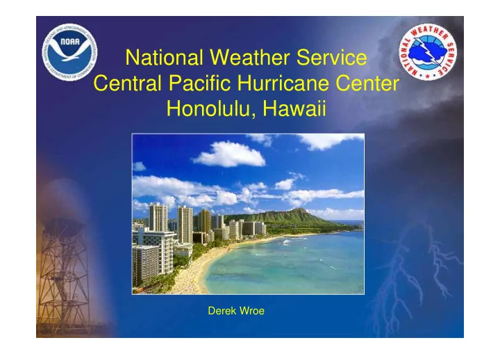
National Weather Service Central Pacific Hurricane Center Honolulu, Hawaii Derek Wroe Area of Responsibility CPHC (RSMC) Aviation (SI GMET) High Seas Central Pacific Tropical Cyclone Climatology Season: June 1 to November 30


slide-1
SLIDE 1

National Weather Service Central Pacific Hurricane Center Honolulu, Hawaii

Derek Wroe

slide-2
SLIDE 2

Area of Responsibility

CPHC (RSMC) Aviation (SI GMET) High Seas

slide-3
SLIDE 3

Central Pacific Tropical Cyclone Climatology

  • Season: June 1 to November 30
  • Central Pacific Average per Year
  • 4 - 5 Tropical Cyclones
  • 1 - 2 Hurricanes
  • 1 - 2 Tropical Storms
  • 1 - 2 Tropical Depressions
slide-4
SLIDE 4

CPHC Staff

  • 20 Meteorologists

– 5 Hurricane Specialists

  • 4 Management Meteorologists

– Proficient in tropical cyclone forecasting

  • Operate 24 hours a day, 7 days a week

– 4 meteorologists on duty

  • Backup for National Hurricane Center in the

eastern Pacific east of 140W

slide-5
SLIDE 5

Dvorak Technique: An Introduction

Derek Wroe Hurricane Specialist Central Pacific Hurricane Center

Acknowledgements: Jack Bevin, National Hurricane Center Peter Donaldson, Central Pacific Hurricane Center Robert Ballard, Central Pacific Hurricane Center

slide-6
SLIDE 6

What the Dvorak Technique Is

  • An empirical method for estimating the intensity
  • f a tropical cyclone from visible and infrared

satellite imagery

  • Based on a “measurement” of the cyclone’s

convective cloud pattern and a set of rules

slide-7
SLIDE 7

What the Dvorak Technique Is Not

  • A direct measurement of wind, pressure, or any
  • ther meteorological variable associated with a

tropical cyclone!

  • A replacement for in situ measurements of a tropical

cyclone

slide-8
SLIDE 8

Dvorak Technique Premise

  • Tropical cyclones have characteristic evolutions of cloud

patterns that correspond to stages of development and certain intensities

  • The technique was not designed to be used with high

resolution or short interval data

  • If you are trying to analyze features only apparent on high

resolution or short interval data you are probably on the wrong track

slide-9
SLIDE 9

Dvorak Technique Essential Output

  • Estimated location of the

tropical cyclone center

  • Estimated tropical cyclone

intensity (CI)

– Maximum sustained wind speed (MSW)

CI MSW (kt)

1.0 25 1.5 25 2.0 30 2.5 35 3.0 45 3.5 55 4.0 65 4.5 77 5.0 90 5.5 102 6.0 115 6.5 127 7.0 140 7.5 155 8.0 170

slide-10
SLIDE 10

Dvorak Technique History & Accuracy

  • Developed in 1970s and 1980s
  • Verification:

– 85% of MSW estimates within ~10 kt

  • f reconnaissance

– 50% of MSW estimates within 5 kt of reconnaissance (Brown and Franklin, 2004)

  • Still an essential tool today!

CI MSW (kt)

1.0 25 1.5 25 2.0 30 2.5 35 3.0 45 3.5 55 4.0 65 4.5 77 5.0 90 5.5 102 6.0 115 6.5 127 7.0 140 7.5 155 8.0 170

slide-11
SLIDE 11

Definitions

  • Data T (DT):

Intensity estimate based only

  • n measurements of satellite

imagery

  • Model T (MET):

Intensity estimate based only

  • n 24 hour comparisons
  • Pattern T (PAT):

Intensity estimate based on general cloud pattern

  • Final T (FT):

Intensity estimate based on DT, MET, or PAT

  • Current

Intensity estimate based on FT Intensity (CI):

slide-12
SLIDE 12

Initial Dvorak Fix

  • Earliest signs of development are typically observed 1 to

1.5 days before disturbance reaches tropical storm intensity

  • Initial Dvorak fix conducted when a cluster of convective

clouds showing curvature has three properties:

  • 1. System has persisted for 12 hours or more
  • 2. System center defined in area 2.5º latitude or less which

has persisted for 6 hours

  • 3. System possesses an area of dense, cold overcast less

than 2º from the center

slide-13
SLIDE 13

Dvorak Technique Cloud Patterns

  • Curved Band (VIS and IR)
  • Shear (VIS and IR)
  • Eye (VIS and IR)
  • Central Dense Overcast (VIS)
  • Embedded Center (IR)
  • Central Cold Cover (VIS and IR)
slide-14
SLIDE 14

Dvorak Technique Cloud Patterns

  • Curved Band (VIS and IR)
slide-15
SLIDE 15

Dvorak Technique Cloud Patterns

  • Shear (VIS and IR)
slide-16
SLIDE 16

Dvorak Technique Cloud Patterns

  • Eye (VIS and IR)
slide-17
SLIDE 17

Dvorak Technique Cloud Patterns

  • Central Dense Overcast (VIS)
slide-18
SLIDE 18

Dvorak Technique Cloud Patterns

  • Embedded Center (IR)
slide-19
SLIDE 19

Dvorak Technique Flowchart

  • The Dvorak Technique

possesses a clear set

  • f rules
  • Most rules needed for

a complete analysis are stated on the flowcharts

  • There are two

flowcharts, one each for visible and infrared imagery

slide-20
SLIDE 20

Dvorak Technique Flowchart

  • Step 1: Locate the

cloud system center

slide-21
SLIDE 21

Dvorak Technique Flowchart

  • Step 2: Determine DT

by analyzing the intensity using satellite based measurements

slide-22
SLIDE 22

Dvorak Technique Flowchart

  • Step 4: Determine

intensity change in the past 24 hours in order to:

  • Step 5: Determine

MET

slide-23
SLIDE 23

Dvorak Technique Flowchart

  • Step 6: Determine

PAT

slide-24
SLIDE 24

Dvorak Technique Flowchart

  • Step 7: Determine FT

from either the DT, MET, or PAT

  • Step 8: Consider

constraints to FT and make any needed adjustments

slide-25
SLIDE 25

Dvorak Technique Flowchart

  • Step 9: Determine CI

based on FT

slide-26
SLIDE 26

Dvorak Technique Flowchart

  • Step 1: Locate the

cloud system center

slide-27
SLIDE 27

Step 1 - Locate the Cloud System Center

  • Locate the Overall Pattern Center
  • Examine for Small Scale Features
  • Compare Center with Previous Pattern Center
  • Compare Center Location with Forecast
  • Make Final Center Adjustments
  • Looking for Lowest Possible Center
  • Tip: imagery animation is crucial
slide-28
SLIDE 28

Step 1 - Locate the Cloud System Center

  • Locate the Overall Pattern Center
  • Examine for Small Scale Features
  • Compare Center with Previous Pattern Center
  • Compare Center Location with Forecast
  • Make Final Center Adjustments
  • Looking for Lowest Possible Center
  • Tip: imagery animation is crucial
slide-29
SLIDE 29

Step 1 - Locate the Cloud System Center

  • Locate the Overall Pattern Center
slide-30
SLIDE 30

Step 1 - Locate the Cloud System Center

  • Locate the Overall Pattern Center
  • Examine for Small Scale Features
  • Compare Center with Previous Pattern Center
  • Compare Center Location with Forecast
  • Make Final Center Adjustments
  • Looking for Lowest Possible Center
  • Tip: imagery animation is crucial
slide-31
SLIDE 31

Step 1 - Locate the Cloud System Center

  • Examine for Small Scale Features

– Indications of an eye – Low level cloud line curvature – Cloud line mergence – Cloud minimum areas – Middle of upper level cloud features such as band curvature and cumulonimbus tops

slide-32
SLIDE 32

Step 1 - Locate the Cloud System Center: Curved Band

  • Draw line from dry slot tip (B) to end of curved band (A)
  • Overall center at line mid point
  • Confidence is inversely proportional to line length
slide-33
SLIDE 33

Step 1 - Locate the Cloud System Center: Curved Band

slide-34
SLIDE 34

Step 1 - Locate the Cloud System Center: Shear Pattern

  • Examine for Small Scale Features
  • Shear patterns can pose

a significant center finding challenge, especially at night

slide-35
SLIDE 35

Step 1 - Locate the Cloud System Center: Eye Pattern

  • Examine for Small Scale Features
  • Eye patterns typically

pose less center finding challenge

slide-36
SLIDE 36

Step 1 - Locate the Cloud System Center: Embedded Center & CDO Patterns

  • Examine for Small Scale Features
  • Embedded center

and CDO patterns

  • ften pose a center

finding challenge

slide-37
SLIDE 37

Step 1 - Locate the Cloud System Center

  • Locate the Overall Pattern Center
  • Examine for Small Scale Features
  • Compare Center with Previous Pattern Center
  • Compare Center Location with Forecast
  • Make Final Center Adjustments
  • Looking for Lowest Possible Center
  • Tip: imagery animation is crucial
slide-38
SLIDE 38

Step 1 - Locate the Cloud System Center

  • Compare Center with Previous Pattern Center

– Track center features from prior images – Best done with animation

slide-39
SLIDE 39

Step 1 - Locate the Cloud System Center

  • Locate the Overall Pattern Center
  • Examine for Small Scale Features
  • Compare Center with Previous Pattern Center
  • Compare Center Location with Forecast
  • Make Final Center Adjustments
  • Looking for Lowest Possible Center
  • Tip: imagery animation is crucial
slide-40
SLIDE 40

Step 1 - Locate the Cloud System Center

  • Compare Center Location with Forecast

– w is evening psn – Vertical wind shear about to develop – x is extrap 6 hr psn – y is extrap 12 hr psn – Analyst chose center at arrow, following cloud curvature

slide-41
SLIDE 41

Step 1 - Locate the Cloud System Center

  • Compare Center Location with Forecast

– In 18 hrs, system center moved from point w to point z – Sunrise surprise!

slide-42
SLIDE 42

Step 1 - Locate the Cloud System Center

  • Locate the Overall Pattern Center
  • Examine for Small Scale Features
  • Compare Center with Previous Pattern Center
  • Compare Center Location with Forecast
  • Make Final Center Adjustments
  • Looking for Lowest Possible Center
  • Tip: imagery animation is crucial
slide-43
SLIDE 43

Dvorak Technique Flowchart

  • Step 2: Determine DT

by analyzing the intensity using satellite based measurements

slide-44
SLIDE 44

Step 2 – Measure to Find DT

  • Select cloud pattern type
  • Measure cloud features that relate to intensity

to obtain DT

  • If cloud patterns show no resemblance to

patterns, proceed to rarely used Step 3: Central Cold Cover

  • Note: DT does not necessarily give the final

intensity estimate!

slide-45
SLIDE 45

Step 2 – Measure to Find DT: Curved Band

  • Most common pattern
  • Curved band axis parallel

to inner edge of band

  • Measure amount of

curvature

  • Can average images
slide-46
SLIDE 46

Step 2 – Measure to Find DT: Shear Pattern

  • For less than typhoon

intensity

  • Factors:

– Definition of center – Distance between center and dense overcast

  • Easier with VIS
slide-47
SLIDE 47

Step 2 – Measure to Find DT: Eye Pattern

  • Most complex
  • Must make several measurements and adjustments
  • Add banding feature for VIS or eye adjustment for IR

WMG OW DG MG LG B W OW

  • 0.5

DG

  • 0.5

MG

  • 0.5
  • 0.5

LG

+0.5

  • 0.5
  • 0.5

B

+1.0 +0.5

  • 0.5
  • 0.5

W

+1.0 +0.5 +0.5

  • 1.0
  • 1.0

CMG

+1.0 +0.5 +0.5

  • 0.5
  • 1.0
  • Surr. Ring Temp

Eye Temperature

slide-48
SLIDE 48

Step 2 – Measure to Find DT: Central Dense Overcast

  • VIS only
  • Measure size and definition of CDO
  • Add banding feature
slide-49
SLIDE 49

Step 2 – Measure to Find DT: Embedded Center

  • IR only
  • For strong TS or typhoon
  • Determine coldest overcast

that center is embedded within a required distance

  • Can add banding feature
  • Highly sensitive to center

position!

slide-50
SLIDE 50

Dvorak Technique Flowchart Steps 4 – 6: Model Comparisons

  • Step 4: Determine

intensity change in the past 24 hours in order to:

  • Step 5: Determine

MET

  • Step 6: Determine

PAT

  • Many errors made

here!

slide-51
SLIDE 51

Step 4 – Determine Intensity Trend

  • Compare cloud pattern now to 24 hours prior
  • Determine if system has developed (D), weakened (W), or

remained steady state (S)

  • Development (D):

– Increased dense overcast around center – Increased center definition

slide-52
SLIDE 52

Step 4 – Determine Intensity Trend

slide-53
SLIDE 53

Step 5 – Determine MET

  • Add or subtract trend obtained in Step 4 from the

24 hour old FT

  • For normal Development or Weakening:

– MET= 24 hr old FT ± 1.0

  • For rapid Development (D+) or Weakening (W+):

– MET= 24 hr old FT ± 1.5

  • For slow Development (D-) or Weakening (W-):

– MET= 24 hr old FT ± 0.5

  • For a Steady State (S) trend:

– MET = the 24 hr old FT

slide-54
SLIDE 54

Step 6 – Determine PAT

  • PAT is an adjustment to MET
  • PAT = MET or MET ± 0.5
  • If PAT ≠ MET ± 0.5, adjust MET by 0.5, if possible
  • Many errors made here!
slide-55
SLIDE 55

Dvorak Technique Flowchart Step 7 – 9: FT & CI

  • Step 7: Determine FT

from either the DT, MET, or PAT

  • Step 8: Consider

constraints to FT and make any needed adjustments

  • Step 9: Determine CI

based on FT

slide-56
SLIDE 56

Step 7 - Determine FT

  • Use DT when cloud features are clear cut
  • Use PAT when DT is not clear cut and MET was

adjusted

  • Otherwise, use MET
  • Rule underscores need for good MET & PAT!
slide-57
SLIDE 57

Step 8 - FT Constraints

  • These include the constraints that are, at times, broken

in special cases

  • If constraints are broken, explain why to colleagues
  • If necessary, go back and

conduct a reanalysis…You may not be breaking constraints after all!

  • Dvorak encourages

reanalysis as a routine

slide-58
SLIDE 58

Step 9 – Determine CI

  • For developing cloud patterns:

– CI = FT

  • For weakening cloud patterns:

– For initial weakening in first 12 hours, hold CI same – Beyond 12 hours, CI remains 0.5 to 1.0 higher than FT

  • For redevelopment:

– CI remains same until FT rises to CI

CI MSW (kt)

1.0 25 1.5 25 2.0 30 2.5 35 3.0 45 3.5 55 4.0 65 4.5 77 5.0 90 5.5 102 6.0 115 6.5 127 7.0 140 7.5 155 8.0 170

slide-59
SLIDE 59

Reanalysis

  • 24 hrs after initial fix, FT must be ≤ 2.5. If not, you

might want to consider a reanalysis

  • Doing a reanalysis can help get better results

down the road (what you do now can affect the 3rd, 4th, 5th, etc fix) – You may not be breaking constraints on the 4th fix after all!

  • Some systems legitimately break constraints
  • Reanalysis should be a routine consideration
slide-60
SLIDE 60

Dvorak Technique Error Reduction

  • Follow the rules!
  • A good MET & PAT are important
  • Reanalysis is usually a better option than

breaking constraints

  • Communicate reasoning for reanalysis or

breaking constraints

slide-61
SLIDE 61

Summary

  • The Dvorak Technique is a time-tested method

employing geostationary imagery

  • Output: center position and intensity
  • Intensity estimates proven to be reliable
  • Follow the rules on the flowchart
  • Do not fear a reanalysis
  • Even if your agency does provide intensity

estimates, the center finding guidance is essential

slide-62
SLIDE 62

Questions?

Derek Wroe derek.wroe@noaa.gov