SLIDE 1 1
Capital Projects Update:
- N. Lynn Street Esplanade and
Custis Trail Improvements
100% Engineering Design - Progress Report –September 2016
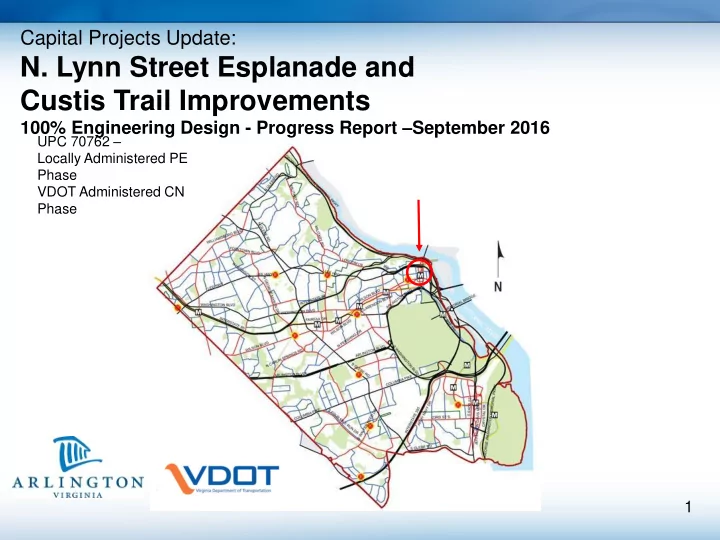
UPC 70762 – Locally Administered PE Phase VDOT Administered CN Phase
SLIDE 2 2
The Lynn Street Esplanade and Custis Trail Improvements project is a pedestrian and bicycle safety, traffic management and street beautification initiative located in Rosslyn. The project incorporates findings from the 1999 Esplanade Study, the 2003 Rosslyn Circle Safety Study and the 2006 Lynn Street Esplanade Preliminary Design Study.
(A) Lynn Street Esplanade: North Lynn Street from eastbound Lee Highway to westbound Lee Highway (B) Custis Trail: Westbound Lee Highway from
- N. Lynn Street to N. Oak Street.
Project Overview
SLIDE 3
3
Project Location:
(A) Lynn Street Esplanade: North Lynn Street from eastbound Lee Highway to westbound Lee Highway (B) Custis Trail: westbound Lee Highway from N. Lynn Street to N. Oak Street.
B A
SLIDE 4
4
Project Location Street View:
(A) Lynn Street Esplanade: North Lynn Street from eastbound Lee Highway to westbound Lee Highway
SLIDE 5
5
Project Location Street View:
(B) Custis Trail: westbound Lee Highway from N. Lynn Street to N. Oak Street.
SLIDE 6 6
The Lynn Street Esplanade (A) Project area includes:
- Widened sidewalks and larger pedestrian and
bike waiting areas
- 11’ traffic lanes
- Upgraded traffic signals and new signage
- On-street 6’ bike lane on Lynn Street
- Upgraded street lights
- “Corridor of Light” public art elements at the four
corners of the I-66 bridge
- Ornamental fencing
- Landscaping
(A) Lynn Street Esplanade (B) Custis Trail
SLIDE 7 7
- N. Lynn Street Bridge Improvements (A)
Gateway Park EB Lee Highway
SLIDE 8
8
East side of Lynn Street Improvements (A)
Plan and profile showing new crash barrier, custom fence, 20’ wide sidewalk and integrated sculptures
SLIDE 9
9
East side Lynn Street (B) NE Corner Luminous Body Foundation and Lighting
SLIDE 10
10
West Side Lynn Street / Gateway Park (A)
Plan and Profile Graphics
SLIDE 11
11
Sculpture Locations:
SLIDE 12
12
East side Lynn Street
Southeast corner of Lynn and Lee Highway
SLIDE 13
13
Public Art - Day View
SLIDE 14
14
Public Art - Night View
SLIDE 15
15
Semi-Custom Fence
Full size mock-up
SLIDE 16 16
Custis Trail Improvements (B) Project area includes:
- Bicycle and pedestrian facility upgrades
- Intersection improvement at Lee Highway and
- N. Lynn Street
- Trail widening to 16’
- Increased trail separation from traffic
- Westbound lane reduction from Ft. Myer to N.
Oak Street
- Curb extensions and wider curb ramps
- New traffic and dedicated bike signals
- New streetlights on both sides of westbound Lee
Highway
(A) Lynn Street Esplanade (B) Custis Trail
SLIDE 17 17
- Planned 16’ wide trail with 6-foot buffer (existing 10’ & 3’buffer)
- VDOT approved lane reduction on westbound Lee Highway provides
space for wider trail and improved sight distances
- Improved pedestrian queuing areas at street crosswalks
- Upgraded traffic and trail signals at major intersections
Overview - Custis Trail and Westbound Lee Highway Improvements (B)
- N. Oak Street to N. Lynn Street
SLIDE 18 18
- Reduced crossing distances
- New traffic and trail signals
- Larger trail queuing areas
- Barrier removed for
Improved visibility of trail users
- Tighter corners to slow traffic
in pedestrian areas
Custis Trail at N. Lynn Street (B)
SLIDE 19
19
Custis Trail at Fort Myer Drive (B)
Dashed lines show existing curb location
SLIDE 20 20
.
Custis Trail at Marriot Entrance (B)
- N. Nash Street and Marriot Entrance
SLIDE 21
21
36’ 3’ 10’ Existing Custis Trail – N. Fort Myer Drive to N. Oak Street (B)
SLIDE 22
22
Approved Lane Reduction – N. Fort Myer Drive to N. Oak Street (B)
SLIDE 23
23
Custis Trail – Existing Marriott Entrance
Custis Trail and Westbound Lee Highway
SLIDE 24
24
Proposed better visibility around columns.
Custis Trail and Westbound Lee Highway
SLIDE 25 25
Project Status
Changes to the Construction Phase VDOT has offered to transition the construction phase of work from Arlington to VDOT. County staff has reviewed this option and has identified multiple reasons this would be in the best interest of the County:
- VDOT has greater construction management capacity for projects of this scale
- Structural modifications to the VDOT bridge over I-66 are part of their work
- All work is being performed in VDOT right of way
- Risk management related to proximity to I-66 tunnel is conveyed to VDOT
Upcoming Major Milestones: Updated plans and submit for final VDOT approval Fall 2016 Washington Gas utility relocations Fall 2016 Dominion Power Undergrounding Spring 2016
SLIDE 26 26
Project Schedule
Schedule: Planned Dates Completion Date 1 Value Engineering Report Finalized. 6/1/2016 2 Update Plans and Submit to VDOT 6/2/2016 - 8/1/2016 08/09/16 3 VDOT Review (30 days) 8/2/2016 - 9/2/2016 09/09/16 4 VDOT Risk Assessment 9/15/2016 8/30/16 5 Address VDOT comments, RA recommendations, & resubmit for PAC Review. 9/02/2016 – 9/22/2016 9/19/16 6 VDOT Pre Advertisement Conference (PAC)Meeting 9/22/2016 9/22/16 7 Address PAC Comments 9/23/2016 – 12/23/2016 working 8 Submit Package to VDOT Central Office for comments / approval 01/01/2017 – 2/01/16 9 Washington Gas Relocation Complete By 12/1/16 10 DVP Utility Relocations Complete 3/01/2017 11 Project Advertisement 04/01/2017 Construction Award 07/01/17 Construction Start Spring 2018 Construction Complete Fall 2019 (18 mo duration)
SLIDE 27 27
For More Information Visit our project webpage:
projects.arlingtonva.us/projects/lynn-street-esplanade-custis-trail-improvements/ Thank you!
End of Presentation
SLIDE 28 28
Public Process
- 2005 - Project initiated and formally scoped. Staff
engaged the Rosslyn Renaissance throughout conceptual design, environmental analysis and 25% engineering phases of work.
- 2006 - Public meetings held and information provided to
residents and businesses. Post Willingness / Public Hearing Requirements met
- 2008 - RFP for full engineering design awarded, which
included pubic outreach elements.
- 2012 - 50% conceptual design presented to the public and
- VDOT. County staff solicited feedback.
- 2013 to 2015 - Meetings with the Rosslyn Renaissance
and the Rosslyn community.
- Spring 2016 – Project update with stakeholders and the
community groups scheduled with the Rosslyn Renaissance.
Luminous Bodies Public Art - Day View
SLIDE 29 29
2/1999 CB appropriates $50K of the Rosslyn Fund to prepare a study for Improvements to Rosslyn. 8/1999 The original Rosslyn Esplanade Study completed – Simple concepts show ways to better link Rosslyn with the Potomac River. Study presented to the public and the Waterview SP committee. 7/2000 CB approves Waterview SP#25. $3.6M for the development of two offsite projects:
- Improvements at 19th and Kent Street
- Improvements to N. Lynn Street
2/2002 Rosslyn Circle Safety Study Ph I, completed and presented to the Pedestrian Advisory Committee. 8/2003 Rosslyn Circle Safety Study Phase II completed. Explored additional bike and pedestrian options around Rosslyn Circle and along the Custis Trail. 12/2004 Planning work starts for19th and Kent Street Improvements. 2/2005 Engineering design starts for 19th and Kent Street. 6/2005 I-66 Entry Ramp Study completed 11/2005 CB approves Contract with Toole Design Group for Lynn Street Planning and Environmental Services. Project stakeholders include VDOT, NPS, Civic Associations and Rosslyn Renaissance. 3/2006 JBG Public Arts contribution linked to the Lynn Street project. 4/2006 Lynn Street design charrette completed 7/2006 NEPA / Environmental Assessment completed.
Project History
SLIDE 30 30
4/2006 Lynn Street public engagement / design charrette completed. 2/2007 Lynn Street Esplanade Planning / Conceptual Design Completed. 2/2008 All Development Condition Funds received from JBG. 12/2008 Lynn and Custis Trail PE Phase Authorized by VDOT. 6/2009 MWCOG TLC Arlington Trail Study completed for Custis Trail improvements from N. Scott St. to N. Lynn St 3/2009 19th and Kent Street Improvements complete. 11/2009 CB approves contract with Toole Engineering for Design Services for Lynn and WB Lee Highway and Custis Trail Improvements 2/2010 Lynn Street and Custis Trail 25% engineering design complete 6/2010 CB approves revision to VDOT Project Funding Agreement to combine the Rosslyn Circle Improvements project with the Lynn Street Esplanade Project. 12/2010 Scope changed to remove proposed improvements on NPS property. 5/2011 CB approves design contract amendment #1 for additional traffic analysis, geotechnical work and survey. 1/2013 60% Plans complete 9/2013 CB approves design contract amendment #2 for major geometry changes as requested by VDOT, coordination with artist and new signals on westbound Lee Highway. 4/2014 CB approves Amendment #3 for additional design services for modifications to the Lynn street Bridge barrier wall and water main relocation design. 7/2015 90% plans submitted to VDOT and Arlington County 3/16/16 VDOT agrees to take back Construction Phase
Project History (cont.)