MOBNET Presentation to Inachus Group (MOBile NETwork for peoples - - PowerPoint PPT Presentation

mobnet presentation to inachus group mobile network for
SMART_READER_LITE
LIVE PREVIEW

MOBNET Presentation to Inachus Group (MOBile NETwork for peoples - - PowerPoint PPT Presentation

MOBNET Presentation to Inachus Group (MOBile NETwork for peoples location in natural and man-made disasters) Project Framework Kick-off January 2016 Duration 26 months Customer GSA EC/H2020 Galileo SME Call 2015 Eduarda


slide-1
SLIDE 1

mobnet-H2020.eu

H2020 grant agreement Number 687338

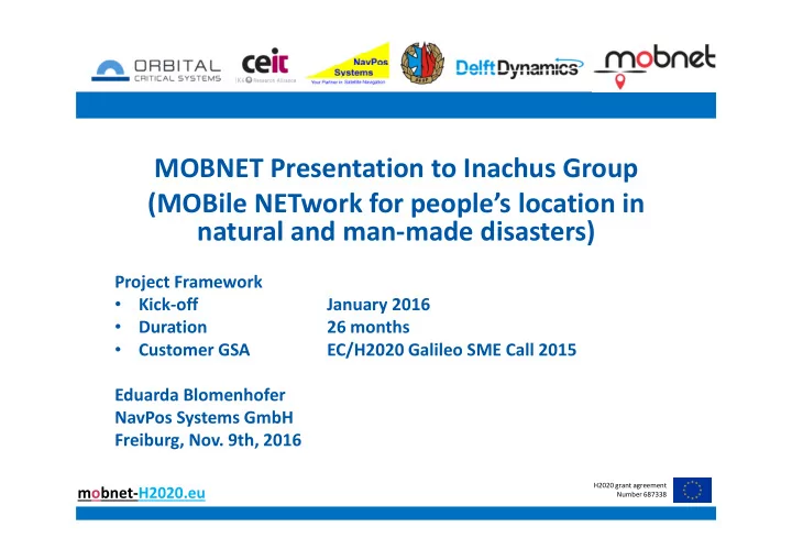
MOBNET Presentation to Inachus Group (MOBile NETwork for people’s location in natural and man-made disasters)

Project Framework

  • Kick-off

January 2016

  • Duration

26 months

  • Customer GSA

EC/H2020 Galileo SME Call 2015 Eduarda Blomenhofer NavPos Systems GmbH Freiburg, Nov. 9th, 2016

slide-2
SLIDE 2

mobnet-H2020.eu

H2020 grant agreement Number 687338

MOBNET Scope

www.Mobnet-h2020.eu

  • Public

Protection & Disaster Relief Service

  • Levels of Operation:
  • Level 1: Everyday Incidents
  • Level 2: Major Events
  • Level 3: Natural and Man-

made disasters

  • Focus
  • n

Rescue Systems Operation

  • Different performance criteria

depending of Mission type

  • Project prototype to cover 2 km

area mission

slide-3
SLIDE 3

mobnet-H2020.eu

H2020 grant agreement Number 687338

MOBNET Example Missions and Use Cases

slide-4
SLIDE 4

mobnet-H2020.eu

H2020 grant agreement Number 687338

MOBNET System Architecture

Basic Idea and Concept: Combine precise GNSS positioning and timing with GSM signal ranging on a drone to locate mobile phones

slide-5
SLIDE 5

mobnet-H2020.eu

H2020 grant agreement Number 687338

MOBNET Study Team and Main Tasks

  • Orbital (Spain)

– Study Coordinator – Datalink Module

  • CEIT (Spain)

– Digital Communication Terminal (DCT) Module

  • Main School of Fire

(SGSP, Poland) – MOBNET Use Cases, Applications and Trials

  • Delft Dynamics

(Netherlands) – Drone Manufactorer

  • NavPos Systems

(Germany) – EGNSS Navigation and Timing Module

slide-6
SLIDE 6

mobnet-H2020.eu

H2020 grant agreement Number 687338

MOBNET Subsystems

  • Drone(s)

– Drone platform – Drone operator

  • Payload(s)

– DCT Module – EGNSS Module – Datalink

  • Ground Station

– Mission Computer and Visualization – EGNSS Ground Station – Datalink

slide-7
SLIDE 7

mobnet-H2020.eu

H2020 grant agreement Number 687338

MOBNET Architecture (I)

www.Mobnet-h2020.eu

  • MOBNET Drone(s) equipped with three airborne payload systems:
  • EGNSS system for accurate ranging
  • DCT system for GSM detection and main onboard processing
  • Payload Datalink for communications with Ground Segment
slide-8
SLIDE 8

mobnet-H2020.eu

H2020 grant agreement Number 687338

MOBNET Architecture (II)

www.Mobnet-h2020.eu

  • MOBNET Ground Segment:
  • D-GNSS system enables augmentation data to airborne systems
  • Segregated Navigation chain to operate any kind of Drone(s)
  • Payload Datalink provides seamless Layer-2 interface to Air
  • MOBNET mission software system (Payload data exploitation)
slide-9
SLIDE 9

mobnet-H2020.eu

H2020 grant agreement Number 687338

WP2.1 User Requirements vs. MOBNET Error Budget

MOBNET Positioning Error Contributers:

  • EGNSS PVT Accuracy

– Depending on EGNSS solution m (Stand-alone) to dm (D- GNSS) to cm (RTK) – level

  • PPS Accuracy

– +/-10ns x c equals +/-3m

  • DCT Ranging Accuracy

– Noise and bias ?

Inaccuracy Responses: [-] [%] <1 m

1 1%

1 - 2 m

14 21%

2 - 5 m

23 34%

<10 m

23 34%

Other

0%

n.a.

6 9%

Total: 67 100%

MOBNET Position Accuracy Objective: ~ +/- 2m to 10m to fulfill most Users Rqmts Source: MOBNET Questionaire User Responses

slide-10
SLIDE 10

mobnet-H2020.eu

H2020 grant agreement Number 687338

Challenge: Provision of ~10ns PPS timing accuracy on a drone!

  • „Cheap“ GPS Timing Receivers and even low cost GPS chip set manufacturer spec‘s

claim to provide pps timing accuracy better 20ns, but

– Typically this is realized at a static position with known or averaged GPS position – 20ns is specified as a „typical“ accuracy which means it is not reliable – Low cost GPS Chip sets show larger than 100ns inaccuracies and drifts to 400ns

  • Multi-Constellation mix could degrade timing accuracy
  • Significant price differences from single frequency & single constellation GPS

Rx&Antenna to multi-frequency & multi-constellation GNSS Rx&Antenna

  • Development Approach

– Investigation of professional GNSS receiver market for best candidates (e.g. Septentrio, Novatel, Trimble, … ) – Trade-off between requirements and architectures to identify best solution(s) considering performance/cost ratio – Anticipate EGNSS module solution(s) development NavPos MOBNET EGNSS Module Design Objectives: Submeter-Positioning and <10ns PPS Time over 10km Drone Range

slide-11
SLIDE 11

mobnet-H2020.eu

H2020 grant agreement Number 687338

EGNSS Payload Module Prototype

  • Functions

– Provides PVT and PPS time synchronization – GNSS PVT and raw data recording

  • Features

– 544 Channels GNSS Rx – Supported signals: GPS (L1, L2, L5), GLONASS (L1,L2,L3), Galileo (E1, E5ab, AltBoc, E6), BeiDou (B1, B2, B3), IRNSS (L5), QZSS (L1,L2,L5) (Galileo, Beidou, IRNSS, E6/B3 – Supports standalone and D-GNSS

  • perations

– Embedded GNSS Antenna

  • Performance

– PPS Timing Acc. ~10ns – Standalone H1.2m V1.9 m – DGNSS H0.4m V0.9m – Option: RTK for cm-Accuracy – Several hours operations on battery

slide-12
SLIDE 12

mobnet-H2020.eu

H2020 grant agreement Number 687338

EGNSS Ground Station Prototype

  • Functions

– Generates DGNSS Corrections – GNSS raw data recording – Multiple drones (return) PVT track data recording using Terminalserver

  • 1 day Autonomous

Operations using its embedded Powerbank

  • Frontpanel
slide-13
SLIDE 13

mobnet-H2020.eu

H2020 grant agreement Number 687338

DCT subsystem

www.Mobnet-h2020.eu

  • Airborne system acting as GSM base station to detect cell phones.
  • Real-time, FPGA-based processing system which generates MOBNET

payload data (victims position estimates).

  • Interface with airborne GNSS for PPS signal
slide-14
SLIDE 14

mobnet-H2020.eu

H2020 grant agreement Number 687338

Payload Datalink subsystem

www.Mobnet-h2020.eu

  • Present in both Air and Ground Segments.
  • Seamless

Layer-2 integration between Airborne DCT payload datastream and Ground Payload Network.

  • !" #$%$$%
slide-15
SLIDE 15

mobnet-H2020.eu

H2020 grant agreement Number 687338

Drone subsystem

www.Mobnet-h2020.eu

  • MOBNET prototype based on Quadcopter RH4 aircraft.
  • Empty weight: 2900 grams
  • Maximum TOW: 5600 grams
  • Payload capacity: 1000-1500 grams
  • Battery weight: 1200-1700 grams
  • Endurance: 15-25 minutes.
slide-16
SLIDE 16

mobnet-H2020.eu

H2020 grant agreement Number 687338

Ground Station

www.Mobnet-h2020.eu

  • Flexible, compact UAV ground control station suitable for MOBNET
  • peration.
  • Segregation between Navigation and Payload chains.
  • Mission data Operation, Exploitation and Recording.
  • D-GNSS integrated in Payload chain.
slide-17
SLIDE 17

mobnet-H2020.eu

H2020 grant agreement Number 687338

Conclusions

  • MOBNET Project and Development well on track
  • First prototypes of subsystem modules available
  • Next step System Integration and further Software Development
  • Trials in Poland planned for Q4 2017
slide-18
SLIDE 18

mobnet-H2020.eu

H2020 grant agreement Number 687338